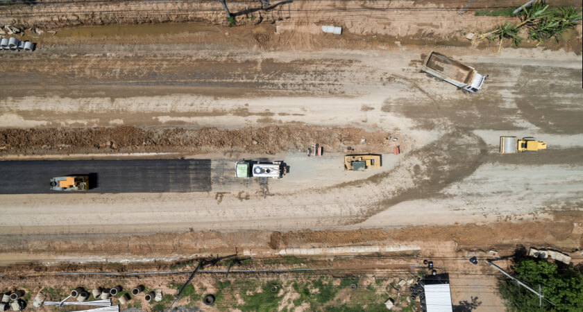
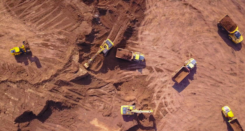
Drones are a natural fit for the construction industry, one that combines large-scale equipment and constant activity with a need for centimeter-level precision. Contractors aiming to make their work faster, safer, and more cost-effective are in constant search of new technologies that can help. Construction drones are the perfect tool to rise to the occasion, gathering essential digital information from an elevated viewpoint, high above the busy environment below. By harnessing the latest in drone technology, contractors can revolutionize their processes, from surveying and 3D geospatial mapping to traffic management, safety inspection oversight, and more.
Businesses that have not considered this technological solution may find it represents an answer to some of the most common issues they're experiencing, from tight profit margins to staffing difficulties. At the very least, a drone can provide a new perspective for contractors, giving them the data they need to bring their work into the future.
How drones fit into today's construction industry
Drones have made their mark in several industries recently, ranging from public safety to utility inspection and even agriculture. By placing a set of sensitive data-gathering instruments in the sky, UAVs allow companies to function in ways that would have been impossible.
The main test of whether a particular sector has a good case for drone use is whether the abilities granted by the technology match up well with the challenges companies are facing. In this regard, drones are a perfect match for the construction business as contractors strive to become simultaneously safer and more efficient.
Construction industry difficulties and considerations
The current global economy, still suffering from the effects of the COVID-19 pandemic and supply chain breakdowns, is challenging for numerous industries, and construction is no exception. Tensions and difficulties that have come to the fore in recent months demand innovative solutions, often including infusions of new technology — potentially including construction drones.
Specific pain points for construction organizations include:
- Lack of digitization and data use: Construction is not a heavily digital industry, from a record-keeping and planning perspective. Following the general trend of collecting and using accurate data could represent savings and increased efficiency for contractors, as paper processes are slower, less precise, and may pose regulatory compliance challenges.
- Skilled labor shortages: One of the factors forcing construction businesses to become more efficient with the way they use their resources is a general lack of skilled prospects. Some contractors have found themselves unable to start jobs due to talent shortages.
- Collaboration roadblocks: As a sort of complement to the general lack of digital data used by contractors, these businesses are also often unable to share information quickly and effectively. Teams may be siloed and disconnected, with no standardized approach to data visibility.
These factors, combined with the financial constraints that have manifested in the past few years and a renewed focus on personal health and safety, have forced contractors to think seriously about how they can revolutionize their workflows and find better ways to perform their tasks.

The impact of construction drone technology
Having access to drone technology can change the way contractors manage their job sites, acting as a central pillar of a new and more digital approach to construction work. Making effective use of the latest drone models can be transformative for workflows and help employees accomplish their objectives.
Effects of drone adoption may comprise:
- Improved planning: Creating a suitable plan for a construction project begins with a detailed survey of the job site. Carrying out the work on foot can be time-consuming, labor-intensive, and even physically dangerous, depending on the size and terrain of the area in question. Topographic surveying by drone is safe and efficient, delivering accurate information that can inform an entire project.
- Detailed project management: The data collected by drones doesn't need to be limited to initial topographical surveys. By using UAVs to collect real-time information through the course of a job, leaders can create an accurate and up-to-date record of the project and then share that drone data with all departments to prevent communication silos from developing.
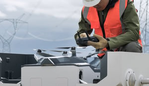
- Reduced risk for personnel: In the years before the development of drones, construction employees still collected necessary surveying data and inspected job sites for danger, but did so on foot. Rather than having workers ascend to high points or navigate difficult terrain, contractors can safely fly drones over the area in question, keeping their workers out of harm's way.
One of the most exciting aspects of integrating drones into construction workflows is that new use cases are constantly emerging. As new sensor payloads become available, construction firms are free to become more ambitious with the types of roles they use their drones in, from real-time job site oversight to thermal scanning and more.
The following are two examples of construction businesses that have already found ways to work drones into their everyday tasks, transforming their operations for the better:
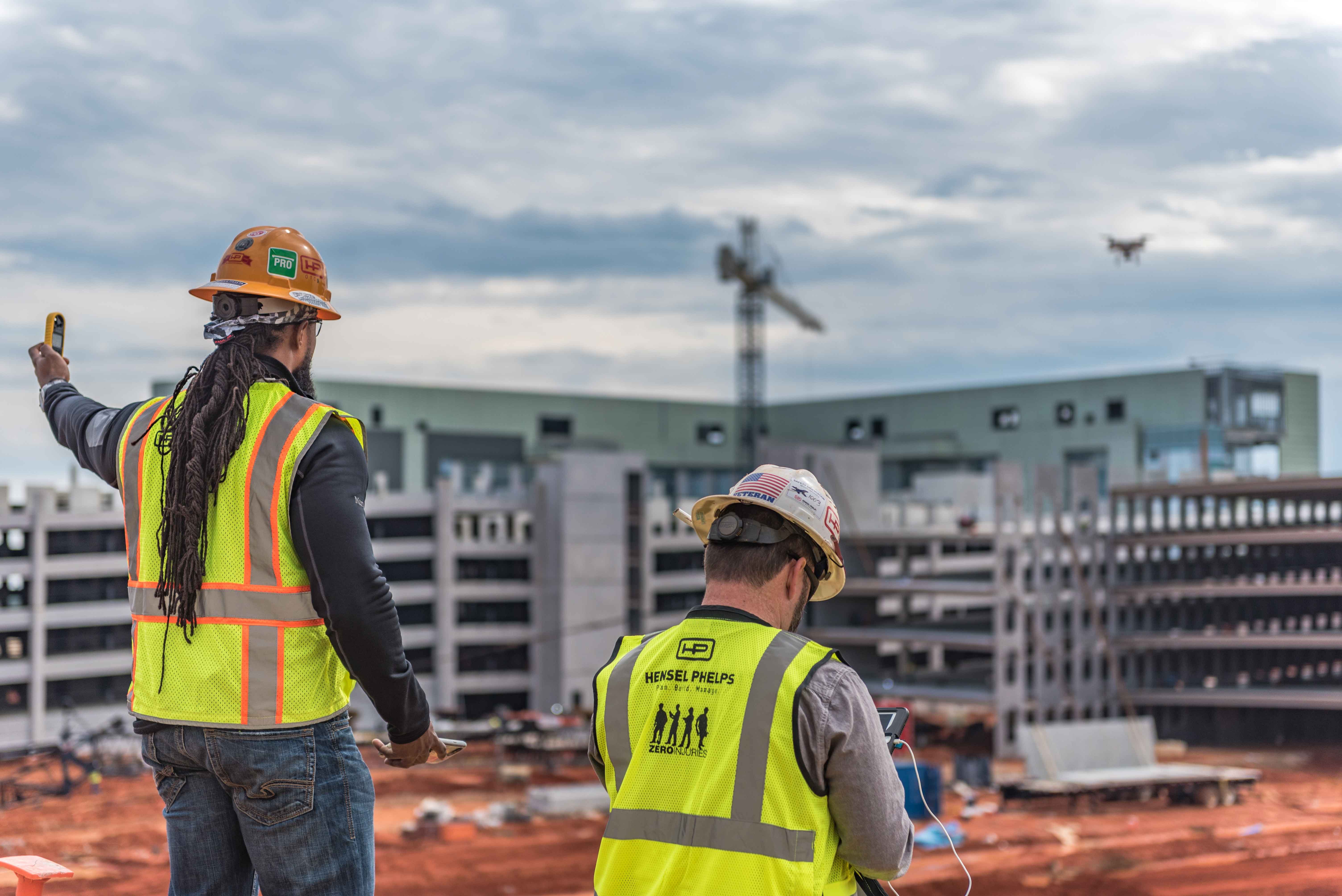
Example: Hensel Phelps
Large-scale general contractor firm Hensel Phelps has become a major adopter of drone technology in construction, first contemplating UAV use more than a decade ago. The construction company has focused on safety and carefully regulates its use of drones — this level of responsibility has enabled the organization to earn a Federal Aviation Administration waiver to fly drones in areas where people are working below.
What does such an advanced contractor do with construction drones? In Hensel Phelps' case, the technology is part of the site planning, site inspection, building inspection, and safety surveillance workflows. The amount of data coming in from the surveying drones allows the organization to perform analytics and gain predictive insights around how to complete jobs effectively and safely.
Example: STRABAG
STRABAG SE, a European contractor that specializes in building transportation infrastructure such as highways has used drones since 2015. Since the organization has thousands of job sites active across the continent at any given time, its surveying needs are enormous, and the UAVs form a vital part of the workflow.
With drones providing aerial coverage of the huge areas being reshaped in STRABAG's highway construction efforts, it is now simpler to collect the data and integrate it directly into the company's digital platforms. The 3D models created with the aerial geospatial data have a high point density, so workers have better-quality digital plans to work from than if they had worked solely with land-based surveying.
The latest construction drone technology
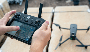
What does it take to create an ideal drone for the construction sector? These professional UAVs are a far cry from the simpler craft used by consumer hobbyists. With a variety of advanced technology features ranging from control and operator assistance tools to advanced sensor payloads, the latest drone models can deliver unparalleled performance in a variety of job site roles.
The following are just a few of the technology features that have made construction drones a valuable addition to construction workflows:
Real-time kinematics
To create finished structures and infrastructure that will stand the test of time, construction personnel need centimeter-level accuracy in their digital maps of work sites. Real-time kinematics (RTK) modules allow them to achieve this quality of surveying performance. The method uses a module on a drone and a fixed-location base station to get more precise readings than would be possible with a solely satellite-based method.

The method triangulates the position of the base station, drone, and satellites, generating geospatial data to import into mapping software. RTK requires fewer ground points than other drone surveying methods, relying on its one base station, and it automatically corrects errors while the flight is still ongoing. RTK drones can also be equipped with post-processing kinematics (PPK), an alternative methodology that is especially useful in obstructed areas or where satellite signals are weak.
Photogrammetry
Photogrammetry involves taking multiple images of your target and stitching them together with software to create digitized high-resolution 2D or 3D maps or models from which accurate measurements can be deduced. This allows teams to quickly and efficiently create topographical models of their construction sites and update them over time. Today's drones can be equipped with photogrammetry modules so sensitive that it's even possible to accurately gauge the amount of material left in a stockpile based on the data points they collect.
Employing drones for accurate, up-to-date material stockpile measurement is a next-generation efficiency-building tactic. By scanning a material stockpile from the air, it's possible to ensure both office staff and crew on the ground know how much inventory they have left. With this real-time information, a foreman knows in advance when to order more materials, and doing the counting via drone means less manual work.
LiDAR
In some cases, 3D job site modeling and stockpile volume measurement may be carried out with a light detection and ranging (LiDAR) module instead. LiDAR is based on pulses of light, sensing the position of points in space directly through these pulses rather than assembling 3D models based on aerial photography.
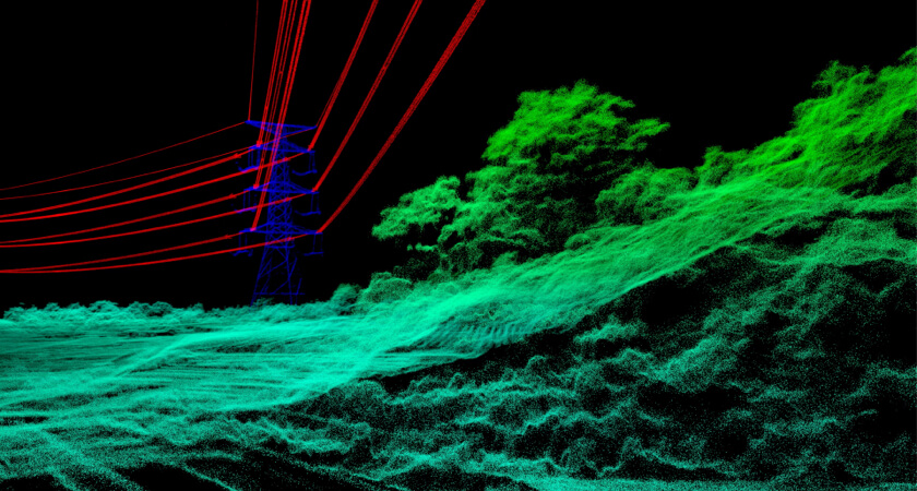
Compared to photogrammetry, LiDAR can deliver a high degree of detail, useful for mapping relatively small objects. It should be noted that LiDAR modules tend to be heavier and more complex to use, and come with greater upfront cost. As technology develops and new models enter the construction drone market, however, this is becoming an increasingly appealing option.
To decide which is right for you, read more about LiDAR vs Photogrammetry.

…And much more
A complete drone loadout doesn't just include the latest mapping, scanning, and sensor technology. These UAVs are also equipped with flight automation and aerial intelligence features to assist operators and ensure flights are safe and stable. Battery technology, too, has advanced in recent years, ensuring pilots always know how much safe flight time they have left.
With such advanced capabilities, user training has become faster and easier in recent years. It remains essential to have employees properly certified and trained on the hardware they are going to use, and organizations still need clearance to fly drones in the airspace over a jobsite. However, the barrier to entry into drone use has never been lower.
Roles for construction drones on the job site
By running down the jobs contractors can accomplish with construction drones, it's possible to build a clear picture of how versatile and valuable these UAVs are. No matter an organization's size or specific needs, there's likely some application for a drone within its workflows. These potential uses include:
- Site surveying and 3D modeling: Beginning at the start of a job, it's possible for construction crews to build accurate 3D maps based on aerial drone surveys. Updating these maps frequently and sharing the drone data with all stakeholders keeps departments on the same page. Having this comprehensive record of construction progress enables crews to detect potential hazards, while also tracking the project's outcome vs. projections and making adjustments if necessary.
- Volumetric calculations: Calculating the volume of a stockpile allows for more precise planning when determining how to manage inventory on a job site. Whether using photogrammetry or LiDAR, this is a way to boost the efficiency of a key job site workflow. Understanding how much is left of a material (and where it's located) is an aid to logistics.
- Asset monitoring: In addition to tracking the volume of material stockpiles, construction crews can use aerial photographs and models to track the movement of large assets around an expansive job site. Knowing the position of assets from day to day is a helpful way to keep workers safe on the site and make sure the equipment itself is secure.
- Digital twins: Building a digital twin of a building in progress or a complete environment is the process of generating a 3D model that will receive periodic updates as the job progresses. With this model, crews can make sure their designs are in compliance with local codes and determine where to watch out for potential points of failure. Planning becomes easier with this model to work from.
- Building information monitoring (BIM): BIM is the digital design process that goes on alongside physical construction work. Contractors can ensure their projects are on track by capturing real-world geospatial data from drones and comparing it with their pre-visualized BIM designs. It's even possible to use LiDAR drones to gather information about the insides of structures under construction and add this data to BIM systems.
- Inspections: Performing an inspection via drone allows contractors to gather information from their building sites without putting workers at potential risk by making them enter hazardous areas. By using advanced drone features such as "AI Spot Check," which enables the tagging of objects within a site, operators can reduce the risk of missing anything due to human error.
- General planning and organization: Not everything a drone can accomplish falls into a neat category, which is one of the most exciting things about using this technology on a job site. Whenever contractors need an extra pair of eyes on one part of a job in progress, they can send up an advanced construction drone to get a new perspective. This flexibility helps keep a job moving efficiently.
Ideal construction drone loadouts
One of the most notable traits of the drone industry is how quickly the technology is evolving. The latest drones are lightweight, affordable, and equipped with sensors that deliver the necessary level of precision for use in sectors such as construction. Even organizations that have considered drones within the past decade may be surprised at just how advanced today's uncrewed aerial vehicles have become.
This rapid development has led to increased adoption of construction drones in a variety of roles, as it's become clear these tools can add to crews' capabilities in ways that boost job site efficiency while also keeping employees safer. Using a drone means keeping employees out of potential danger while navigating to any part of a work site, a valuable and previously untapped capability.
Just as there are plenty of uses for drones on the construction site, there are numerous potential UAV models for contractors to deploy. Likely options for job site operations include:
- Phantom 4 RTK: Companies that need effective 2D and 3D mapping via real-time kinematics can invest in the Phantom 4 RTK. This commercial drone is compact and affordable, yet allows users to capture centimeter-accurate position data via its onboard RTK module.
- Phantom 4 Pro V2.0: Contractors starting with drone usage that haven't yet committed to RTK or LiDAR can start capturing aerial imagery and video with the Phantom 4 Pro V.20. This drone is the most affordable model suitable for construction use and is a valuable drone pilot training tool.
- Matrice 300 RTK: The Matrice 300 RTK is an advanced and versatile commercial drone that supports configurable payloads — it can carry up to three optional sensors at once, up to 2.7 kg of weight. By equipping it with the Zenmuse L1 LiDAR sensor, contractors can produce point clouds that can inform the construction process. And with the Zenmuse P1 with its 45 MP sensor, you can collect high-resolution photos and orthomosaics of your worksite.
Using these versatile drone options with advanced mapping software such as DJI Terra enables construction crews to change the way they look at their job sites, injecting digital data into their workflows.
If your organization is ready to start working with drones but not sure where to start, it may pay to team with a third-party drone operator or run a hybrid drone program, operating some of the equipment in-house and outsourcing for high-volume applications. Whichever approach you choose, drone use is a way to take construction into the future.
To learn more about all drones can accomplish in the construction space, download The Drones in Construction Guidebook.