For most households, energy bills are a consistent and expensive outgoing. These costs peak during the winter months when the cold arrives. The U.S. Energy Information Administration predicted that the winter of 2022 will see multi-year highs in household energy costs due to rising retail energy prices.
There are two ways for homeowners to combat this rise: Grab an extra layer and turn the thermostat down, or take steps to minimize domestic heat loss. The second option is becoming increasingly popular, as insulation improvements can lead to significant savings in the long term.
The first step in reducing heat loss is understanding where it’s coming from. The picture changes depending on the age of a home and its location, but generally external walls, windows, and roofs are the prime culprits. So how can you find out if your building is needlessly leaking heat and money out into the world?
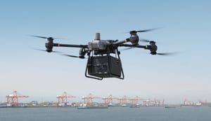
An initiative in Warren, Minnesota, has shown that drones and thermal inspections from above can be a big part of the solution.
Thermal roof inspections: One city’s energy-saving initiative
Warren is a small city in northern Minnesota. The winters are bitterly cold but the residents have one significant advantage in terms of energy: The city owns and manages all of its utilities. This dynamic means the local administration and the community are incentivized to cut heating costs and make every home and structure as efficient as possible.
With help from the nearby Northland Community and Technical College, Warren launched an energy initiative in 2017. Students from Northland’s Aerospace department studying unmanned aerial systems and imagery analysis were tasked with thermally mapping the entire city. The partnership is win-win: students get practical experience in the emerging drone industry, while the city gets aerial data that highlights how local buildings are losing heat.
With every building in Warren thermally mapped, residents can head to city hall to get the lowdown on their heat loss. “That way, they can make a decision that would give them the greatest energy savings and cost savings,” Warren City Administrator Shannon Mortenson told the Local Energy Rules Podcast.
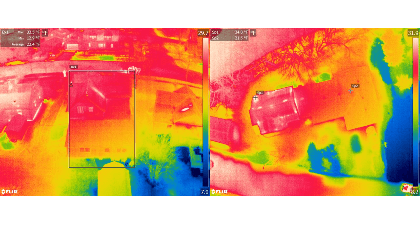
The thermal scans highlight heat loss and point to areas - usually roofs, walls, windows, and doors - that require further insulation or completely replacing. The intention is to provide the results alongside access to an Inclusive Financing program, which will allow residents to take a loan from the city to make energy efficiency upgrades. The loan is gradually paid back through the regular utility bill and, once it’s paid off, the homeowner gets to keep the savings.
For Mortenson, the project has been empowering for the city and its residents. “On the city side, we can determine what our energy loss is overall in the community and where that energy loss is occurring. [It’s helped us learn] “how can we be more efficient, how can we be good stewards, how we can mitigate climate change, and how we can increase sustainability in our community”.
Capturing thermal data in freezing conditions
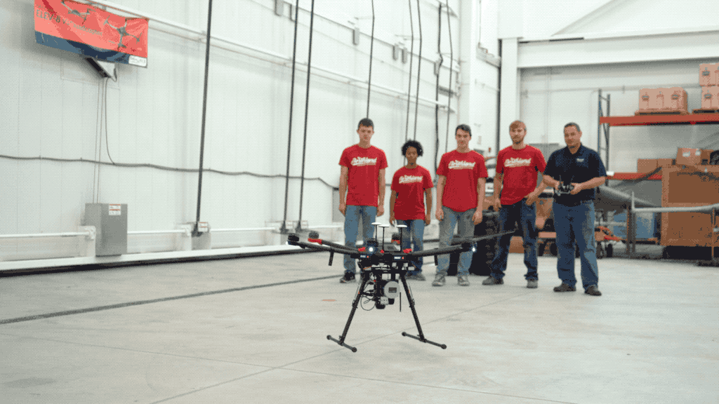
Zackary Nicklin is the Unmanned Aircraft Systems Instructor leading the UAS program at Northland Community & Technical College. He explains that an important part of the college’s Small UAS degrees is hands-on training. In 2017, the opportunity arose for students to gather thermal data for the city of Warren. Putting the Northland Fleet - which includes a number of DJI Enterprise aircraft and sensors, including the Matrice 600 Pro, M210 RTK, Inspire 2, and Zenmuse XT and XTR thermal sensors - to work has been a vital teaching mechanism.
As with any pilot project, there was a steep learning curve. To gather useful thermal data, it was anticipated that students would need to fly in winter when residents were actively heating their homes and the difference between the outdoor and indoor temperatures was most marked. But it quickly became clear there were other factors in play. Thermal scans started in November, but low temperatures and occasional high winds reduced the efficiency of their drone batteries. And, immediately after sunset, residual heat from the day needed extra time to dissipate.
Nicklin decided to do the scans on calm nights, sometimes until 2 am, in conditions well below freezing. Students kept flying until one of two things happened: they got too cold or the targeted section was completed.
Many of the mapping processes are familiar. For example, the team worked in a grid pattern, each area was scouted before takeoff to ensure tall objects are avoided, and flights were planned and executed using Pix4D. There were also some quirks as a result of the freezing winter temperatures.
2 am in the bitter Minnesota cold is one time you won’t hear drone pilots complain about having to move to maintain VLOS.
Extra care had to be taken with batteries, too. Those with full charge were stored in a cooler to keep them temperature-controlled or left in the truck with the heating on. The devices the team relied on were also impacted by the weather. Heating pads were taped to the back of the tablets to prevent them from becoming unresponsive. Also necessary was a combination of hand warmers and fingerless gloves, in order to delicately maneuver the control sticks and tap screens without hands becoming numb. Right after takeoff, the drones had to hover for a few minutes to warm up the batteries and allow the camera sensor to adjust to the ambient temperature.
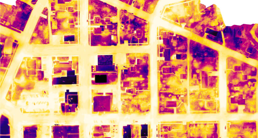
The second phase of the initiative involved students stitching the images together and overlaying them with a GIS map. By combining photos of each structure with a thermal signature reflecting its heat loss, they were able to discover a correlation between building age and the amount of thermal leakage.
The best drones for thermal roof inspections
If you are planning your own thermal mapping initiative, you’ll need a drone that’s capable, rugged, energy-efficient, and compatible with infrared payloads. We recommend three aircraft for capturing thermal data at scale.
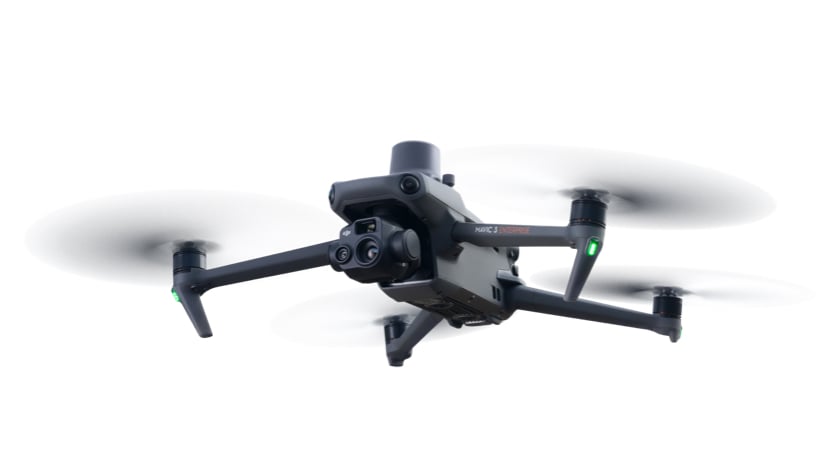
Mavic 3T
The Mavic 3T is DJI’s smallest thermal mapping solution, with high-resolution thermal and visual cameras. Its 640×512 px infrared sensor combines with centimeter-level RTK positioning for accurate thermal mapping missions. This aircraft is quick to deploy, easy to fly, lightweight, and offers a max 45 minutes of flight time.
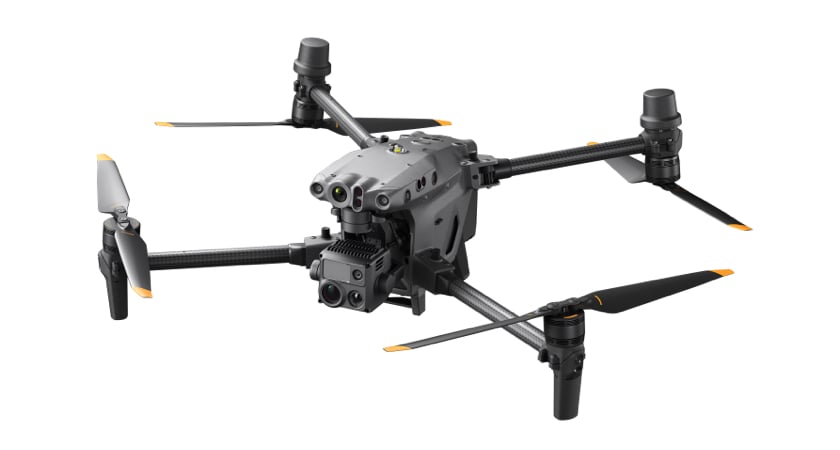
Matrice 30
The Matrice 30 is the perfect balance between power and portability. It has flagship-level camera performance with the weather resistance and environmental adaptability you expect from a Matrice, all in a compact airframe.
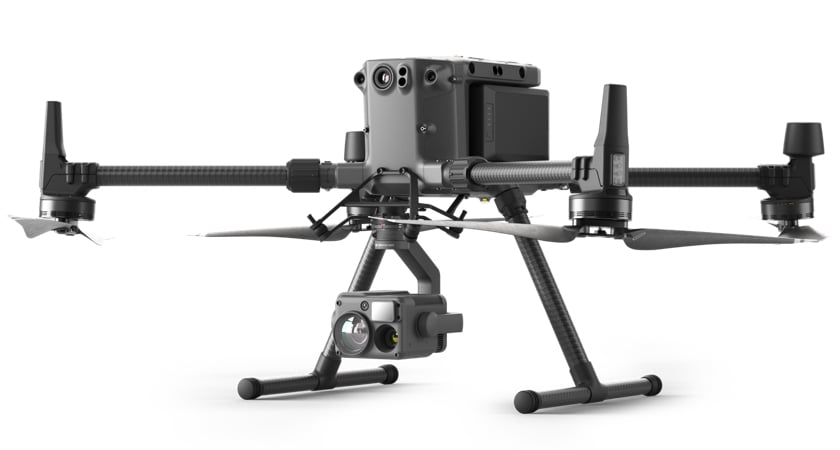
Matrice 300 + H20T
The Matrice 300 RTK is DJI’s flagship industrial platform. It’s capable of operating in extreme environments and weather conditions. With 55 minutes of flight time, obstacle sensing in six directions, and compatibility with DJI’s most advanced payload options, this rugged aircraft won’t let you down. The H20T is a multi-sensor payload that includes a 20 MP Zoom Camera, a 12 MP Wide Camera, a 1200 m Laser Range Finder, and a 640×512 px thermal camera. It’s ideal for thermal mapping missions in challenging conditions.
Thermal drones and a greener future
Warren’s thermal mapping initiative is a perfect example of how drone technology can empower communities and inform decisions on energy efficiency. Of course, the project was helped by having city-owned utilities and a nearby college full of students in need of UAS experience. But that’s not to say its core elements aren’t repeatable for communities around the world.
In fact, it was inspired by Warren’s participation in the Climate Smart Cities Partnership. Similar mapping missions were flown in Arnsberg, Germany (Warren’s partner city) and the two compared results.
Energy sustainability has never been more important and thermal mapping is just one way drones can support environmental efforts and lay the foundations for a greener future. For more inspiring and environmental drone applications, take a look at How Drones are Saving the World.