DJI Geospatial Mining Solution

DJI Geospatial Mining Solution

DJI Geospatial Mining Solution

Six Core Mining
Applications

Download Solution Brief
Exploration and Construction
01  /  06
Exploration & Construction

Equip DJI Matrice 400 with DJI H30T (for thermal data) and DJI Zenmuse L3 (for DEMs) in separate dedicated flight tasks. These datasets correct Landsat 8 thermal infrared data, minimizing atmospheric and terrain shading biases to enable high-accuracy mineral vein identification.

Industry Pain Points
Low Precision
Large sampling intervals and low accuracy in ground magnetic surveys
Low Efficiency
TPS/GPS data fails to reflect subsurface mineral distribution accurately
Multi-source Data
Multi-source integration of surveying and mapping data
Harsh Environment
Mineral resources are mostly distributed in undeveloped areas; infrastructure is limited
Drill and Blast
02  /  06
Drill & Blast

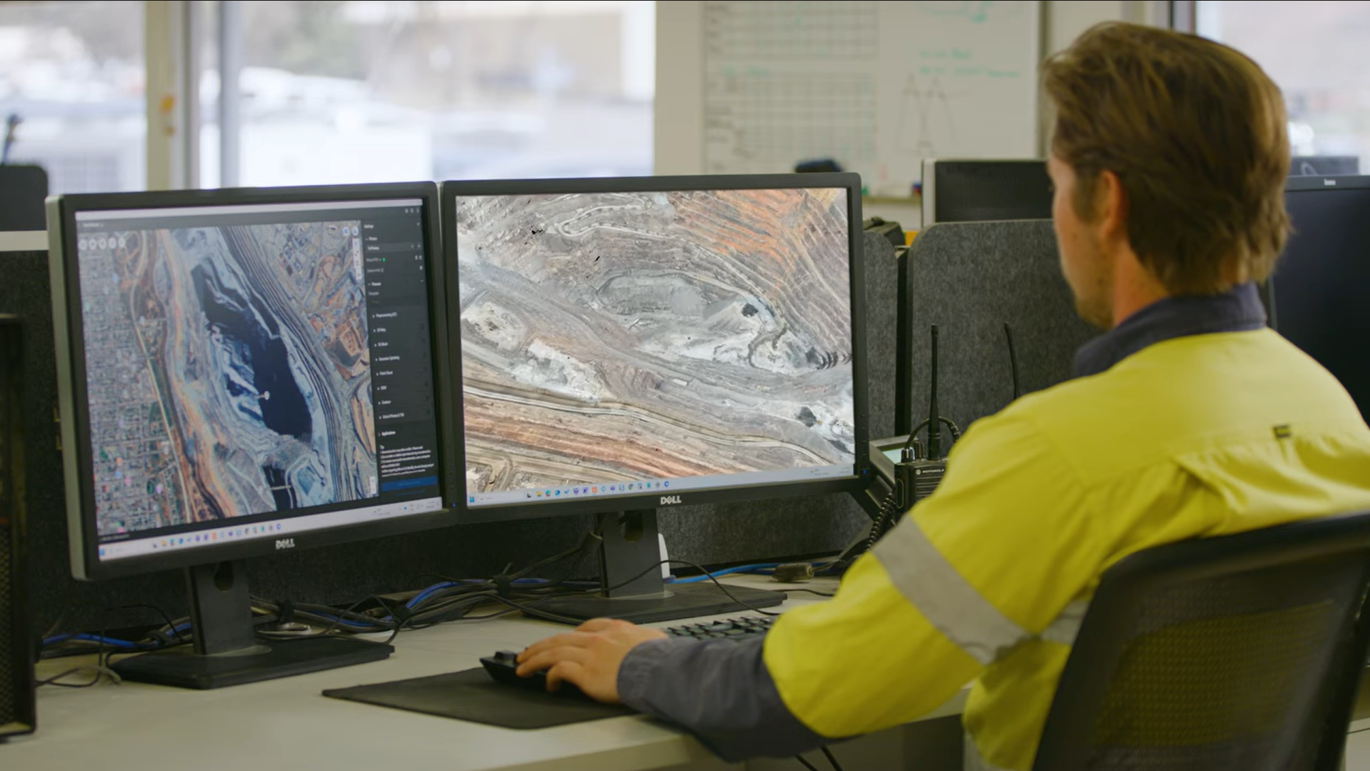
Use DJI Matrice 4E, or equip DJI Matrice 400 with DJI Zenmuse L3, for high-accuracy terrain surveys. Process the data with DJI Terra, 3DMine, and Hexagon SPLIT to optimize blast-hole layouts and explosive dosages.

Industry Pain Points
Inaccurate Drilling
Cost overruns. Wasted Ore.
Blasting Evaluation
Hard to estimate the blasting output
Incomplete Info
Flawed drill and blast
Harsh Environment
Higher drill and blast risks
Load and Transport
03  /  06
Load & Transport

Use DJI Matrice 4E to survey road networks, then process the data with DJI Terra and Strayos to build 3D digital twins, identify hazards, optimize routes, and reduce haul costs.

Industry Pain Points
Ineff. Management
Manual inspection fails to detect road defects in time, causing excessive tire wear and high fuel costs
Lack of Loading Control
Manual judgment of loading volume/fragmentation causes overloading/underloading and downstream downtime
Outdated Stockpile
Manual on-site stockpile survey leads to low measurement accuracy and high personnel safety risks
On-site Safety Risks
No real-time monitoring of slopes and haul roads, with collapse and rollover hidden dangers
Operation Management
04  /  06
Operation Management

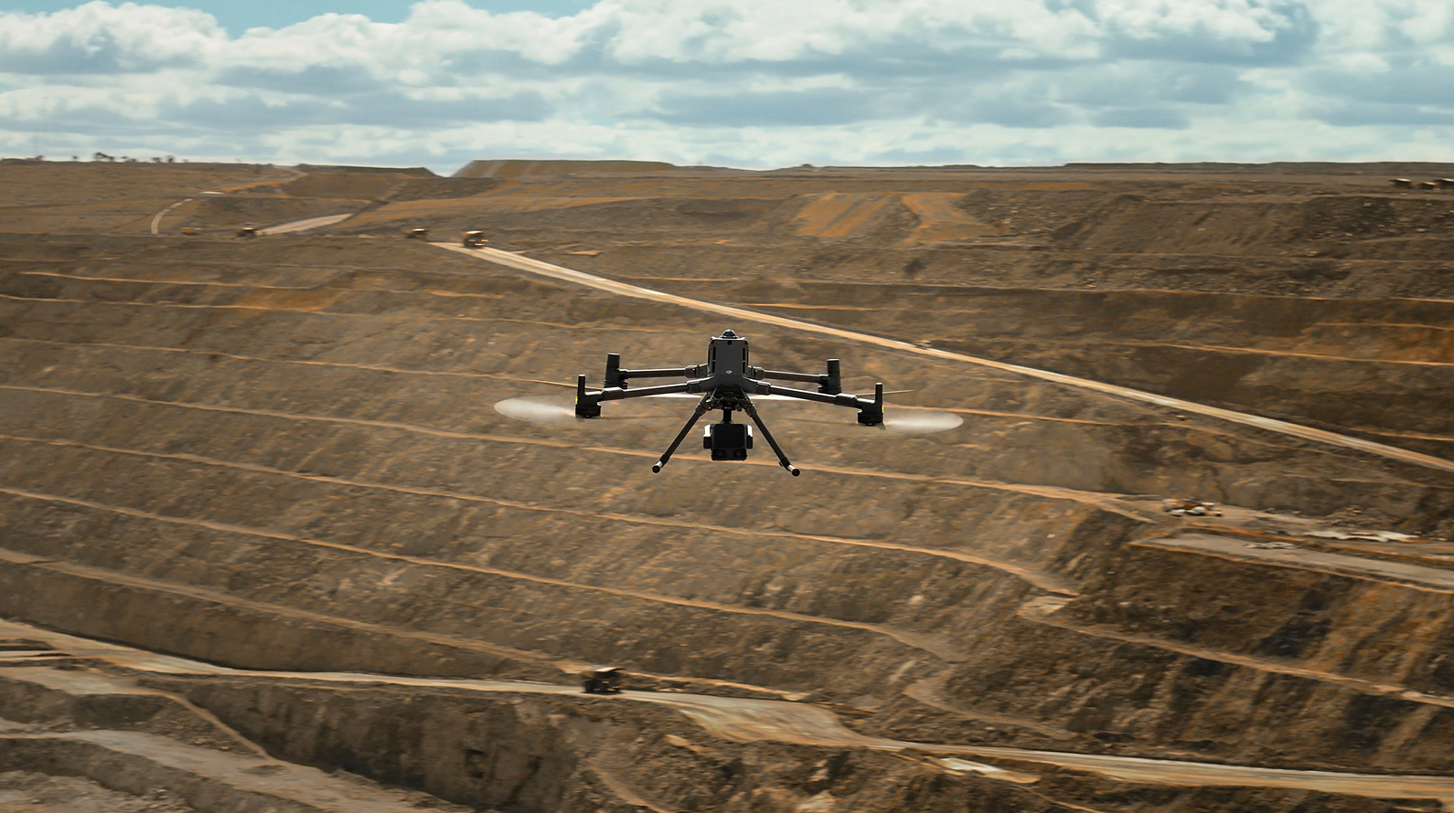
DJI Dock 3 enables 24/7 automated surveys in deep-pit environments. When paired with DJI Terra and FlightHub 2, it allows teams to quantify production metrics and evaluate site performance for timely, efficient mining management.

Industry Pain Points
Shift Handover
Critical hazards and temporary controls are lost between shifts, leading to repeated exposure and inconsistent execution
Equipment Readiness
Machine health, proximity risks, and operator fitness are checked unevenly, making "available" equipment not always "safe to run"
Limited Transparency
No automated KPI dashboards or reports
Disconnected Workflows
No end-to-end optimization (exploration to processing)
Safety Monitoring
05  /  06
Safety Monitoring

Pair DJI Matrice 400 with Zenmuse L3 for long-range terrain surveys, or deploy DJI Dock 3 for scheduled flights. Process the data with DJI Terra and FlightHub 2 to analyze multi-temporal models for continuous landslide monitoring and proactive safety management.

Industry Pain Points
Hidden Hazard Zones
Limited line-of-sight and inaccessible areas leave blind spots where instability and gas buildup can start undetected
Alarm Overload
Dust, vibration, moisture, and blasting degrade sensors and networks, causing dropouts and delayed warnings
Alarm Fatigue
Threshold-based alerts generate noise; teams learn to ignore alarms, while real events get buried in clutter
Slow Response
Even accurate readings may not become clear decisions—who stops work, where to evacuate, and how to document compliance
Reclamation
06  /  06
Reclamation

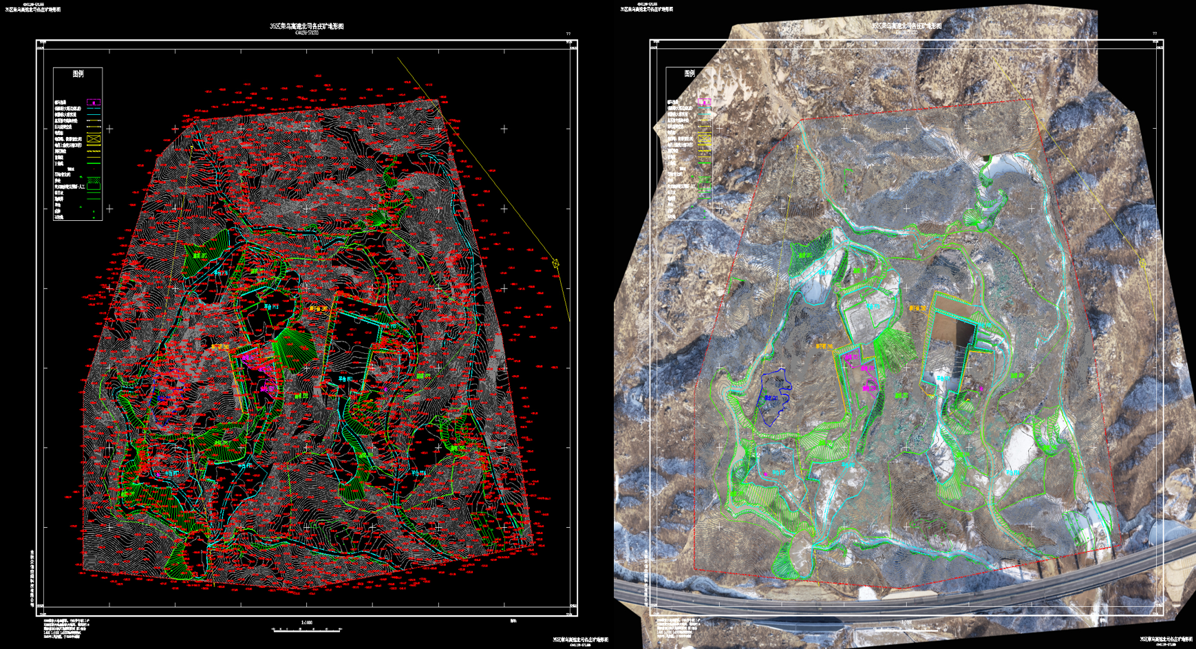
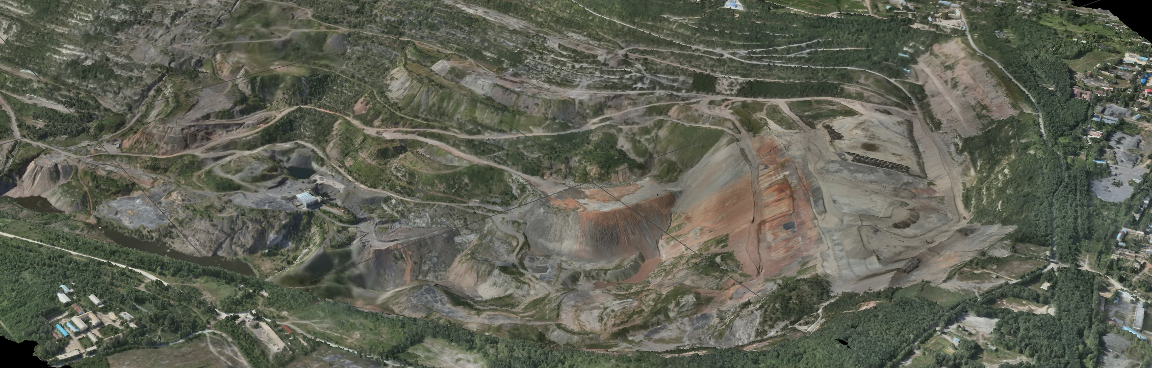
DJI Matrice 4E conducts large-scale mining area surveys. Process the data with DJI Terra and EPS Software to generate 3D models, track reclamation progress, and support compliance acceptance.

Industry Pain Points
Ground Instability
Subsidence, loose slopes, and abandoned infrastructure limit where crews can work and how frequently sites can be inspected
Water Uncertainty
Ponding, seepage, and potential acid drainage complicate grading plans and require continuous checks beyond periodic sampling
Soil Variability
Borrow material variability and compaction issues can prevent root growth, even when the surface "looks" finished
Proof Gaps
Evidence for regulators and communities is scattered across photos, tests, and contractor logs, slowing sign-off and increasing rework
Case Study · Australia

Real-World Results
Australian Mining Operations

DJI KCGM L3 Australia Mining Case Study
Kalgoorlie, Western Australia  ·  KCGM Super Pit Gold Mine

From 5 Hours to 15 Minutes — Full-Pit LiDAR Survey at the World's Richest Mile

The Super Pit stretches 3.5 km long × 2.5 km wide and plunges 650 m deep — too deep to scan from the rim with conventional drones. Surveyors once spent 1 hour driving to the pit floor before flying, then several more hours processing deliverables. With DJI M400 + Zenmuse L3, a single flight from the top now captures the entire pit in 15 minutes. Real-time point cloud preview lets the team spot gaps mid-flight, while multi-temporal comparisons track exact material movement every 24 hours — giving mine planners and geologists the data they need to make real-time decisions.

"I would say it's been a real game-changer because we've now been able to do things we haven't been able to do before."

— KCGM Survey Team

Watch on YouTube
20×
Faster — 5 hrs → 15 min
650m
Pit Depth Covered
3cm
Vertical Accuracy
3.5km
Pit Length, 1 Flight
Learning Series

Master Mining Mission Planning
& Point Cloud Processing

In-depth tutorials covering aerial survey mission planning, Zenmuse L3 point cloud reconstruction, POS solving, and point cloud editing — helping you capture and apply precise geospatial data more efficiently.

Tutorial 01
DJI Terra — Zenmuse L3 Point Cloud Reconstruction
Tutorial 02
LiDAR Point Cloud POS Calculation in DJI Terra
Tutorial 03
FlightHub 2 — AEC Mission Automation
Tutorial 04
DJI Modify — Zenmuse L3 Point Cloud Editing
Interactive Results

Explore the
3D Mine Model

3D Mine Model