
Public safety agencies across the world are turning to drones to give them aerial intelligence so they can better protect and serve their communities.
From search & rescue to law enforcement, to firefighting and hazmat response, drones give first responders invaluable aerial insight, enabling quicker, safer, and better decisions to be made.
DJI is pleased to announce that through September, we will be hosting a series of webinars together with our partners, where we explore best practices and workflows for drone operations in public safety.
Tune in to learn from leading public safety drone experts about the following topics:
Wednesday, August 25, 9:00-10:00 AM PST | 6:00-7:00 PM CEST
You know drones can make a difference, but building a law enforcement drone program from scratch can seem like a daunting task. Fortunately, this trail has been blazed by many before you, and they are eager to share their findings.
In this webinar Jon Beal and Kyle Williams, President and Vice-president of the Law Enforcement Drone Association (LEDA), kick off this series by sharing their experience establishing and leading a UAS Program for LE. They'll cover things to consider, essentials, policies, procedures, SOPs, training, and more.
 |
 |
| Jon Beal - President, LEDA | Kyle Williams, Vice President, LEDA |

Thursday, September 2, 9:00-10:00 AM PST | 6:00-7:00 PM CEST
Thermal drones enable rapid and informed decisions when responding to volatile emergency situations. Learning the ins and outs of thermal tech can bring your drone program to the next level.
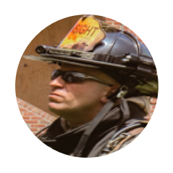
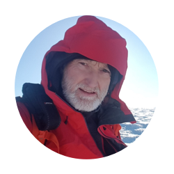
In this webinar, Andrew Starnes, Founder of Insight Training LLC, Lee Newman, Drone Project Manager and Chief Pilot of the London Fire Brigade, and David Perrachino, Drone Squad Leader of the Isère Firefighter Service, dive into the value of thermal UAS.
Learn how to implement and interpret thermography for drone use, including discussion of topics like resolution, radiometric vs. non-radiometric, color palettes, and how to communicate key information to IC.
 |
 |
 |
|
| Andrew Starnes, Founder, Insight Training LLC |
|
David Perrachino, Drone Squad Leader, Isère Firefighter Service |

Thursday, September 9th, at 9:00-10:00 AM PST | 6:00-7:00 PM CEST
Drones have long since demonstrated their capacity to enhance SAR operations. In this webinar, hear from three panelists: Kyle Nordfors, Weber County SAR; Gemma Alcock, SkyBound Rescuer Founder; and Darryl Ashford-Smith and Stewart Gibson, Search and Rescue Aerial Association - Scotland. Each panelist has years of experience deploying drones in search and rescue missions.
 |
 |
 |
 |
| Kyle Nordfors, Weber County SAR | Gemma Alcock, SkyBound Rescuer Foundation | Darryl Ashford-Smith, Search and Rescue Aerial Association - Scotland | Stewart Gibson, Search and Rescue Aerial Association - Scotland |

Monday, September 20, 9:00-10:00 AM PST | 6:00-7:00 PM CEST
A major opportunity for Public Safety professionals lies in the re-thinking of the concept of situational awareness. Gaining a top-down or 3D view is key to fully comprehending a given area. Integrating GIS into emergency response has improved mission planning, responding, and analysis even in the most challenging disasters.
In this webinar, you will learn why Public Safety professionals are adopting mapping and modeling into their workflows, to help with their response. We will walk you through how you can use DJI Pilot and DJI Terra to produce quick and reliable maps to help with emergency response.
 |
 |
| Grant Hosticka, Solutions Engineer, North America, DJI Enterprise | Erick Razon, Senior Regional Marketing Manager, Europe, DJI Enterprise |

Tuesday, September 28, 9:00-10:00 AM PST | 6:00-7:00 PM CEST
For new law enforcement drone programs, there are always opportunities to grow. Chief UAS Pilot, Luis Figueiredo, Elizabeth PD has 7 years of experience operating drones and has helped numerous departments in New Jersey develop their programs. Tune in as he discusses everything you need to know about scaling your drone program, from community engagement, command staff buy-in, and growing your team, to staying on top of logistics.
 |
 |
 |
| Luis Figueiredo, Chief UAS Pilot, Elizabeth PD | Rickard Henningsson, Process & Flight Operation Manager, Swedish National Police Authority | Jamie Allan, CEO, Allan Panthera and Special Constable, Police Scotland |

Wednesday, October 6, 8:00-9:00 AM PST | 5:00-6:00 PM CEST
Heroes who go above and beyond protecting and serving their communities have had numerous successes with drones. We are proud to report that drones have been responsible for rescuing over 700 people from peril, worldwide.
In this webinar, DJI's Adam Lisberg shares some of the most compelling moments where drones made a difference.
 |
| Adam Lisberg, DJI Corporate Communication Director |
