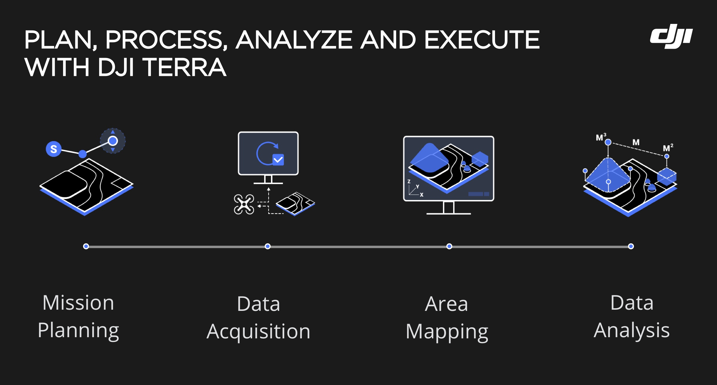
Explore DJI Drone Solutions

Optimized for accurate geospatial data collection

Drone technology has been transforming the AEC and surveying industry. High-precision drone platforms and photogrammetry software streamline processes and improve efficiency throughout the project lifecycle. DJI is proud to lead the surveying drone market in providing highly-integrated, accurate, and affordable solutions for land surveyors, urban planners, AEC professionals, and more. 

Portable Mapping Solution 

Phantom 4 RTK

  • All-in-one centimeter-level accurate platform
  • Fits in a backpack
  • 20 MP 1-inch CMOS Sensor
  • Built-in RTK module

1cm+1ppm
RTK Horizontal Positioning Accuracy

1.5cm+1ppm
RTK Vertical Positioning Accuracy 

5cm* Absolute Horizontal Accuracy of Photogrammetric Models

*When flying at 100m height, 2.7cm GSD, sunny

  • Accurate positioning data with TimeSync
  • Integrated flight planning with GS RTK app
  • Compatible with D-RTK 2 High Precision GNSS Mobile Station
  • Supports RTK and PPK using DJI's Cloud PPK Service
  • Max flight time: 30 min
  • Max transmission range: up to 4.34 miles (7 km)

Full-frame Photogrammetry Solution

Matrice 300 RTK + P1

P1 on M300

  • 45MP Full-frame Sensor
  • Low-noise, high sensitivity imaging extends daily operational time
  • Global Mechanical Shutter, Shutter Speed 1/2000 Seconds
  • Supports 24/35/50mm lenses with DJI DL mounts
  • Cover up to 7.5 km2 in a single work day with Smart Oblique Capture

Smart Oblique Capture -1

Versatile LiDAR Solution

Matrice 300 RTK + L1

L1 on M300

  • True-color point cloud models in real-time
  • Survey-grade 20MP RGB Camera with a 1-inch CMOS and mechanical shutter
  • Frame Lidar with up to 100% effective point cloud results
  • Detection Range: 450m (80% reflectivity, 0 klx) /190 m (10% reflectivity, 100 klx)
  • Point Rate: 240,000 pts/s, supports 3 returns
  • High-accuracy IMU: 0.025° (roll/pitch) / 0.08° (yaw)

LiDAR Topographic Map GIF

Software Solution

DJI Terra 

  • PC-based photogrammetry software
  • Supports real-time 2D mapping and 3D point clouds. Produces highly detailed 2D and 3D reconstructions, as well as supports measurement and annotation
  • Bulk process up to 400 images/1 GB of RAM *, minimizing the wait time between field work and digital visualization
  • Convert the coordinates of your maps and models into 8500+ major coordinate systems

Optimized Terra Transform


Ready to purchase? Fill out the information below, and a member of our team will reach out to you soon.

New call-to-action

Explore More Content