Jon Mills is Professor of Geomatic Engineering in the School of Engineering where he leads the Newcastle Earth Observation laboratory (NEOlab) within the Geospatial Engineering Group. Jon is currently Chair of Commission 1 on data acquisition for EuroSDR (European Spatial Data Research). He has previously served as an elected Member of Council for the International Society for Photogrammetry and Remote Sensing (ISPRS, 2012-16), as President of ISPRS Technical Commission V on close range image measurement techniques (2008-12), and as Chair of ISPRS Working Group I/4 on airborne digital sensor systems (2004-08). Jon's research develops optimised image and range-based modelling solutions for measurement, mapping, monitoring and parameterisation of engineering models and has been disseminated through the publication of over 200 papers in refereed journals, conference proceedings and professional periodicals. His work has also been highlighted in the national and international media.
.jpg?width=158&name=picture%20(1).jpg) Land surveying engineer with comprehensive expertise in integrating geospatial data from various sources (UAV, TLS, ALS, GNSS, Total station, CCTV cameras etc.) as well as applying photogrammetric and computer vision techniques to real world problems relating to the natural and built environment. Member of the Newcastle Earth Observations laboratory (NEOLab) within the School's Geospatial Engineering Group.
Land surveying engineer with comprehensive expertise in integrating geospatial data from various sources (UAV, TLS, ALS, GNSS, Total station, CCTV cameras etc.) as well as applying photogrammetric and computer vision techniques to real world problems relating to the natural and built environment. Member of the Newcastle Earth Observations laboratory (NEOLab) within the School's Geospatial Engineering Group.
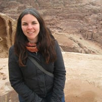
 Lesley Davidson is a professional archaeologist specialising in survey, GIS and illustration. In 2004 she obtained an undergraduate degree in archaeology from Wilfrid Laurier University, Canada and in 2013 an MA in Landscape Archaeology, GIS and Virtual Environments at the University of Birmingham, UK. After more than 10 years of working in industry, Lesley decided to return to academia and is currently undertaking a PhD at Newcastle University in Geospatial Engineering and Archaeology. Her research focuses on assessing and predicting the impact of natural environmental hazards on cultural heritage landscapes using Hadrian’s Wall World Heritage Site as a case study. As part of her PhD research, Lesley has collected both video imagery and lidar data with a DJI Phantom 4 Pro and a Robin Mini UAV lidar system mounted to a DJI Matrice 600 Pro.
 Postgraduate Research Student at Newcastle University and James Hutton Institute Aberdeen.
Blog
White Paper
Blog
We do not disclose your personal information to third parties in exchange for monetary consideration. Nevertheless, under certain U.S. state privacy laws, such as the California Consumer Privacy Act ("CCPA") and the Virginia Consumer Data Protection Act ("VCDPA"), disclosing personal information for personalized advertising purposes may be considered a "sale" or "sharing" of personal information, or processing for "targeted advertising" purposes. Residents of these U.S. states have the right to opt out of the "sale" or "sharing" of their personal information or the processing of their personal information for "targeted advertising." This opt-out right may vary by state, but we nevertheless offer a unified option for our U.S. customers to exercise this right.
If you want to opt out of the sale or sharing of your personal information or processing for targeted advertising, please deselect the "Marketing Cookies" checkbox through Cookie Preferences. Please note that you will need to opt out on each browser you use.
You can learn more about how we collect, use, and disclose your personal information, as well as other rights and choices you may have, by reviewing our Cookie Policy.
Copyright © 2026 DJI All Rights Reserved.
Feedback on web experience? Click here