
Most people take electricity for granted until a power outage occurs. Only then do we realize how much our modern lives rely on well-maintained energy infrastructure. And our need for power keeps rising. In fact, world energy consumption has skyrocketed from 7,323 terawatt-hours (TWh) in 1980 to a whopping 23,398 TWh in 2018.
To keep up with surging electricity demands, countries have had to generate more and more power. In that respect, China actually leads the world in energy production as well as energy consumption. Staying ahead of the demand curve, China’s sophisticated national power grid produces energy from a number of sources including coal, solar, wind, nuclear, and hydroelectric. However, most of China’s coal and hydroelectric plants are located in the western section of the country while the majority of its citizens live in the eastern part.
Due to this fact, China has constructed a number of ultra-high-voltage (UHV) electricity transmission power stations. Interestingly, UHV transmissions allow more electricity to be transmitted over longer distances at a higher voltage. It’s also more efficient than other methods of power transmission and produces less pollution.
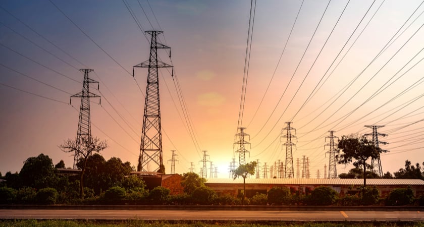 Electrical transmission towers
Once power is generated in the west of China, UHV electricity is piped out over large cables and travels great distances over huge electrical transmission towers. It eventually ends up at electrical substations where the voltage is either stepped up or stepped down depending on where it is headed to next: another substation, an industrial park, or a residential area. Thus, electrical substations are critical components of any power grid, and keeping these substations up and running is essential to the overall productivity of any country.
We’ve all driven past electrical substations and marveled at the design and curiously gazed at all the odd components inside. From afar, substations look like a huge alien-inspired mesh of twisted metal and steel. In actuality, each element of these substations plays a vital role in the safe transmission of electrical power. As a result, these substations employ a large team of engineers who routinely inspect the infrastructure to ensure that the electricity keeps flowing 24/7. However, inspecting these structures on foot is incredibly time-consuming, costly, and even dangerous.
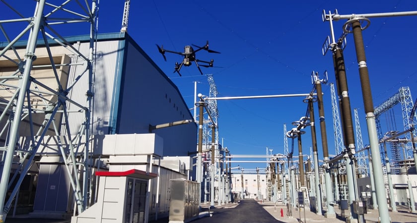
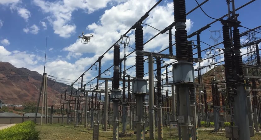 Substation inspection with the P4 RTK
Drone LiDAR Inspection
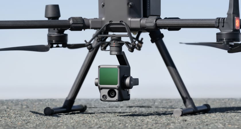
To lessen the burden of substation inspectors, DJI offers the Matrice 300 RTK drone with a Zenmuse L1 camera. The M300 is ideal for power station inspection as it has six obstacle-avoidance sensors which come in handy when flying around cables and high voltage areas. The L1 leverages a highly accurate IMU and a Livox LiDAR module, along with a survey-grade RGB camera, all on a triple-axis stabilized gimbal. This combination allows for the seamless production of high-density true-color point clouds in real-time.
 M300 RTK with the Zenmuse L1
To prove how effective the M300 + Zenmuse L1 are in power station inspections, DJI and their local partner, Cloudstar, demonstrated their automated drone inspection solution at the Kunbei substation located in Yunnan province in southwestern China. This substation is part of the Wudongde hydropower project which was constructed for the China Southern Power Grid (CSG). Built for massive power generation, it creates the world’s highest voltage and has the world’s largest transmission capacity. Furthermore, the 1,452 km (902 miles) Wudongde hydropower project delivers power from Yunnan in the west, all the way to Guizhou, Guangxi, and Guangdong provinces as well as to Hong Kong and Macau. Once completed, the project is expected to transmit up to 33 TWh of clean power annually.
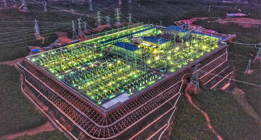 The Kunbei electrical substation in western China. Source: China Southern Grid
Power Station Inspection
In general, automated drone inspection entails mission planning and waypoint selection, automated flight, precise data capture, and post-processing and analysis. Initially, a drone is flown over the inspection area to create a 3D map. After a true-color 3D map is created, engineers can produce a highly detailed flight path for the drone, one that covers every important detail of the substation. To obtain extremely detailed data, the Zenmuse L1 uses a LiDAR module that aims pulsed laser-light beams at structures to generate precise point clouds.
Next, DJI Terra software can be used to simulate the flight path and the user-friendly software also allows inspectors to quickly make flight adjustments.
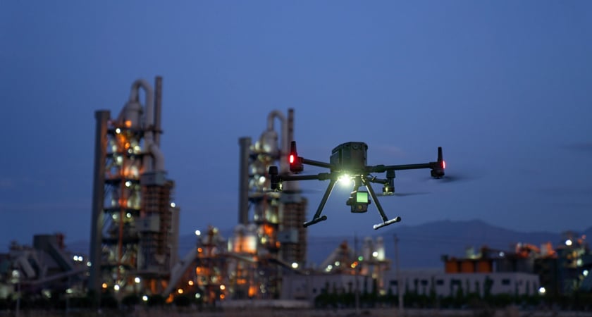
Automated Inspection
Once the flight path has been set, a pilot can then fly the drone through the designated mission and fine-tune the camera angles, gimbal settings, and waypoint settings further. Afterward, engineers can simply run the automated drone inspection whenever they like and the drone will fly the exact same flight and take the exact same pictures every time it flies a mission.
This not only simplifies the inspection process but also provides the engineers with a library of historical data captured by the drone’s cameras. This allows inspectors to compare drone images over time and more readily discover flaws in the infrastructure.
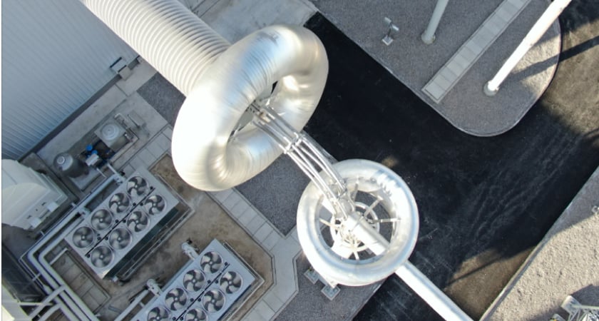 Detailed drone inspection of substation components
The end result is the substations can be inspected more often and in more detail, the inspectors are kept safe, the company saves time and money, faults and damage to the infrastructure are more readily noticed, and the consumers benefit from a continuous, uninterrupted flow of electricity.
At the Kunbei substation, the M300 with its Zenmuse L1 flew 8-minute missions that included 43 waypoints and produced 120 high-resolution images. The drone ended up covering an area of 306 m x 120 m (335 yd x 131 yd) and effortlessly flew through sections of the substation prone to high levels of electromagnetic radiation. When the drone returned after each pre-programmed flight, the engineers easily generated a refined 3D model in minutes using DJI Terra software and then analyzed the data. This way the team was able to quickly stay abreast of any structural changes to the substation.
 Matrice 300 RTK with the Zenmuse L1
Amazing Results
After implementing automated drone inspection, the CSG team discovered that drone inspection was 500% more effective than human inspection alone. Better yet, automated drone inspection eliminated safety issues, reduced costs, and dramatically improved efficiency.
After using DJI drones in numerous substations, the CSG team determined that DJI’s automated drone inspection solution is a critical part of keeping the west-east power grid up and running in China.
“By using DJI’s automated drone inspection, we are ensuring the safe transmission of hydroelectric power from Yunnan in the west all the way to the east coast of China and beyond. And having consistent and reliable power throughout the region not only provides a boost to the economy but also ensures that our customers can lead more productive lives.” - Dan Wang, Deputy Head of the Kunbei Substation
 Matrice 300 with Zenmuse L1 inspecting the Kunbei substation
To date, DJI drones have actually inspected over 400,000 kilometers (216,000 miles) of power lines across China which is more than 30% of all the lines in China.
Collaborating with the CSG team and successfully implementing automated drone inspection on China’s national power grid has been a major milestone for DJI. Looking ahead, DJI plans to launch more efficient, more intelligent, and more user-friendly automated drone inspection solutions that will help engineers more quickly and more effectively inspect substations, transformers, transmission towers, and other critical aspects of the power grid.
To learn more about how drones are used during powerline inspection, click here. And to learn more about how drones are used for general inspection, click here.
And for more information on how your team can implement automated drone inspection, contact a DJI representative near you.
Sources:
https://www.statista.com/statistics/280704/world-power-consumption/

-2.png?width=300&name=Insight%20blog%20featured%20image%201140X660%20(4)-2.png)
-2.png?width=300&name=Insight%20blog%20featured%20image%201140X660%20(3)-2.png)
.png?width=300&name=HS%20-%20Featured%20Images%20(7).png)