
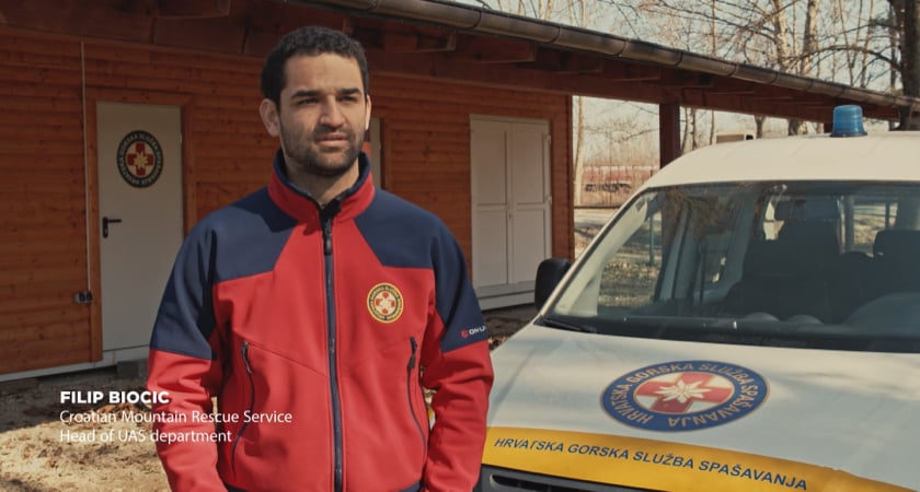
“No training and scenario simulation can prepare you for the real thing. So, we started doing what we do best: using technology to help save lives.”
~ Filip Biočić, Head of UAS Department, Croatian Mountain Rescue Service
Amidst aftershocks, panic, and debris, the Croatian emergency services of Petrinja, Sisak, and Glina were called upon on December 29, 2020, to offer immediate assistance following a 6.4 Richter magnitude earthquake.
But according to Filip Biočić, Head of UAS Department at the Croatian Mountain Rescue Service – HGSS, no training or scenario simulation can match up the severity of the real situation. “The first challenge was to establish the base of our operations and be ready to adapt as quickly as possible to a relatively new situation,” he says.
Drones in earthquake disaster response
HGSS’s K9, mobile aid, and UAS teams were quickly deployed to get the lay of the land, provide food and water, and conduct a first assessment of the damage caused by the shakes, along with the help of M SAN Grupa’s certified UAS pilots Dijana Uljarevic and Goran Bajci.
“Except for a post-earthquake aerial mapping in Zagreb in March 2020, we never found ourselves in a situation of such gravity. So, we just started doing what we do best: using technology to help save lives,” says Biočić.
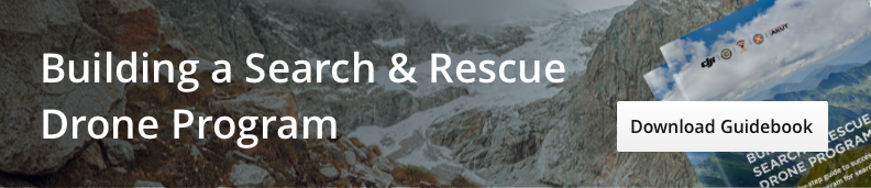
Indeed, there are few organizations in the world that have as much experience with deploying drones for search and rescue operations as HGSS. Their experience has been cataloged in a DJI guidebook for other groups who seek to build their own SAR drone program.
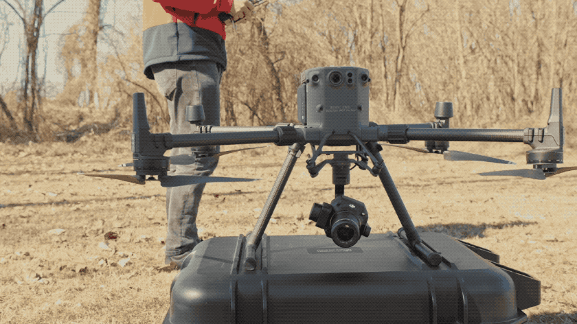
On two separate occasions, it took them just 15 minutes to locate a missing person thanks to the Matrice 300 RTK thermal camera and a third-party loudspeaker payload, whereas a helicopter would have meant hours and increased risk of hypothermia.
Post-disaster emergency mapping with drones
While locating people covered by rubble is one of the primary reasons why drones are used in disaster scenarios, it is thanks to detailed orthomosaic maps that a search and rescue mission can be planned in the first place.
Nowadays, drone mapping for disaster response is indeed the most time and cost-efficient way to inspect and collect data, while simultaneously running rescuing operations.
The robust Matrice 300 RTK with the new Zenmuse P1 camera, increased flight time, auxiliary lights, and directional sensors, was instrumental for the HGSS team in inspecting, surveying, and mapping the hard-hit area. But for any mission to work out smoothly, a great amount of time and energy is invested in the preparation of the area of intervention, drone equipment, and personnel.
“Permissions always come first, so it is crucial to get in touch with the relevant authorities that will eventually use our material for future risk assessment and rebuilding,” says Biočić, stressing the importance of cooperation and compliance.
“We then designate an area of operation for every specific team, usually two people per drone on a given day, before moving on to the next task, coordinating between the UAS command requirements and our headquarters’ state crisis missions,” he adds.
Furthermore, continuous communication with pilots on the field is paramount to even ensure an uninterrupted and timely workflow, with additional personnel carrying new SD cards and re-charged batteries.
In total, it took approximately three weeks for rescue operators to map 5300 ha of the damaged area. Just to map the 2300 ha affected area in the city of Sisak, the team needed to set up 68 polygons in one day with the support of 8 DJI drones, including Matrice 300 RTK, Matrice 200, Inspire 2, and Phantom 4 RTK with P1, X5S and X7 payloads and deliver a ground sample distance (GSD) of 5 cm/pix.
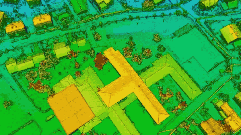
“The P1 mechanical shutter and full-frame sensors allow us to get textures and terrain details in real-time that were simply not possible to obtain with other cameras,” says Biočić. “Also, while the Phantom 4 Pro has always been useful for mapping, the arrival of the Phantom 4 RTK has drastically increased the frequency and improved the precision required for this task.”
After drone mapping is complete, all devices are checked again, micro-SD cards are unloaded, and data is delivered to all relevant institutions for processing and analysis – a step that typically can be carried out seamlessly with the DJI Terra integrated mapping software.
Drones as ideal tools for disaster response
Not only were drones a more efficient disaster response mapping solution compared to the prohibitive challenges entailed with the use of helicopters, but they also removed the risk of having personnel inspect precarious infrastructure.
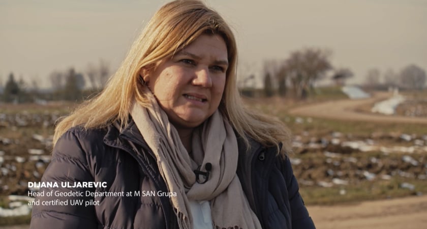
Just as Dijana Uljarevic, Head of Geodetic Department at M SAN Grupa was warming up her drone on the ground and a group of operators were climbing down from an inspection on a roof, the ground began to shake suddenly and violently. “I began to flee to save my life, my drone got buried in the rubble, under the collapsed house. But I am happy that only the drone was destroyed, and my colleagues and I survived,” Uljarevic recalls.
Today, Biočić’s team at the Croatian Mountain Rescue is planning to continue adding more enterprise-level equipment to their drone fleet for special operations such as mapping, 3D survey with LIDAR scanners and multispectral imaging.
Speaking of his personal experience, Biočić cannot stress enough the importance of unity and cross-collaboration with his UAS team: “There are no other people I’d rather be with in this type of situation other than my colleagues and teammates,” he says. “I know that when we are together, our knowledge, expertise, shared will, and empathy can be used to save lives, and that is all that matters.”
We at DJI take this occasion to extend once again our most sincere condolences to the families of those who lost their lives in the Petrinja earthquake in 2020. We also wish to thank the Croatian Mountain Rescue Service and M SAN Grupa for believing in our technology and for their commendable actions during the post-disaster response.
-2.png?width=300&name=Insight%20blog%20featured%20image%201140X660%20(3)-2.png)
.png?width=300&name=HS%20-%20Featured%20Images%20(7).png)
-1.png?width=300&name=HS%20-%20Featured%20Images%20(5)-1.png)