
As we brace ourselves for the effects of climate change, one of the greatest threats immediately facing us is that of wildland fires. Rising temperatures combined with rainfall shortages in regions that normally don’t see such dry conditions leave great swathes of land at risk of wildfires.
More alarming is that these hazards arise at a time when the budgets of those who protect against these threats are either not increasing, or worse, being reduced by negatively impacted government budgets, thanks to issues such as the recent pandemic.
So, how can firefighters facing a modern medley of challenges adapt and respond to the increased frequency and intensity of fires, despite decreased budgets? How can they meet this increased operational tempo and respond to increasingly larger incidents that demand levels of efficiency not seen before?
You guessed it - among the many solutions being sought, one answer can be found in the use of wildfire drones, especially thermal drone cameras.
The perfect wildfire drone: Matrice 30T
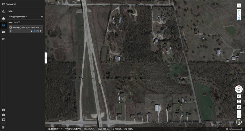
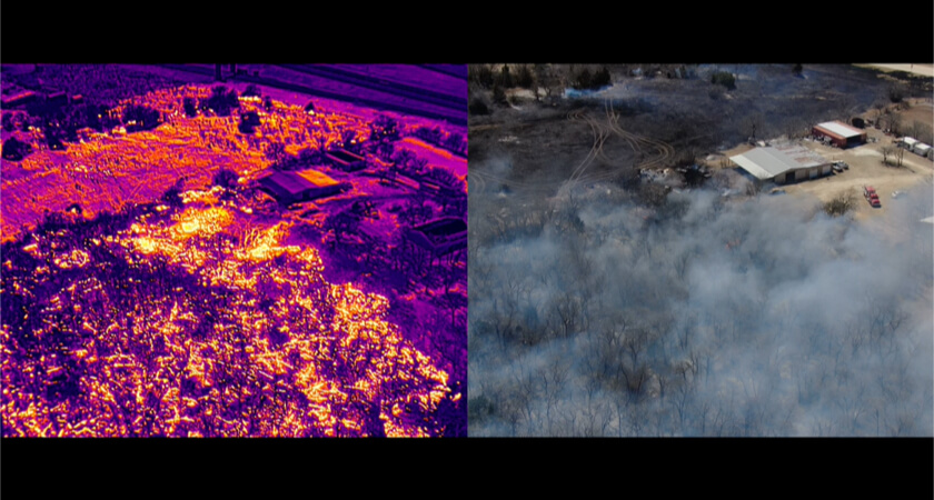
A recent wildfire in Cleburne, Texas proved to be an exceptional example of how drones can elevate firefighting response efficiency while increasing the safety of citizens and responders. At around noon, March 20th, 2022, a fire broke out in a rural area near a busy highway.
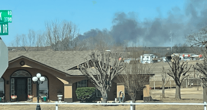
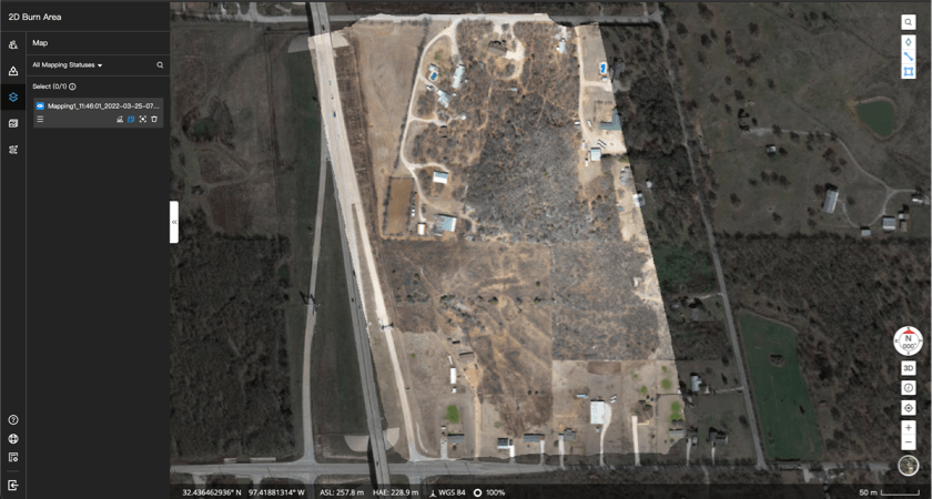
As it rapidly expanded and threatened nearby houses, numerous fire departments rose to the call quickly. Arriving on scene, they were greeted with a smoking expanse of 20 acres that was rapidly spreading but with little information as to where and how fast it was consuming everything in its path due to the usual issues with a ground level view.
Among the teams who responded to the call were the North Central Texas Public Safety Unmanned Response Team (NTXPSURT), including Garret Bryl and yours truly (Ret. Chief Wayne Baker).
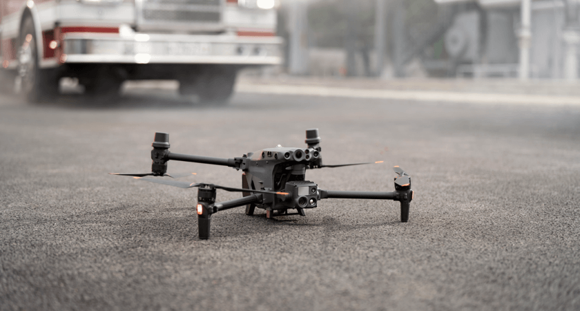
NTXPSURT happened to be in possession of an early test unit of the Matrice 30T and it was quickly deployed to provide valuable real-time aerial awareness to the incident commander.
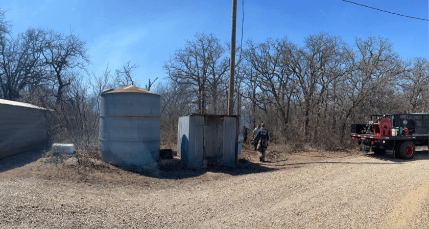
As the fire began to spread into a wooded area, ground visibility for personnel became obscured by trees and smoke and communication became impaired with the inability of crews to effectively describe their location and needs to the incident commander, a seasoned wildland firefighter himself.
Fortunately, the M30T’s thermal drone camera enabled the incident commander the ability to not only monitor the size, location, and direction of the fire, but also identify a spot fire igniting in the woods ahead of the fireline and crews operating along the flanks protecting houses.
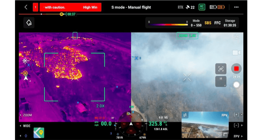
Equipped with this clarity, the incident commander could now confidently develop his incident action plan and immediately direct firefighters to specific locations under threat. Ultimately, the M30T and its thermal camera helped make it safer, easier, and more efficient to contain and extinguish the wildfire.
Improved firefighting efficiency with FlightHub 2
While drones themselves work tremendously as an information-gathering tool, we are also beginning to see improved drone software solutions designed and built to help teams mobilize around the intelligence they provide.
In the case of the Cleburne fire, Garret Bryl fully leveraged DJI FlightHub 2 to keep track of the wildfire’s perimeter. To start, he used a feature called 2D Cloud Mapping to quickly create a brand new orthomosaic map of the fire.
He quickly dragged a box around the target area and the M30T did the rest. This map, which is processed in minutes, is automatically overlaid on the satellite maps of the area, and gives emergency teams the latest information they need to assess the area as it currently exists, thus allowing them to respond with greater safety and efficiency.
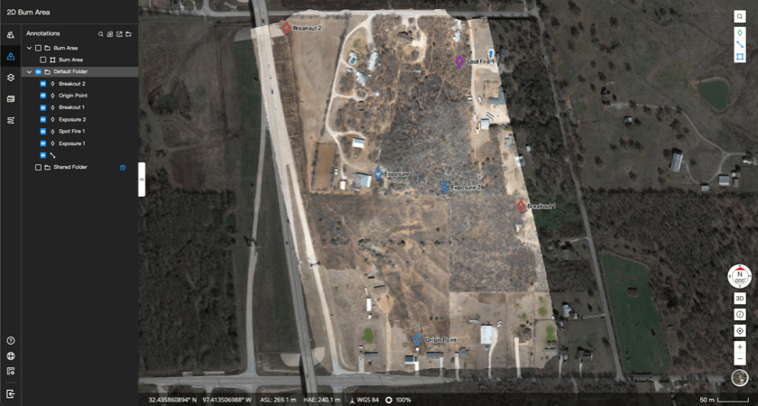
Next, thanks to the M30T’s laser rangefinder, he was able to drop PinPoints, which are beacons that are placed on precise coordinates, to help delineate the fire’s boundaries and communicate points of interest to team members, such as the location of the spot fire.
Each PinPoint can be labeled, color-coded, and has GPS coordinates that can be shared, so the incident commander could readily refer to them and direct resources to areas of greatest need.
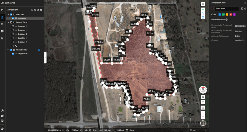
Post-fire, Garret was able to go back and measure the perimeter of the area affected by the wildfire, as well as the total area thanks to the measurement and Live Annotation tools in FlightHub 2.
Altogether, Bryl is impressed with the software’s features and how seamlessly it combines rapid mapping with cross-team communication during live fire response.
The Incident Commander showed me three structures that were in danger and asked me to monitor them closely. I dropped a waypoint (aka PinPoint) on each one. Every time he returned, we could look at each in seconds, regardless of where I had maneuvered to.” - Garret Bryl, NTXPSURT
Wildfire drones make for quick work
Four hours later, by 4 pm that afternoon, the wildfire had been entirely brought under control.
Drones have been shown to be a force multiplier in other areas of public safety for many years. From increasing situational awareness for decision makers, to decreasing risks at emergency incidents, we have seen time and again how drones have dramatically improved the efficiency of public safety operations.
As seen in Cleburne, the efficiencies in decision making brought by thermal drone cameras are realized when we see an incident commander leverage wildfire drones for greater situational awareness of the size, location, and movement of a fire, as well as the threats that it poses to the people and area around it.
Information provided by wildfire drones can aid rapid decision making, such as where to deploy resources, where the safest locations are to make direct attacks on a fire, as well as the best actions to indirectly attack a fire and protect the areas threatened - all with the ultimate goal to reduce loss of life and property while stabilizing the incident.
Even though use of drones in public safety goes back several years, the use of drones in wildfires is one of the areas still seeing a slower integration by agencies for many reasons such as lack of funding, lack of personnel to pilot and maintain drones, risks to crewed firefighting aircraft, as well other policy and regulatory issues involved in such large scale incidents.
However, where drones have been integrated into operations we have seen great success, such as the use of drones to identify areas in most need of mitigation efforts such as pre-emptive fuel removal, clearing of fire breaks, as well as use of multi-spectral imagery to assess fuel moisture content of areas most at risk to fire. These prevention efforts serve as some of the first lines of defense for a wildfire.
Conclusion
As is often discussed, drones are benefiting our lives in tremendous ways. Some we can directly see, others we may not. While we may not be able to directly see drones used by our first responders to benefit our lives, we can see that in the case of wildland fires drones have a great potential to make a difference, from reducing the risk to our firefighters, to helping them keep us safe and our houses protected.

-2.png?width=300&name=Insight%20blog%20featured%20image%201140X660%20(3)-2.png)
.png?width=300&name=HS%20-%20Featured%20Images%20(7).png)
-1.png?width=300&name=HS%20-%20Featured%20Images%20(5)-1.png)