Propeller’s 3D drone mapping and data analytics solutions give you the power to track, map, and measure your site with visual tools that everyone can use from any device, anywhere, anytime. Heavy civil and resources operations trust Propeller to help teams work together better to understand how fast they’re working, how much they’ve done, and if they’re on budget. Track, inspect, and report on job progress and productivity safely and accurately, with the platform that shows you where you are and where you’re headed.
Find me on:
Recent Posts
Matrice 30 Series Resources
Your home for everything Matrice 30 Series, from official trainings to blogs, user stories, and more
Construction |
AEC & Surveying
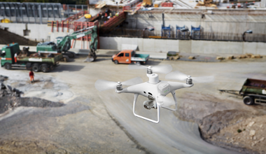
Why DJI’s Phantom 4 RTK is the Missing Piece in the Drone Surveying Puzzle
The Phantom 4 RTK represents the perfect synchrony of price point, level of accuracy, and reliability.
by
Propeller Aero September 9, 2020
To stay in touch and receive ebooks, resources, and product updates, subscribe to our newsletter.