
Growers looking to stay ahead of the curve this growing season can now use the powerful duo of DJI’s Mavic 3 Enterprise (M3E) and DroneDeploy for stand counts and crop scouting.
The latest advancements in DroneDeploy’s Stand Count solution allows agronomists and growers to capture high-quality images that will enable them to make critical planting decisions faster and significantly more accurate.
What sets the DJI Mavic 3 Enterprise Apart
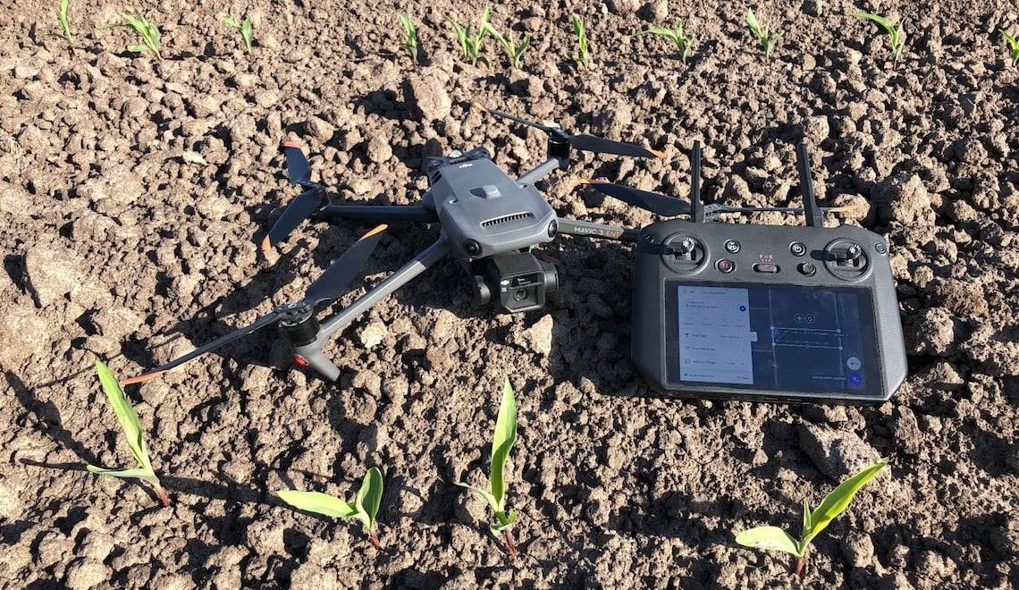
DJI Mavic 3 Enterprise
Using DJI M3E for stand counts and crop scouting enables your teams to:
- Cover more area in less time: With the M3E’s faster flight speed (of up to 34 mph) and longer battery life (45 minutes of flight time), you can cover nearly double the area in the same time as if you were flying with the DJI Mavic 2 Pro. When mapping with the M3E, images will be captured every 0.7 seconds compared with every two seconds with the M2P, which allows the drone to fly fast while maintaining high-quality image capture.
- Capture superior image quality: The M3E’s 4/3” CMOS 20MP wide lens with a mechanical shutter ensures crisp image quality on Stand Count flights and while mapping. The mechanical shutter reduces motion blur allowing the machine learning algorithm to provide highly accurate results.
- Analyze more detail at early crop emergence: The M3E’s zoom lens unlocks the ability to capture more details while maintaining a safe altitude, allowing growers to conduct DroneDeploy Stand Counts on earlier phases of growth, including VE, or emergence, to evaluate uniformity and make replant decisions as early as possible.
- Use a dedicated smart controller: Put your personal iPhones and iPads away as the M3E comes with a smart controller you can run on the DroneDeploy Flight app. You no longer have to worry about your screen going dim when capturing in the bright sunlight or your mobile device overheating.
Map Fields in Minutes, Conduct Automated Stand Counts, and make In-field Recommendations - all Offline at a Field's Edge with DroneDeploy
Growers looking for better ways to demonstrate product efficacy in remote areas, identify field management opportunities faster and more reliably with real-time drone data can count on DroneDeploy’s solutions for agriculture.
Particularly for early season, DroneDeploy Stand Count removes the need for manual, time-consuming, inaccurate stand counts with our automated, field-edge stand count workflow that enables growers to quickly and accurately capture and analyze the crop data needed to evaluate planting decisions.
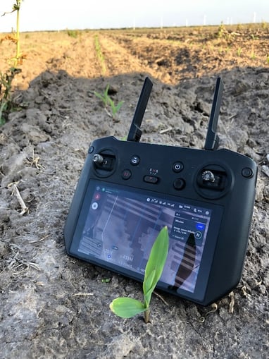 DJI RC Pro Enterprise
- Evaluate uniformity, assess gaps in your field, prevent weed growth, estimate population and yield, and make replant decisions: With DroneDeploy’s automated Stand Count solution, fly and receive processed results for a 400-acre field in less than 30 minutes, all offline.
- Real-time, offline, insights: Live Map allows growers to produce a 2D map on your device as the drone is flying – even without a cellular or data connection – for real-time insights, so you or your team can immediately validate findings and take follow-up action while still in the field.
- Data capture on-demand: Growers can fly with confidence over varied terrain with DroneDeploy’s Terrain Awareness feature. With Terrain Awareness enabled, your flight altitude will automatically update to fly relative to the ground’s elevation, maintaining the same altitude throughout the flight to ensure the highest quality imagery, even if you’re flying completely offline.
- Get a complete and accurate picture of crop health in minutes: Immediately after your flight, analyze your field with Plant Health. Use Plant Health maps to generate variable rate prescriptions and quantify the benefit of your services pre- and post-treatment applications. Increase the accuracy and efficiency of your insurance claims process by quantifying areas of total loss after weather events using aerial maps.
- Easily share results with your team and customers: Once your flight is complete, you’ll receive an automated Stand Count report that is easy to share with colleagues and customers via email or text. You’re also able to share view-only links from the field for immediate analysis by colleagues and customers.

DroneDeploy software with M3E
How Corveta Agriscience is Using DroneDeploy to Increase Yields
Recently, Paul Yoder, Field Agronomist for Pioneer brands, spoke with DroneDeploy on a webinar about how he is using drone technology to enhance his efficiency in the fields within his portfolio.
As an experienced agronomist, Paul uses DroneDeploy’s automated Stand Count software in his daily operations. He’s able to make timely, data-driven decisions on replanting or tweaks to seed drill implements that can ultimately boost yields. With DroneDeploy, growers can make more accurate decisions by easily highlighting areas to focus on–saving time, money, and energy. Additionally, time can be saved by eliminating the need for growers to physically walk fields in order to gather health and growth information.
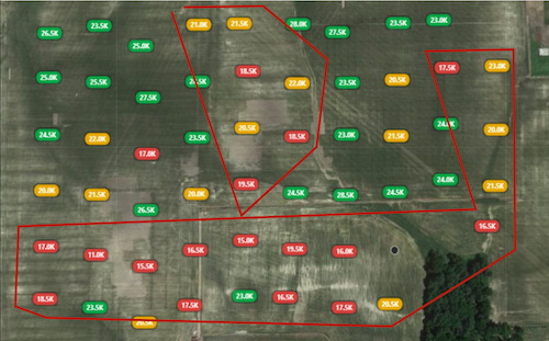
In the webinar, Paul spoke about a scenario that involved having to make replant decisions as a result of uneven emergence and crop damage from adverse weather conditions (see example below). DroneDeploy’s Stand Count feature provided Paul with the ability to quickly evaluate the affected areas and provide precise recommendations to the grower. This efficiency not only saved time, but also reduced the resources expended on field assessments.
Mapping Field with DroneDeploy
Will AI or Technology replace me, or us, as agronomists? I can assure you that technology will not replace us, but the agronomists who are using technology will replace those who don't.
- Paul Yoder
How to Get Started
Watch the webinar with Paul Yoder, Field Agronomist for Pioneer Seed brands here or learn more about DroneDeploy’s agriculture solutions here.
Ready to start mapping? Book a demo here.


-2.png?width=300&name=HS%20-%20Featured%20Images%20(2)-2.png)

