
With remote sensing technologies playing a greater role within precision agriculture, seed and chemical companies are leaning more and more on drone imagery to monitor test plots. We have seen the use of small and affordable drones by agronomists to deliver insights become more commonplace, but how has drone technology been adopted within agricultural research farms? Let’s find out.
Research Farms Data Collection
When focusing on research farms, capturing and analyzing drone datasets can be a much more difficult process. Some challenges agricultural researchers face when implementing drones are:
- Researchers have many roles and responsibilities on the farm already, and flying drones can add a significant amount more work time per week
- Missions are flown lower to capture a higher-resolution map for analysis
- Flights over research farms can take significantly longer than flights over commercial agricultural production fields since the required resolution is much greater
- Routine daily/weekly capture is challenging to maintain during the growing season
- High data storage demands with high-resolution recurring flights
- Test plots are often located around the world, but senior researchers are based in a central location
With these factors in place, let’s find out how Syngenta deployed the first DJI Dock for agricultural research purposes.
Syngenta and DJI Dock Test
Syngenta is a global company with headquarters in Switzerland. Syngenta’s 30,000 employees in more than 90 countries are working to transform how crops are grown and protected. Syngenta accelerates its innovation and invests in advancing more sustainable agriculture which is good for nature, farmers, and society.
As part of its thrive for innovation and integration of new technology, Syngenta decided to deploy the DJI Dock on a research farm in Illinois. The DJI Dock was installed in an area with access to 3 different large-size plots capturing both corn and soybeans, it was the ideal location to test the capabilities of remote drone operations for agriculture use. Once the installation and set-up were completed, it was time to plan the missions.
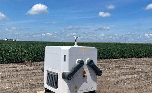
DJI Dock During Installation Process
Mission Planning
There are many ways to utilize the Matrice 30T for agricultural research. The Zoom sensor can help capture leaf-level imagery to look for specific diseases and insect damage, the Thermal sensor gives insights into stress caused by heat, fertilizer, and water levels, and the Wide sensor can help generate basic orthomosaics. However, to use each sensor's strength it requires different mission plans.
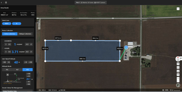
First, a major goal for Syngenta was the autonomous capture of nitrogen test plots to generate orthomosaics. FlightHub 2 recently released support for Area Route planning with the Matrice 30 and Mavic 3 Enterprise series drones. By using the Area Route, we could click around the plot to set mission boundaries, and adjust the flight route altitude based on Ground Sample Distance.
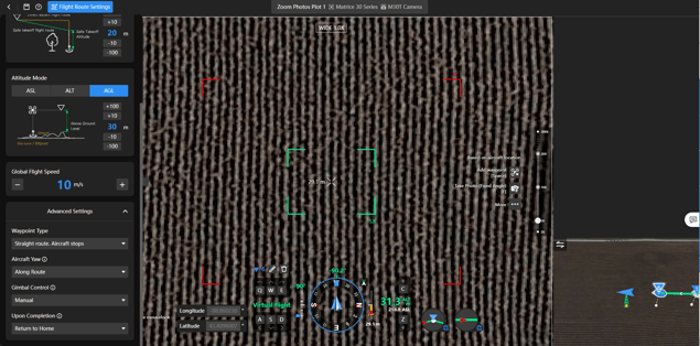
Next, we wanted to create a flight plan to utilize the Zoom sensor to capture ultra-high resolution photos. This type of mission planning can be done in two different ways. If the goal is to capture a few Zoom photos, the Waypoint Route plan functionality within FlightHub 2 works well. Select the Waypoint Route option, and use the Virtual Flight mode to easily fly virtually around the plot and create waypoints for the drone to stop and trigger the Zoom lens.
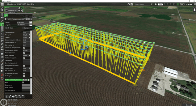
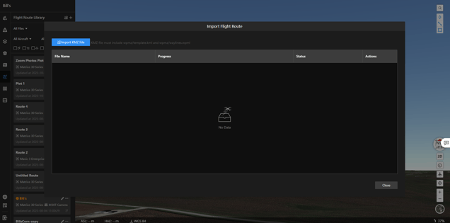
If the goal is to automate a large number of Zoom captures, third-party flight planning software like UgCS can help create a flight plan for the Zoom sensor in minutes. Once the mission is created in UgCS, it can be exported as a kmz. To import into FlightHub 2, navigate to the Flight Route Library, and choose to Import a KMZ instead of making a new flight plan. For more information on UcGS, visit their website.
The only thing left to do before flight was to schedule each Flight Route. This can be done in the Task Plan Library tab. For the most accurate data possible, missions were scheduled around 10 AM to 2 PM during the week so researchers could keep an eye on the drone, and the imagery captured was with sunlight directly overhead.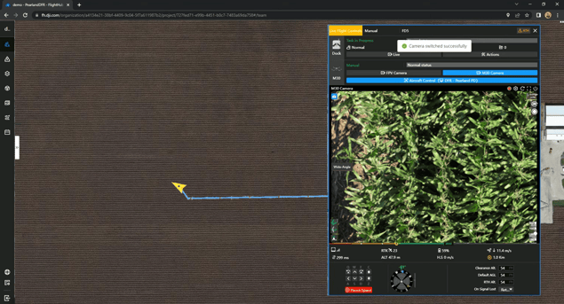
Data Processing
Once the missions were created and scheduled, the drone started capturing data over the plots. The Syngenta team could now access the raw photos from anywhere around the world with FlightHub 2.
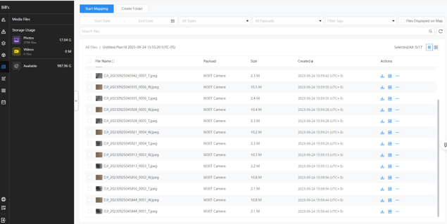
Syngenta is partnered with DroneDeploy, a third party solution specializing in photogrammetry, to help process their research plot data. At the time of testing, each mission folder was exported manually and uploaded to a shared DroneDeploy project.
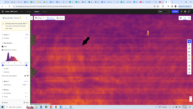
Thermal Data in DroneDeploy Highlighting Water Stress
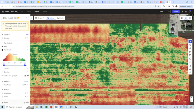
VARI Plant Health Map Derived from Matrice 30T Visual Sensor
With the data capture complete, the final analysis will take place during the winter months. All sources of data capture (including soil test results; tissue sampling; planting, as-applied, and yield maps; and drone data) will be overlaid and gone through by highly trained agronomists and plant scientists.
What's next for DJI Dock & Agriculture
While testing was limited to August and September, Syngenta concluded that the concept of a dock living at the test farm to capture repeatable data saved the agronomy team 10 hours/week of flying and transferring data. With the dock automatically capturing and transferring data to the cloud, the agronomy team could focus on more important tasks, such as analyzing the data, collecting tissue samples, and more.
“With the DJI Dock automatically capturing data weekly, we now have more time to focus on what’s important on the research farm. This not just saves us time, but also increases the frequency of capture, unlocking a deeper level of plant growth trends.” - Bill McDonell (Digital Solutions Lead, Syngenta)
The Matrice 30T’s sensor array came into play for different purposes. The Zoom sensor has proven to be valuable in understanding leaf-level disease pressure. The oblique zoom technology helps capture extremely high levels of detail, but each photo is simply a “snapshot” of a single location. The Wide sensor can create basic orthomosaic maps. The thermal sensor found a few abnormalities late in the season as drought stress increased.
With DJI’s new Dock 2 product focusing on mapping and surveying, 2024 aims to be a great year for research on autonomous dock solutions between DJI and Syngenta.
Special thanks to Bill McDonnell and Jeremy Groeteke for helping conduct this case study!
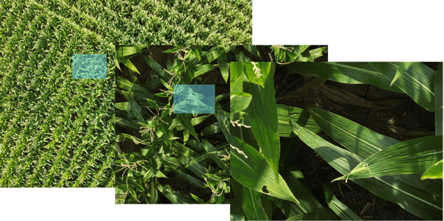
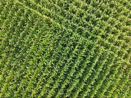
Matrice 30T Wide sensor at 30 feet
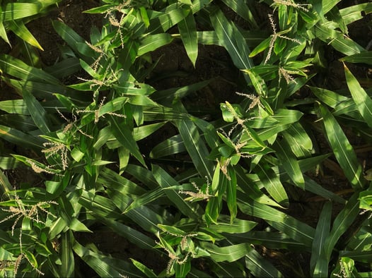
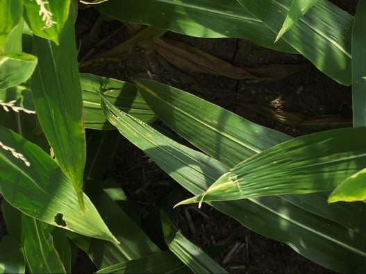
Matrice 30T Zoom sensor 30 feet @ 10X Zoom
Matrice 30T’s Zoom sensor 30 feet @ 15x zoom (cropped in)


-2.png?width=300&name=HS%20-%20Featured%20Images%20(2)-2.png)

