Candrone presents LiAirV: Drone LIDAR Integration with the M300 RTK

Aerial LIDAR now compatible with the DJI M210, M210 RTK, M300 RTK, M600, and other UAV systems

By Candrone Candrone
July 27, 2020

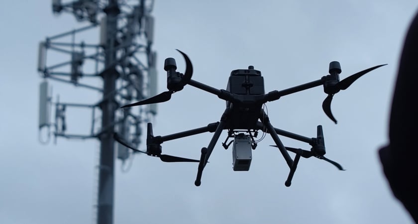
Candrone, an official DJI channel partner, is proud to present the world's first LIDAR system for the DJI Matrice 300 RTK. With sub 5cm± accuracy, 260-meter range and 35+ minutes scanning time, here is the most recent addition to the DJI Matrice family: LiVOX LIDAR and M300 RTK combo.

Drone LIDAR for your business

Designed for versatility, ease-of-use, and high precision, this laser scanning technology captures and delivers accurate point cloud data for mapping, creating GIS (geographic information systems) and streamlining asset management for a plethora of industries. 

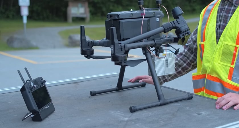
The powerful pairing of LiVOX LIDAR with the long range DJI M300 drone is lightweight and portable, with sky-port mounting for quick and easy setup. Delivering 35-45 minutes of flight time, the LIDAR system acquires impressively precise and accurate data with its 5cm± accuracy. Data processing is quick with its comprehensive software suite, RTK integration and the LiVOX unit makes it easy to merge with ground-based LIDAR data.

Candrone M300 Lidar 3

This powerhouse duo is bound to take your operations to a new level with its versatility, high accuracy and longer range. Put your drone to work to create new and impressive data sets as well as provide valuable data to leading industries such as:

Energy: mapping corridors, scheduling maintenance and simulating environmental situations
Forestry: estimating tree count, managing inventory and removing forest to create bare earth models
Mining: calculating volumes
Construction: mapping sites outside, and merging with inside LIDAR scans, creating full accountability
Infrastructure: digitizing crucial assets and turning into 3D replicas

Candrone M300 Lidar 2

This unique, lightweight and quick-detachable technology is available and supported through Candrone. Visit their website today at Candrone.com to learn more about how to leverage this technology within your industry. 

Rentals, training and data processing are also available to get you up and running quickly, allowing you to evaluate and validate the technology. Connect with Candrone today, at support@candrone.com to talk with one of our on-site experts. 

Share on Social Media:

Tags: AEC & Surveying, Product Innovation

matrice-300-rtk-learn-more

To stay in touch and receive ebooks, resources, and product updates, subscribe to our newsletter.

Candrone
About the Author Candrone

Candrone is a robotics consultancy specializing in aerial and ground-based solutions. We know businesses are looking for assistance in dissecting the information available to choose what tools, software, and sensors are best for their needs. Candrone has a full spectrum of service offerings aimed to make getting started and integrating robotics into your company as easy as possible. The longest-running company of our kind in Canada with over ten years in existence, we've helped countless businesses (including many Fortune 500 companies) gain value through technology.

Related articles

Recent Posts

ZENMUSE L3

AEC & Surveying | Zenmuse | Zenmuse L3

Meet DJI Zenmuse L3: DJI’s Newest Long-Range High-Accuracy LiDAR System

DJI has taken a major step forward in LiDAR innovation with the launch of Zenmuse L3, a system designed to make high-precision aerial mapping faster, easier, and more accessible for professionals...
Read More

DJI Terra

DJI Terra V5.1 Release: Free LiDAR Processing and Cluster Reconstruction Transform Enterprise Workflows

DJI Terra and DJI Modify have released new versions with groundbreaking updates. DJI Terra now offers free support for Zenmuse L3 point cloud reconstruction* Standard and Flagship versions now...
Read More

FlightHub 2

DJI FlightHub 2 On-Premises & AIO: Enhanced Data Security for Drone Operations

In an era where data security and sovereignty have become paramount priorities for enterprises and government organizations, traditional cloud-based platforms might not be a preferred solution for...
Read More

FlightHub 2

DJI FlightHub 2: A New Era of Cloud-Based Drone Intelligence

The latest version of DJI FlightHub 2 introduces a significant leap forward in drone operations management. By integrating intelligent algorithms and a Multimodal Large Language Model (LLM), this...
Read More