
It’s safe to say that drones have already been established as critical tools for emergency teams and inspection crews, and the insights drones deliver from above are invaluable. But as teams bring in more drones, more payloads, more pilots, and more data, the emphasis is now on how this all fits into the big picture.
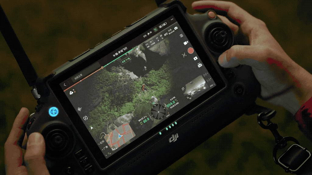
To make the most of UAV technology, incident commanders and drone program managers need a software solution to help synchronize ground teams with what the drones pick up.
The situational awareness drones provide is most powerful when it’s available to the right people at the right time. That’s where DJI FlightHub 2 enters the scene.
FlightHub 2 is DJI’s complete ground-to-cloud drone operations management software, and it’s packed with tools to help you plan missions, stream data, and collaborate with your team in real-time. From fast mapping to DJI Dock management, here are the top five features of FlightHub 2.
Cross-device compatibility
FlightHub 2 is entirely cloud-based, which means it’s accessible, not only to pilots with remote controllers but also to everyone else on the team who has a device with a web browser.
This includes laptops and computers, tablets, and cell phones. All you have to do is log in to your team’s FlightHub 2 mission, or “Project,” and you will have access to the same intelligence gathered by the drones.
Every team member that’s logged in can see and add updates as the mission unfolds. The command center computer, the drone pilots' RC, the cell phones of the team on the ground - everyone shares a single interactive map that enables active collaboration.
Fast mapping for rapid situational awareness
Speaking of a single interactive map, FlightHub 2 offers some quick drone mapping features to give you fast overviews of your target area.
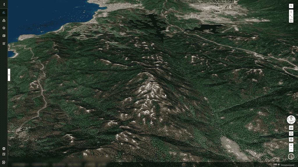
2.5D Base Map
The 2.5D Base Map tool is ideal for emergency scenarios that take place in environments with variations in elevation. It overlays this elevation data over the satellite map of your area, so you can have a more 3-dimensional sense of the immediate environment. This helps you, and ground teams, before you even fly a drone, so you can now take mountains and elevation into consideration as you plan your initial steps and flight routes.
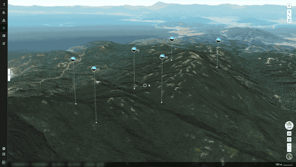
One-Tap Panorama Sync
One-Tap Panorama Sync brings greater clarity at the onset of any public safety or inspection scenario. With one tap, you’ll get a shareable, 360° view of the mission site. This data capture takes just one minute to provide team members with rapid situational awareness of the mission area. Also, your panoramas, and the coordinates from where they were captured, can be displayed on, and opened from, the 2.5D Base Map.
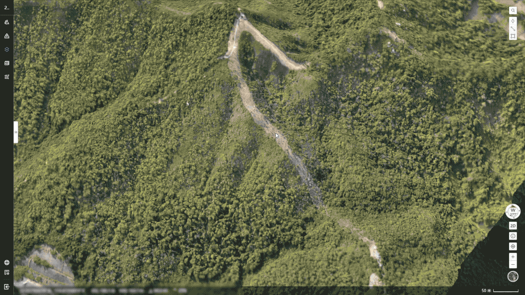
Cloud Mapping
If you need high-resolution details, you can choose Cloud Mapping, which is a game-changer for emergency response teams who need spatially and temporally accurate orthomosaics. Simply drag a box across the area you want to create a map or model of, and FlightHub 2 takes care of the rest.
In a single flight, you can cover up to 1.5 km2 if you need an RGB orthomosaic, or 0.2 km2 if you need an infrared orthomosaic. Your final Cloud Map is then overlaid on your 2.5D Base Map, giving you and your team highly accurate spatial information, captured just minutes before.
Live Annotations
The original FlightHub application allowed drone program managers to manage fleets, track mission progress, and organize the data captured. With FlightHub 2, we’re introducing a range of new tools to enhance real-time collaboration in the field.
FlightHub 2 also has a suite of new measurement tools, called Live Annotations. Team members can drop pins or draw lines, boxes, and shapes to coordinate operations and designate points or areas of interest.
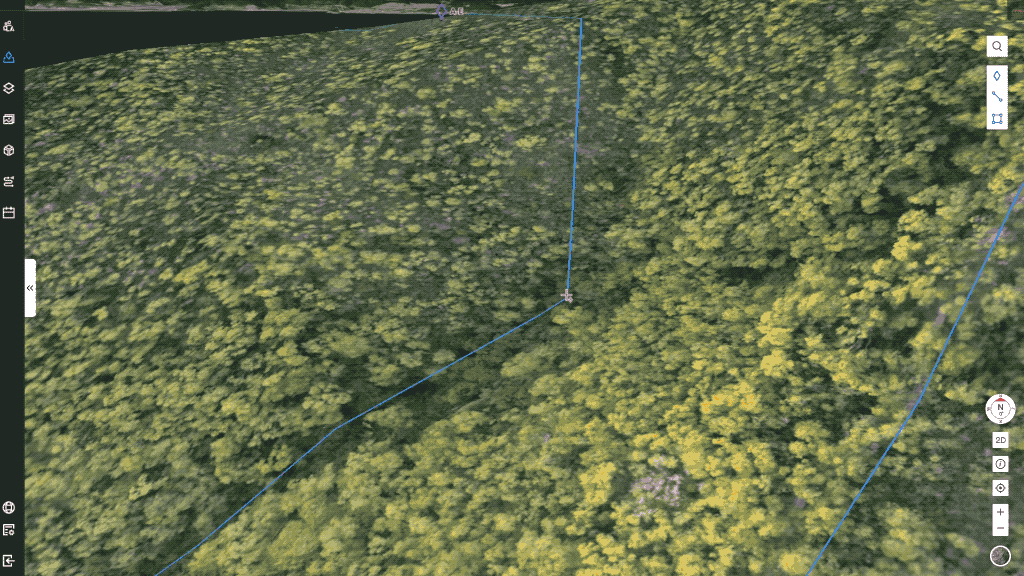
With lines, draw paths and guide ground teams along the safest or most direct routes, while also getting precise distance measurements between points.
With the polygon tool, create and drag shapes to coordinate search/mission areas, while providing your team with the total m² that needs to be covered.
All of these Live Annotations can be overlaid onto shared 2.5D Base Maps and Cloud Maps to enhance collaboration between mission commanders, drone pilots, and ground teams. These tools were developed to get aerial intelligence to the people who need it most, fast. They provide instant synchronization for operations with moving parts.
Advanced media management
FlightHub 2 was built for more than just search and rescue teams and emergency first responders, but also any job, like surveying and inspection, that uses drones and needs to keep organized.
FlightHub 2 has powerful mission planning functions, so flight routes or tasks can be created, saved, and shared to other pilots. It also has everything you need to effectively store and manage your aerial data. On top of embedding information in real-time onto 2.5D cloud maps, all of your photos and videos can be automatically uploaded to the cloud for later analysis.
Crew members can be assigned varying levels of access and tasks can be assigned in the cloud.

Full control of DJI Dock operations
FlightHub 2 is also your hub for all DJI Dock operations. Within the app, you can monitor the status of your M30, plan and schedule missions, and coordinate everything required for round-the-clock, automated operations.
As long as it has power and an internet connection, the DJI Dock takes care of charging your M30, housing it, and monitoring its status. All you have to do is plan your flights. You can set up routes with waypoints, choose a fixed area for data gathering, or select an operational corridor for regular data collection.

Built for DJI’s flagships
FlightHub 2 is launching alongside the Matrice 30, but it also supports the Matrice 300 RTK and the H20 Series payloads. And in the future, FlightHub 2 will support new Enterprise platforms. This is a software solution built specifically for the latest drones from DJI Enterprise, and devoting the time and resources into learning how to use FlightHub 2, will have major payoffs for your drone program, in both the short and the long term.

Cloud-based mission planning & collaboration
FlightHub 2 combines data storage and fleet management with intuitive tools that support public safety and inspection operations in real-time. It’s packed with collaborative solutions that improve situational awareness for all team members. We’ve built an empowering application that enables better data sharing communication, giving mission commanders everything they need to make smarter decisions and deploy resources more effectively.
Through October 31, 2022, FlightHub 2 has a free open beta where you can test and enjoy all FlightHub 2 features.
To find out more visit the DJI FlightHub 2 page here: https://www.dji.com/flighthub-2


-3.png?width=300&name=Insight%20blog%20featured%20image%201140X660%20(2)-3.png)