Drone surveying has fast become one of the most effective uses of drone technology to date. Instead of traditional manual methods of surveying, which are expensive, time-consuming, and can take anywhere from weeks to months for large sites, drone surveying is significantly faster and more efficient.
However, speed is not the defining factor for a good survey. Rather, a good survey needs accuracy. And this is where the Matrice 300 RTK paired with Propeller PPK is leading the charge. In this article, we take a look at how this powerful combination can deliver top-quality survey results, faster and more accurately than ever before.
Simply one of the best surveying tools
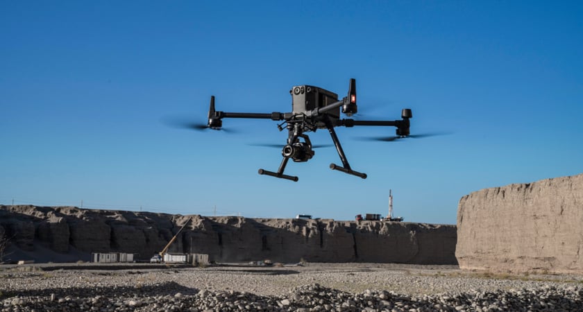
When it comes to accuracy, efficiency, and reliability, DJI’s latest flagship combo – the Matrice 300 RTK and Zenmuse P1 payload - is widely regarded as the industry standard. And one of the key reasons for this is the P1’s Smart Oblique Capture feature.
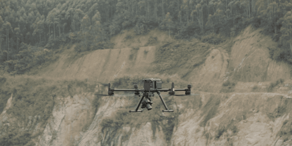 Smart Oblique Capture in action
Oblique photogrammetry is the technique that uses multiple lenses to capture images in order to build highly detailed 3D models. Lenses are typically mounted together in an array with fixed axis angles and the resulting images reveal details that are sometimes missed when only capturing vertical photographs, such as features occluded by vegetation or tall structures. With Smart Oblique Capture, the P1 is able to capture detailed 3D models of your target, all with one lens, even in the most complex of terrains or during variable weather conditions.
On the subject of adverse weather conditions, the P1 is complemented by the extreme durability of the M300. Having been put through its paces by the DJI’s durability lab, the M300 has proven itself capable of handling some of the most extreme weather conditions and still come out flying. It can safely operate in temperatures ranging from 50°C right down to -20°C as well as handle wind speeds of up to 33.5 mph. At the same time, it has also received an IP45 rating from the Centre Testing International Group meaning it can easily withstand some of the most stubborn downpours. Quite simply, the M300 is one of the most reliable and durable drones ever made.
Introducing Propeller Aero’s Propeller PPK solution
Of course, collecting accurate data quickly and accurately is only one half of the equation when it comes to effective surveys. Once captured, images need to then be processed into something usable – and that is where Propeller’s PPK solution comes in.
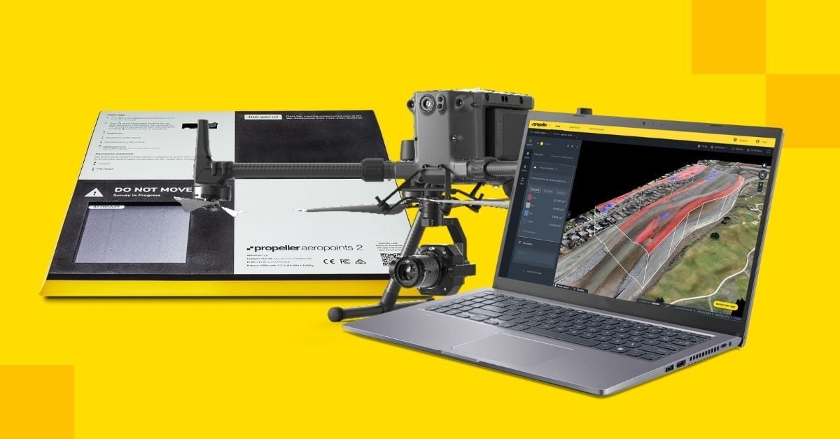
Propeller Aero is one of the world’s leading survey drone software solutions companies with more than 13,000 users across more than 120 countries around the globe. PPK, or Post Processed Kinematic, is a GPS correction technology technique that corrects location data after it is collected and uploaded.
The solution is designed to minimize time in the field by collecting ground control data using Propeller’s AeroPoint technology - high-precision, smart ground control points – with a single AeroPoint able to cover up to 150 acres. But again, speed is not the only important factor when it comes to surveys but crucially, Propeller's automated processing delivers data that is accurate to within centimeters while aerial images are also automatically enhanced with PPK geotag processing and photogrammetry all in one go.
What’s more, the process for this is extremely simple. Operators need only place and activate the required number of AeroPoints to survey the area, fly the drone over the site, and then simply upload the AeroPoint and drone data. Typically, data sets are processed within 24 hours leaving you free to view and analyze the resulting models.
M300 + P1 + PPK = A significant upgrade
Prior to the M300 + P1 combo, the Propeller PPK solution utilized the Phantom 4 RTK drone. However, with longer flight times, heavier payloads, and greater collision protection, switching to the M300 means drone surveying has been given a significant upgrade.
“When we did our tests with the M300,” says Jared Martinez, Customer Success Engineer at Propeller, “we found that we were able to survey 250 acres in about 45 minutes with just one battery. Previously, with the Phantom, we would need 4 battery swaps to achieve the same.”
At the same time, the Zenmuse P1 provides significantly better accuracy when it comes to image capture. “At 45 mega-pixels, the P1 has a bigger sensor which gives three times the efficiency,” says Simba Wang, Geospatial Channel & Solutions Manager at DJI, “So, if efficiency is the key to your survey, the P1 is always going to be the best choice.”
The last word in drone surveying
By combining the best drone surveying option in the M300 + P1 combo with Propeller’s powerful PPK software solution, surveyors are now able to conduct large-scale, complex surveys with a level of reliability, speed, and accuracy not seen before.
Not only are surveys more accurate, able to accurately handle rugged features from bridges to highways to mines, but they are also less complicated and faster, meaning fewer people in the field for less time, saving considerable time, resources, and money. No wonder people are calling it the last word in drone surveying.
Check out our webinar to hear Propeller’s Jared Martinez and DJI’s Simba Wang discuss how the M300 + PI and Propeller PPK solution work together.