
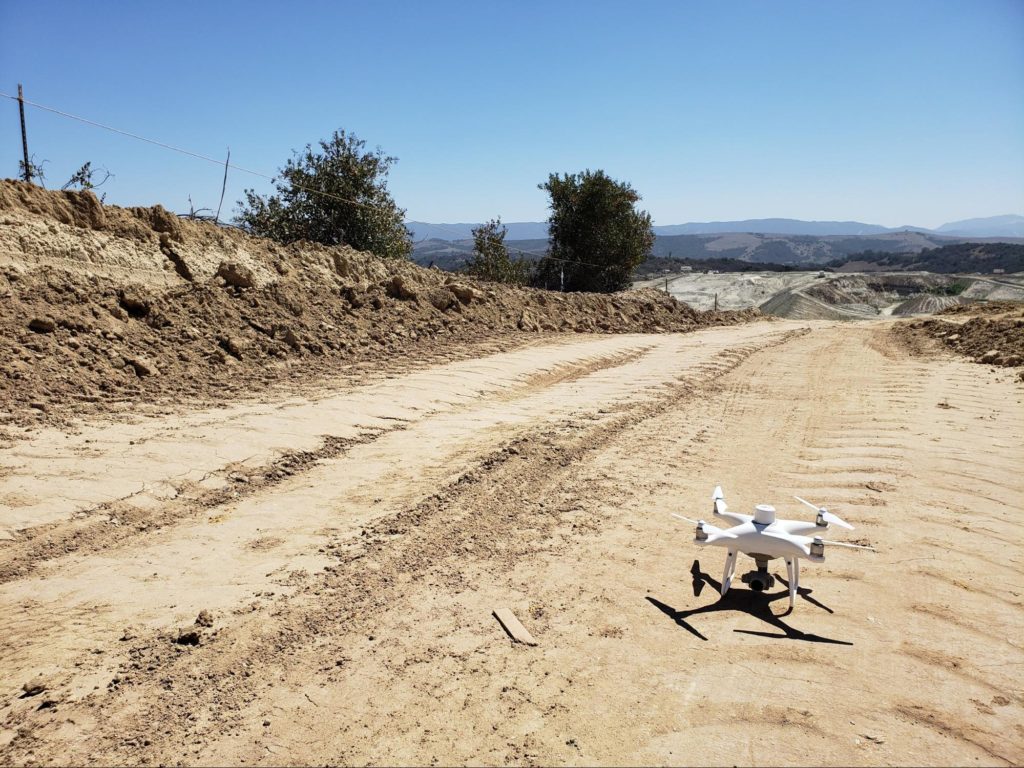
The Phantom 4 RTK represents the perfect synchrony of price point, level of accuracy, and reliability.
An on-board real-time kinetic sensor geotags each image as it’s captured, so when the aerial data is corrected against ground control, surveyors are able to reach centimeter-level accuracy. Not only are they reaching 1/10ft (3cm) accuracy, they’re doing so every time they fly.
Because it’s significantly less expensive than alternative options, it’s a low-risk investment for all sized businesses and operations, especially those who couldn’t afford to start a drone program previously.
In 2013, DJI introduced the world to the Phantom, a durable quadcopter that brought an air of professionalism to a largely recreational market. Around this time, individuals outside of the aerial photography community began exploring use cases for the objectivity and visibility a bird’s-eye view presents.
From there, the Phantom drone series became the workhorse of the construction, aggregates, and waste management industries for years. The most recent release, the Phantom 4 RTK (P4RTK) drone, which is DJI’s first survey-focused UAV, has only amplified DJI’s importance to the earthmoving community.
But, what made the Phantom 4 RTK so revolutionary? The answer: An unsuspecting cylinder that sits atop the drone, tagging images with positional data in real time.
Here’s how DJI’s RTK-enabled drone shifted the surveying paradigm.
The difference RTK makes
With the introduction of the Phantom 4 RTK (P4RTK), DJI has brought surveying workflows closer to real-world accuracy than ever before—we’re talking accuracy down to 1/10ft (3cm).
To achieve centimeter-level accuracy, the P4RTK uses TimeSync technology to coordinate its camera and RTK receiver, ensuring the most accurate geospatial information is tagged to each and every image. In addition, TimeSync centers the positioning data to the optical center of the camera, which helps ensure data accuracy is maintained during processing.
The real-time geotagging, plus corrections from a base station on the ground, means unprecedented reliable accuracy for your drone surveys.
Now, surveyors can weigh what’s collected in the sky against what’s collected on the ground to form a single source of locational truth.
What else do you get with the Phantom 4 RTK?
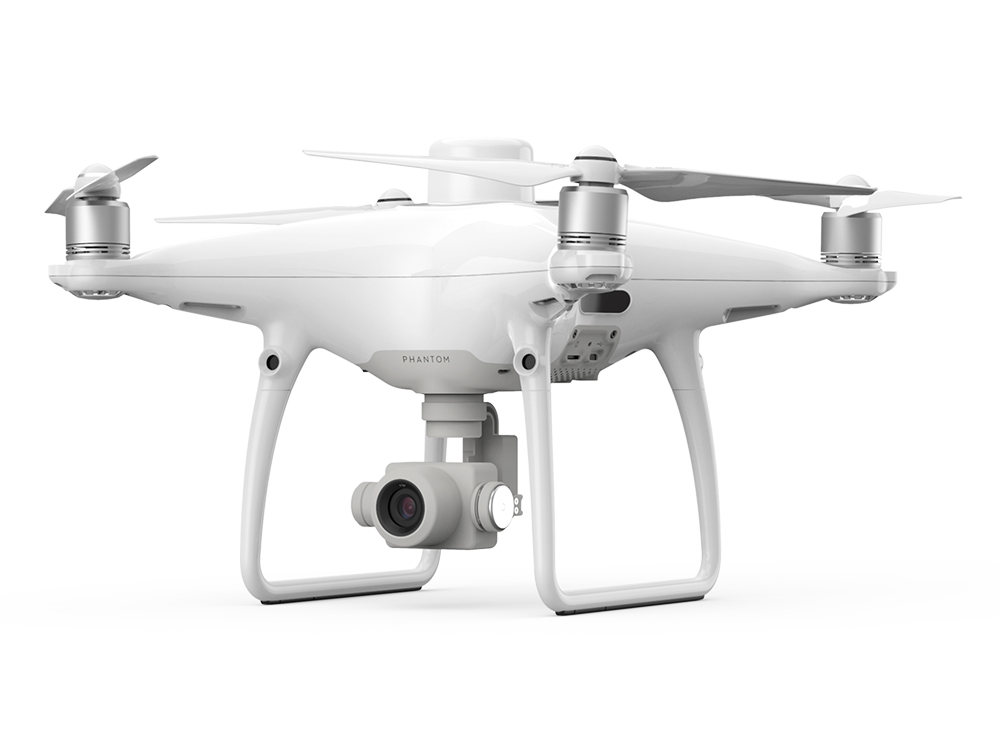
Superior image quality: The P4RTK combines a one-inch, 20-megapixel CMOS sensor; a mechanical shutter that improves captures of moving objects; and an aerial-optimized wide-angle lens with a 24mm focal length, to deliver you clear, consistent images every time you fly
A controller designed for professionals: Includes a microSD card slot, high-quality speaker, and hot-swappable batteries, so users don’t lose connection to their drone if they need to change batteries mid-flight.
1/10ft accuracy, every time you survey
In the past, worksites juggled speed and accuracy; quick data collection meant compromising accuracy. Because surveying took copious amounts of time (and a surveyor’s time came with a hefty dollar amount), worksites weren’t surveying frequently enough to extract as many useful progress-tracking metrics as they wanted.
Surveyors were caught in a stalemate with their data collection methodology, a battle they conceded to out of necessity. Walking a site, shooting points, establishing ground control—these things took days, sometimes weeks depending on the acreage.
The Phantom 4 RTK has dismantled that delicate balance between quality and pace to reduce survey time to a matter of hours, without forfeiting quality.

Today, surveyors get near real-time data as often as they want to fly a drone, with accuracy down to 1/10ft (more on how we reach this level of accuracy in the next section).
With bandwidth restored, surveyors can finally direct their attention to their core strength—site analysis, leveraging collected data to make observations about efficiency and progress.
Why the Phantom 4 RTK Paved the Path for PPK
The P4RTK inspired Propeller to go somewhere no one had gone before, a place where hardware and software joined in fully-integrated harmony, completely liberated from compatibility issues.
To complete the drone workflow puzzle, DJI and Propeller combined forces in fall of 2018, bringing a seamless flyover-to-processing workflow to market. And just like that, Propeller PPK came to fruition.
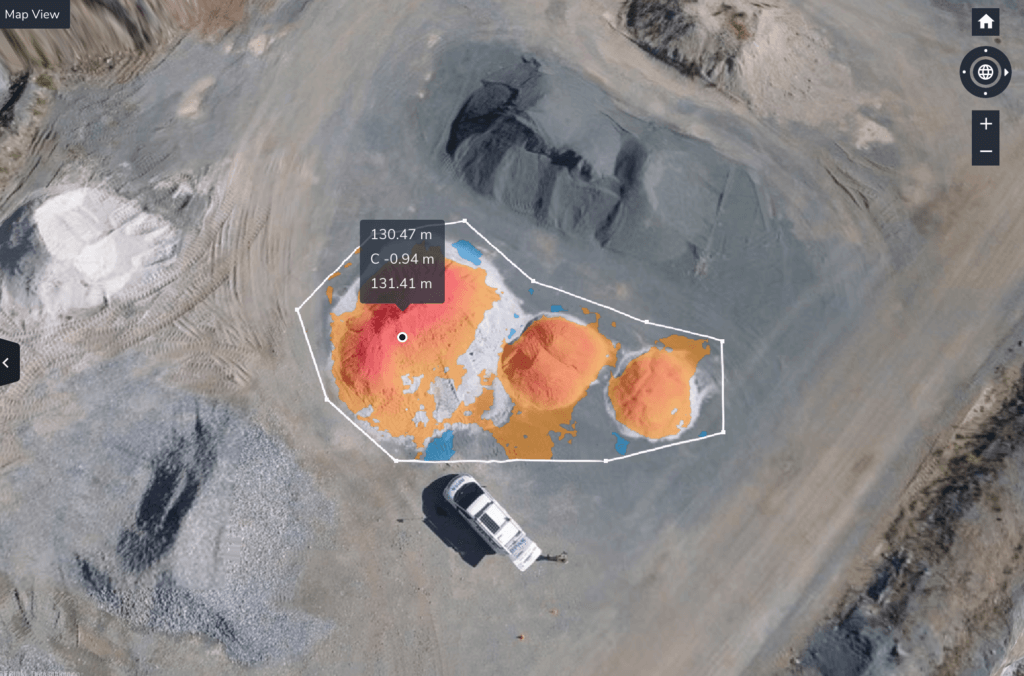
Propeller PPK combines the P4RTK with 1) AeroPoints, our "smart," high-precision ground control points, and 2) the Propeller Platform, a cloud-based application for processing, mapping, measuring, and sharing aerial data. When we fuse these elements together, they form a singular worksite management solution that’s easy for new users to integrate into their workflow.

With more consistent ground control, you get more accurate data. And with more accurate data you have the capacity to peel back surface layers and get strategic with your material movement, risk assessment, and cross-team collaboration.
Integrating AeroPoints into surveying workflows also means less time traveling around busy, dangerous worksites, dropping off GCPs.
The Phantom 4 RTK didn’t just help surveyors to do their job more efficiently, and with greater accuracy. It allowed Propeller to arm customers with the tools they need to join (and define) the next generation of worksites.
With less time on site, those in charge of drone operations—who typically have other duties ranging from machine control to modeling—can focus more of their attention on leveraging collected data to improve efficiency and progress.
Where do we go from here?
The surveying professional is only one part of a very complex network of individuals—you have foreman, clients, contractors, tradesmen, and the list goes on. They may have been the initial aerial data gatekeepers, but now, Propeller’s primary users are tethering all their moving parts together using 3D drone models.
Single-handedly, DJI brought consistency and accessibility to an otherwise erratic workflow, giving construction, aggregate, and mining sites the stepping stones they needed to decimate informational silos and conquer age-old collection challenges.

-2.png?width=300&name=HS%20-%20Featured%20Images%20(2)-2.png)

