
Explore the latest updates for DJI Terra (V3.7 and V3.8) in this blog post, a significant leap forward in processing tools that can be used following geospatial data collection. New features include Automatic Ground Control Points Identification, LiDAR Data Ground Point Cloud Classification, and additional tools to create unmatched accuracy and efficiency.
DJI Terra V3.7.0 released
1. Support Automatic Ground Control Points Identification
UAVs acquire height information through RTK and other methods, which is usually in ellipsoidal height. However, the deliverables often require heights in orthometric, need to deliver results with local vertical datum. Therefore, Ground Control Points are needed to help optimize the results of aerotriangulation, and checkpoints are needed to check the accuracy and reliability of the results.
When using control points/checkpoints, surveyors need to mark corresponding ground survey markers on the photos.
With the Automatic Mark Identification features Introduced in DJI Terra's V3.7 update, surveyors only need to manually mark one photo for the control point/checkpoint, and the software will automatically identify the same control point/check point in other photos, significantly reducing the need for manual marking.
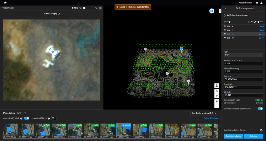
Once auto-mark identification is complete, you can see the number of identified points and the error from each photo.
Through data comparison between auto-mark identification and manual marking, it was found that:
① .For a 45 km² oblique photogrammetry project with 100 ground control points: On average, manually marking 20 photos for each control point took about 5.5 hours. After using the Automatic Mark Identification feature, an average of 32 photos were automatically identified for each point, taking around 20 minutes, resulting in time savings of over 5 hours.
② For a 15 km² orthophoto project with 30 ground control points: On average, manually marking 10 photos for each control point took about 53 minutes. After using the automatic marking feature, an average of 12 photos were automatically identified for each point, taking around 5 minutes, and saving nearly 50 minutes.
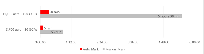
Data comparison results
It's important to note that when staking a photo, it's recommended to zoom in to ensure accurate staking. DJI Terra will automatically mark control points on other photos once a point is staked
Access to this feature: Create a visible light mission->Add photos->aerotriangulation settings->Advanced settings->GCP management->Automatic Mark Identification
2. L1 data Ground Point Cloud classification
When using L1 for data collection and DEM (elevation data model) creation, it's essential to classify ground points out of the point cloud. Otherwise, the result will be a DSM (Digital Surface Model) that does not represent terrain DEM.
DJI Terra 3.7.0 introduces the ability to classify ground points in the point cloud without the need of third-party software. This simplifies the process significantly.
Ground Point Cloud Classification
Access to this feature: Create a Lidar point cloud mission-> Add Lidar data -> Point Cloud Processing settings->Check the Ground Point Type box
3. Automatic alignment of Blocks
In large-scale real-world 3D projects, it's common to divide the region of interest into multiple blocks for reconstruction and then merge the block results back into one large model. During the merging process, it is essential to adjust the block models as needed to ensure the accuracy of multiple datasets.
DJI Terra version 3.7.0 supports automatic alignment of reconstruction blocks based on the region of interest boundaries. This means that the software automatically aligns reconstruction blocks based on boundary lines, selecting all blocks within the defined region and outputting model files that adhere to industry standards.
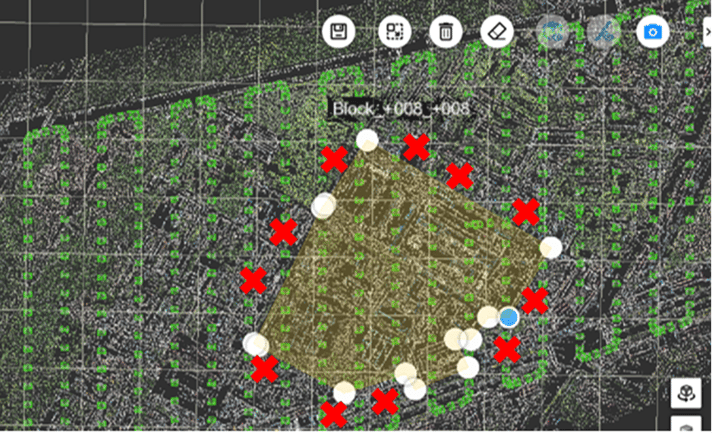
Only rebuilding the edge blocks partially may cause missing data
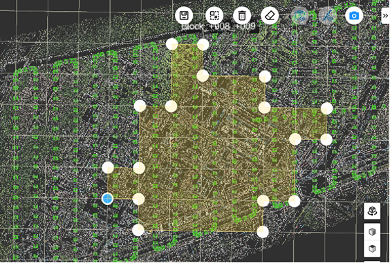
V3.7.0 version can automatically align blocks along edges to avoid data missing
By using the "Auto Align Blocks" feature, all related blocks within the area of interest are fully reconstructed, ensuring precise data stitching.
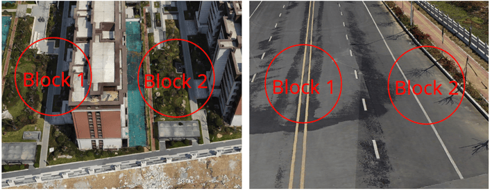
Building structures and road surfaces are visible, and the stitching results are ideal, with no apparent gaps.
.png?width=710&height=524&name=image%20(2).png)
The picture above shows the reconstruction effect of the V3.7 version, and the block vulnerability of low buildings in the task area no longer exists.
It is important to note that before using this feature, you should check whether the block parameters such as the coordinate origin and coordinate system are consistent, whether aerotriangulation results are correct; whether there are control points constraints at the overlap between blocks from different reconstruction blocks, and the overlap is sufficient. If these conditions are not met, issues with uneven stitching in the final model may occur.
Access to this feature: Create a Visible Light Task->Add Photo->3D Model->Advanced Settings->Area of Interest/Block->Import KML Range (optional)->Edit Area of Interest
4. Reduce Model Size Feature
When displaying real-world 3D models on online platforms like DJI FlightHub 2, uploading highly detailed models can strain both computer performance and network bandwidth.
DJI Terra 3.7.0 introduces a reduced model size feature, which significantly reduces the number of triangles in the model, improving the smoothness and loading speed of online model reviewing.
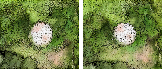
100% ResolutionModel (left) experiences lag during loading
50% Resolution model (right) loads more smoothly
It is important to note that when you enable the model size reduction feature, DJI Terra will strive to preserve model accuracy to the maximum extent possible. However, it may still lose some fine details. For tasks where high detail fidelity is required, it is recommended to either disable the model size reduce feature or set the size reduce parameter to greater than 80%. A model size reduction parameter below 20% may lead to texture map misalignment in some flat areas.
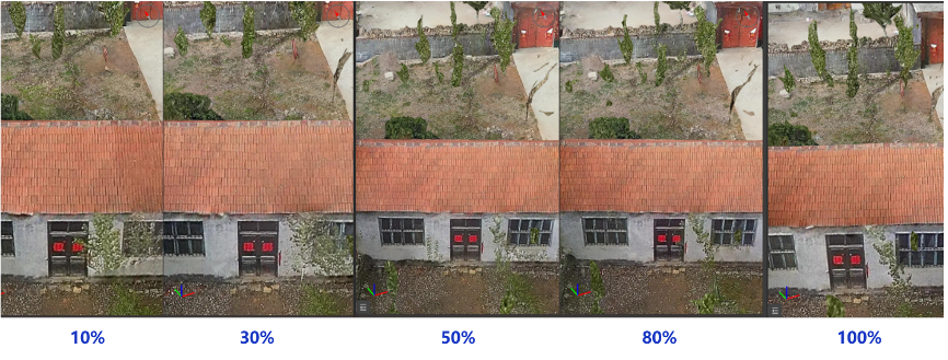
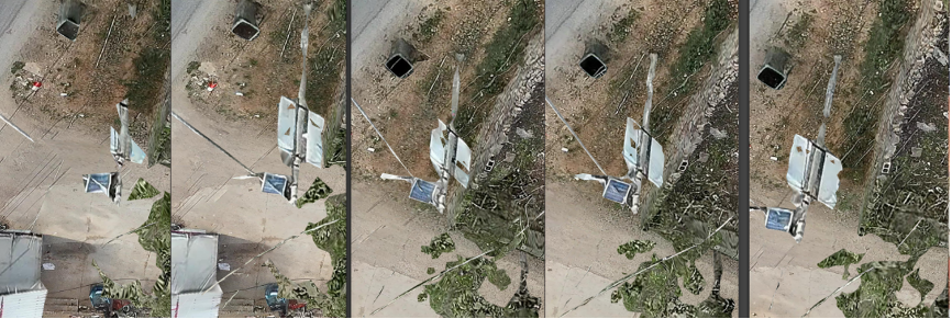
When using 50% resolution, the model remains virtually unchanged.
When using 10% resolution, the model loses many details.
Access to this feature: Create a Visible Light mission- >Add Photo->3D Model->Advanced Settings-> reduce the model to XX%
5. Comprehensive upgrade of quality reports
DJI Terra V3.8.0 released
Generate of DEM -from Classified Point Cloud
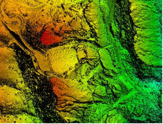
DEM in image form
Previously, DJI Terra supported Optimize Point Cloud Accuracy and point cloud classification for point cloud data. Version V3.8.0 employs an improved DEM generation algorithm, supporting the generation of DEM data in Tiff format based on ground point cloud data.
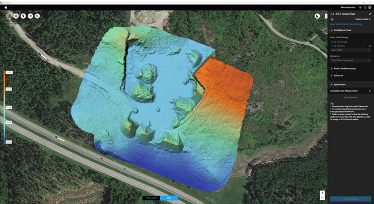
DEM Generation
Scale - setting parameters support user-defined DEM results with 1:500, 1:1000, and 1:2000 scales. Users can also set DEM results resolutions based on Ground Sampling Distance (GSD).
| Scale | GSD |
| 1:500 | 50cm |
| 1:1000 | 100cm |
| 1:2000 | 200cm |
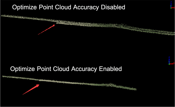
The use of the Optimize Point Cloud Accuracy significantly reduces stratification phenomena.
Additionally, the quality report for point clouds has been further improved, providing better visualization and more intuitive data representation.
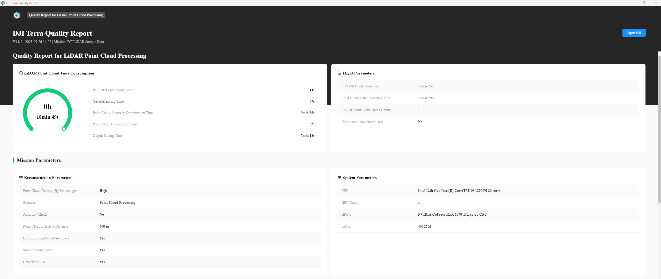
Quality Report
Check out this video to learn about the new geotiff formatted DEM output feature for LiDAR point cloud data in the Terra 3.8 update!


-3.png?width=300&name=Insight%20blog%20featured%20image%201140X660%20(2)-3.png)