
How accurate is accurate enough? If you’re like most land surveyors, the answer is “as much as possible.”
With an RTK drone, surveyors and other kinds of enterprise drone pilots can expect centimeter-level positioning accuracy with each flight. The system represents a marked improvement from satellite data on its own and can help ensure you have the accurate information you need to get the job done.
What exactly is RTK?
Real Time Kinematics, or RTK for short, is a special technique for satellite positioning that can produce accurate results to the centimeter, making it an invaluable tool for surveyors around the world. The method involves measuring satellite data against a ground station for precise, real time information.
 D-RTK 2 Mobile Base Station
The key parts of the RTK technique include:
- A base station: The RTK GNSS base station, also known as a reference station, remains at a defined point on the ground, where its GPS location is continually contrasted with the location of a drone. In order to work properly, an RTK drone must stay in constant connection with the base station.
- RTK receiver: This device is a part of the hardware of the drone and sends signals to both the controller and a satellite.
- A controller: Your drone’s remote controller sends signals to move the drone and displays coordinate changes.
- Satellite: Satellite data is still a key part of any RTK system. However, rather than simply communicating with the drone receiver, information is also tested against the base station, establishing position accuracy.
The RTK advantage
RTK GPS data is far superior to satellite data on its own because it can be used to correct inaccuracies and discrepancies, ensuring information hews as close to reality as possible. There are numerous factors that can skew satellite coordinates, including incremental weather, tall buildings, mountains, and other issues calling for RTK correction. These are called “tropospheric delays.” The RTK system fills in these gaps with real time data from the base station and drone.
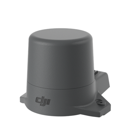 RTK Module for the Mavic 2 Enterprise Advanced
The major benefits of an RTK system include:
- Improved accuracy: This is the big one. When compared to satellite data alone, an RTK system offers high accuracy — typically down to centimeter-level.
- Real-time corrections: While other adjustment technologies like PPK (more on that below) correct skewed data and fill in gaps after a flight is completed, RTK corrections fix errors automatically. This means that the data you see during a flight is data you can trust.
- Fewer ground control points: Ground control points are set spots on the ground with known coordinates that can be used to readjust GPS data. Laying out and measuring these points can be time-consuming. However, with RTK, the base station makes GCPs moot, allowing you to complete projects with significantly less hassle.
The difference between similar drones with and without RTK is startling. In one recent study, DJI and DroneDeploy compared the Phantom 4 RTK and Phantom 4 Pro (a consumer edition that does not have a built-in RTK receiver) over more than 30 different flights with a control point system for a rooftop building survey. The results showed that the RTK-enabled drone calculated horizontal and vertical accuracy of the measured points better, as well as the accuracy of linear measurements.
For more information, download our white paper How Accurate is the Phantom 4 RTK?: Measurement Accuracy of the DJI Phantom 4 RTK & Photogrammetry.

Using an RTK Drone with PPK
While RTK technology represents a major step forward from using satellite data alone (especially if it isn’t corrected with ground control points), it does have some limitations. For example, if your drone loses connection with the controller or satellite, then real time data transmission won’t be possible. Some jobs, especially longer ones in challenging terrain, make it difficult or even impossible to maintain stable data transmission.
As a result, the RTK system is not the only way surveyors and other drone professionals correct satellite coordinates and ensure accuracy. Another method is called “post-processing kinematics,” or PPK for short. While often talked about together, it’s important to note that RTK technology and PPK are actually quite different.
PPK requires essentially the same equipment as RTK but is run with a completely different workflow. Unlike RTK, a PPK workflow means you won’t require any real time corrections. Rather, the drone system stores data onboard the drone, and calculations post-flight combine both the aircraft data and base station data, producing results in PPK software on a computer. Data is created with geotag coordinates from an on-board GPS unit. Your base station, meanwhile, will also keep track of the drone’s positional information. These numbers can then be compared against each other after the completion of a flight.
While you don’t get the convenience of on-the-go corrections, a PPK system requires fewer transmissions and thus can get the job done even with a poor network signal reception or other obstructions. To maximize the potential and cover the limitations of each method, many top-shelf enterprise drone solutions utilize both RTK and PPK technologies to ensure the most accurate positioning possible. The Cloud PPK Service for DJI’s Phantom 4 RTK, for example, can be used to conduct calculations on the drone’s remote controller, in addition to the DJI GS RTK flight planning app. This setup also means you can adapt the Phantom 4 RTK to the workflow that makes the most sense for the job.
The resulting data can be quickly imported into DJI’s advanced mapping software, DJI Terra, for additional analysis.

Getting the most out of your RTK hardware
If you’re looking for an RTK system that’s reliable for each and every flight, you’ll want an enterprise drone from DJI. Our RTK systems utilize an on-drone module and a high-precision GNSS Mobile Station. The combination of onboard RTK receiver and GNSS signal reference station delivers a high degree of RTK accuracy. Whether you elect to rely fully on RTK or also have PPK capabilities as a backup, using a DJI drone means you can expect to stay connected no matter the mission.
Some of DJI’s premier RTK drones include:
The Phantom 4 RTK
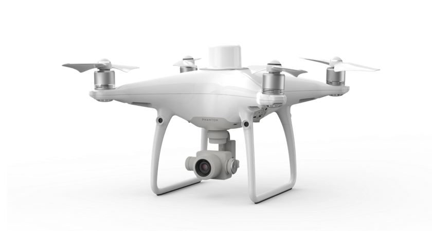
The perfect starter-level surveying drone is here. Thanks to its RTK module, this enterprise drone offers 1 cm+1 ppm horizontal positioning accuracy, 1.5 cm + 1 ppm vertical positioning accuracy, and absolute horizontal accuracy of photogrametric models within 5 cm. The drone also stores satellite observation data to be used for PPK with the DJI Cloud PPK Service.
Matrice 300 RTK
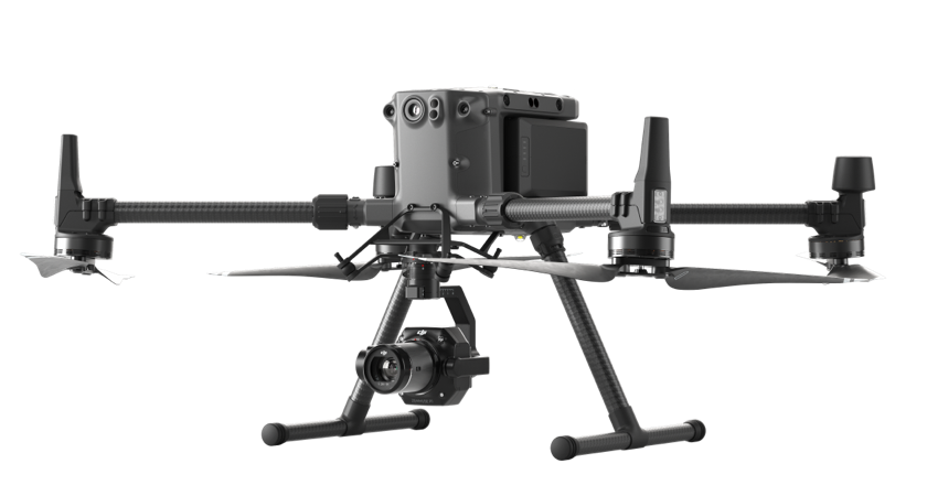
Welcome to the future of commercial drones. The Matrice 300 RTK accentuates its advanced RTK positioning system with advanced intelligent capabilities and six directional sensing positioning. Add in a 55 minute maximum flight time, hot-swappable batteries, and a wide-ranging operating temperature and you get a drone that’s ready for any job you can throw at it.
Matrice 30
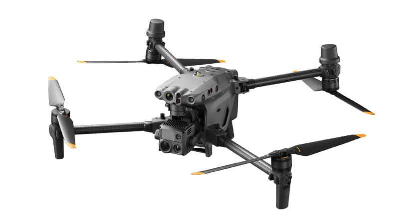
The Matrice 30 takes everything the Matrice 300 has, and packs it into a portable package. With a smaller footprint and weight, the Matrice 30 is far easier to take along for your inspection missions. With built in RTK modules, it's the perfect solution if you need to conduct precise drone inspections of assets or infrastructure that require centimeter-level accuracy.
Mavic 2 Enterprise Advanced
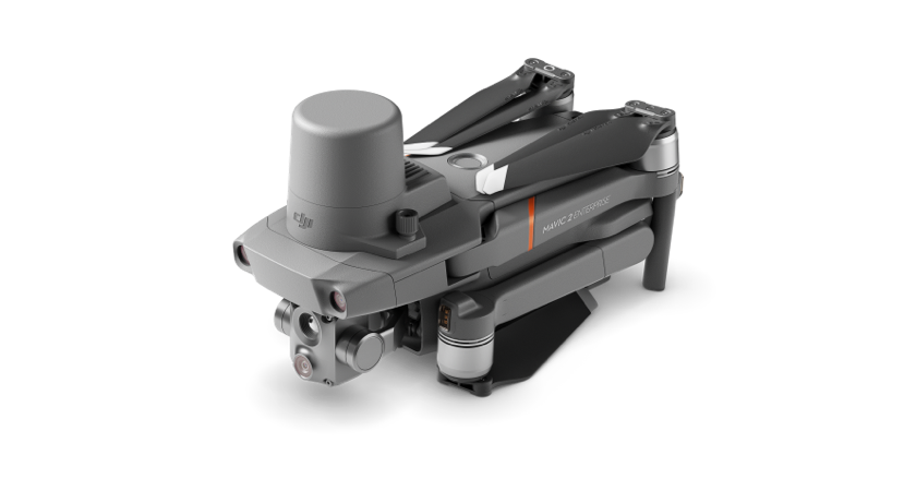
This compact, foldable tool comes with a built-in 48MP dual-sensor with 640x512 px thermal resolution. Its attachable RTK module enables this drone to fly precise, repeatable inspection missions. With up to 31 minutes flight time, this is a powerful, portable solution.
For more information on our land surveying solutions, visit https://enterprise.dji.com/surveying/land-surveying.


-2.png?width=300&name=HS%20-%20Featured%20Images%20(2)-2.png)

