Built for BVLOS, Ready for Compliance
The DJI Dock series offers product technical documentation, risk mitigation features, and regulatory reference materials to support operators in preparing BVLOS operational authorization applications.
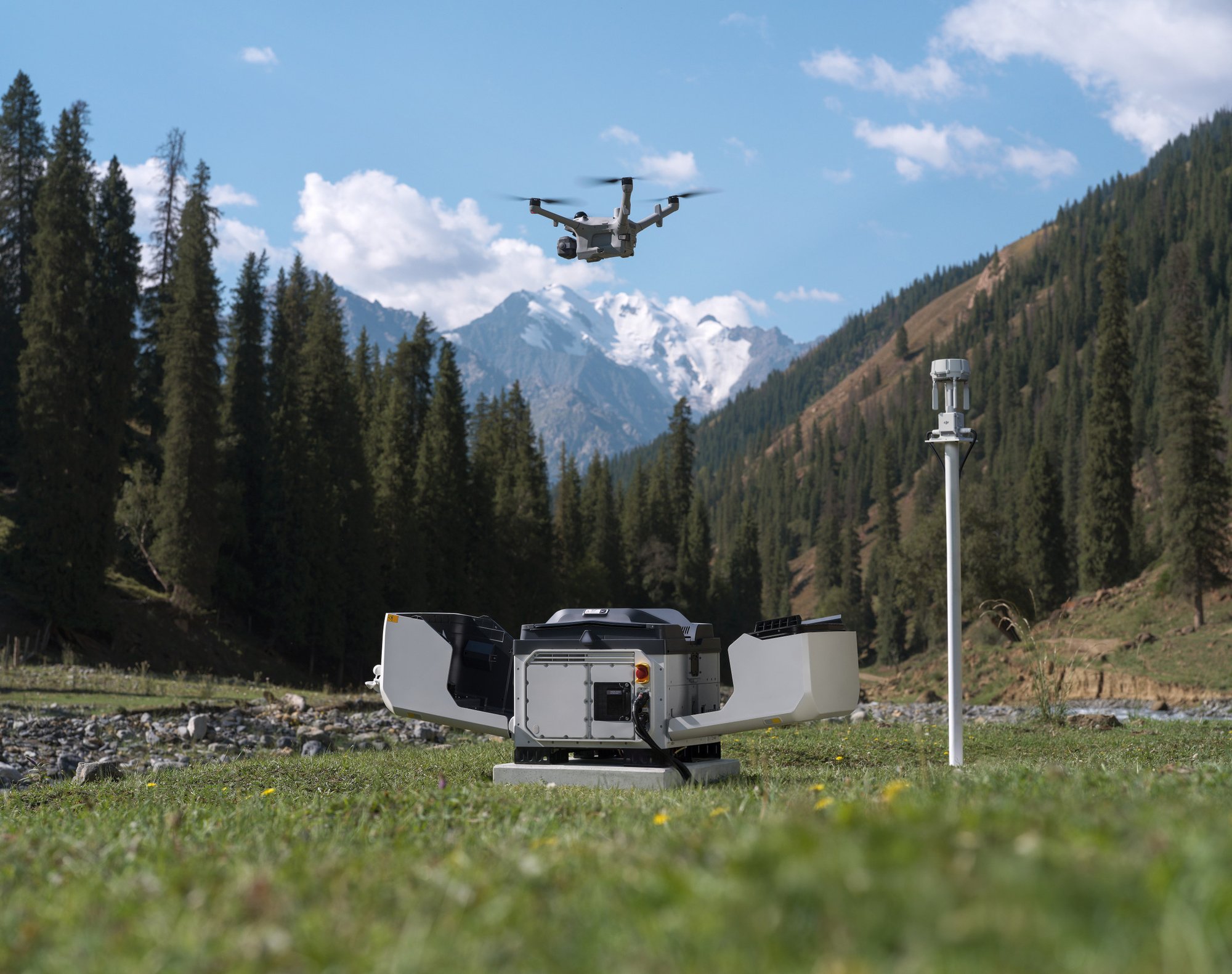
Compliance Guide: From Risk Assessment to Operational Authorization
Across EASA Member States, Australia, and similar jurisdictions, BVLOS (Beyond Visual Line of Sight) operations may require authorization based on a risk assessment;
Requirements vary by jurisdiction. SORA-based methodologies assess ground and air risks around the Concept of Operations (ConOps) and identify the applicable Operational Safety Objectives (OSOs). Since May 2026, CASA has used AusSORA, the Australian adaptation of JARUS SORA 2.5, for new BVLOS and complex applications.
Define the Concept of Operations
Describe the operation, Operational Volume, and procedures. DJI provides ConOps templates [6].
Mitigate Ground Risk
Reduce risk to people on the ground. Where applicable, a parachute may support SORA M2, which reduces the effects of UA impact dynamics and the expected critical area.
Mitigate Air Risk
Onboard and third-party airspace data can support airspace risk assessment. They do not replace the required airspace assessment or applicable airspace/ATC requirements [4].
Determine SAIL
Determine the SAIL from your ground and air risk results. It informs the applicable OSOs.
Determine Containment Requirements
Keep the aircraft within the Operational Volume. GeoCaging and an FTS, where applicable, may support SORA containment requirements.
Demonstrate Operational Safety Objectives
Provide technical documentation to support relevant design-related OSOs.
Ground Risk Mitigation
Reduce risk to third parties on the ground through operational area planning and solutions that reduce the consequences of a potential ground impact. The applicability and robustness of each mitigation must be assessed for the intended operation.
Operational Area Planning
DJI Dock features help operators plan flights within designated areas. In DJI FlightHub 2, Custom Flight Area [1] lets operators define task-permitted areas, GEO zones restricting task flight, and no-landing zones. These settings may help inform the operator's definition of the Flight Geography (FG), which, together with the Contingency Volume (CV), forms the Operational Volume (OV). The operator remains responsible for the operating area and any claimed SORA ground-risk mitigation.
GEO zone boundary behavior
Boundary behavior at GEO zones varies by flight mode (brake and hover in Live Flight Controls; brake, hover, then automatic return to home in Flight Task; GEO zones are bypassed during RTH).
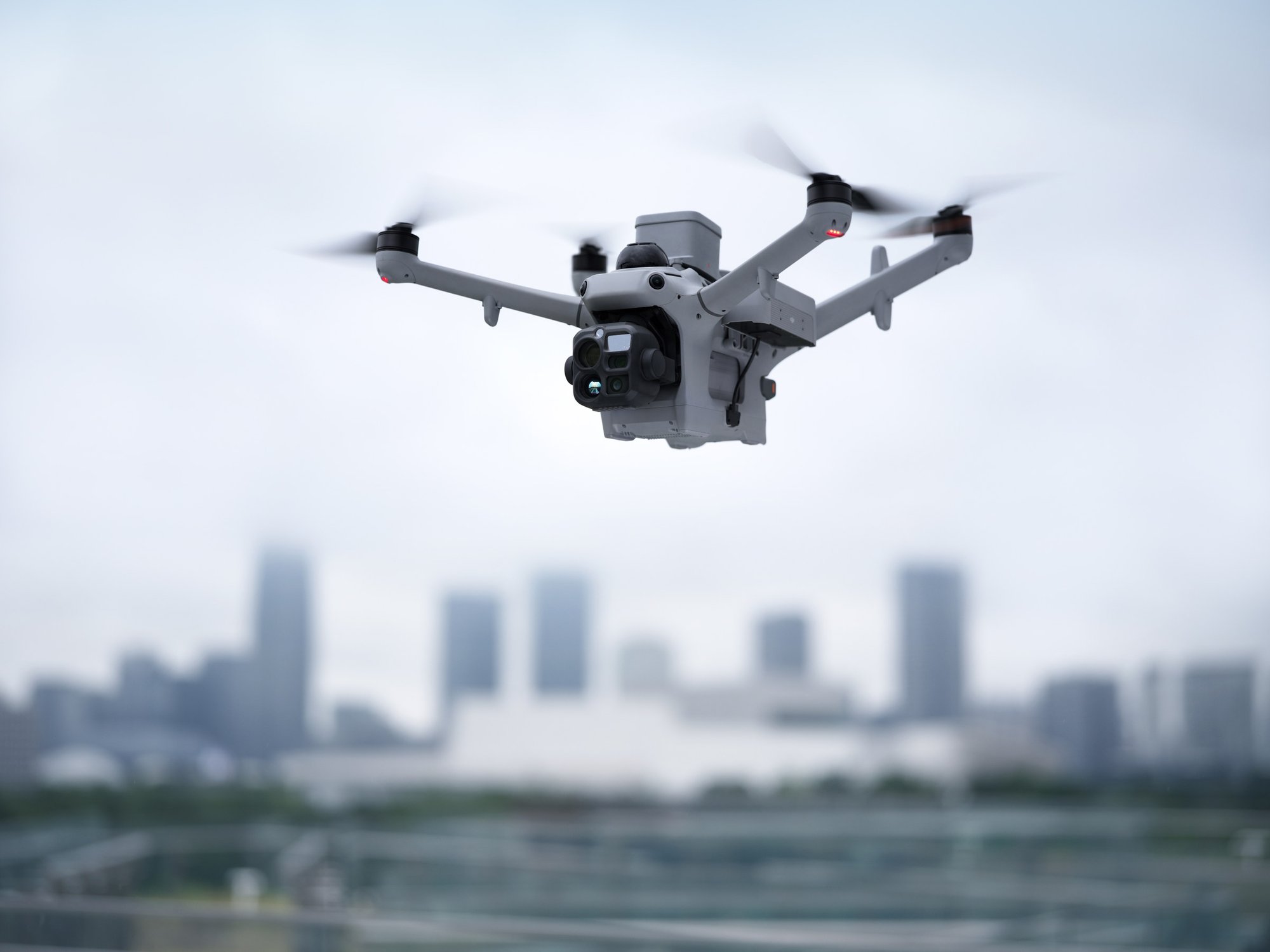
Parachute Solution
A supplementary safety device that reduces descent speed in an emergency, helping reduce impact dynamics and potential damage [3]. Its activation is independent of the Flight Termination System (FTS) and can be automatic or manual through DJI FlightHub 2. Applicability and validation status are subject to officially released DJI compliance documents.
Deployment details
The parachute activation function is independent of the Flight Termination System (FTS). It may deploy automatically when abnormal aircraft attitude or velocity is detected by its onboard safety logic, or be activated manually through DJI FlightHub 2. Parachute deployment therefore does not depend on successful FTS activation.
In supported regions, the parachute may also deploy automatically following successful FTS activation. This coordinated function is an additional deployment mode and does not replace the parachute's independent automatic and manual activation capabilities.
The parachute is an optional accessory. Installation and operational requirements vary by region; operators should consult applicable local requirements. Applicability and validation status are subject to officially released DJI compliance documents.
Air Risk Mitigation
Onboard detection and multi-source airspace data may inform the assessment and monitoring of airspace risk. They do not by themselves establish SORA air-risk mitigation credit and do not replace official airspace information, the required airspace assessment, or applicable airspace and ATC requirements [4].
Onboard Airspace Awareness
AirSense receives ADS-B signals (ADS-B In) from nearby conspicuous crewed aircraft and shows the available traffic in DJI FlightHub 2, helping remote operators identify potential conflicts. DJI Dock 4 additionally supports onboard reception of DJI Remote ID signals from compatible nearby DJI aircraft. Detection is limited to compatible and detectable traffic and is not a complete detect-and-avoid solution [5].
Third-party data and receiver integration
Third-Party Airspace Data — External airspace data can be connected through DJI FlightHub Sync to complement onboard awareness. SafeSky may be integrated via API to provide information on nearby conspicuous aircraft, supporting pre-flight assessment and in-flight situational awareness. Availability, coverage, performance, and integration scope depend on the third-party service and region.
Receiver Integration — Based on ESDK 2.0, the DJI O4 Ground Station supports integration with third-party Remote ID and ADS-B receivers, adding supplementary awareness of drones and crewed aircraft in the operating area. Receivers are third-party devices and are subject to their own availability, coverage, performance, and compliance requirements.
Containment
Containment measures are intended to prevent the aircraft from leaving the operational volume and entering adjacent areas or adjacent airspace. In SORA, containment is assessed separately from ground and air risk mitigation.
GeoCaging
Define the Operational Volume (OV), consisting of the Flight Geography (FG) and Contingency Volume (CV), in DJI FlightHub 2 [1]. It can be linked with the Flight Termination System (FTS).
Flight Termination System
An emergency containment function that stops the motors and terminates the flight. In supported regions and configurations, it can be triggered automatically through GeoCaging if the aircraft breaches the outer boundary of the Contingency Volume (i.e. the Operational Volume boundary), or manually through DJI FlightHub 2 [2].
GeoCaging and FTS may support demonstration of the applicable SORA containment requirements using EASA MoC Light-UAS.2511, where applicable.
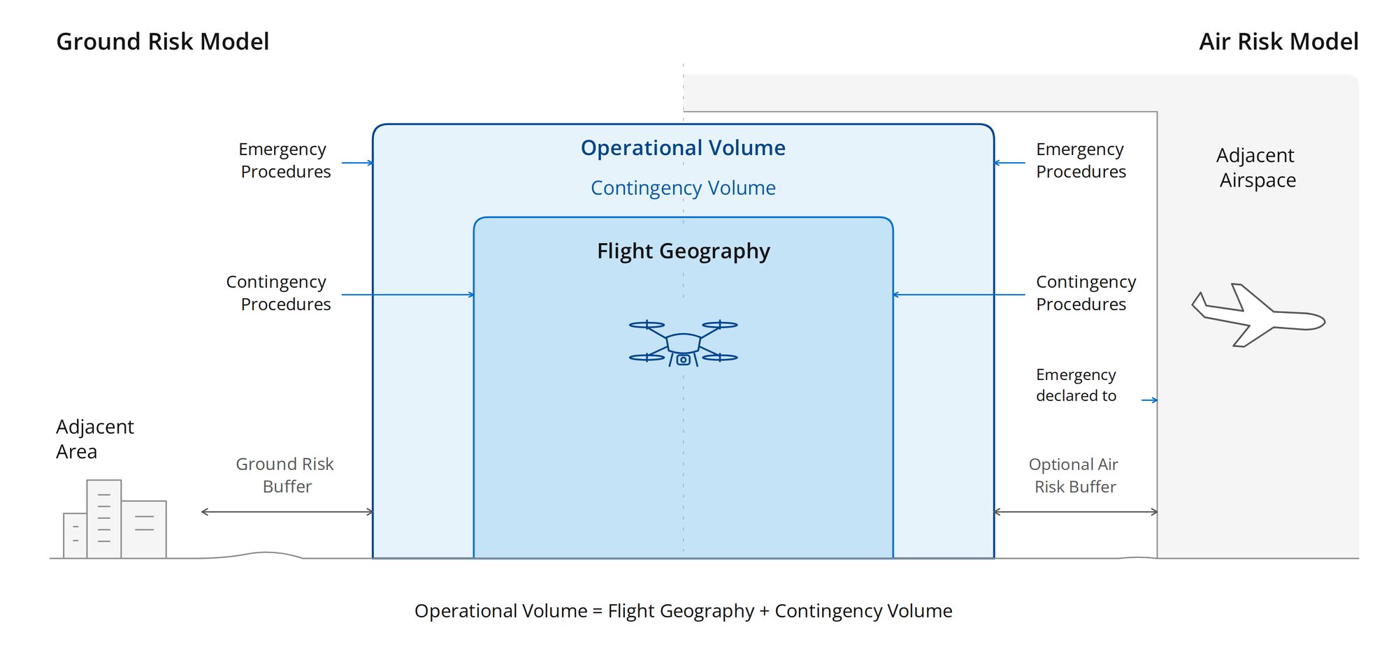
Illustrative. The operator defines the FG, CV, and OV for each operation.
Product Safety and Compliance
As the designer and manufacturer, DJI provides product technical documentation and Statements of Compliance, where available, to help operators prepare the product-related portion of a SORA-based application.
Product Compliance and Conformity
DJI provides EU Class Identification Labels, where available, for supported DJI Dock series models under the applicable EU product regulation. Separately, DJI provides Statements of Compliance with relevant SORA Means of Compliance (MoC) for selected models. Scope and availability are subject to officially released DJI documents [6].
Applicability details
Applicable class labels, Notified Body information, Standard Scenarios, configurations, firmware versions, regional availability, and compliance status vary by model and are subject to officially released DJI documents.
SAIL III Statements of Compliance
For DJI Dock 3 / Matrice 4D series, DJI has prepared Statements of Compliance with the applicable EASA Means of Compliance (MoC) for SAIL III operations, covering these OSOs:
These materials support operators in demonstrating product-related OSOs within a SORA-based application; they do not constitute an operational authorization. For DJI Dock 4 / Matrice 5TD, availability and OSO scope are subject to officially released DJI compliance documents [6].
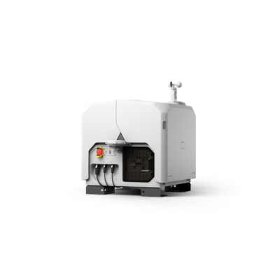
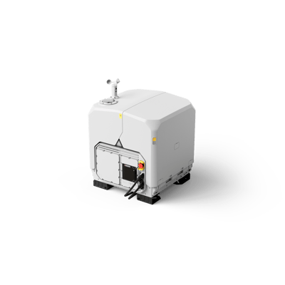 DJI Dock 4 (Matrice 5TD) |
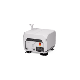
 DJI Dock 3 (Matrice 4D / 4TD) |
 DJI Dock 2 (Matrice 3D / 3TD) |
|
|---|---|---|---|
| EU Class Identification Label | C5 and C6 (UK: UK5 and UK6) | C2 and C6; C6 also in standalone mode with DJI RC Plus 2 Enterprise [7] | None; authorization may require an individual SORA-based assessment |
| Operational Area Planning | Custom Flight Area [1] | Custom Flight Area [1] | Custom Flight Area [1] |
| Parachute Solution | Official DJI AP1 Parachute [3] | —Not listed | —Not listed |
| Containment | GeoCaging [1] and built-in FTS [2]; an available SIM card may be required | GeoCaging [1] and FTS hardware module [2] | —Not supported |
| SORA Application Materials | Official compliance resource kit, subject to released scope | Official compliance resource kit, incl. available SAIL III Statements of Compliance with relevant MoC | —Not listed |
Regional Compliance Information
Brazil: ANAC UAV design authorization for low-risk BVLOS completed.
Get Resources
Receive a link to the compliance resource folder by email. Follow the guide in the folder to find documents and templates for your model and region.
Available Documents and Templates
- Compliance documents by model
- Available SAIL II and SAIL III Statements of Compliance with relevant Means of Compliance
- Comprehensive SORA Safety Portfolio templates
- Operations Manual templates with product technical specifications
- Compliance checklists
Get Compliance Resources
Notes and Disclaimer
* The content of this page is a general introduction to product capabilities and compliance support materials, and does not constitute legal advice or any guarantee of operational authorization. Drone operations must comply with local laws and regulations. Operational authorization is applied for by the operator and granted by the applicable competent aviation authority in accordance with local regulatory requirements.
In the event of any inconsistency between this page and officially released DJI documents, the officially released DJI documents shall prevail. DJI reserves the right to update, amend, or discontinue the content of this page at any time without prior notice.
Footnotes
- Device availability: DJI Dock 4 and DJI Dock 3 support GeoCaging and Custom Flight Area; DJI Dock 2 supports Custom Flight Area. The GeoCaging feature is supported in certain regions only.
- Device availability: Matrice 5TD has a built-in FTS and requires at least one SIM card to use it; Matrice 4D series requires a SIM card and a DJI Cellular Dongle 2 (4G) for the FTS module; Matrice 3D series does not support FTS.
- For precautions and usage details, refer to the User Manual on the official product page. Matrice 5TD supports the official DJI AP1 Parachute, mounted via a dedicated bracket and connected directly to the aircraft's E-Port V3 high-speed port.
- AirSense, third-party airspace data including SafeSky, and Remote ID / ADS-B In receiver data provide supplementary situational awareness and do not replace the operator's obligation to verify official airspace information, such as NOTAMs, U-space information, and local authority requirements.
- Device availability: DJI Dock 4 (Matrice 5TD) features built-in AirSense (ADS-B In) and Remote ID receivers; DJI Dock 3 (Matrice 4D/4TD) and DJI Dock 2 (Matrice 3D/3TD) feature a built-in AirSense (ADS-B In) receiver.
- Availability, scope, applicable SAIL level, covered models, configurations, firmware versions, and release timing are subject to officially released DJI materials and may vary by region. Compliance information assumes operation using DJI FlightHub 2 with the specified configuration. The list of OSO Statements of Compliance and supporting documentation — including ConOps, SORA application templates, and training materials — is indicative only, and certain documents may be provided on request.
- C6 compliance in standalone mode requires DJI RC Plus 2 Enterprise, the specified firmware version, and a DJI Cellular Dongle 2 for Matrice 4D/4TD. For details, see the blog.