
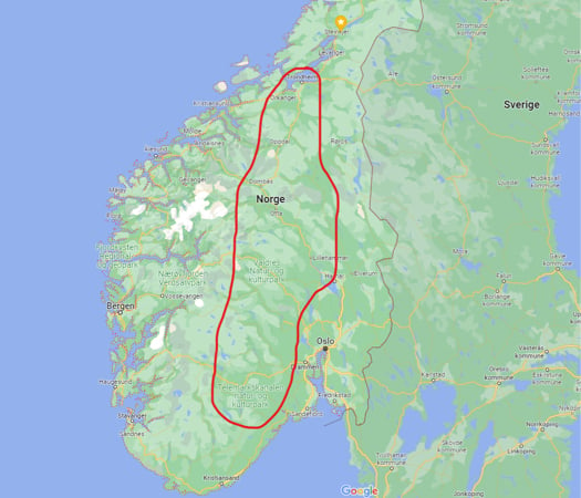
In the winter of 2021-2022, Norway experienced several extreme weather events that wreaked havoc on the country’s forests. These storms resulted in power outages for thousands of homes and in the destruction of up to 2.8 million cubic meters of forest, primarily from windthrow. Over 15,000 hectares of trees were downed, resulting in the greatest destruction of Norway’s forests in modern recorded history.
The threat of fallen trees
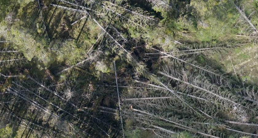
The downed trees represented not only a significant economic loss of harvestable lumber - 2.8 million cubic meters refers to the total volume of usable wood downed - but also, a threat to the long-term health of the forest. Downed trees left to dry and rot would result in breeding grounds for bark beetles and an increased risk of forest fires, drought damage, and other issues that would damage the value of the forests.
To mitigate these losses, the damaged areas and timber needed to be harvested and cleared as soon as possible. A critical step necessary to guide ground teams and harvesters is mapping the forest.
However, mapping these areas with helicopters is very expensive. And walking in forests downed by windthrow is very dangerous - trees often lie with tension and may “pop” up at any time, creating severe risk for those working in the area.
A drone-based solution
Biodrone, a Norway-based drone services provider, was approached by Allskog, a Trondehim-based branch of the Norwegian Forest Owners Association, and Skogbrand, a forest insurance agency in Oslo, to map these damaged areas using drone technology. Biodrone specializes in providing professional drone services within the forestry, agriculture, and nature management sectors.
The company used a Matrice 300 RTK drone combined with photogrammetry and AI to give their clients precise maps of the damaged areas, including the position and amount of timber.
The Matrice 300 RTK provided Biodrone with several advantages. As a drone operator in the Specific category in the EASA regulations, they were allowed to fly at 1,500 FT AGL, which combined with the drone's long flight time, made it possible to map up to 650 hectares per hour. This helped to speed up the mapping process, making it possible to cover large areas quickly and efficiently. At such high elevations, winds are more powerful than on the ground, but thanks to the M300’s robustness and 15 m/s wind rating, the team was able to map the areas without having to abort.
Even though 1,500 meters is very high for drone operations, the P1’s powerful sensor made it possible for Biodrone to achieve a ground sample distance of 5.6 cm/px. 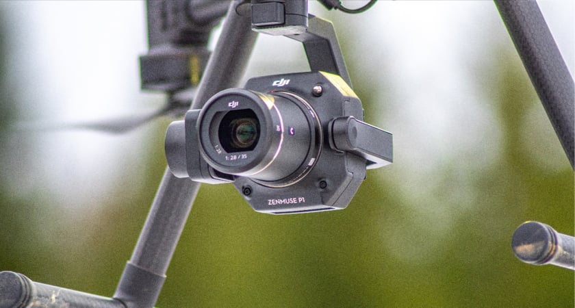
DJI Terra for forestry
To process the high-quality images captured by the Zenmuse P1 camera, Biodrone utilized DJI Terra, a powerful software for photogrammetry and mapping. DJI Terra allowed the team to create accurate and detailed orthomosaics of the damaged areas.
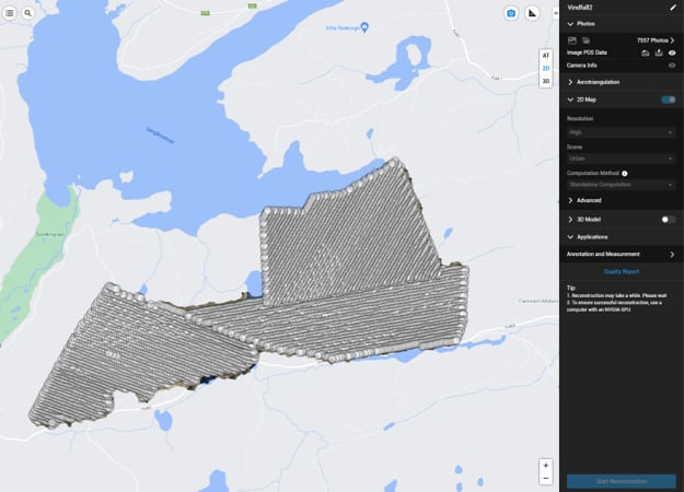
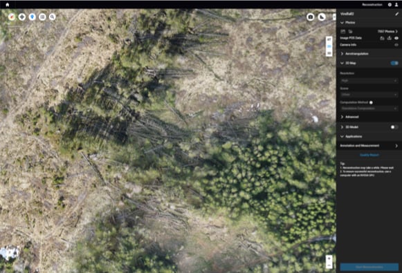
DJI Terra is exceptionally fast. This dataset containing over 7,500 42 MP images took only 5.5 hours to process - Atilla Haugen, General Manager, Biodrone
Biodrone AI-portal
These orthomosaics were then uploaded to the Biodrone AI-portal, where the deep learning algorithms were applied to analyze the data.
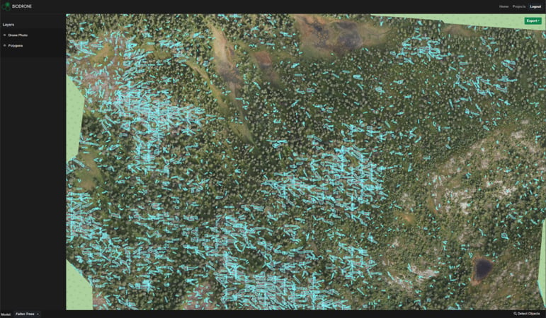
The Biodrone AI-portal was specifically developed for forestry applications, and it uses advanced machine-learning techniques to identify damaged areas and locate the position and amount of timber.
Using the Biodrone AI-portal to localize the damaged forest areas, they were able to provide their clients with an overview, including the precise location and area of the windthrow.
The results obtained from the AI-portal are geo-referenced, meaning that the exact location of the damage could easily be displayed in the harvesters' equipment. This is done by downloading the results from the portal as a geojson file and loading them in the terminal of the harvesters.
The portal can also share orthomosaics as a WMS, WFS, or WMTS to be displayed in the terminal of the harvesters as a separate map, giving the operator of the harvester the opportunity to plan the mission in detail and be more efficient and precise.
These outputs allowed the harvesters to plan their work more efficiently, ensuring that they could cover all the damaged forest while minimizing the risks associated with working in these areas.
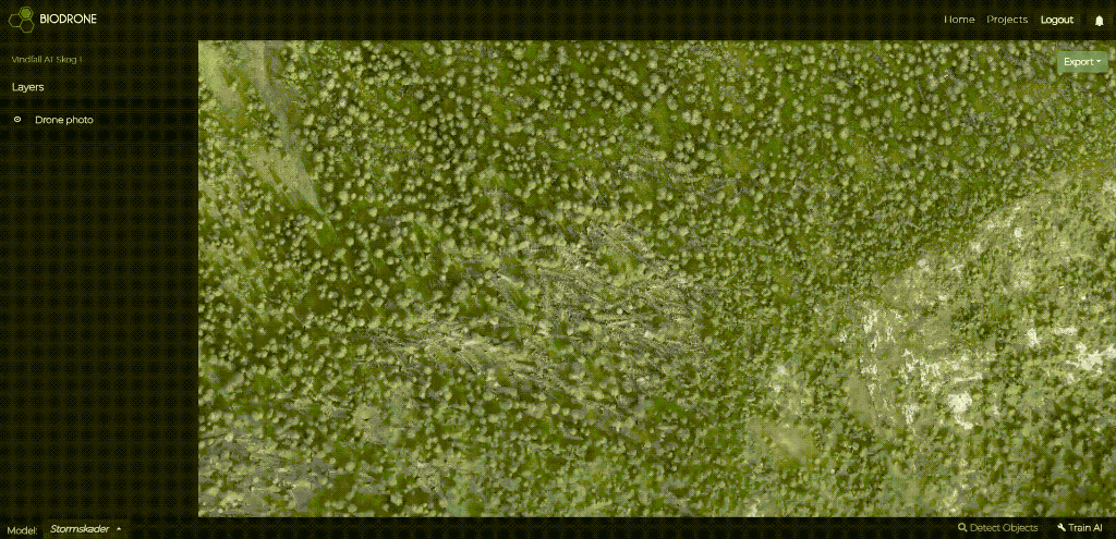 Biodrone AI-portal makes it easy to select an AI-model and run it on the data. The platform can be used to create new AI models and train them to detect anything, as long as it is visible in the orthomosaic from Terra.
Drones and AI elevate forestry
Despite the challenges presented by the mountainous terrain in some areas, Biodrone was able to complete the mapping project efficiently and seamlessly. The use of drones enabled them to map the damaged areas quickly and safely, helping their clients to harvest the timber before any further damage could occur.
Overall, this project highlights the benefits of using drone technology in the forestry sector, particularly in times of crisis such as the extreme weather events experienced in Norway in 2021-2022. Biodrone's expertise in drone services, combined with their use of AI and advanced drone technology, enabled them to provide their clients with precise maps of the damaged areas, helping to prevent further losses in the forestry sector.
About Biodrone:
Biodrone is a distinguished drone service provider based in Scandinavia, recognized for its expertise in the fields of forestry and agriculture. With a deep understanding of these industries, Biodrone offers cutting-edge mapping services that leverage the power of DJI hardware and their proprietary software, specifically tailored for forestry applications.
As a leader in the drone services sector, Biodrone has garnered extensive experience in the field, enabling them to deliver exceptional results to their clients. They employ state-of-the-art DJI drones, including the renowned M300 RTK, known for its reliability, robustness, and exceptional flight capabilities. By combining these advanced drones with their expertise in forestry mapping, Biodrone ensures the highest level of precision and efficiency in their services.
One of the key differentiators of Biodrone is their in-house software, specifically developed for forestry applications. This specialized software empowers their team to analyze and process data captured by the DJI drones, enabling them to provide accurate and detailed maps of forestry areas. By utilizing their software, Biodrone delivers comprehensive insights into forest health, damage assessment, and resource management, supporting sustainable practices within the industry.
Notably, Biodrone's exceptional partnership with DJI goes beyond utilizing their hardware and software. As an authorized DJI Dealer, Biodrone assists customers who aspire to harness the potential of drones in forestry applications. They provide expert guidance, comprehensive support, and access to the latest DJI technologies, ensuring that clients can effectively leverage drones for improved forestry practices.
With a focus on sustainability and innovation, Biodrone has become a trailblazer in transforming the forestry and agriculture sectors. Their advanced drone services, coupled with their expertise and strategic DJI partnership, enable them to lead the way in delivering sustainable mapping solutions and driving positive change in the industry.
-2.png?width=300&name=Insight%20blog%20featured%20image%201140X660%20(3)-2.png)
.png?width=300&name=HS%20-%20Featured%20Images%20(7).png)
-1.png?width=300&name=HS%20-%20Featured%20Images%20(5)-1.png)