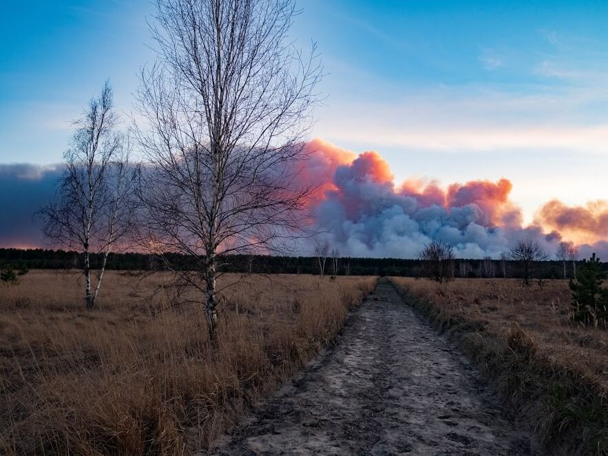
A huge wildfire broke out in the forests surrounding the Chernobyl Exclusion Zone on April 4th, almost exactly 34 years after the meltdown of reactor No. 4 in April 1986 that caused the worst nuclear catastrophe in human history. Once approaching the radioactive remnants of Chernobyl’s nuclear reactors, the rapidly spreading fires raised alarms that the site of the nuclear plant, located near the city of Pripyat, north-west of Ukraine’s capital Kyiv, could be threatened.
The situation was critical. More than 1,000 response personnel, 120 firetrucks, several helicopters and planes battled the blazes and contained the fires within 10 days1, preventing the fire from spreading to either the defunct nuclear plant or other facilities in the area.
On April 14th, the fires were completely extinguished. Background radiation in the exclusion zone remains within normal limits and is not increasing, according to the Ukrainian National Emergencies Service.
A fleet of 10 drones were deployed by response teams of the State Agency of Ukraine for Management of Exclusion Zone, State Emergency Service of Ukraine, and State Forest Guard, to capture high quality aerial intelligence that helped incident commanders quickly understand the situation and make the right decisions.
It helped us work faster, smarter. The captured [drone] data helped responsible personnel make decisions to change the direction of ground teams deployment, and even correct manned aircrafts deployment.” commented Alexander Sirota, Chairman of the Public Council at the State Agency of Ukraine for the Management of the Exclusion Zone.
Thermal drones: the game changer
Drones were sent in the air for an initial aerial overview when the first fire started on April 4th. The situation soon escalated as the fire rapidly expanded due to the unusually dry weather in the area.
Plumes of black smoke billowed into the sky as blazes ripped through over 40,000 hectares of the forests surrounding the exclusion zone. This was when the drones' thermal function became critical assets for the response teams.
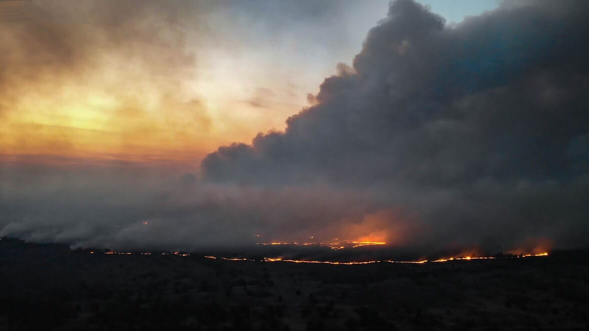 Black smoke blocked visual views of the area
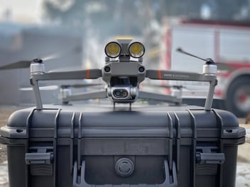
Mavic 2 Enterprise Dual provides responders with actionable aerial intelligence through thick smoke
“It was impossible to get a visual view with such dense smoke, but we needed to get on top of the situation, clear and fast. We had 2 Mavic 2 Enterprise Duals. The thermal cameras gave my team the eyes to see through the smoke.” said Sirota, adding that the compact drone with dual sensors (visual and thermal) could be almost instantly flown in the air when taken out of the box.
Two units of the Mavic 2 Enterprise Dual were sent to support the response efforts by DroneUA, a DJI channel partner in Ukraine
The M2E Duals’ thermal capabilities immediately elevated situational awareness, allowing incident commanders to see real-time thermal imagery, read heat measurements, and locate hot spots within minutes. The FLIR MSXTM technology overlaps the standard visual image with a thermal one in real-time for greater clarity, embedding edge and outline detail onto thermal readings. Crews were able to pinpoint hot areas quickly while improving their awareness of objects in the area.
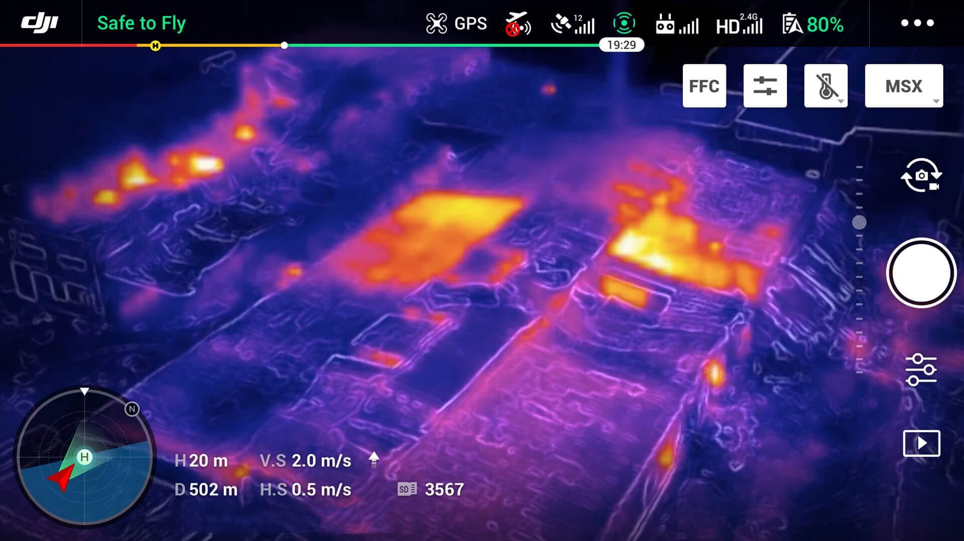 The Mavic 2 Enterprise Dual’s FLIR MSXTM function combines thermal and visible images in real-time (note: this image is added to show the effect of FLIR MSX and is from a separate mission)
This greatly reduced response teams’ time on scene, according to Sirota.
“Even without fire, it is unsafe to stay in some parts of the Chernobyl area. With the fire, we are facing additional risks for the personnel. Drones helped to shorten the time they needed to be in radioactive areas and lower the potential harm.” (Alexander Sirota)
While first responders risk their lives to keep communities and properties safe, it’s important to equip them with reliable tools that keep them safe, and out of harm’s way.
The latest version in the Mavic 2 Enterprise series is the Mavic 2 Enterprise Advanced. It has an updated hybrid camera with 640x512 px thermal resolution.

Collective Deployment: Closing the Information Gap
Large-scale wildfires are complicated missions that require multiple ground and aviation teams to cooperate for maximized response efficiency. The Chernobyl incident, being within kilometers distance to the remains of the Chernobyl power plant, made it an even more complicated mission.
Over 1000 firefighters, 120 firetrucks, several helicopters and planes, 10 drones. How to allocate these resources and tackle the mission most effectively posed a challenge to incident commanders.
“We deployed drones to cooperate with ground teams and manned aviation, giving crews informed guidance,” said Sirota.
“For every drone operator, we had dedicated ground team representatives with field radio stations. Understanding of the situation, coordinates of the new hot spots discovered, direction of wildfire spreads, or any important data was shared via radio channels, as well as correction of our tasks to the command centers.”
These all translate into actionable intelligence that helped incident commanders navigate ground teams and manned aircraft to where they should be.
The use of emergency aviation becomes much more effective with the help of low altitude data provided by drones. This is because the visibility was almost zero level within the area, no visual data could be obtained where it was most needed.
Aircraft dropped 538 tons (488 metric tons) of water on the blaze on April 12th, a week after the fire first broke out, as a critical containment measure. “We used drone data to direct them to the right spots. When aircrafts were approaching to drop water, drone operators were already grounded or stayed on the low altitude,” said Sirota, explaining how manned and unmanned aviation worked collectively on the mission.
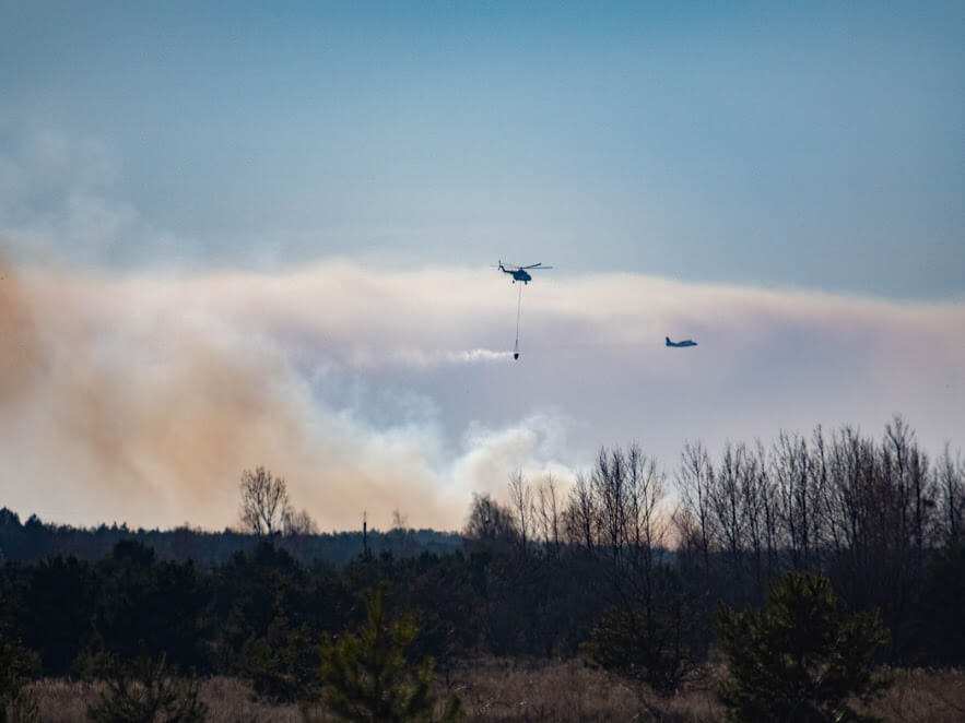 Helicopters and planes deployed to drop water on the blaze
Drones in Wildfires: “the Must-have Tool”
The Chernobyl Nuclear Power Plant Zone of Alienation is an officially designated exclusion zone around the site of the Chernobyl nuclear reactor disaster, also commonly known as the Chernobyl Exclusion Zone, the 30 Kilometre Zone, or simply The Zone.
The fires in the Zone are a recurring seasonal phenomenon, but their scale this year was unique due to several factors. Ukraine had an abnormally warm and snowless winter, which dried up the forest floor, followed by a dry and windy spring that aided the spread of flames.
The response teams’ preparedness helps them contain and extinguish the fires quickly and effectively.
Sirota introduced that the State Agency of Ukraine for the Management of the Exclusion Zone has been routinely using drones in the Zone since 2016, monitoring the area and detecting abnormal heat measurements and fires at their early stages. Drones are effective tools not just during missions, but more importantly in fire prevention before an incident happens.
“Drones are the must-have tool to fight wildfires, and thermal imagery is especially important.” he commented, “We’ve used drones to monitor wildfires for years, and after working with M2ED and seeing the thermal, it seemed that I was blind for the whole time before.”
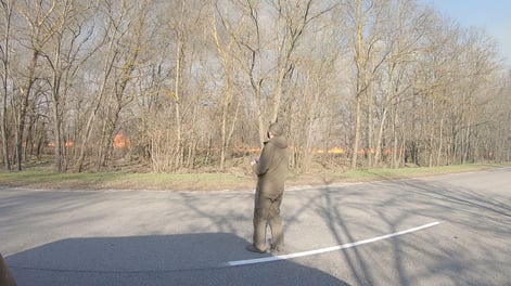
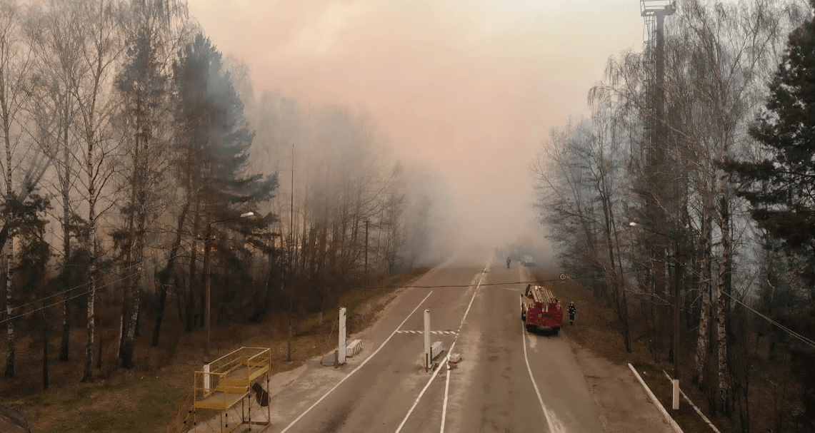 A ground team at the Chernobyl fire scene
Drones are particularly crucial for forest fires that tend to get out of control quickly and put both pilots and crew at risk. There’s only a small containment window between when the fire starts and when it gets out of control. Drones give firefighters a bird’s eye view of the terrain and help them determine where the fire moves next so they can swiftly make decisions about where crews should go and who should be evacuated. Read more about the 4 ways drones help fight forest fires here.
Learn more about the basics of thermal drones or about when thermal drones made an impact.
1. Report from the State Emergency Service of Ukraine https://www.dsns.gov.ua/ua/Nadzvichayni-podiyi/106889.html


