
The list of use cases for uncrewed aerial vehicles (UAVs) is always expanding. Much of this growth is due to the development and refinement of valuable new capabilities and drone loadouts. For instance, the prevalence of thermal imaging is on the rise.
Drones that leverage thermal camera equipment to detect heat in addition to conventional video cameras are seeing use in a variety of scenarios. From fire detection to search and rescue missions and utility grid inspections, thermal drone deployment could be the answer to an ever-growing list of important jobs across industries.
Thermal drones in action
Despite the relative newness of the technology, there are already numerous examples of DJI thermal drones in action, each of which can inspire more users to take up the technology:
- Firefighters responding to a grasslands wildfire in Cleburn, Texas on March 20, 2022, leveraged thermal drones to provide comprehensive situational awareness of the growing fire. The thermal drones could see through the thick billowing smoke and guide ground teams to safely respond to the hotspots. They were able to contain flare-ups and keep the blaze away from residential areas, and brought the fire under control within 4 hours.
- In 2020, the Chernobyl Exclusion Zone in Ukraine suffered massive wildfires. Thermal drones allowed firefighters to navigate to hot areas despite the thick plumes of smoke that severely limited their visibility.
- Drones proved pivotal in searching for missing people during monsoon-related floods and landslides in Vietnam. The UAVs served a triple role, capturing high-quality aerial footage, using thermal sensors to look for heat signatures and collecting telemetry data for 3D models of the area.
- Oil refineries in Argentina employ thermographic imaging drones to sense the relative energy being generated in different parts of their plant infrastructure. This allows inspectors to get a clear image of the status of equipment, without forcing employees to get close to potentially dangerous areas.
- Thermal drones provided aerial recon imagery during a chemical leak in Sarasota, Florida. The UAVs allowed crews to pinpoint the source of the issue amid a spreading ammonia cloud.
- Thermal UAVs allowed firefighters in Bentonville, Arkansas to carefully track the temperature of a tank of flammable difluoroethane while a surrounding industrial plant burned. This enabled the crews to cool the tank strategically and prevent it from exploding.
- Thermal drones help farmers scan fields for baby deer, which otherwise would be hidden amidst the tall grass. The baby deer are brought to safety, and the farmers can mow their fields without endangering the lives of the fawn.
These are just a few of the applications of thermal drone technology, and they demonstrate just how important it can be to have the right drone payload for the job. UAVs equipped with thermal imaging systems are already making a difference, and the equipment is still evolving.
Thermal imaging: How does it work?
When considering the present and future of thermal imaging drone technology, it's worth delving into the technical principles that make thermal cameras function. Understanding how thermal imaging equipment works can inspire more effective use of the technology and new deployment approaches for thermal drones.
Heat 101
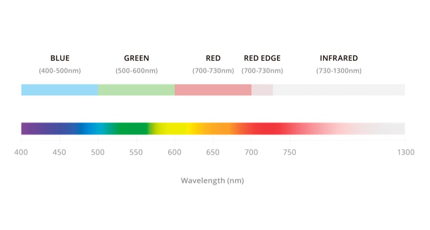
Heat, also known as infrared radiation (IR), is just the vibration of atoms. Objects give off a heat signature based on how much their atoms are moving — the more motion, the hotter the object. Thermography is the process of studying these heat signatures and putting that thermal imagery knowledge to practical use.
Humans feel heat, but we can't see IR. Why is that? Because this radiation occurs on an electromagnetic wavelength that the eye can't detect. Thermal cameras are designed to turn infrared signatures into something visible to humans.
How thermal cameras work
Thermal cameras use specialized lenses that pick up IR frequencies, along with thermal sensors and image processors to render the results on a visual display. When an infrared camera is mounted on a drone, the device is typically placed on a gimbal, which stabilizes the image and lets the lens rotate a full 360 degrees.
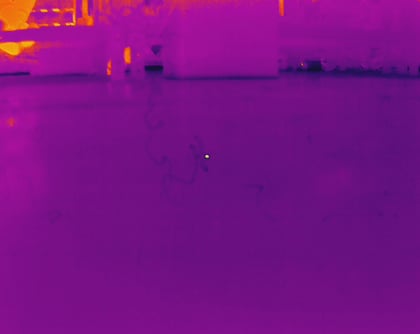
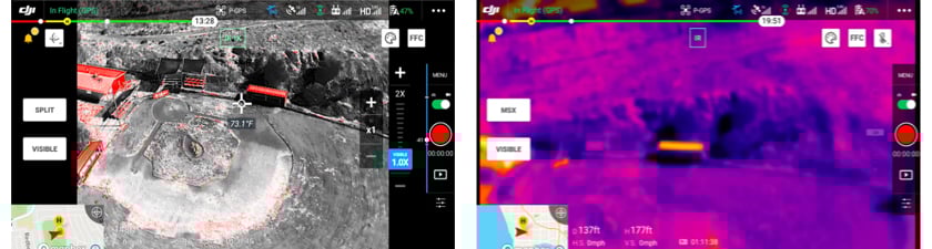
 Thermal image of a utility pole captured with the H20T
The thermal sensors within these advanced cameras, technically known as microbolometers, have received notable updates in recent years. Today's options do not require the exotic cooling materials used in the past, making them much more affordable.
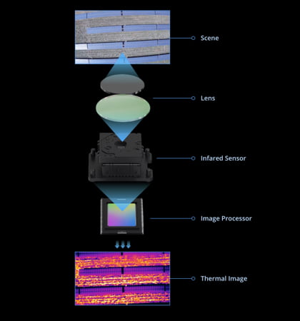 Diagram of how a thermal camera works
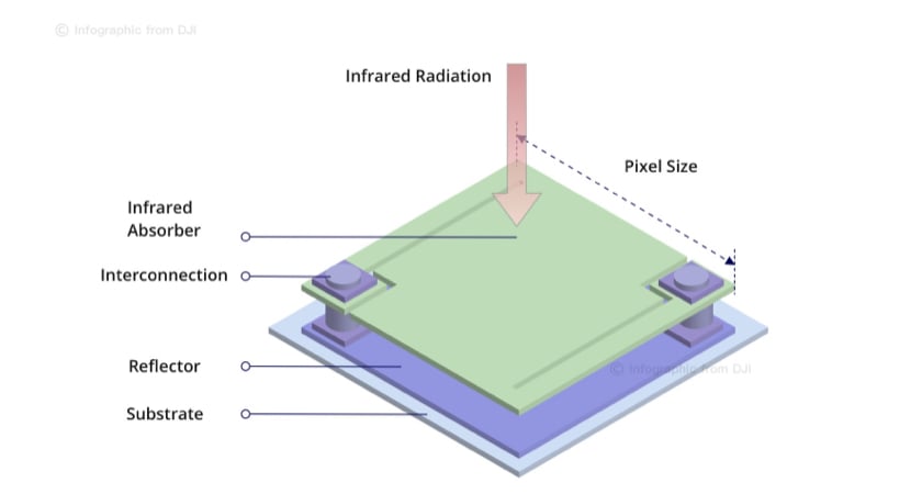 Diagram of a thermal sensor (microbolometer)
Drone thermal cameras can detect the surface temperature of many objects, but there are exceptions. For example, highly polished, shiny and reflective objects do not absorb much heat — they have what is known as low emissivity. These are hard to detect on thermal cameras. High emissivity objects like wood, concrete — and even people — are easy to scan.
 Wood has high emissivity
Reading and processing thermal images
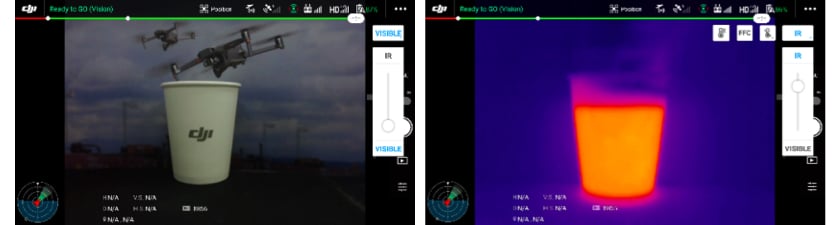
Once drones capture thermal information using their IR cameras, that thermal data is displayed on a screen as a conventional image for operators to review.
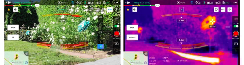
 DJI in-flight thermal imaging software
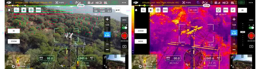
Using thermal imaging software users can change the palette of colors used to represent the heat of the scene. Each view is useful for picking various details out of the image, and these options include:
- White Hot: Hotter objects appear lighter, and colder areas are darker.
- Black Hot: The opposite of hot white, with hotter objects appearing darker.
- Rainbow: Temperature corresponds to hues, with warm colors representing heat.
Of course, those three options are just the beginning. More advanced thermal cameras offer a wider variety of views — the Zenmuse H20T offers 12 separate color palettes.
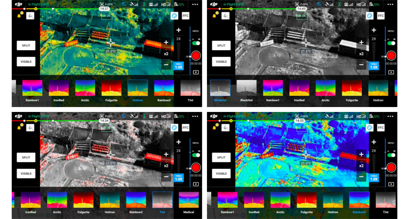 Common thermal color palette settings
The type of thermal camera used also determines what format imagery is captured and stored in. While lower-end options capture pictures as simple image files, advanced solutions also contain thermographic data and temperature readings, along with GPS tags. Thermographic data can be inspected further with the DJI Thermal Analysis Tool.
Caring for your thermal camera and how to keep it from harm
Before you start using your thermal drone, it's important to know some common ways that thermal sensors are damaged and how to prevent this. While DJI products are known to have excellent build quality and durability, thermal sensors by their very nature are extremely precise, finely-tuned instruments that demand care and caution when in use. Improper use can lead to permanent damage to the thermal sensors, leaving artifacts across the data you collect.
Here are some examples of thermal images captured by M30Ts that has had their thermal sensors damaged by direct exposure to sunlight:
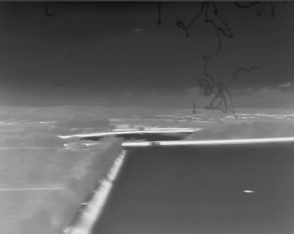
To prevent this from happening to your thermal drone’s sensor, DO NOT expose the thermal camera lenses to strong sources of energy such as the sun, lava, or a laser beam. Otherwise, the camera sensor may be burned leading to permanent damage.
Taking accurate thermal measurements
Even highly effective thermal cameras have to cope with a variety of environmental factors that can make it challenging to take an accurate reading of surface temperature. These include atmospheric conditions — too much warmth, humidity, clouds, rain or snowfall can impede thermal camera accuracy. Thermal cameras also struggle with glass, as the reflective glass may be capturing heat from the sun, the ground or another object.
An object's surface coating may also affect a thermal drone's ability to take temperature readings. Corrosion or a new coat of paint can change the relative temperature reading of an object. The relative position of the sun, too, can potentially cause items made of the same material to look different in a thermal camera.
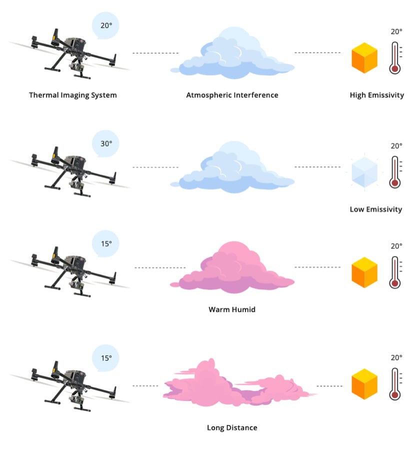
Using a thermal camera effectively means keeping the following factors in mind:
- Atmospheric conditions
- The presence of smoke, dust, and debris
- Emissivity
- Transparency
- Reflectivity
- Time of day
- Viewing angle
- Paint on an object
- Distance from target
- Amount of thermal energy
- Surface roughness or smoothness
By bearing these traits in mind, it's possible to build an accurate picture of an object or landscape's thermal properties.
 Surface readings by thermal cameras can be affected by a number of factors
Advanced camera considerations
High resolution and more color display options are a few of the advantages that come with high-tech thermal imaging camera systems. In today's fast-moving tech development landscape, the most forward-thinking capabilities will go beyond these incremental upgrades.
Powerful new capabilities to consider include:
- Dual camera drone payload options: Drones equipped with modern thermal imaging systems may be able to capture multiple kinds of images simultaneously. Hybrid thermal payloads are two cameras in one, a conventional imaging system and an IR camera.
- User-customized isothermal settings: Using a thermal drone control panel, users can set isotherms, which are custom temperature settings. For example, users looking for potential fires can ask the camera to automatically display images that contain high-temperature zones.
- Next-generation thermal imaging software: The software used to interpret IR images is evolving over time, delivering new abilities such as temperature tracking for specific objects, real-time heat updates, an overlay of visible-light and IR images and more. One option is the DJI Thermal Analysis Tool.
Backed with ever-evolving thermal drone technology, companies can expand the ways in which they use these UAVs. Mission specifications that may have been impossible just a few years ago are worth revisiting as thermal imaging becomes more precise, versatile, and affordable.
Thermal imaging camera technology: Payloads to consider
Choosing a thermal imaging payload for a drone is a matter of matching the equipment's capabilities with an organization's use case. There are a few different factors that determine how a camera system will perform in the field, as well as how much you can expect to pay. These include:
- Field of view (FOV): This is a measurement of how large an observable image the camera can take in.
- Weather resistance: Measured in ingress protection (IP), this determines an electrical enclosure's resistance to the elements — including moisture from rain and fog.
- Spectral band: The spectral band is the electromagnetic range detectable by the camera's IR sensor.
- Thermal sensitivity: This metric denotes the degree to which a sensor can measure differences in relative temperature, and is also called noise equivalent differential temperature (NEDT).
- Image resolution: Rather than how big an area the camera captures, this reflects how many pixels go into the digital image generated, which in turn determines level of detail.
 Mavic 2 Enterprise Advanced: 640x512 sensor (left) vs. Mavic 2 Enterprise Dual: 160x120 sensor (right)
Depending on the type of work you're seeking a drone for and the conditions in which you plan to use the thermal UAV, you can select a thermal camera payload to meet your needs. Some of the highly capable payloads currently on the market include models from the Zenmuse H20 series, such as:
- Zenmuse H20T: The standard Zenmuse H20 is a triple-sensor drone camera consisting of a 20MP zoom camera, a 12MP wide camera and a 1200m laser rangefinder. The Zenmuse H20T also adds a 640×512px radiometric thermal camera. The camera generates R-JPEG files with embedded temperature information, enabling further analysis.
The thermal camera records at 30fps to a high degree of thermal sensitivity. Sporting a wide variety of color palettes, customizable isotherms and temperature alarms, the payload lets users choose between high gain and low gain modes, depending on whether they need a wider temperature range or more sensitivity.
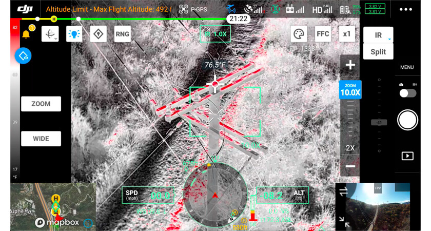
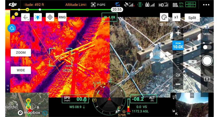 Split mode with the Zenmuse H20T
- Zenmuse H20N: The Zenmuse H20N payload is similar to the H20T, however it sports even more advanced features, many tied to its mission profile as a night vision camera. The payload's starlight night vision camera can zoom in synchronized with the thermal camera, showing the results in side-by-side splitscreen.
With two thermal cameras, capable of 2× and 8× zoom, the system is capable of a 32× zoom. Moving in on a thermal image allows users to carefully inspect any hotspots or other temperature anomalies they detect.
Using advanced camera payloads allows drones to intervene in a wide variety of situations, whether that means searching for missing persons at night, scanning for potential fires, conducting electrical inspections or any other potential application.
Use cases for thermal drones: Now and in the future
Thermal drones can serve in more roles today than they could in the past, with more precise sensors and lower price points opening up new possibilities. This process of expansion and discovery is ongoing, with new use cases opening all the time.
Thermal drone use today
If your organization engages in any of the following activities, a thermal drone may be the perfect piece of technology for your needs:
- Firefighting: One of the most common uses of thermal drones is as firefighting tools. Heat mapping from the air allows firefighters to get ahead of risk factors. When working inside structures, it's possible to map out possible points of failure, while in wildfire scenarios, drones can help crews intercept fires' progress in the open.
- Search and rescue: Fires aren't the only types of disasters where thermal drones can assist rescue crews. In the aftermath of catastrophes such as floods, landslides, earthquakes, tornadoes and hurricanes, thermal drones can help crews find missing victims, even at night. These thermal UAVs are also capable of tracking down individuals who have become lost in the wilderness.
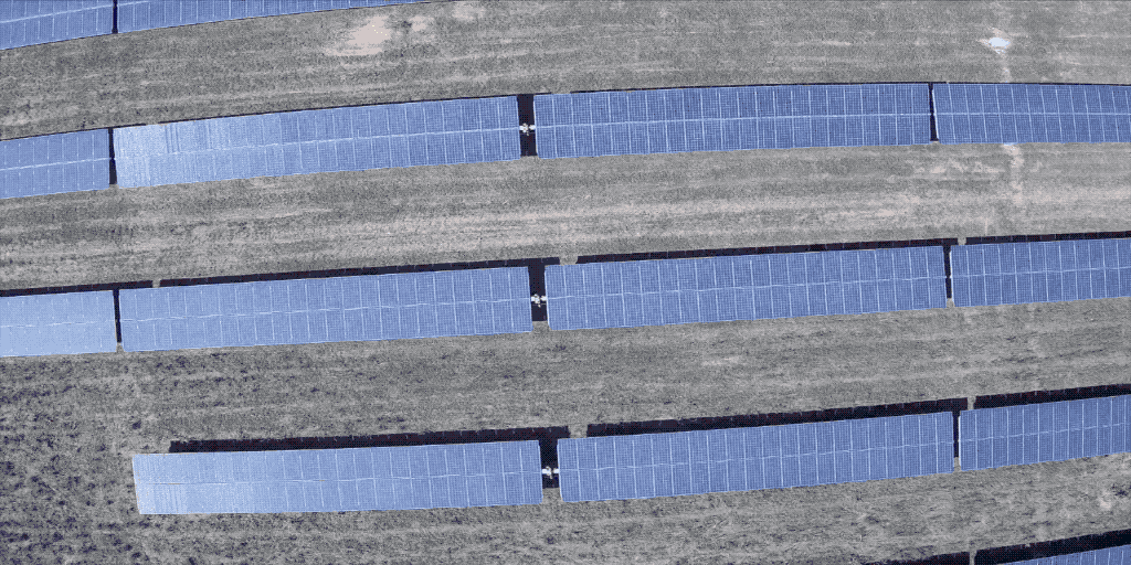
- Aerial utility and mine drone inspections: Inspecting utility infrastructure, from plants and solar panel installations to far-flung power lines, is easier with drones. Using thermal cameras alongside conventional imaging allows crews to watch out for potential failure risks in new ways, or even inspect the status of thermal panels. No matter how large a plant or mine is, drones can fly over the site and take readings.
- Advanced agriculture: Monitoring crops and grazing herds from the air is a potentially overlooked use for drones. Thermal imaging lets farmers measure fields' heat exposure and track animals, even at night. Ongoing efforts to make farming more efficient through technology deployment are a perfect match for drone deployment.
Use case expansion: Still ongoing
The expansion of thermal drone use beyond public safety roles, and into its efficiency-building part in utilities and agriculture, is a relatively recent development. This shows that as users, both professionals and consumer enthusiasts, are constantly thinking of new uses for thermal drones.
If your business needs to make careful aerial inspections of hard-to-reach infrastructure or to watch over personnel or assets at night or in adverse weather conditions, a thermal drone may fit your use case. As thermal camera payloads become more sophisticated yet simultaneously more affordable, the sky's the limit.
Drone options: Find the best thermal drone for your purposes
While your choice of camera payload is important for thermal drone performance, so is the commercial drone chassis you pick. The right drone body will deliver the speed, maneuverability, service range, battery life and other traits that will determine what types of tasks your new thermal drone can accomplish.
The following are a few of the market-leading commercial drones you can choose from for your thermal deployment.
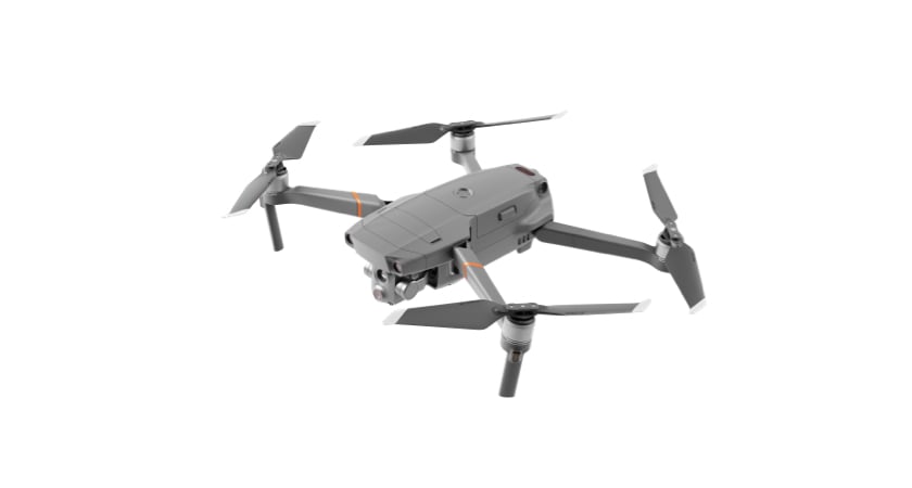
DJI Mavic 2 Enterprise Advanced
The M2EA is an extremely compact and lightweight drone chassis that still contains a wide range of powerful features. It sports an integrated 640×512 thermal sensor capable of 16× zoom and a 30hz frame rate. The drone's RTK module allows centimeter-level positioning, and its ability to work with up to 240 waypoints makes it perfect for automated inspection missions, even in complex environments.
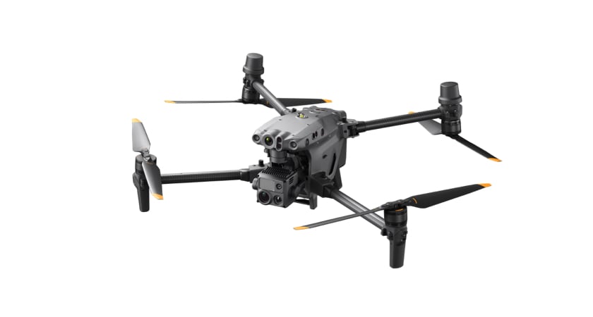
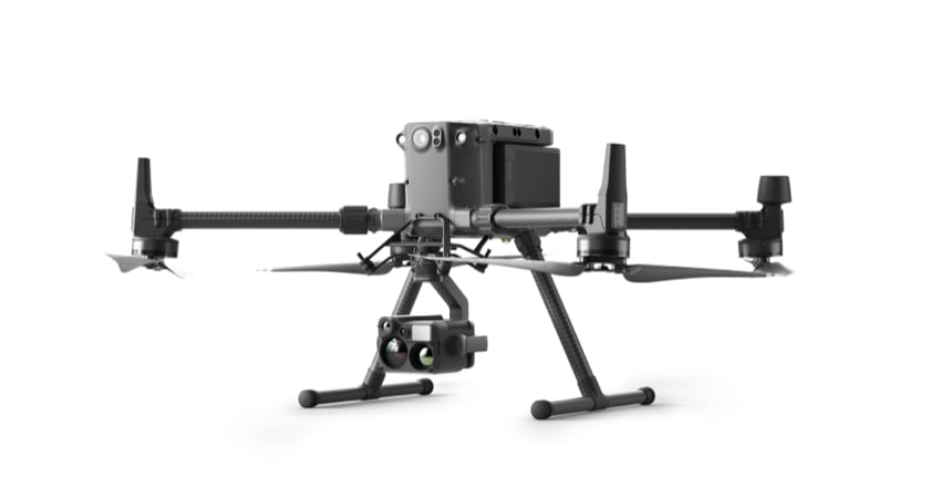
DJI Matrice 30T
The M30T is a tough drone chassis built to stand up to the elements and designed to be highly portable despite its impressive sensor payload. The camera's specifications align with the M2EA — 640×152 resolution, 30fps. The control system for the M30T is especially advanced, with a 7-inch widescreen display on the dual-stick control system designed for enterprise drone pilot use.
DJI Matrice 300 RTK
The M300 RTK is the latest in commercial drone technology, with the adaptability to carry up to three payloads simultaneously. At maximum, the drone may be equipped with one upward gimbal and two downward gimbals. The M300 RTK uses a new display system, incorporating more information into the primary screen, to help a drone operator navigate around any potential obstacles. Equipping the M300 RTK with a Zenmuse H20T or H20N as one of its payloads allows users to capture unprecedented levels of high-resolution thermal information.
Empowering professional drone users
Whichever thermal drone configuration you choose, you can further empower your users by selecting additional options. For example, the DJI Care Enterprise program, which includes all kinds of care and service for your equipment, no matter how many DJI drones are in your fleet. Investing in support helps you safeguard your investment and keep your thermal drones flying, no matter what they encounter.
With an ever-expanding list of use cases and a high degree of technological sophistication available today, there's never been a better time to dive into thermal drone use. Whether you're delivering new capabilities to your public safety personnel or creating an efficient new inspection method in utilities, agriculture or any other industrial setting, a thermal drone can add a new dimension to your operations.
To help you decide if a thermal imaging device is right for your unique set of circumstances, contact a DJI representative in your area.
Read more about how thermal drones have made a difference for our customers.


-2.png?width=300&name=HS%20-%20Featured%20Images%20(2)-2.png)

