
The construction industry, which has traditionally been governed by analog processes, has recently made leaps into the digital future. Over the past few decades, firms have upgraded their planning, collaboration, and oversight systems to include accurate digital data, and the benefits have been numerous.
Building information modeling (BIM) is one of this new wave of digital planning technologies. Acting as a modern counterpart to traditional blueprints, BIM adoption allows firms to accurately view the progress of their jobs as project team members make their contributions. To make sure this system lives up to its potential, strengthening job site workflows, firms need a way to repeatedly collect accurate data — this is where drones enter the picture.
Drones have made major strides in construction as technology has become more common and accessible. Contractors have found numerous roles for drones on the job site and made use of the data collected by their increasingly sophisticated sensor modules. This information is the fuel BIM solutions need, making drones and BIM a perfect match.

What is building information modeling?
As defined by ScienceDirect''s collection of peer-reviewed reports, BIM is a system for sharing data about a building project before, during, and after construction. While BIM is meant to act as a modern take on the classic blueprint, its uses go beyond acting as a digital replacement for paper documents.
When contractors use BIM, they are gaining a system for collaboration and data sharing. One of the important roles BIM can fulfill is acting as a single source of data truth for a construction project, ensuring that every part of the crew knows the initial plan for the structure, the current state of construction, and the projected future of the job. From the architect's initial design on, BIM files can keep all project team members informed.
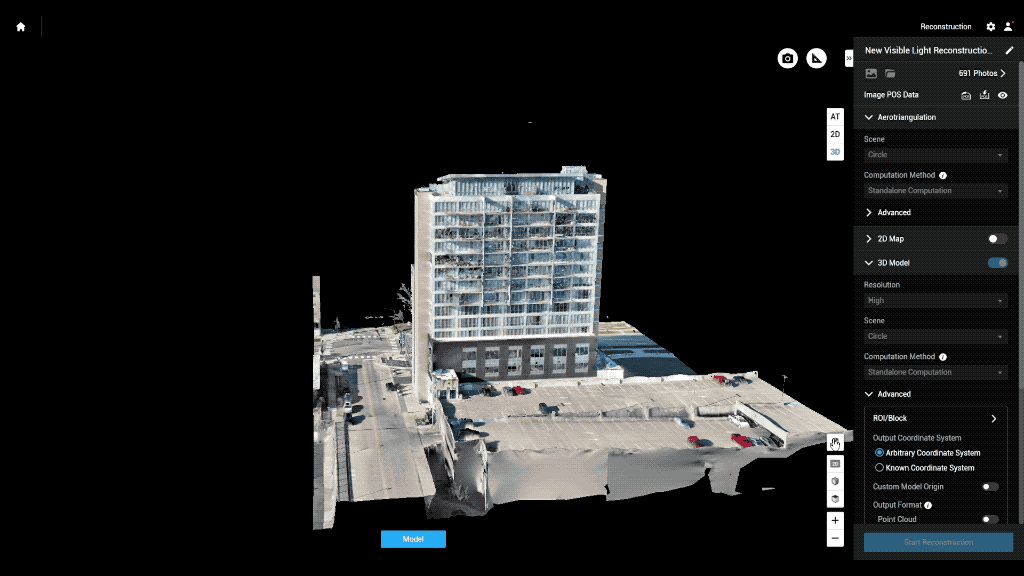
One of the defining features of BIM is the use of a 3D model of the structure. By comparing the latest BIM data to speculative models made when the job was in its planning stages, contractors gain a valuable and clear side-by-side view of their planned, current, and projected buildings.
While BIM prominently features 3D model technology, it should be noted that the overall definition of BIM goes beyond the digital BIM model itself. BIM software is also a valuable place for stakeholders to make comments and give updates about the state of a construction project. Real-time updates to the BIM system can allow personnel to log on from the office or the job site to monitor current levels of inventory, staffing, and more.
The need for accurate, real-time data to feed into the BIM software is one of the major areas contractors should account for when adopting these systems. To use the solutions to their fullest extent, they need updated figures. One of the most effective, safe, and reliable ways to provide that content is the use of construction drones.
What's the role of drones in BIM?
Drones solve one of the major issues companies may encounter after BIM implementation: If the actual progress of construction differs from the projection created in the planning stages, working from those 3D plans can be challenging. Superimposing a 3D model of the in-progress structure as it exists over the plan is a handy way to keep working with BIM technology throughout a project's progress.
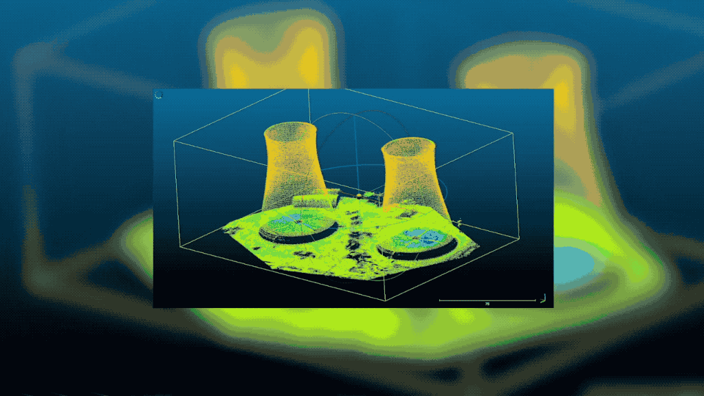
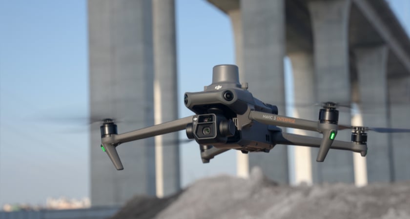
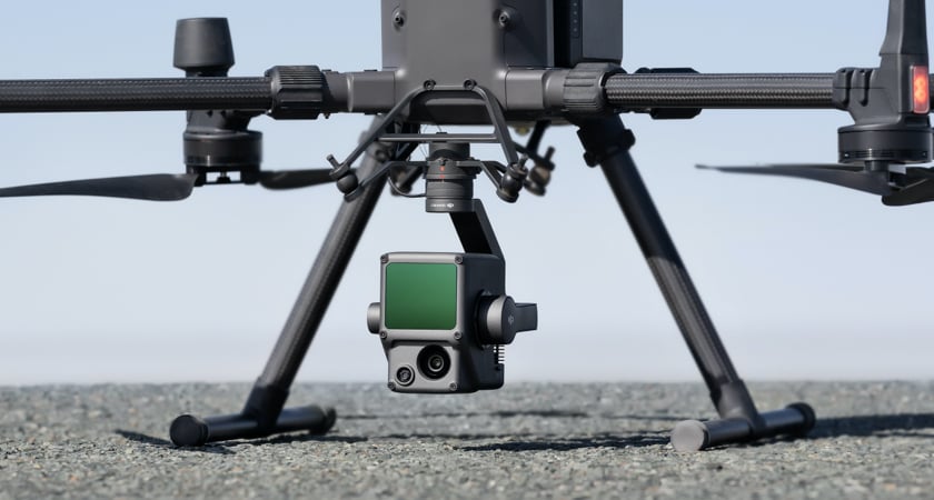
Drones today may be equipped with multiple kinds of sensors that allow them to generate a 3D point cloud to craft an accurate digital model. The most common method employed by drones is called photogrammetry, and is based on assembling 3D representations out of numerous 2D photos. This is made easy with the Smart Oblique Capture function available with the Mavic 3 Enterprise and the Matrice 300 RTK with a Zenmuse P1. Another method, light detection and ranging (LiDAR), involves invisible beams which give the exact position of objects.
While drones are useful in constructing the real-time 3D models at the heart of BIM systems, it's important to note that they may have other roles to play in generating up-to-date data. For example, drones flying over material storage areas can perform stockpile volume measurements, giving accurate reports on how much inventory is left in a given location and helping contractors make plans.
Since drones provide an unobtrusive way to capture information about a site or structure, they are useful at every stage of a building project. The BIM data they provide can inform a contractor's initial plans, track the progress of a job and ensure it has been completed up to high standards of quality and safety through ongoing facilities management.
Before a job
Drones can survey a job site, providing accurate topographic data that is incorporated into the initial, projected 3D model within the BIM platform. Starting with this level of pinpoint accuracy will help contractors keep their work on track. Even on rough terrain, drones provide a safe, efficient way to scan the whole site.
During a job
Drone fly-overs can periodically keep all stakeholders aware of the current state of a job. Generating updated 3D models to overlay on the initial plans is a BIM-specific role for drones. These unmanned aerial vehicles can also provide aerial photos showing where assets are located, helping leaders coordinate the job.
Following completion of a job
BIM technology's role isn't over when the last nail is hammered, and the same is true of drones. UAVs can provide safe, effective inspections and facilities management, seeing a structure from all sides and ensuring that every part of the building is structurally sound and up to code.
How are construction firms using drones for BIM?
Seeing some of the specific uses contractors are finding for their drones is a way to appreciate the technology's ever-expanding role in BIM construction workflows. Drones may prove especially useful when dealing with situations that would be logistically difficult for crews on the ground.
Contractors are using drones to assist with:
- Power line construction: Power lines are challenging to plan, as they have to cover a large area of terrain. Unless contractors have accurate position data in their BIM software, they can encounter issues on the job. Drones provide an efficient, cost-effective way to generate accurate terrain maps and keep them updated as the job progresses.
- Prefabricated concrete embeds: To correctly install prefabricated embeds in concrete, contractors need to know exact position data. A fly-over with a drone allows them to capture the necessary information and access it through a BIM platform.
- Updated BIM planning in complex geography: There are many things that can make terrain tough to navigate — a site may be remote, have major changes in elevation or be located in an area being significantly changed by construction. Drones can capture updated information more affordably than would be possible with an airplane fly-by, and more accurately than with satellite imaging.
Whenever a contractor firm needs to gather information, using a drone is an option. Safer than sending surveying crews onto a site and more accurate than other data collection methods, BIM drone use in the construction industry is a potential value-add on the job site.
How does drone-based BIM adoption deliver return on investment?
BIM, at its heart, is an information sharing and collaboration solution. This makes it an important part of the construction planning process, and a reliable generator of value. Adding drones to the mix allows companies to improve their BIM workflows by providing a constant source of accurate data from the site.
Construction firms equipped with drone-powered BIM can see value by:
- Adjusting building plans on the fly: Having a consistently updated BIM model to superimpose over plans lets contractors know immediately if they have deviated from their original intentions. This allows them to adjust as they go — being able to change course is more efficient than having to make drastic changes later in the construction process.
- Working with the most accurate possible figures: Drones don't just provide timely data — when using today's advanced sensor modules, the information coming in from these UAVs is also highly accurate. Real-time kinematics (RTK) is a system that uses a drone, a base station, and a satellite to triangulate centimeter-level accurate position data. Working from highly detailed figures helps contractors with planning at every step from initial visualization to final inspection.
- Managing the job site from a bird's eye view: Drones' ability to measure more than the structure under construction makes them valuable and cost-effective parts of any contractor's overall equipment. A drone flying over the job site can inform contractors where assets and materials are and perform ongoing inspections. All this data can be uploaded to the BIM for access by all relevant stakeholders, who can immediately incorporate the intelligence into their workflows.
BIM and drones are a valuable match, one that delivers a wellspring of accurate data throughout the construction process and an efficient way to share it.
How do you find the perfect BIM drone loadout?
Surveying a job site from the air and collecting important BIM data are roles for specialized and powerful commercial drones. The exact right drone for a contractor's needs will depend on what role the company envisions for its UAVs.
Top options include:
- DJI Mavic 3 Enterprise: Light, affordable, and equipped with an accurate RTK module, this drone can gather all the information a contractor needs to keep a construction job on track.
- DJI Matrice 300 RTK: This drone's configurable loadouts can include a powerful Zenmuse L1 LiDAR sensor, allowing contractors to collect accurate point cloud data, even in the dark.
If you're ready to learn more about drones' ever-increasing role in the construction industry, download our Drones In Construction Guidebook.


-2.png?width=300&name=HS%20-%20Featured%20Images%20(2)-2.png)

