
The International Union for Conservation of Nature (IUCN) estimates that more than 60 percent of the world’s population lives less than 150km away from the sea. This wouldn’t be a worrying fact had climate change not made several environmental assets and economic activities fall under the radar of vulnerability – think fisheries, agriculture, tourism, infrastructure, et al.
According to a study by the World Bank, flooding, erosion, and pollution cost about $3.8 billion in GDP to the West African nations of Togo, Benin, Côte d'Ivoire, and Senegal in 2017 alone. Benin, particularly, is grappling with erosion rates that are especially high with an average loss of 4 meters per year on 65 percent of its coast.
As such, it has become more dire than ever to predict the future evolution of shorelines in West Africa and develop dynamic flood models through frequent, accurate surveying. This is why the World Bank launched the West African Coastal Areas Management Program (WACA) in 2018 to help West African countries meet the challenges posed by climate change and preserve their coastline.
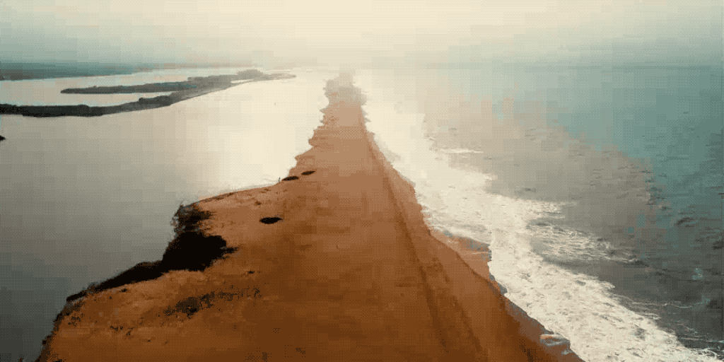
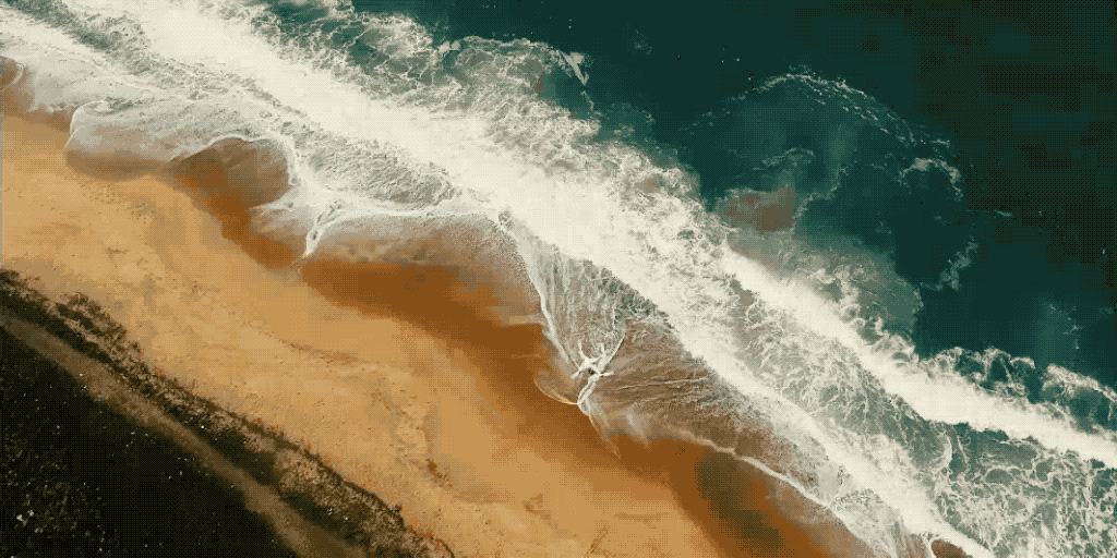
As part of this program, a littoral survey was conducted last year in Togo and Benin, covering more than 60km of the shared coastline between the two countries. The survey aimed to digitalize the state of the fragile coastal ecosystem and refresh the non-existent or poor technical data on it with fresh ortho-images and accurate topographic data.
While the project is still ongoing, its focus areas and mission management were discussed in detail during a Breakout session at AirWorks 2020 – DJI’s annual gathering of commercial drone professionals, technology experts, and policymakers.
Why drones are ideal for coastal surveys
Since shorelines and coastal regions are mobile, highly-sensitive areas, the surveying protocols there need to be non-intrusive and offer flexibility in terms of deployment and cost-effectiveness.
Unmanned aerial vehicles (UAVs) or drones have emerged as the perfect technology solution for surveying since they can be deployed in a matter of minutes to cover large areas in the most time-efficient manner. And with companies like DJI rapidly improving the payloads, platform safety, and flight-times, drones can now be used to capture precise topographic data in trying weather conditions too.
For the World Bank’s incredible mission in Togo and Benin, an international team led by Artelia, one of Europe’s leading independent engineering firms, utilized bi-frequencies GNSS and the Phantom 4 RTK drone.
The Phantom 4 series was chosen for its unbeatable performance in hot, tropical climates where wind speeds could vary between 20-27 knots. With no reliable GNSS base station and inconsistent cellular network along the study area, the P4’s onboard real-time kinetic sensors proved instrumental in allowing surveyors to reach the centimeter-level accuracy they desired.
At the same time, a bathymetric survey acquired sub-water topographic data for the specified tidal area.
Using drone data to understand global warming
Benoît Guillot, Drone Manager at Artelia, explained at AirWorks 2020 how the coastal risk data collected by DJI drones would be used for strategic shoreline planning and the strengthening of community monitoring efforts.
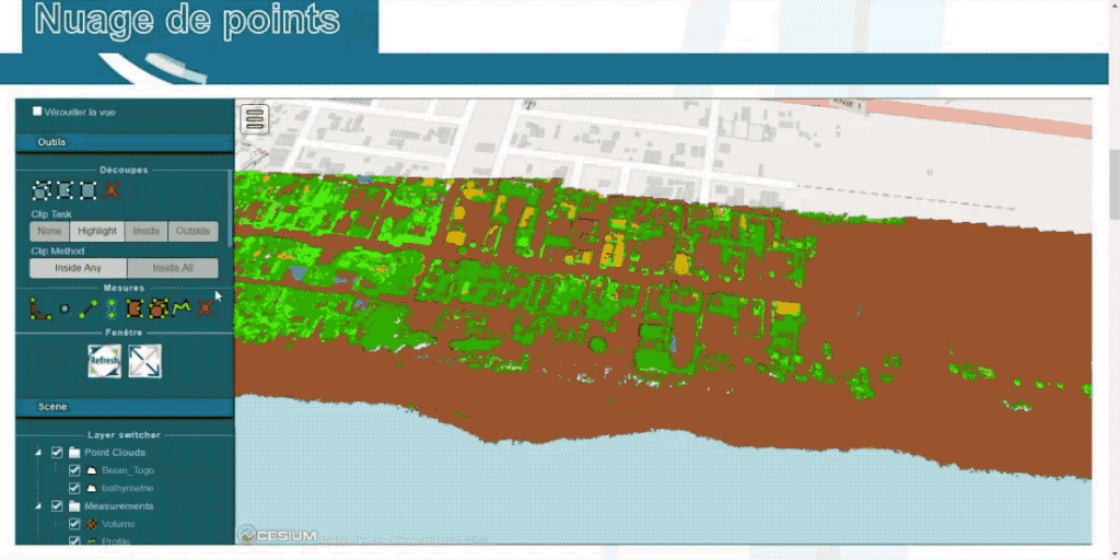
“Our engineers will use the drone data for dense point cloud extraction, and 2D shoreline position would be established using photo-interpretation of drone imagery,” Guillot said, detailing that the processed data would be leveraged for:
- Simulating waves with 2D/3DH models
- Simulating shoreline changes with regard to rising sea levels
- Powering storm impact and flooding simulation models
These simulations will help the local authorities to anticipate potential issues that can be triggered by climate change and design sustainable solutions to mitigate their effects.
“Our goal is to empower the locals to undertake similar missions every year and help them build a database of annual variations in the coastal areas. This will inform their planning process,” Guillot told. “We are looking at sharing our best practices and protocols for drone flying and teaching the local authorities the best ways to process the data and leverage it to the fullest.”
Moving forward, multispectral imagery will also be captured using drones to improve vegetation studies along the coastlines in West Africa.
For more insights on this vital project and to see the topographic data captured by Artelia in remarkable detail, watch a recording of the session here.


-3.png?width=300&name=Insight%20blog%20featured%20image%201140X660%20(2)-3.png)