
Food and Agriculture Organization of the United Nations projects that feeding a continuously increasing population would require raising overall food production by some 70% by 20501. In the face of this challenge, the agriculture industry is eager to embrace new technology to increase productivity while keeping operations sustainable and profitable.“The ultimate goal of farming is not the growing of crops, but the cultivation and perfection of human beings.”
― Masanobu Fukuoka, The One-Straw Revolution
From mechanized production tools that improve efficiency in the field, to digitized information that puts research to practice, innovations in the agriculture industry have boosted productivity and empowered farmers. The use of sensors and robots like drones, in particular, is a significant step toward scalable smart farming as they automate data collection and generate actionable insights much more quickly than traditional methods.
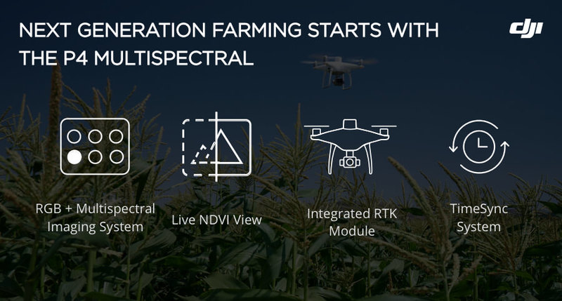
DJI recently launched the world’s first truly accessible multispectral imaging drone, the P4 Multispectral, designed for uses in precision agriculture and more by providing insights into plant health that a regular camera is not capable of capturing. Here’s a look into how the P4 Multispectral brings your agriculture operations to the next level.
A Drone Capable of Delivering Multispectral Imagery
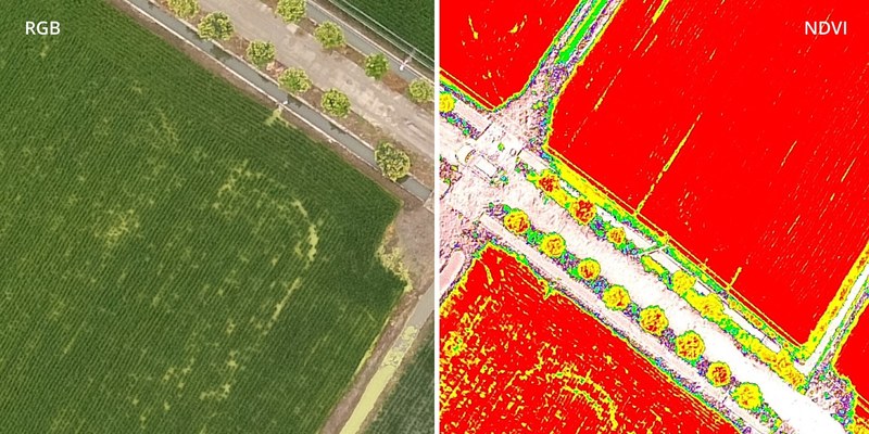
Throughout all growing seasons, multispectral imagery can be helpful to agriculture professionals by providing information invisible to the human eye across the electromagnetic spectrum. Having access to this data and the subsequently obtained vegetation index data such as NDRE and NDVI, farmers can make timely, informed decisions on crop treatment, lowering costs, saving resources, and maximizing yields.
While traditional crop monitoring technology employs satellite images, the availability of usable data is completely dependent on favorable weather conditions. Using a multispectral-capable drone, like the P4 Multispectral, not only improves the quality and resolution of your data but also makes monitoring much more flexible and the data collected more consistent.
Multispectral Imaging System
Agriculture imagery collection is now simpler and more efficient than ever before with the built-in stabilized imaging system that collects comprehensive sets of data right out of the box. Access information collected by 1 RGB camera and a multispectral camera array with 5 cameras covering Blue, Green, Red, Red Edge, and Near-Infrared bands – all at 2MP with global shutter, on a 3-axis stabilized gimbal.

Integrated Spectral Sunlight Sensor
One disadvantage of satellite imagery is that changes in weather conditions from one day to the next also changes the data captured each day, resulting in inconsistent data that gives little insight into the factors that impact plant health. The P4 Multispectral has an integrated spectral sunlight sensor on top to capture solar irradiance, which maximizes the consistency of data collection. By adjusting for sunlight levels, the P4 Multispectral can help capture consistent plant health information across seasons and throughout the plant's life.

View Both RGB and NDVI Feeds
Simply having aerial imagery is not always enough, as stressed plants can look fine on the outside. Switch between a preliminary Normalized Difference Vegetation Index (NDVI) analysis and the live RGB feed in GS Pro to immediately visualize where attention is needed, so targeted treatment decisions can be made quickly.
Centimeter-level Precision
To be able to act on the insights from a vegetation index map, it needs to be closely aligned with the actual positions of plants in the field, which means it is important to get centimeter-level accurate measurements. The P4 Multispectral records real-time, accurate positioning data on images captured by all six cameras with DJI’s TimeSync system.
In areas with poor internet connections, you can connect the P4 Multispectral with the D-RTK 2 High Precision GNSS Mobile Station and NTRIP, or store the satellite observation data to be used for PPK. Compatibility with a variety of positioning systems, including CORS networks, enables the P4 Multispectral to use the same networks as equipment and devices on the farm.

The Beginning of Intelligent Agriculture Missions
The data a P4 Multispectral drone captures is the start to new intelligent agriculture missions, enabling farmers to add additional technology to truly bring their farming operations into the digital age. Here is just one example of what such a digital agriculture workflow might look like:
- Plan flights, execute automated and repeatable missions, and manage flight data using GS PRO – DJI’s leading flight planning iOS app.
- Collect multispectral images efficiently across a large area using the P4 Multispectral and gain an overview of problem areas in both RGB images and preliminary NDVI images.
- Use DJI Terra or a compatible third-party software to analyze the data. Generate vegetation index maps using the multispectral images collected during flight.
4. Act on the data by implementing targeted treatments on areas that need attention.

Don’t Work Another Day Without Aerial Insights:
Having easy access to plant health data will be instrumental in the wider adoption and integration of data insights in day to day farming operations. It’s time to equip yourself with a powerful drone like the P4 Multispectral as a standard piece of farm equipment.
For more information on how drones can help your farm, click here.
Learn more about the P4 Multispectral here.


-2.png?width=300&name=HS%20-%20Featured%20Images%20(2)-2.png)

