
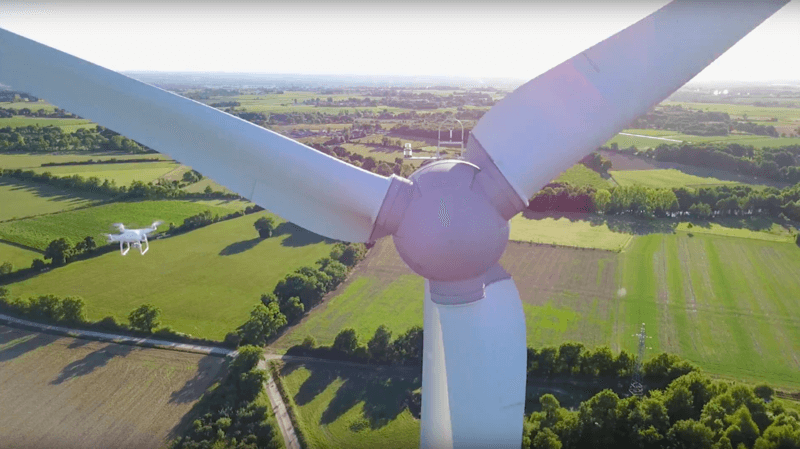
Drone technology provides endless entertainment for hobbyists, photographers, and FPV racers. Even crowds looking for a creative alternative to fireworks are jumping on the bandwagon.
But we’ve long since evolved from the perception of drones as toys. With advances in computer vision, autonomous flight, and safety systems, drones have become something more: sophisticated data-gathering tools capable of adding value in all manner of industries.
Flying robots are being put to work in transformative ways, cutting costs, dramatically increasing efficiency, and improving safety in the process.
DJI Enterprise was established to take flying robots into the world of work. Here are 13 ways our drones have succeeded...
Wildlife Protection and Research
The vital work of wildlife conservation and research has its challenges. Often, projects are run by small teams with limited budgets. And there are significant barriers to entry for those who want to get involved.
One of those barriers is funding. Conservation and research projects have to be paid for. Data doesn’t collect itself.
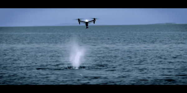
Marine conservation
Drones have become a powerful and affordable tool for all sorts of wildlife projects, democratizing participation and extending the reach of science. The technology has been a game-changing tool for marine conservation organization Ocean Alliance, where Dr. Iain Kerr and his team are using DJI platforms to gather whale snot for analysis in order to monitor the health of our oceans. This priceless data is being collected faster, with greater accuracy, and at a lower cost than ever before.
Drones are also bringing outdated research methods into the 21st century. Previously, Ocean Alliance would have attempted physical biopsies to gather the data they need. Another marine organization, Oceans Unmanned, is using the technology to provide an overview during efforts to untangle whales from fishing nets, ensuring humans can help without themselves being put at risk.
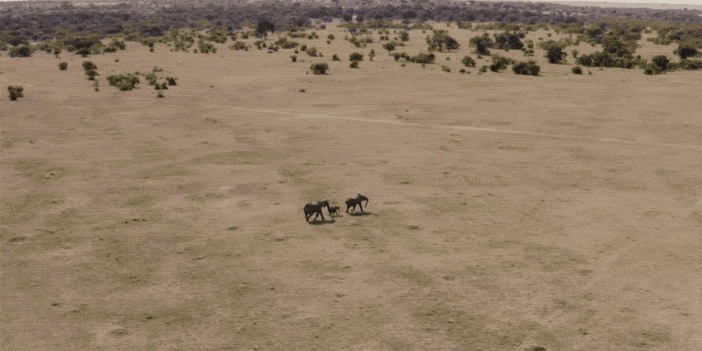
Protecting endangered species
Drones are making an impact on dry land, too. In big cat research, DJI equipment is being used to track and monitor lions on the savannah. In Kenya, security teams are using the technology to protect elephants from poachers.
Following forest fires and habitat destruction in Australia, commercial drones with thermal imaging capabilities have been put to work supporting wildlife search and rescue missions; countless koalas have been saved and that number will grow now this new application has been tried and tested.
Exploring, understanding, and protecting the natural world has never been more important. Drones from DJI are empowering the work of scientists and conservationists around the world.
Public Health
Since the Coronavirus pandemic rose to prominence, drones have become an in-demand tool in the sphere of public health.
The promise of drone deliveries - consisting of both vaccines and other medical supplies - has the potential to supplement COVID-19 efforts, from the Democratic Republic of Congo to the UK’s Isles of Scilly.
Drones are coming to the fore because they can travel directly and reach isolated populations. They also allow for remote deliveries and minimal human to human contact.
These latest efforts follow a series of success stories from companies such as Zipline, who have pioneered autonomous delivery by drone - first in Africa, and now in the United States.
Beyond the pressing need to tackle the pandemic, drones are at the forefront of efforts to tackle arguably the biggest killer in human history: Malaria.
You can learn more about scientists’ efforts to reduce mosquito numbers with the aid of DJI’s commercial drones in our blog, or by watching a talk from subject matter experts Guido Welter and Bart Knols from last year’s AirWorks conference.
Renewable Energy
Commercial drones are useful tools in any scenario that involves data gathering at scale, heights, or a requirement for mobile sensors. In the burgeoning renewable energy industry, flying robots are being used to cover all three of those bases.
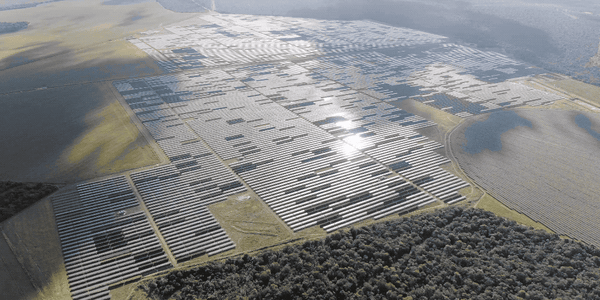
Solar
The size and capacity of solar farms are growing exponentially around the world. To keep them operating at maximum efficiency, regular inspections are required. But the scale involved makes this a challenge.
By combining drones with the latest remote sensors and AI, inspection crews can cover huge areas and pinpoint areas of concern. You can read more about the solar industry’s adoption of drones here.
Wind
Just like in the solar industry, wind farms are made up of delicate equipment that can, when not working efficiently, considerably impact electricity generation and bottom lines for energy companies.
Drone technology has enabled new inspection workflows, reducing costs compared to manned aircraft, preventing the need for inspection crews to scale turbines unless it’s absolutely necessary, and using the data gathered to detect anomalies.
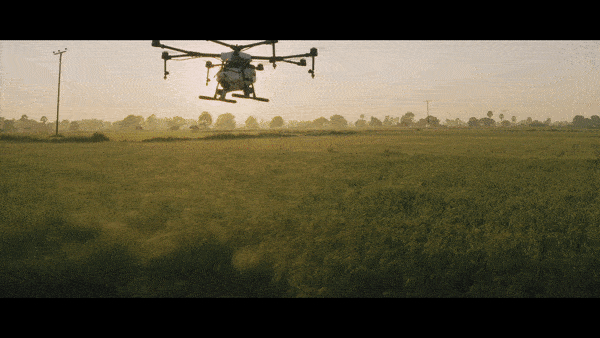
Agriculture
The agriculture industry represents one of the single biggest adopters of commercial drone technology and flying robots are making an impact on farms all over the world.
Models including the Agras T16 are rapidly and precisely dispersing fertilizer and pesticides, while multispectral platforms that capture data beyond visible light, like the P4 Multispectral, are established and essential tools for modern farming.
You can learn more about the intersection of drones and farming with DJI’s Agriculture Buying Guide, or visit our Agriculture page for more details on how drones, data analysis, mission planning, and cloud services can all combine to inspire growth in your farming business.


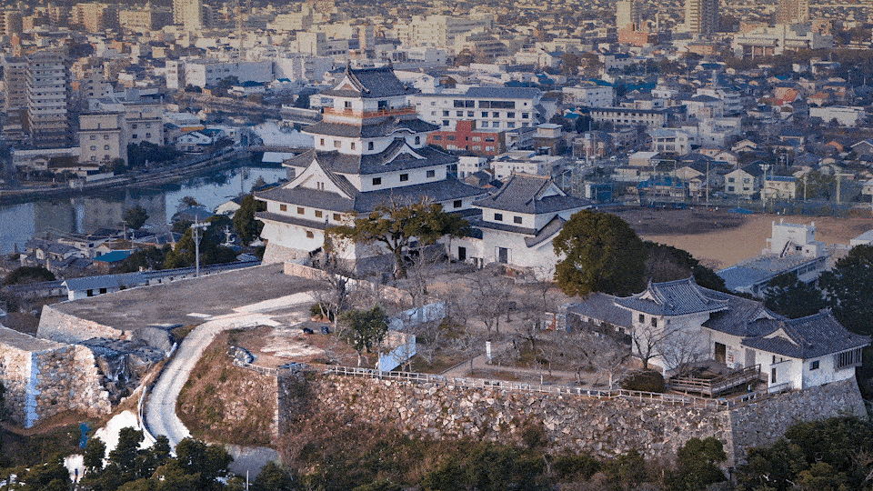
Historical Preservation
Drones are being used around the world to support cultural preservation programs. One reason why is that they provide accessible platforms for remote sensing.
For many archaeological and restoration projects, detailed maps and models are required before work can get started. The need to gather this data in a timely and cost-effective manner has always been present and developments in drone technology have led to the rapid adoption of DJI equipment for aerial surveys.
One example is in Japan, where work is underway to protect and restore the 17th-century Karatsu Castle. The DJI Phantom 4 RTK was used alongside mapping software DJI Terra as part of the project.
Search and Rescue
First responders armed with the latest in remote sensing technology can more easily locate people in need. Drones have made thermal imaging from above an accessible and affordable tool for search and rescue teams around the world.
Often, S&R missions have to navigate total darkness and wide search areas. Drones with thermal cameras provide a combination of fast response times, ease of use, and persistent aerial monitoring - all at a fraction of the cost of a helicopter carrying the same equipment.
And it’s not all about thermal. Advances in RGB and zoom functionality, such as the DJI H20 payload, put powerful visual capabilities at the fingertips of first responders.
Mountain rescue and police teams around the world have adopted drone technology, finding missing people in England, stranded hikers in Iceland, and survivors following devastating floods and landslides in Vietnam.
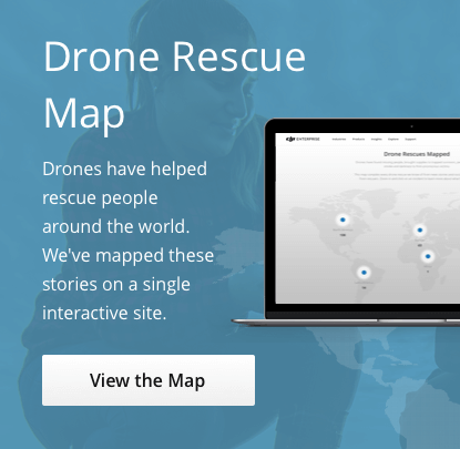
To get a full sense of the impact drones are making in life or death scenarios across the globe, take a look at our Drone Rescue Map. There are currently 553 lives saved and counting.
Drone Firefighting
Many data gathering tasks traditionally mean putting people in harm’s way. With drones, that doesn’t always have to be the case.
Nowhere is that trend more apparent than in firefighting, where drones are being used to support time-tested approaches and in the development of new methodologies.
DJI drones can be used as situational awareness tools, providing aerial intelligence to first responders on the size and direction of a blaze - particularly at night or through smoke, when thermal imaging can be used to provide clarity from above.
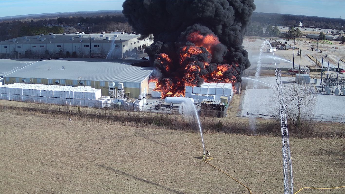
An aerial perspective of an active fire situation in Bentonville, Arkansas, helps guide ground teams
Often, that aerial view can be used to guide the actions of groundcrews, tackle fires with greater efficiency, and sweep for hotspots that might lead to secondary fires. And, with battery hot-swap technology on platforms such as the DJI Matrice 300, firefighters can count on having a persistent eye in the sky.
Drones also provide the spark for innovation. The Matrice 600 has been used in the development of a preemptive controlled burn solution to prevent wildfires from growing out of control.
Find out more about how drones and remote sensors support firefighting efforts in our Firefighting Fire With Thermal guidebook.

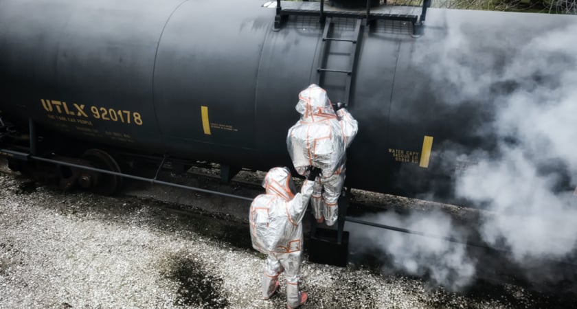
HazMat Drones
Emergency situations involving hazardous materials require a great deal of care and caution. First responders approach scenarios with a time-tested process that prioritizes safety.
But despite long-standing methodologies drones are making a significant impact in the field, providing situational awareness for teams that typically rely on radio contact, scouting areas of concern to pinpoint where crews need to deploy to and what situation they will be faced with and, in the case of a particularly innovative hazmat crew in Florida, delivering tools between zones.
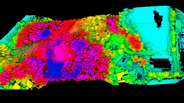
Aerial Surveying
Aerial surveys are another example of drone technology expediting the process of gathering data.
With preset flight paths and advanced payloads, drones can be used to generate 2D and 3D orthomosaic maps, LiDAR point clouds, 3D models, thermal maps, and multispectral maps. The application tends to depend on the industry.
For example, multispectral maps are popular in agriculture to give farmers an overview of crop health. More dynamic situations in which data needs to be gathered quickly, such as car crash reconstructions, can combine LiDAR point clouds with images taken on the ground and aerial photos.
Compare LiDAR with photogrammetry here. Or take a look at our aerial surveying guide for more information on how drones can gather the data you need for detailed maps and models.
Drone Inspections
Much of the critical infrastructure we rely on in turn relies on regular maintenance inspections. For assets such as bridges, railway lines, and communications towers, it’s long been standard practice for crews to operate in precarious environments.
Commercial drones offer a safer and, in many cases, more efficient way to conduct these infrastructure inspections.
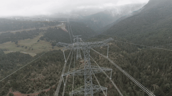
Powerline inspections
One example is powerlines. By carrying out inspections remotely and at scale, grid operators can reduce downtime and quickly decide what the next steps should be.
DJI’s Matrice 300 - fast becoming an inspection team’s dream tool - combines a 20 MP camera with 23x zoom, allowing inspectors to identify even the slightest of defects.
Construction Management
Construction is an industry of tight margins and long-term productivity stagnation. As such, it’s ripe for disruption and drones are making a big impact in the way data is gathered and site awareness is shared.
From stockpile measurements and pre-project planning to safety inspections and big picture progress updates, an eye in the sky is proving invaluable for construction companies.
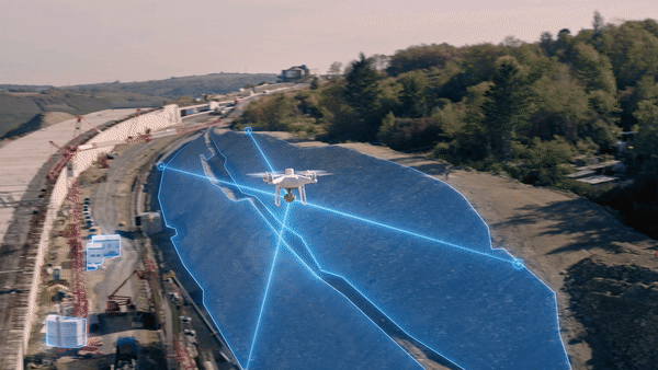
For more detail on how drones are adding value to construction operations, take a look at our Drones in Construction guidebook.

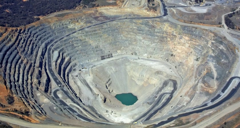
Mining
Mining is a dynamic industry in which granular data is needed for informed decision-making. Drones have proven to be useful tools for gathering comprehensive and high-quality volumetric information with millions of data points - in less time, at a lower cost, and with less human error compared to traditional methods.
Automated flight planning and data processing have led to a workflow revolution across the industry. The adoption of drones also ensures staff aren’t put in harm’s way when conducting site surveys or carrying out stockpile measurements.
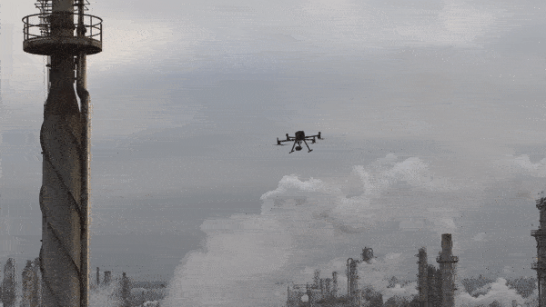
Oil & Gas
The Oil & Gas industry is full of dynamic and potentially dangerous environments. Naturally, drones are proving their worth by gathering data safely and accurately.
In part, their adoption is because Oil & Gas infrastructure such as flare tips and floating roof tanks can be difficult to assess from ground level.
But the rise of drones in this industry is also down to developments in software and sensing. For equipment inspections and emergency response, platforms such as DJI’s M300 RTK can be used to automate inspections with centimeter-level precision. Software features like DJI’s AI-Spot-Check solution combine machine learning algorithms with a built-in Real-Time Kinematic (RTK) system to ensure the right data points are gathered during each mission.
Empowering a Productivity Revolution
Commercial drones are becoming vital data collection tools in countless industries. DJI technology is saving lives with applications in public health and emergency response, keeping workers safe by bringing industrial inspections into the 21st century, and powering a productivity revolution in the agriculture and construction industries.
Discover how commercial drones can give your business an edge at www.enterprise.dji.com.

-2.png?width=300&name=HS%20-%20Featured%20Images%20(2)-2.png)

