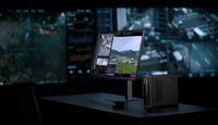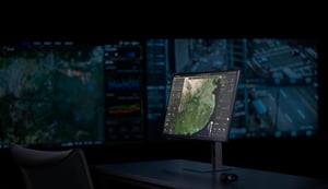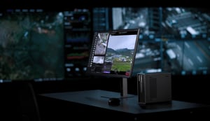

The latest DJI Terra update introduces Thermal 2D Reconstruction, high-precision Rolling Shutter optimization, video-based 3D modeling, and Gaussian Splatting cluster computing.
What's new in DJI Terra
This update brings powerful capabilities to drone mapping and survey professionals. DJI Terra now supports comprehensive Thermal 2D Reconstruction with built-in temperature measurement, solving a long-standing challenge in solar and power grid inspections. Additionally, the software introduces high-precision Rolling Shutter correction to eliminate the jello effect during high-speed flights, and video-to-model frame extraction to accelerate rapid emergency responses.
For large-scale projects, DJI Terra now supports cluster computing for 3D Gaussian Splatting (3DGS) and allows importing local GeoTIFF elevation files to align datasets with localized survey coordinates.
Thermal Infrared 2D Reconstruction
Overcoming the limitations of single thermal images
In traditional drone inspections, operators could only view thermal images individually. This made it difficult to aggregate temperature measurements, archive complete project files, or precisely locate temperature anomalies. Consequently, large-scale inspections of solar panels, electrical grids, and industrial infrastructure remained highly inefficient.
The latest version of DJI Terra addresses this with an integrated Thermal 2D Reconstruction workflow. By using visible-light and thermal dual-light camera imagery, DJI Terra completes aerial triangulation (AT) using the visible-light photos, matches the thermal images to them, and generates a 2D thermal map containing comprehensive temperature data.
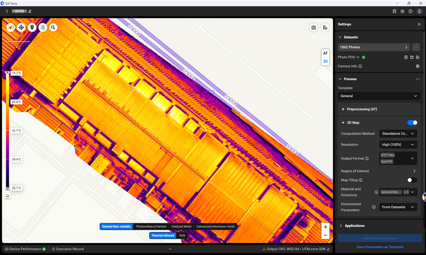 2D Thermal Infrared Map
Field data collection guidelines
To ensure the best reconstruction quality, operators should follow these field flight guidelines:
- Camera mode: Use DJI Pilot 2 in orthophoto capture mode, selecting both the visible light and thermal camera lenses.
- Flight planning: Base the Ground Sampling Distance (GSD) calculation on the thermal camera specifications.
- Camera overlap (normal scenes): Set a minimum overlap of 60% forward and 50% side.
- Camera overlap (low-texture scenes): For areas with repeating patterns or water surfaces, increase overlap to 80% forward and 70% side.
- Altitude and range: Keep flight altitude below 120 meters, and ensure the distance between the drone and target objects is within 60 meters.
Office workflow and parameters
Back in the office, the processing workflow integrates smoothly with existing DJI Terra projects:
- Data import: Supports POS data import and local PPK (Post-Processed Kinematic) calculations.
- Processing: The aerial triangulation process is identical to standard projects and supports cluster computing.
- Thermal map activation: Once the thermal map option is enabled, users can select the calculation mode, resolution, and material emissivity. Material emissivity corrects for surface radiation differences, and temperature parameters calibrate for ambient environmental factors.
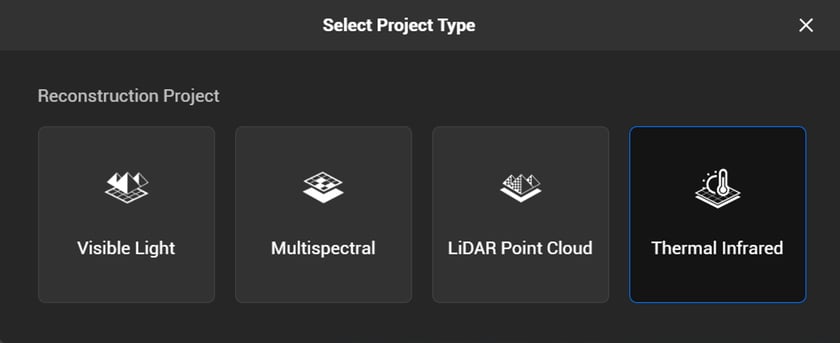 New Thermal Infrared Project Type
Temperature measurement and reporting
After reconstruction, users can analyze and share thermal data directly from DJI Terra:
- Measurement tools: Measure point, line, and area temperatures within the "Annotation & Measurement" section of the thermal map.
- Visual options: Toggle between 10 different color palettes and customize the temperature display range.
- Reports: Export professional reports in
.xlsxor.pdfformats for record-keeping and historical compliance.
*Note: Thermal 2D reconstruction requires visible-light photos for aerial triangulation, so data capture in low-light conditions is not recommended.
*Supported drone models: Mavic 3T / Matrice 3TD / Matrice 4T / Matrice 4TD / Zenmuse H20N / Zenmuse H20T and Zenmuse H30T. For surveying-grade accuracy, high-precision mapping models such as the M4E are recommended.
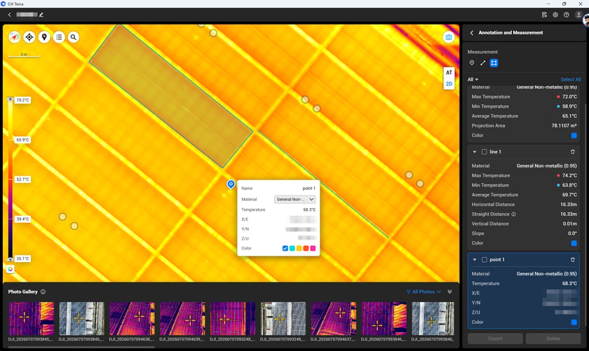
Thermal map supports point, line, and area temperature measurement.
Rolling Shutter High-Precision Reconstruction
Eliminating the jello effect in high-speed flights
Drones equipped with rolling shutter (RS) cameras can experience the "jello effect" or geometric distortion when flying at high speeds or along long flight lines. To maintain high accuracy without requiring a global shutter (GS) camera, DJI Terra now features high-precision rolling shutter reconstruction.
Key capabilities and accuracy
This feature supports RS images for high-precision aerial triangulation, 2D mapping, and 3D modeling. It also allows operators to mix RS images and GS images in a single dataset:
- Optimization switch: Upon importing eligible RS data, the preprocessing panel automatically shows an "Optimize RS Files" switch (enabled by default) to optimize the final reconstruction, though processing times may increase slightly.
- Historical data reuse: Teams can reprocess existing RS imagery to achieve higher precision without having to repeat flights.
- Proven performance: In flight tests with the M4T drone at altitudes of 60 meters and 120 meters over area-based flight paths with stable RTK signals, enabling RS optimization produced a horizontal accuracy of approximately 3 to 4 times GSD and a vertical accuracy of 4 to 5 times GSD.
*Note: For projects that require strict, surveying-grade high precision, global shutter models like the M4E are recommended.
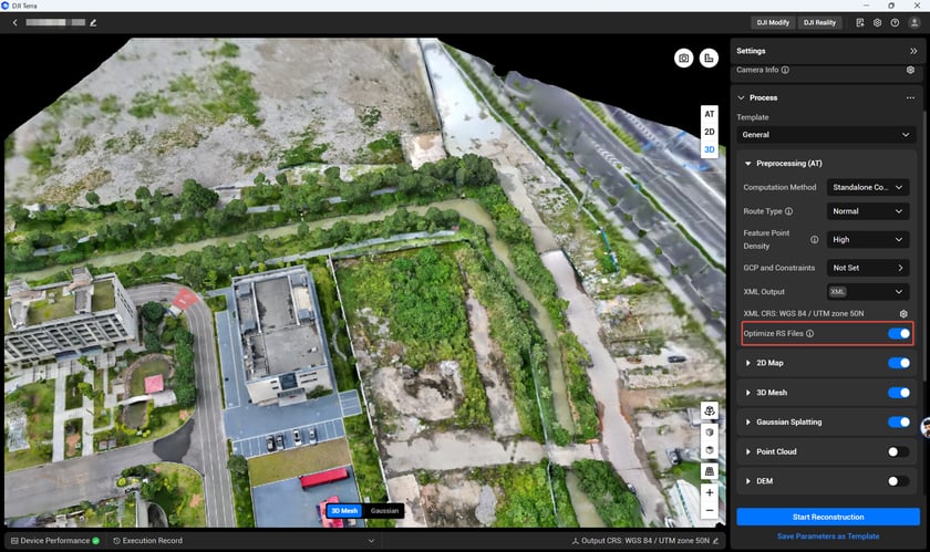
Rolling Shutter Material Optimization in Project Photo Selection
Video Frame Extraction Reconstruction
Rapid 3D modeling from video archives
While field operators often record synchronized video files for archiving, earlier versions of DJI Terra could only build models from photos. In emergency scenarios where teams lack time to capture individual photos, video archives often went unused.
DJI Terra now supports direct video frame extraction for reconstruction:
- Create a new project and import the video file.
- Select the specific time segment needed for reconstruction.
- Choose the extraction method (the system recommends "Auto Extract Keyframes" to select optimal frames).
- Confirm the selection to extract high-quality photos for 3D modeling.
*Note: The imported video files must contain GPS metadata. It is highly recommended to use DJI Enterprise industrial drone platforms for capture.
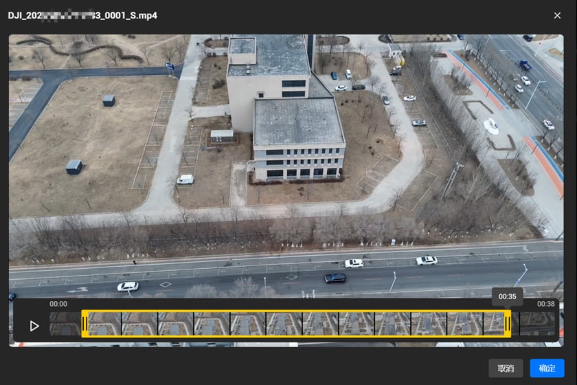
Video Frame Extraction
Gaussian Splatting Cluster Reconstruction
Scaling up 3DGS models
For large-scale projects or applications requiring high model clarity, DJI Terra now supports cluster computing for 3D Gaussian Splatting (3DGS) reconstruction.
- Cluster computation: Process both visible light and LiDAR point cloud Gaussian Splatting tasks across a network of computers.
- Local acceleration: Support local multi-core parallel processing, which significantly improves 3DGS processing efficiency.
- Format options: Export Gaussian Splatting results in custom TerraGS, PLY, and 3DTiles formats, with automatic Digital Orthophoto Map (DOM) generation.
*Note: Each processing node in the cluster must have a valid Gaussian Splatting license.
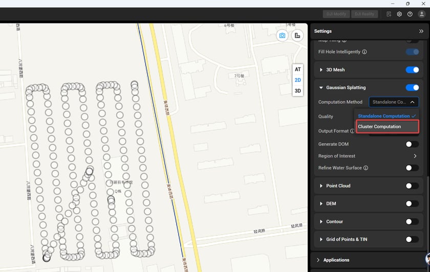
Gaussian Splatting supports Standalone or Cluster Computation
Local Elevation Files Support (GTG Format)
Seamless alignment with local datums
To resolve localized elevation benchmark differences, DJI Terra now supports importing local GeoTIFF elevation files in .gtg format. This ensures that the final coordinates match the localized survey benchmarks, engineering designs, and official acceptance requirements.
- How to use: Within the "Output Coordinate System" settings, select the built-in elevation and geoid models, or click "Import Geoid" to upload a local TIFF file before submitting the reconstruction.
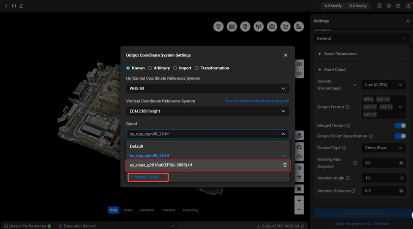
Supports importing local TIFF elevation files in GTG format
Additional Usability and Performance Updates
The update also brings several quality-of-life improvements:
- Execution Record Panel: A new timeline dashboard shows critical task steps, progress, and results. If an error occurs, it displays specific error codes and troubleshooting solutions. In cluster environments, records are separated by node to simplify troubleshooting.
- AI Intelligent Assistant: Ask questions and receive instant, in-app guides for software operations (internet connection required).
- 3DGS Water & Floating Artifact Optimization: Reduces noise on water surfaces, fixes color patch stitching anomalies, and minimizes floating artifacts in the sky and around buildings.
- KNGeoid26 Support: Added support for the South Korean KNGeoid26 coordinate system.
- GSI-Compliant Reconstruction Reports: Generate reports matching the Geospatial Information Authority of Japan (GSI) standards, with added cover pages, tables of contents, A4 print formats, and a detailed time breakdown of each sub-process.
- Instant Update Notifications: Receive immediate in-app alerts for software updates without checking the official website.
- One-Click Cache Cleanup: Quickly free up local disk space by clearing cached project files.
- Point Cloud Exports: Added support for exporting point cloud data in LAS 1.4 and LAZ 1.4 formats.
- Online Documentation: The user manual has been upgraded to an online document format, enabling faster navigation and real-time updates.
Get started
These features are available in the latest version of DJI Terra. Upgrade today to unlock these advanced reconstruction tools and streamline your mapping workflows from capture to delivery.
For a full breakdown of the release and a list of specific bug fixes, please consult the official DJI Terra release notes.
Disclaimer: Always comply with local drone laws and regulations when operating. Contact an authorized DJI dealer or DJI After-Sales Support if you experience any issues with your equipment or software.