
Imagery captured from drones is one of the best methods of capturing insights on your site. The resolution of the data, as well as the frequency of capture makes it possible to get daily or weekly updates on your jobsite. This data can be imported and analyzed in your end platform of choice, after being processed into a map and model using DJI Terra.
This step-by-step guide will help you import maps and models captured with DJI Enterprise equipment and processed through DJI Terra. Please check out these guides if you need help capturing the data or processing the data.
Coordinate systems and projections
First, note that Trimble Business Center can import 3D data as a point cloud with a .LAS file extension. When processing with DJI Terra, make sure to toggle On the 3D Model processing, and a new menu should appear. Toggle On Point Cloud, and select LAS file type. Finally, select the coordinate system your team is using within TBC.
IT IS IMPORTANT THAT THE COORDINATE SYSTEMS IN TERRA AND TRIMBLE BUSINESS CENTER ARE THE SAME.
Note: While TBC supports imports of 2D maps as a .TIFF file extension, stockpile measurements should be conducted on the point cloud data layer.
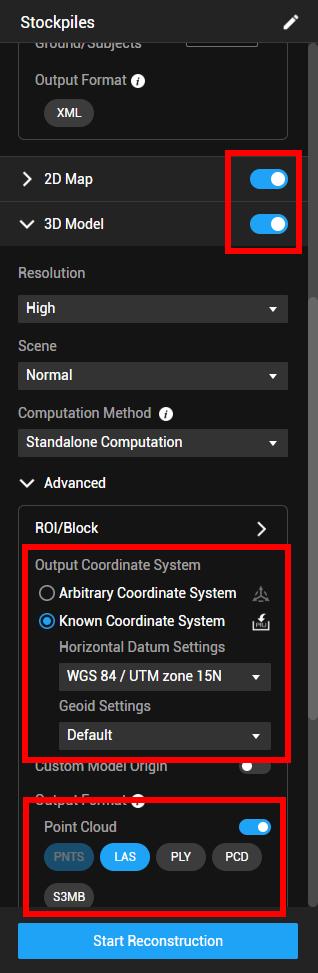 One more important note, make sure to export in the same projection you are using in Trimble Business Center. DJI Terra supports exports in local and custom coordinate systems.
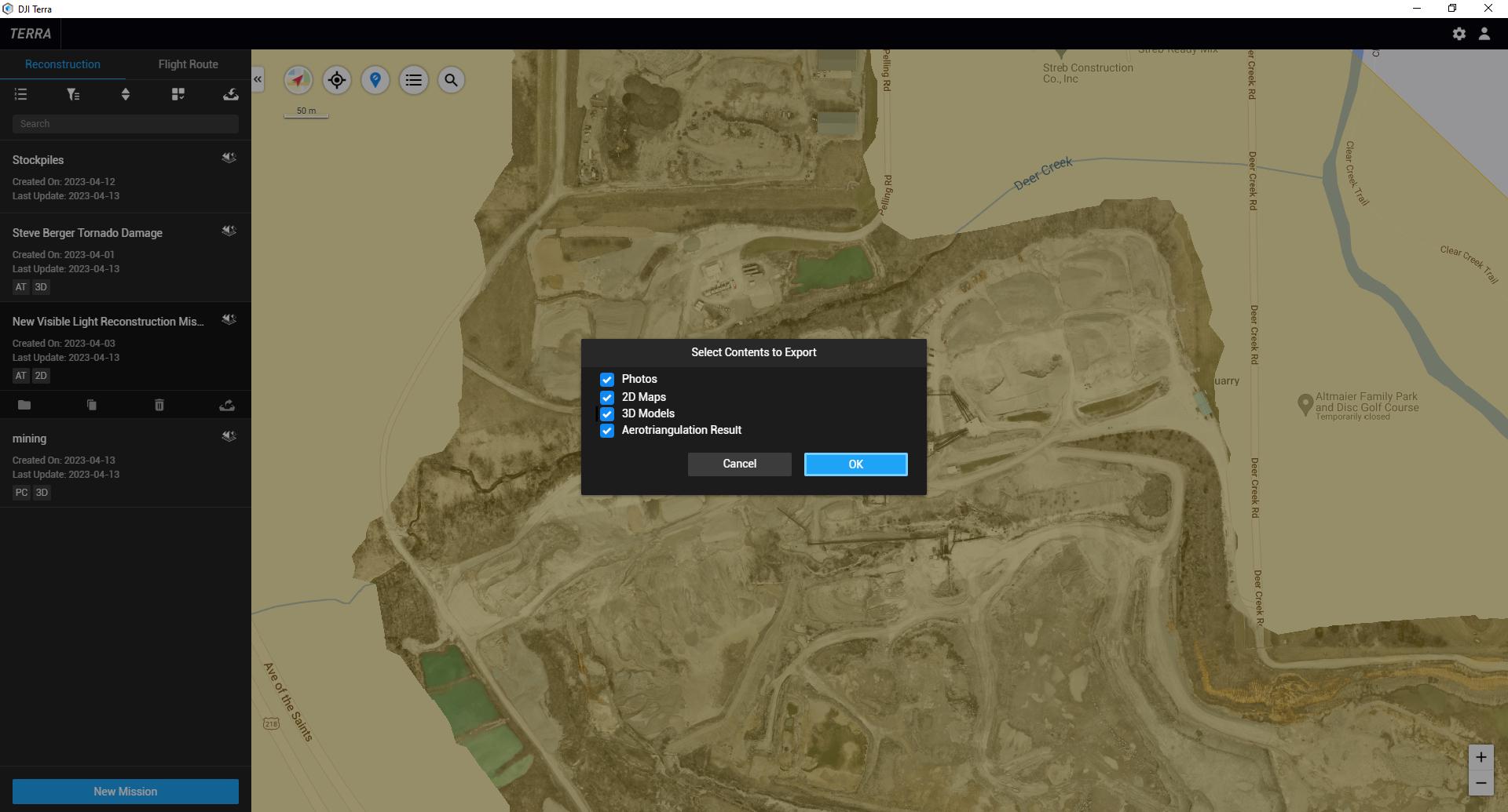
Once the dataset has been processed, Export the 3D layers by viewing the Home Screen, selecting the project, and choosing Export. Make sure 3D data layers are toggled On. 2D maps can also be exported for importing as a base layer.
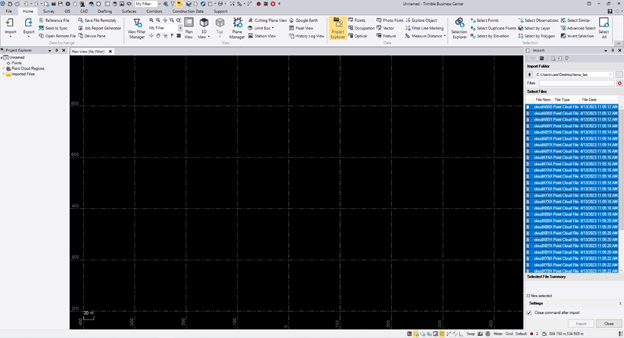
Find the zipped folder from the data export and extract the .las files to a new folder. Then, open Trimble Business Center. Once Trimble Business Center is loaded, you can either highlight the contents in the 3D point cloud folder and drag the files onto the Trimble Business Center Main Map, or use the Import tool in the upper right corner of TBC and select the .las files. This will display the import settings.
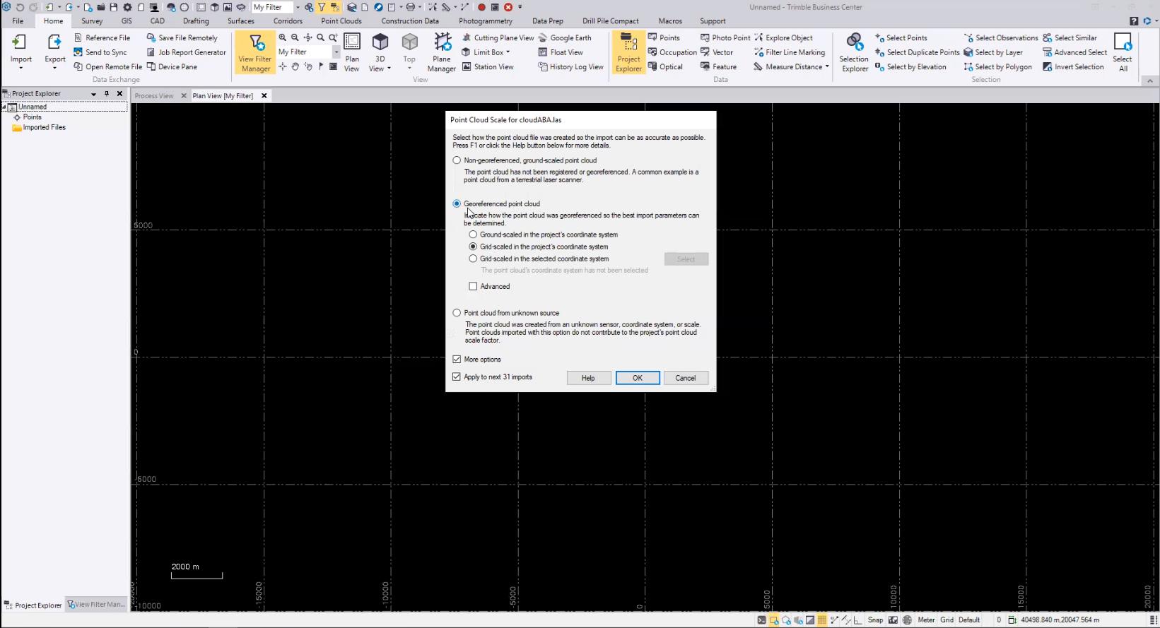
Drone data captured with DJI equipment and processed with DJI Terra will maintain the GPS metadata in the point cloud. Select the “Georeferenced Point Cloud” option, and choose “Grid-scaled in the Project’s Coordinate System”. If the las export is tiled, check the box to “Apply to Next XX Imports”.
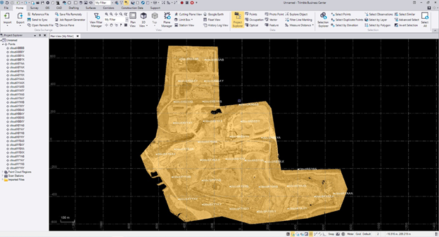
You can now view and use the point cloud captured from a DJI drone in Trimble Business Center!
Special thanks to Travis LeMoine from Sieler Instruments for helping with this article.