
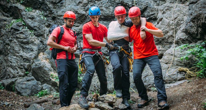
Rescue missions don’t just save victims from dangerous scenarios, they also can put responders in harm’s way. That’s why so many SAR teams have turned to enterprise drone technology to assist them on their missions. Drones can quickly cover vast areas and challenging terrain, and can even locate missing individuals and gather substantial information before responders arrive at the scene — giving them the context they need to move quickly and make the right decisions.
Today’s search and rescue missions
While you hope you’ll never need the services of a search and rescue team, the truth is that they’re in demand now more than ever. Natural disasters, like wildfires and tropical storms, have become an expected part of life for many across the world in recent years. As the pace of climate change accelerates, the prevalence of these natural disasters — and the importance of search and rescue to save lives — will continue to climb.
Climate change isn’t the only reason for the increased need for effective SAR. According to a 2020 article from Outside Magazine, the increase in outdoor recreation in the U.S., especially in remote places in the West, has led to a spate of new missions compared to previous years. The Colorado-based Rocky Mountain Rescue Group, for example, noted that it now handles almost 250 missions a year — up sharply from an average closer to 170. In many places, SAR groups are being stretched thin, as most depend on volunteers with full-time jobs to fill their ranks.
To meet these new challenges, search and rescue teams need to be able to handle each mission with limited time and resources. This is where drone technology comes in.
How drones are helping save lives
While not a replacement for tried and true traditional methods, the right drone and payloads can complement existing efforts and expand capabilities.
Drones can offer teams an extensive amount of information at a quicker pace — ultimately, the potential difference between life and death. In fact, according to a study conducted by DJI, EENA, and Black Channel, drones can shave extensive amounts of time off of SAR activities. The study compared teams with drones to those operating exclusively on foot in multiple randomly simulated search efforts. Across the board, the teams with drones were able to locate victims an average of almost three minutes faster than their counterparts, which is a significant margin.
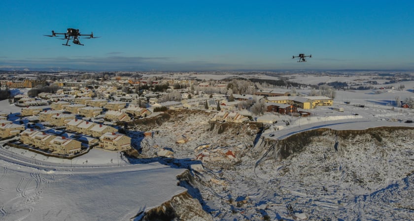 Photo: Anders Martinsen, UAS Norway
Across the board, search and rescue teams use drones to efficiently build situational awareness, plot rescue strategy, and even relay messages to individuals once they are found — all while keeping personnel at a safe distance.
Some key uses and advantages of search and rescue drones include:
- Map out disaster zones: When the mission requires a full understanding of the surrounding terrain, drones can map the area faster and safer than traditional methods. Depending on the camera payload and software, you can create 2D maps, 3D topographic models, or thermal maps. During a disaster, drones are the ultimate tool for situational awareness. This was never more evident than in a recent landslide in Norway where drones were flown for 270 hours over 40 days to create and continuously update a map of the disaster area.
- Find missing people in the dark: Drones can see what humans can’t. With a thermal camera, like the one equipped on the Zenmuse H20T, you can identify missing people who may not be visible based on their body heat. This capability is invaluable during night missions and avalanche zones.
- Communicate with people in trouble: Drones can be equipped with a speaker to communicate with stranded people, send out a signal that they can hear, and then let them know they’ve been found and help is on the way. Such a technique has been successfully used by the Croatian Mountain Rescue Service (more on them later) to locate a missing woman.
- Assess without intrusion: In avalanche zones, one small move or even too much noise can cause a new slide — and put stranded people out of reach. Luckily, the right drone can stay in the air for significant lengths of time and hover at altitudes that don’t emit excess noise or turbulence. Drones also limit the amount of time SAR workers need to be out in an avalanche zone by allowing them to access the site from a distance and only go where they need.
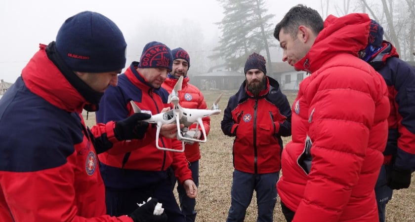
Search and rescue drones in action: The Croatian Mountain Rescue Services
As a country filled with mountains, islands, and inlets, Croatia has plenty of places where explorers can easily get lost or badly injured while hiking, climbing, skiing, or caving. Since 1950, the Croatian Mountain Rescue Services (HGSS) has been rescuing locals and tourists alike from dangerous situations.
Since 2013, the service has utilized drone technology to improve its response times and perform more comprehensive searches. Today, the HGSS boasts a formal drone program with 40 drones and 49 pilots. The team has also established a robust training proforma to ensure responders can take full advantage of the technology.
So far the drone program has been a great success for the HGSS team. In all, HGSS has performed a total of 10 rescues with the drones. HGSS responders have reported that missions take an average of 30 minutes less with drones — a substantial drop.
The right search and rescue drones and payloads with DJI
At DJI, we understand the precision and reliability that’s demanded. Over that time, we’ve established ourselves as the brand of choice for SAR responders around the world.
Some of our drones, cameras, and other payloads that are up to the search and rescue challenge include:
Mavic 2 Enterprise Advanced
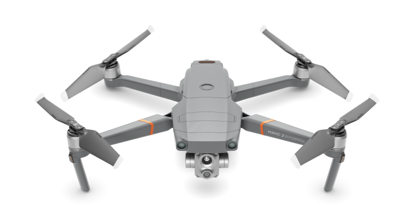 A SAR drone needs the speed and agility to manage difficult terrain and the heft and sturdiness to carry multiple payloads. The Mavic 2 Enterprise Advanced delivers on both counts. This drone can carry both thermal and visual cameras and features centimeter-level positioning and a 10 kilometer HD transmission.
Matrice 300 RTK
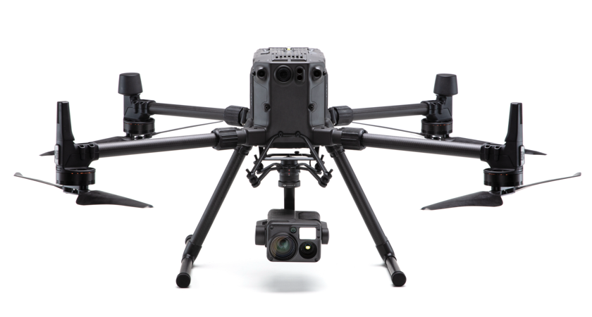 This drone has everything you need for effective mission oversight. From a safe distance, you can identify threats, gain a quick understanding of the area and the 55 minute flight time means you can gather the information you need with limited flights, no matter how remote the mission.
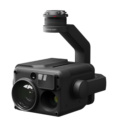 Zenmuse H20T
Thermal imaging can add a new dimension to your search and rescue efforts — making it possible to run effective search and rescue missions at night, in dark spaces like caves, and in avalanche situations where a person may be out of sight. The Zenmuse H20T is the perfect payload for these kinds of missions. This multi-sensor camera can do it all. In addition to a radiometric thermal camera, the series comes equipped with a 20 MP Zoom Camera and Active Image Stabilization technology.
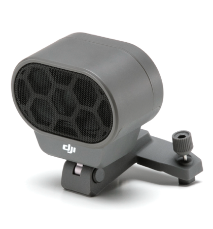
Modular Speaker
For victims of a natural disaster, a simple message of hope can make a huge difference. With the DJI Modular Speaker, SAR teams can communicate with trapped individuals once they are sighted by a drone and let them know that help is on the way. This accessory is one of several fully compatible with the Mavic 2 Enterprise Advanced.
For more information about how you can incorporate drone technology into your search and rescue missions, read our new white paper, Building a Search and Rescue Drone Program.
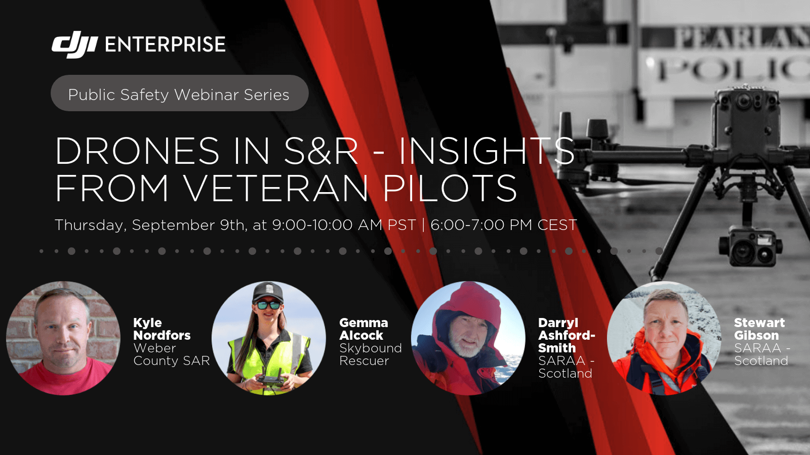
A webinar on drone search and rescue
In September 2021, DJI hosted a webinar with Weber County Search and Rescue, Skybound Rescuer, and Search and Rescue Aerial Association - Scotland. For nearly two hours, we discussed their drone programs, the future of drones in SAR, and answered questions from attendees. Click the image below to learn more and to view the recording:


-3.png?width=300&name=Insight%20blog%20featured%20image%201140X660%20(2)-3.png)