
As the most populous city in Ukraine, Kiev often tops as the most polluted, according to Air Quality and Pollution City Index’s recent report. This inevitably means lower quality of life for urban residents and property buyers seeking to live in the city.
In an attempt to measure the air quality for existing and future residential complexes, the Ukrainian builder Lun and UAV enterprise DroneUA teamed up to conduct a drone experiment with the support of a DJI Matrice 300 RTK equipped with gas sensors.
The experiment – the DroneUA team explains – was aimed at measuring the level of carbon monoxide (CO) and Nitrogen Dioxide (NO2) concentration around high-rise buildings near busy road intersections – and verify whether air quality does indeed improve with altitude.
On the one hand, according to the Central Geophysical Observatory, Kiev’s average monthly concentrations of carbon monoxide in September 2020 did not exceed the recommended standards; nitrogen dioxide, on the other hand exceeded by 3 times.
However, these figures may fluctuate depending on the altitude these measurements are performed, meaning we may not have accurate information on the presence of toxic pollutants in the vertical space of a building.
Does this necessarily mean that air quality is different on the ground floor compared to the top floor? And is air quality at higher altitudes always better?
To answer these questions for potential Kiev’s residents, Lun and DroneUA chose to focus their research in Odessa – a dense urban area with no squares, an elevated road intersection, new and old residential high-rises, and a nearby vast green clearance.
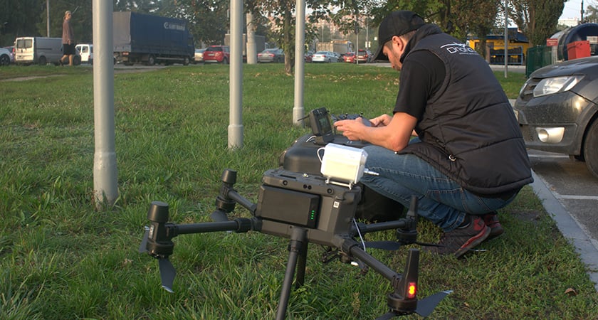
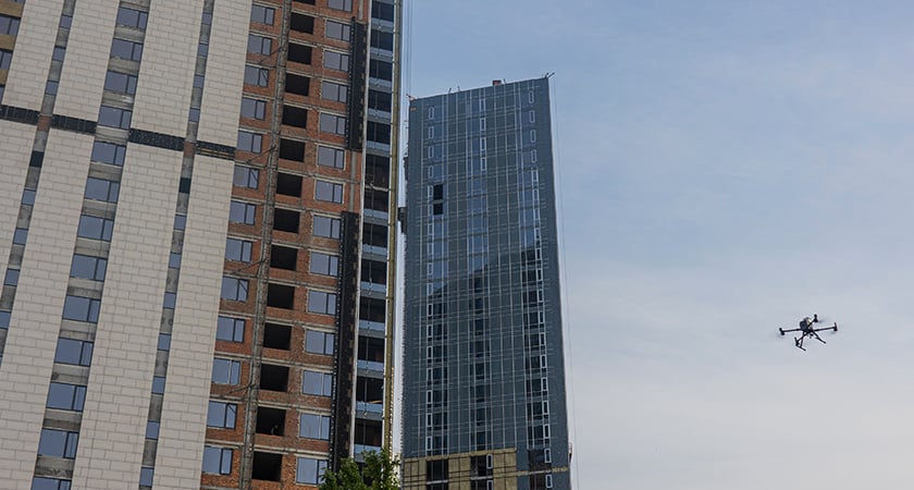 The Matrice 300 RTK leveraging the Sniffer 4D V2 to detect pollutants at height
Why use drones to measure air quality
From their niche “hobbyist” history, drones have come a long way and are now an essential tool that is revolutionizing the way we work across virtually all industrial sectors.
In this specific case study, where measurements were taken either at a ground level or on top of a roof, there was simply no alternative solution that could show the distribution of pollutants vertically. The closest option, as DroneUA puts it, could have been a weather balloon, which is ineffective at low layers.
Inspired by the extensive use of UAV technology in China, where air quality monitoring is performed on a regular basis, Ukraine has only recently started using drones to gather the right kind of data that was impossible to obtain before.
In fact, drones can hover over a specific point for a longer time, allowing for more accurate and precise measurements that are crucial for generating maps of gas concentrations or for identifying the source of pollution in industrial areas.
Last but certainly not least, being able to plan a research mission through automated flights removes any potential human factor that could affect the results – and that is why Lun and DroneUA decided to go with drones for this specific mission.
As with everything, though, relying on drones for air quality measurement in densely populated areas also comes with some challenges, such as the presence of wires, poles, trees, or telecommunication towers.
This is why choosing the right platform becomes extremely important for the success of a mission.
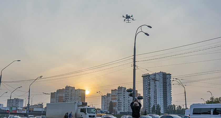 The Matrice 300 RTK hovering in place allows the Sniffer 4D V2 to collect highly accurate data on gas concentrations
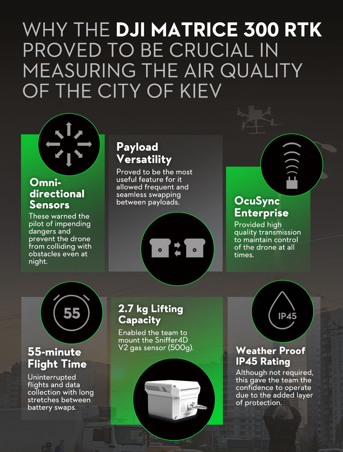
Key benefits of the Matrice 300 RTK
Undoubtedly, drones are the most efficient and effective solution for industrial inspections, including air quality measurement. But when it came to measuring in highly populated Odessa, the Matrice 300 RTK was the platform of choice for Lun and DroneUA for some very specific reasons:
- Its omnidirectional sensors can warn the pilot of impending danger and prevent the drone from colliding with obstacles. On other occasions, they have been useful to navigate challenging spaces at night safely.
- The payload versatility turned out to be the most useful feature for the research group’s numerous tasks, which required frequent swapping of payloads.
- The high-quality OcuSync Enterprise transmission system allowed them to maintain control over the drone at all times – and generally speaking, in any situation.
- The 55-minute flight time was key to uninterrupted data collection, with long stretches between battery swaps.
- The lifting capacity up to 2.7 kg enabled them to work with a mounted Sniffer4D V2 gas sensor system that can scan large areas and instantly analyze the contamination. The Sniffer 4D V2 is just one of many third-party payloads that are compatible with the M300 RTK.
- While all of its improved weatherproof features with an IP45 rating were not required for this specific operation, they clearly stand out as some of the teams’ most appreciated benefits at any time of the year.
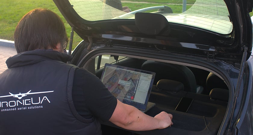
Planning, workflow, and results
Once the area of interest was identified and selected, along with frequency line, altitude, speed, and hovering time on specific spots, the automatic flight was set to go, with only some occasional manual interventions.
 Technicians from DroneUA preparing the drone's automated flight path
Crucial to their optimal performance were the following tactics, which DroneUA swears by as a rule of thumb for all UAV operators in similar circumstances.
- Check local flight restrictions in all interested areas and obtain all necessary authorizations early in the planning stage.
- Inspect the gas analyzing sensors frequently and replace them in a timely manner when necessary.
- Never disable the obstacle sensors.
- Depending on the type of gas analyzer, ensure there is always a good and steady internet connection available.
 The Sniffer 4D V2 aboard the M300 RTK, primed for flight
The Sniffer4D V2 is one of the most advanced gas analyzing systems on the market. It can scan and identify several gases present in the air in real-time and render a 3D image to show their distribution in a given spot. This was crucial for Lun and DroneUA to understand how pollution levels vary depending on height and proximity to nearby pollution sources, such as busy roads.
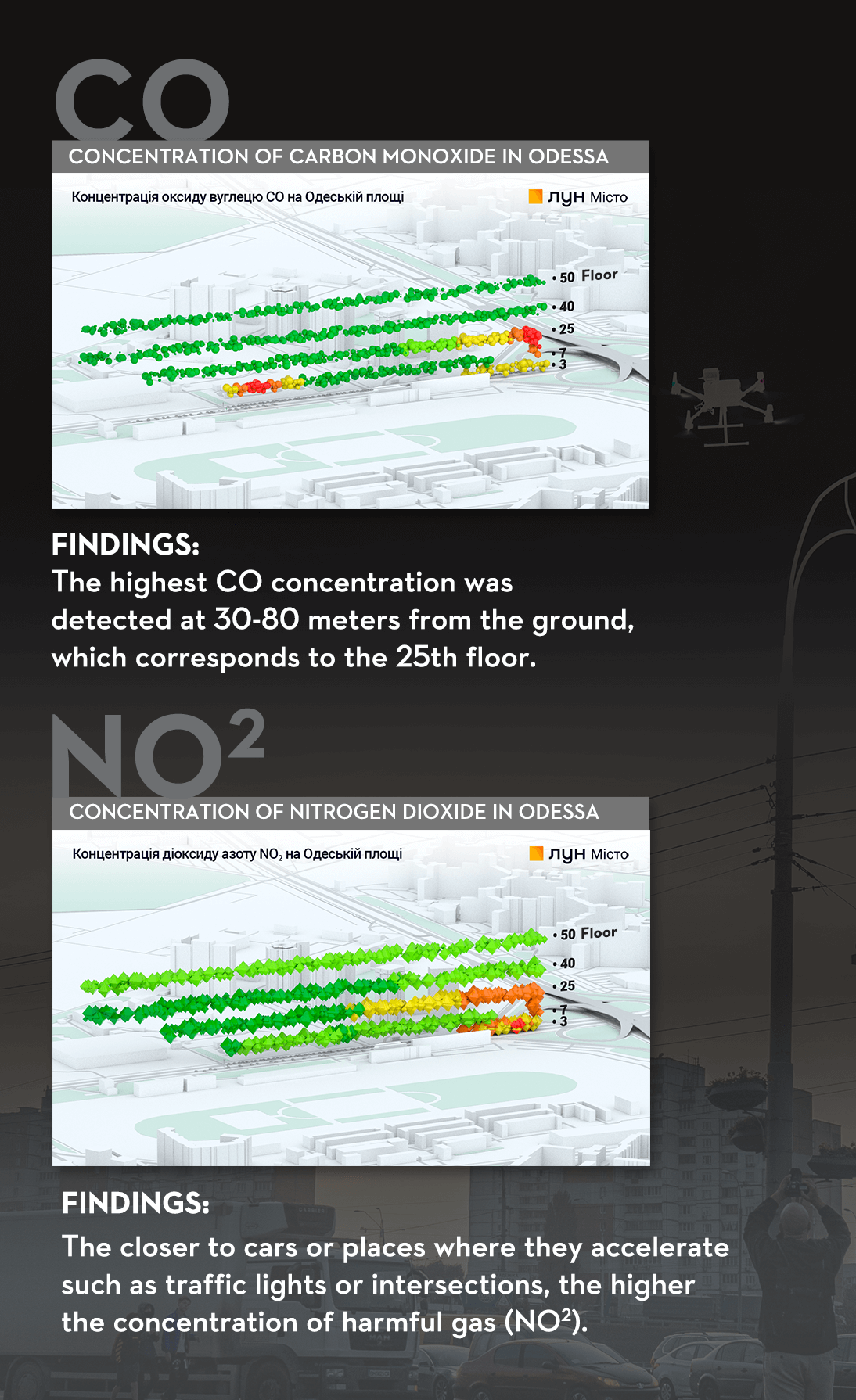
Carbon Monoxide
The acquired data revealed that there is indeed a correlation between altitude and CO concentration. However, such concentration does not depend only on vertical distance from the road (height), but also on the distance to the close-by elevated road intersection.
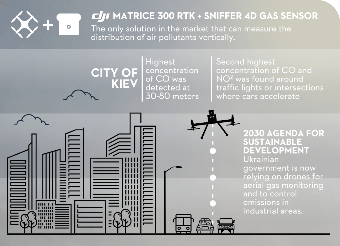
- Height: The highest CO concentration was detected at 30-80 meters from the ground, which corresponds to the 25th floor.
- Length: The second highest concentration was found around traffic lights. Indeed, it is during the acceleration of the car that more toxic polluters are released.
Nitrogen Dioxide
Similarly to CO, the closer we are to cars and their area of acceleration, such as traffic lights or intersections, the higher the concentration of NO2.
In conclusion, the test confirms that the comprehensive level of pollution does not depend exclusively on altitude, but it also varies based on height (as in number of storeys) of the nearby buildings and proximity to roads and traffic lights where cars’ acceleration causes for more CO and NO2 to be released in the air.
As Sustainable Cities and Communities continue to be an important goal in the 2030 Agenda for Sustainable Development, the Ukrainian government is now relying on drones for aerial gas monitoring and official missions to control emissions in industrial areas.


-2.png?width=300&name=Insight%20blog%20featured%20image%201140X660%20(3)-2.png)
.png?width=300&name=HS%20-%20Featured%20Images%20(7).png)
-1.png?width=300&name=HS%20-%20Featured%20Images%20(5)-1.png)