
Demolishing a cooling tower is no small feat. The sheer size and age of the structure requires a deeper inspection to assess for erosion, hazardous materials, and structural integrity. This is the challenge that faced the Sopreco team when assessing three towers scheduled for demolition in Metz, France. To ensure the safe, accurate inspection of these cooling giants, they decided to use a LiDAR-equipped drone solution.
Sopreco, a subsidiary of the Eurovia group in France, operates as a prominent referrer for quarry management, inspection, and specialized Geographic Information System Mapping (GIS) solutions. Sopreco also leads the Eurovia drone program for asset inspection, land surveying, LiDAR, and mine detection.
For this four-day project, it was decided that a mixed drone approach using both LiDAR and photogrammetry techniques would suit best under the strict time constraints. In this case, DJI provided Sopreco with a Zenmuse L1 payload for the task.
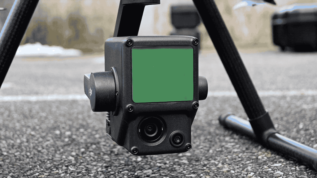 The Zenmuse L1 and P1 were both responsible for collecting essential inspection data.
Obsolete methods call for commercial drone solutions
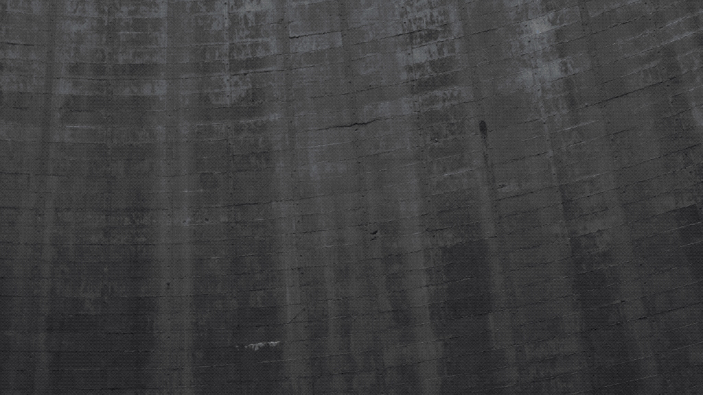
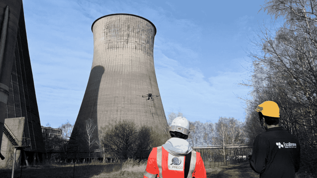
The traditional approach to cooling tower maintenance or demolition usually requires teams working from scaffolding, or other suspension methods. The project’s tight schedule, however, mandated a faster inspection method. More importantly, because some of the concrete was damaged and was covered with asbestos-tainted paint, traditional inspection methods were simply not feasible.
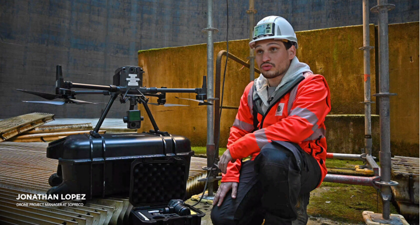
An alternative approach for the team could have been the use of a crane or helicopter to assess the damage but, as Jonathan Lopez, the Sopreco drone division’s lead specialist, makes clear:
“A drone inspection was the only solution considered. There are simply no advantages to other options when it comes to costs and security for our inspection team.” - Jonathan Lopez, Sopreco Drone Division Lead Specialist
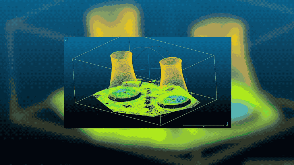
The first step in demolition is planning. Sopreco decided to first capture and build a 3D model of the three cooling towers with the support of both the Zenmuse P1 and L1. All data would be collected with the drone(s) and processed into an accurate 3D model with DJI Terra. The accurate data set acquired could then be shared with the groups pitching for the subsequent demolition job. This 3D phasing of the process can help these companies identify risks, explain planned methods, and ensure a better quote from the vying companies.
“The flight process is pretty straightforward and relatively quick to complete - about one and a half days per tower. Data processing and model creation can take 1-3 weeks. Teams should keep that in mind when planning,” adds Lopez.
A tandem approach: Photogrammetry with LiDAR support
The Sopreco team traditionally uses drone photogrammetry for a job of this scope for capturing data to create orthomosaics or 3D models, as do many surveying and mapping professionals.
The affordability and flexibility of photogrammetry to provide detailed maps and models have made this option the most accessible choice for many inspectors of assets or structures such as cooling towers.
However, there are some minor setbacks to using photogrammetry when surveying. For example, in this project, there were major differences in luminosity on the inside and outside of the cooling towers. Especially on the insides, lighting is much dimmer and it can be difficult to capture high-quality visual data. Additionally, the tight schedule for this project meant that much of the work would need to be completed under low-light conditions, which can result in lower-quality photos, and ultimately a less useful model.
This is where a LiDAR option comes in and fills the gap.
LiDAR (light detection and ranging) works by emitting laser light and measuring the ping time and intensity from the object back to the sensor. It builds topographically accurate terrain models by incorporating the high-accuracy systems of satellite positioning (GNSS data) and an inertial measurement unit (IMU).
A major benefit to LiDAR is that it does not require bright, well-lit conditions, unlike photogrammetry. Moreover, the final data outputs are point-cloud coordinates and are much quicker to process into a workable model with software. In this case, the L1 was a perfect option for Sopreco’s tight schedule and the necessity to work even in the evenings and at dusk.
The result: centimeter-accurate rendered point clouds (3D representation of objects) that are quicker than ground survey or photogrammetry options.
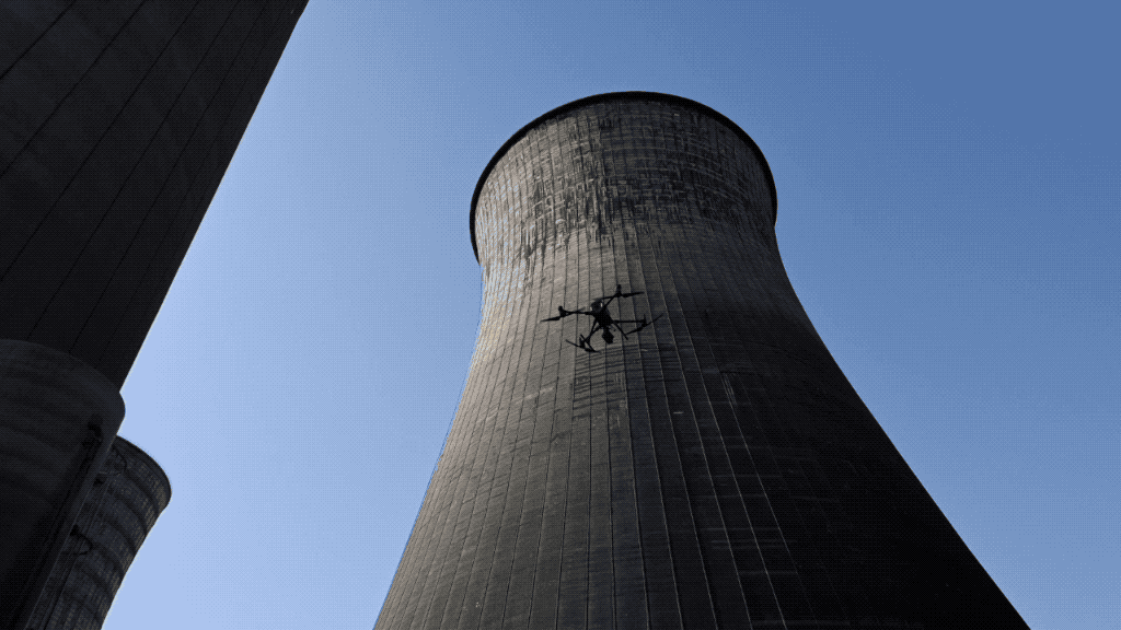
The Zenmuse L1 on-site
After the initial steps of acquiring accreditation for the flight, the Sopreco team created a mission analysis in order to define a comprehensive strategy for the collection of data. Ground control points were set and measured before the scheduled flights.
The main challenge of the task lay inside the cylindrical behemoth where, due to its metallic structure, GPS can become inaccurate. For this reason, a trained drone pilot took over complete control of the drone for this phase of the project.
Before initiating the automated drone LiDAR inspection, a manual photogrammetry flight with the P1 was first conducted to capture the outside and inside faces of each structure. Next a LiDAR flight collected accurate data inside and outside of the towers.
“We did not have an easily markable target on top of any of the structures. So, we used the data collected by LiDAR to control and rescale the photogrammetry data,” remarked Lopez. “The new P1 sensor really improved the overall results and was outstanding despite the low light conditions.”
Zenmuse L1 at-a-glance |
|
|
|
|
The Zenmuse L1 LiDAR solution as a game changer
Integrated drone LiDAR solutions like the M300 and L1 are more affordable and accessible than ever. This has allowed for the democratization of LiDAR across many professions, including the geospatial, surveying, and construction industries. For this reason, what was once seen as an exorbitant cost, LiDAR can now be included in a drone inspection alongside photogrammetry and thus ensure maximum precision.
“The drone makes it possible to do this topographical work in complete safety. On a site like this, it will bring new perspectives and new ways of working that were not possible before,” explains Bruno Pillon, land surveyor and drone remote pilot at Sopreco.
The accuracy and versatility of LiDAR, for example, in low light and areas of heavy vegetation means it can bring more efficiency to even the most demanding aerial surveying missions.
Jonathan Lopez from Sopreco explains it quite simply:
“Using drone technology is similar to a drill, hammer, or any tool. When put into the hands of a drone pilot and land or building surveyor, the competitive advantages are enormous.”

-2.png?width=300&name=Insight%20blog%20featured%20image%201140X660%20(3)-2.png)
.png?width=300&name=HS%20-%20Featured%20Images%20(7).png)
-1.png?width=300&name=HS%20-%20Featured%20Images%20(5)-1.png)
.png?width=300&name=Stormpoint%20(1).png)