
Update October 14, 2020: This buying guide has been updated to include DJI’s newest surveying solutions, the Zenmuse P1 and L1.
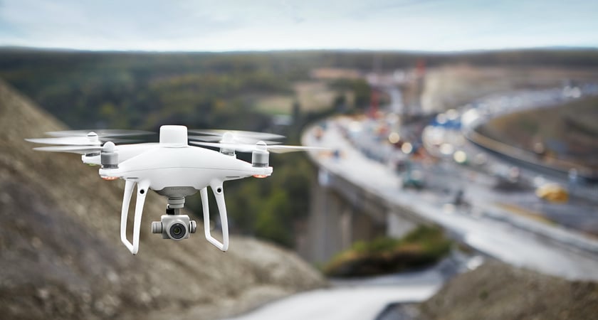
As drone technology is becoming increasingly streamlined and accessible, a variety of industries are adopting drones into their workflows to dramatically increase efficiency. Simply put, drones are changing how businesses operate by reducing costs, saving time, improving safety, and providing a direct ROI.
In particular, surveying and mapping have been revolutionized by drone solutions. While traditional surveying methods can produce results on the scale of days or weeks, drones can do the job on a timescale of hours.
Depending on your and your client’s project requirements, these are the best drones for surveying and mapping:
- Phantom 4 Pro
- Phantom 4 RTK
- P4 Multispectral
- Matrice 300 RTK + P1
- Matrice 300 RTK + L1
- Matrice 600 Pro + Surveying Payload
There is a saying in the construction industry, “Schedule, Cost, and Safety, pick two.” And what makes drones truly transformative for us is we get to choose and improve all three. - Grant Hagen, VDC Manager, The Beck Group
With all the benefits drones bring to surveying, it’s no wonder many businesses have come to us asking which drone is right for them. Investing in new technology can be intimidating, and with so many options it can be overwhelming when it comes time to make a choice.
This buying guide will give a breakdown of the surveying and mapping solutions DJI offers, and familiarize you with everything you need to know to make an informed decision. First, we’ll review some key considerations when it comes to surveying with drones, and then we’ll highlight which DJI drone best suits your needs.
Mapping vs. Surveying
First, let’s clarify the differences between a survey and a map. A map is a visual representation of an area used to illustrate geography and features. A survey, while also a map, is also used to measure the positions of and distances between two- and three-dimensional points. Maps and surveys, while highly related, have different use cases and value.
Speed vs. Accuracy
A major selling point of drone surveying solutions is that they can get the job done fast. A quick flight over your target area can rapidly yield accurate and actionable data.
However, when it comes to choosing a drone solution for your surveying and mapping needs, it is important to recognize the inherent tradeoff between speed and accuracy. Within surveying and mapping, some techniques and equipment can yield data with a higher degree of accuracy, while others can provide actionable results under time pressure.
Ground Sample Distance
What exactly does accuracy mean when talking about surveying and mapping? One way to put it is how accurately your end product reflects the reality of your surveying site. The main way this is described in photogrammetry is Ground Sample Distance, or GSD. GSD is defined as the length (in inches, centimeters, or millimeters) between the centers of two consecutive pixels on your map.
Alternatively, GSD can be thought of as the length of one pixel in your map. For example, if a drone achieves a GSD of 5cm/px, then we can understand that one pixel on this digital map corresponds to 5cm in reality. A map with a “smaller” GSD has higher resolution and more accuracy.
When conducting photogrammetric missions with drones, the main factors that can affect your GSD are your camera quality (focal length, camera resolution), and flight altitude. For example, flying your drone at a higher altitude would allow you to cover more area in a shorter time, but capture your data at a lower resolution.

Ground Control Points and Real-Time Kinematics
Ground Control Points (GCPs) are fixed points on the ground with a known position that are used to calibrate your survey and increase its accuracy. Most surveys employ multiple GCPs. This is a striking example of the tradeoff between survey speed and accuracy because it can take a long time to prepare and measure your GCPs.
A popular alternative to using GCPs is Real-Time Kinematics (RTK) which uses satellite positioning and a ground station with a secondary known position reference to deliver more precise data. To learn more about RTK, click here.
Here is a breakdown of your choices when it comes to surveying and mapping with a drone.
|
|
GCPs alone |
Drone without RTK |
Drone with RTK |
Drone with RTK + GCP |
|
Accuracy |
High |
Low |
High |
Highest |
|
Speed |
Low |
High |
High |
High-ish |
|
Cost |
High |
Low |
Low |
Low |
Choose your data sensors
When choosing your surveying and mapping solution, you should also keep in mind which type of data you or your clients require. Different projects may call for different types of data, so we offer different solutions for these demands.
Photogrammetry
Most typical aerial surveying calls for photogrammetry, or the creation of high-resolution 2D or 3D models of your surveying site through a combination of many digital photos. Each of our surveying and mapping drones is equipped with a powerful digital camera capable of capturing high-resolution digital photos. Some solutions can be equipped with an oblique camera that can collect the images necessary for 3D modeling with fewer flyovers. Next, your photos can be stitched together using photogrammetry software, like DJI Terra, and the resulting models can be used to identify and measure features like distance, area, volume, and more.
Here are 5 Reasons Why DJI Terra is a Top Drone Mapping Software.
LiDAR or light imaging detection and ranging
This technology is flown above a surveying site where it uses a laser to illuminate a target, and measures the reflected light with a sensor. This process is repeated thousands of times to produce a point cloud that can represent your site with a finer degree of accuracy than photogrammetry. LiDAR and Photogrammetry each have their uses, so it's important to consider carefully before selecting your payload.
Multispectral and hyperspectral
These special cameras can capture visible and invisible wavelengths of light. For agriculture customers or surveys conducted to measure crop growth or environmental compliance, multispectral data is especially helpful for providing provide critical, actionable information
With drone solutions, you have a wide selection of surveying and mapping techniques and it’s up to you to choose which methods best fulfill your requirements.
Choose your surveying solution
Once you’ve determined the type and quality of data you will be needing, we can choose which DJI drone solution is the best fit.
Phantom 4 Pro
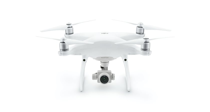
This classic DJI airframe comes with a 1-inch 20-megapixel CMOS sensor for high-resolution aerial photography. Consider this an entry-level drone to get you started with mapping. At a cheaper price point compared to our Enterprise line solutions, this is a great tool to learn more about mapping. Learn more about the Phantom 4 Pro here.
Phantom 4 RTK
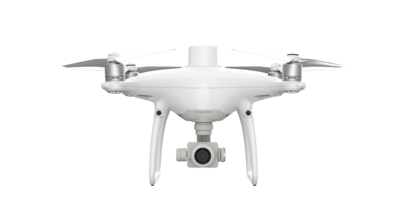
Built specifically for surveyors, this turnkey solution comes crowned with an integrated RTK module for centimeter-level accuracy. This is a powerful and reliable surveying drone for professionals who want a complete solution that you can pack up and carry in a backpack.
Learn more about the Phantom 4 RTK here
P4 Multispectral
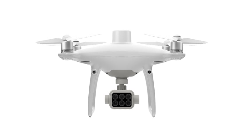
For agronomists, farmers, scientists, and researchers, the P4 Multispectral is the go-to solution for capturing __ beyond the visible spectrum. Easily create Vegetation Index maps with 1 RGB camera and a multispectral camera array with 5 cameras covering Blue, Green, Red, Red Edge, and Near-Infrared bands – all at 2MP with global shutter, on a 3-axis stabilized gimbal.
Learn more about the P4 Multispectral here.
Matrice 300 RTK + Zenmuse P1
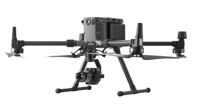
The M300 RTK is our flagship and most powerful industrial platform. Now with the Zenmuse P1, this is the industry’s ultimate aerial photogrammetry surveying solution. The P1 integrates a full-frame 45 MP sensor with interchangeable fixed-focus lenses on a 3-axis stabilized gimbal. It also features Smart Oblique Capture so you can efficiently create 3D models of your target. This combo captures survey-grade data with vertical accuracy of 5 cm and horizontal accuracy of 3 cm even without GCPs, and can cover 3 km2 in a single flight.
Learn more about the DJI P1 here.
Matrice 300 RTK + Zenmuse L1
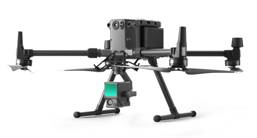
The L1 is DJI’s first official fully integrated LiDAR payload. It combines a Livox LiDAR module, a highly accurate IMU, and a 1’ CMOS camera on a 3-axis stabilized gimbal.
With vertical accuracy of 5 cm and horizontal accuracy of 10 cm, this LiDAR payload supports 3 returns, a point rate of 240,000pts/s and a detection range of 450 m, all in an IP44 rated ingress protected frame. This is a complete LiDAR solution for capturing real-time 3D point clouds, collecting the details of complex structures and bodies, and producing highly accurate reconstructed models.
Learn more about the DJI L1 here.
Matrice 600 Pro
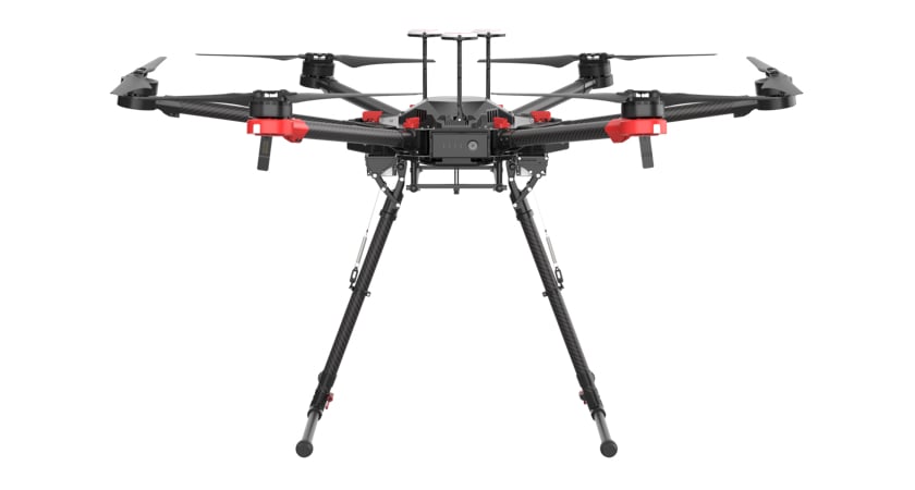
This heavy lifter is designed for versatility and reliability. Through PSDK integration, this hexacopter is prepared to leverage a host of 3rd party payloads, from LiDAR to multispectral, hyperspectral, oblique cameras, and more.
Learn more about the M600 Pro here
We hope this information has helped direct you towards making the right purchase for you and your surveying and mapping needs. Whether you or your clients demand speed or accuracy, we have the right drone solution for you.


-3.png?width=300&name=Insight%20blog%20featured%20image%201140X660%20(2)-3.png)