
Malaria is an ancient disease that continues to devastate some of the world’s most vulnerable communities. In 2019, an estimated 409,000 people died after contracting it, with children under the age of five making up 67% of those casualties. 90% of cases are in Sub-Saharan Africa.
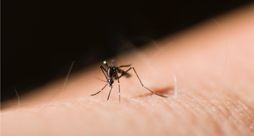
The disease is transmitted through the bites of infected female Anopheles mosquitoes. Until a vaccine with extremely high efficacy is developed, stopping those mosquitos is key to stopping the spread. In the last few decades, spraying insecticide indoors and the use of insecticide-treated bednets have helped to steadily reduce transmission. But progress has slowed as mosquitos have gained insecticide resistance. It has become an arms race between malaria control programs and the mosquito populations they are fighting.
Now, there is hope that drone technology can provide valuable data to support prevention efforts.
Larval source management
A second approach for controlling malaria transmission aims to disrupt the lifecycle of mosquitos and prevent them from reproducing. Larval source management (LSM) bypasses the issue of insecticide resistance by instead modifying the environment. Mosquitos lay their eggs in water. If you prevent that water from accumulating or treat it with larvicides, the number of infected mosquitos can be reduced.
However, finding mosquito larval sites isn’t easy. The process is complicated by different mosquito species having differing habitat preferences. Some prefer to breed in permanent bodies of water with emergent vegetation, others prefer transient, smaller pools of standing water. Permanent water bodies are easy enough to find. But seasonal patches of standing water shift depending on the weather.
All of this explains why the biggest barrier to effective LSM is the question of where and when interventions should be put in place. For years, it’s been seen labelled an impractical option because of the time and cost involved.
Typically, LSM efforts are guided by data gathered manually or with the help of satellite imagery. The former is costly and time-consuming, while the latter lacks detail and immediacy. Now, drones have a role to play in making the search for larval habitats faster and cheaper than ever before.
Enlisting drones for LSM: the Maladrone project
Since 2018, researchers from the Vector Biology Department at the Liverpool School of Tropical Medicine and the Malawi-Liverpool-Wellcome Trust Clinical Research Programme have been using drones to gather data in Kasungu, Malawi. By combining aerial imagery and object-based classification, the Maladrone team has confirmed that orthomosaics can be used to identify the environmental characteristics associated with mosquito larval habitats.
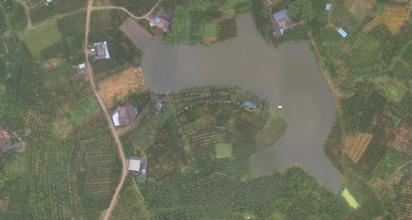
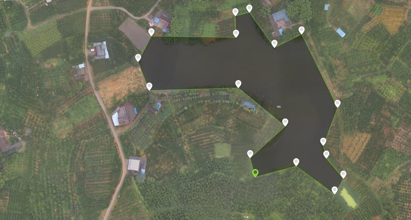
The aerial data was assessed alongside the results of manual larvae surveys, which allowed the team to link what was found on the ground to what could be seen from above. Using object-based classification, the Maladrone team attempted to train classification algorithms to categorize areas within the orthomosaic maps produced and, in turn, highlight locations likely to be mosquito breeding sites. The process enabled the researchers to identify which parts of the reservoirs contained the aquatic vegetation associated with mosquito larvae and find tiny pools in the surrounding area.
Due to the technical challenges in capturing and analyzing drone data between 2018-2020, the Maladrone project has since adapted its approach. Image capture and orthomosaic generation have now been outsourced, leaving the team with more time to analyze the data.
How Crowddroning by GLOBHE is supporting the Maladrone project
Since April 2021, the Maladrone project has enlisted the help of local drone pilots in Malawi. The collaboration has been facilitated by GLOBHE, a digital platform that connects pilots to clients who need drone data. GLOBHE’s Crowddroning concept has been a game-changer for Dr. Michelle Stanton’s Maladrone team.
“We realized relatively early on that capturing and processing the drone imagery was possibly too big a task to manage alongside all the other research activities we were involved in,” she explains.
“It was exceptionally helpful to have a go at doing things ourselves to start with, as it gave us a deeper understanding of the technology, its positive and its limitations. However, once we got to the stage of repeatedly capturing images of relatively large areas to monitor environmental changes over time, we decided to take a different approach. GLOBHE’s Crowddroning platform allowed me to arrange for some of the first African Drone & Data Academy graduates to complete the drone data capture on our behalf. This has worked wonderfully well, and we’re going to use this approach in our upcoming drone mapping projects.”
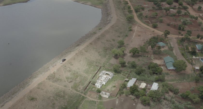
Drones are now sent out once a month to identify mosquito breeding sites. The team are gathering data through the dry season to better understand where mosquitoes are laying their eggs, with a focus on areas around dams, reservoirs, and other suitable habitats.
With the data-gathering aspect simplified, Dr Stanton’s attention is now on how it can be manipulated to provide the most useful insights. “The area I can envisage more immediate improvements is in the processing of the images”, she says.
“We’re gathering more and more images of rural larval habitat to train classification algorithms, and are able to remotely access increasingly powerful servers to run these algorithms. The volume of data captured is enormous, and improvements in drone technology will only increase this volume. Since experimenting with the Crowddroning approach, our focus has now shifted to “what’s the most useful thing we can do with this imagery”.
The Maladrone team’s work has proven the impact drones can have on malaria vector control. Looking ahead, the role of automated systems looks set to increase.
“Assuming drone imagery becomes increasingly easier to obtain and manage, I can see a world where most of the information on larval habitat locations can be derived from drones, supplemented by ground sampling.”
Lessons learned in the field
Introducing drones to wary communities
Although drones are overwhelmingly a force for good, people who are unfamiliar with the technology can be skeptical at first. This can prove to be a barrier to adoption if not handled carefully. Dr. Stanton explains that a lot of time and energy was put into making sure the local community was comfortable with the Maladrone project. It helped that the area had some exposure to drones through UNICEF’s Humanitarian Drone Corridor. “We supplemented this with our own engagement activities, supported by the Science Communications team at the Malawi-Liverpool-Wellcome Trust in Blantyre, which was very successful,” she says.

“We demonstrated the drones and the mosquito monitoring techniques we were employing in the project and explained why we were doing what we were doing. So while the drones still drew some attention during the mapping surveys, the communities we were working in were very comfortable with them.”
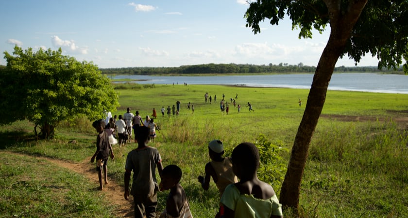
Alexander DC Mtambo is a Crowddroning pilot for GLOBHE. He’s captured data for the Maladrone project and believes that introducing the latest technology to rural communities could have a profound impact on future generations.

“I see it every time I fly in these local villages,” he says. “That exposure is great. We may never know what inspiration we are providing to the children there. Great people can come out of these places. Whenever I go out flying I make sure I spend time with the kids and show them what I am doing.”
The importance of a friendly regulatory environment
The Maladrone project has benefited hugely from being able to operate inside Malawi’s Humanitarian Drone Corridor, an initiative launched by the Government of Malawi and UNICEF in 2017 to test the use of drones for humanitarian purposes. It’s been a powerful proof-of-concept to date and enabled a number of innovative drone applications.
“The humanitarian drone corridor was absolutely crucial to getting this project set up”, explains Dr. Stanton, who at that point was researching with drones in Malawi for the first time.
“The drone corridor was a gateway to understanding Malawian regulations and processes, while also introducing me to a community of experts in this area. This has given us the confidence to set up projects elsewhere in Malawi. The link with the drone corridor also helped alleviate any concerns the funders and ethical review boards had around privacy and safety, given that drones are still a very new component of medical research.”
Vaccines, automating LSM, & the role of drones in the future
Gathering mosquito data and acting upon it are two very different things. And it may be that drones can be a solution for both challenges.
In 2019, modified DJI Agras MG-1S drones supported an innovative pilot program in Tanzania from Anti-Malaria Drones. The team sprayed a system of rice paddies with Aquatain, a biological control agent. Rather than act like a conventional pesticide, the substance covers standing water with a thin coating that prevents adult mosquitos from emerging.
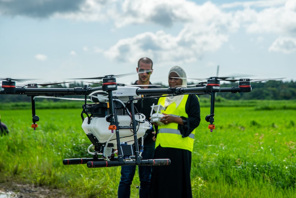
The results were hugely promising. Aquatain-sprayed fields saw a near-90% reduction in emerging adult mosquitoes for more than one month after. Drones are also an option for distributing traditional pesticides. With these results in mind, it’s easy to imagine a future in which drones are playing a central role in mapping target locations and delivering next-generation preventative measures.
Unsurprisingly, a joint approach has been considered by the Maladrone team. “One of the motivations for Maladrone was to use the information we gathered to inform malaria control programs on how to best target their interventions,” says Dr. Stanton.
There are several environmental modifications that can be introduced to prevent mosquitos from developing. These come under the umbrella of larval source management (LSM) and can include spraying chemicals into water bodies.
“Due to how laborious this task can be, particularly in hot, difficult to access environments, drones may have a role to play in both identifying and subsequently treating the larval habitat. One major bit of feedback we received from the communities where we worked in Kasungu is that they’re now eager to see our initial research translate into action. We share this enthusiasm and are currently seeking additional funding to look at ways of reducing the mosquito populations in these areas – which includes drone-supported spraying.”
You may have seen recent headlines about a breakthrough vaccine. It promises to have a huge impact on infant mortality rates in sub-Saharan Africa, where more than 260,000 children under the age of five die from malaria every year. The RTS,S vaccine for children is expected to save countless lives, but it’s not a silver bullet and needs to be used in conjunction with other measures.
“There’s no single solution to ‘solving’ malaria,” explains Dr. Stanton. “The vaccine news is fantastic and should hopefully have an impact on transmission in the not too distant future, but this is not the time to take our foot off the accelerator, as that mistake has happened before.”
Combating malaria transmission is particularly challenging in the face of environmental changes. Mosquito habitats are dynamic, changing with the seasons and as a result of human interference. Interventions used can have an impact on transmission patterns. With these constantly moving goalposts, the need to understand and target transmission ‘hotspots’ is a priority.
“Monitoring is key to this understanding, and this is where drones and other automated systems have the potential to contribute,” she says.
“This monitoring can be of the physical environment - as we’ve done in Maladrone - but I’ve also seen early prototypes of drones being used to capture and analyze adult mosquitoes (Microsoft’s Project Premonition) and take water samples to check for mosquito larvae. Drones could also be used to administer or deliver interventions. I think there’s lots more useful technology to come!”


-3.png?width=300&name=Insight%20blog%20featured%20image%201140X660%20(2)-3.png)