
Nestled within the dense jungles of Mesoamerica, the ancient civilization of the Maya flourished with unparalleled brilliance, leaving behind an intricate tapestry of culture, knowledge, and enigmatic achievements. The history of the Maya Civilization, often shrouded in the mists of time, reveals a captivating narrative that spans millennia and encompasses a civilization whose influence reached across vast stretches of Central America.
Today, the history of the Ancient Mayas lives on through their ancestors. Most Maya cities have been lost in time, letting the harsh jungle environments overtake for many years what once was the infrastructure that supported this civilization. While some Maya civilizations have been discovered, many are still to be found.
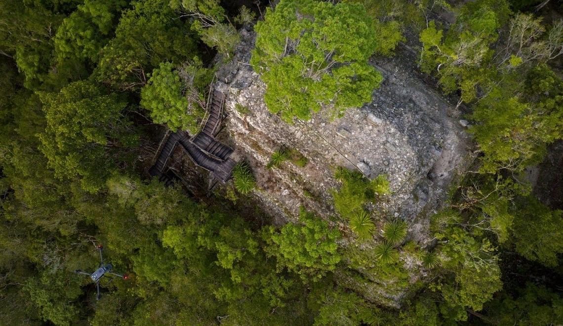
El Mirador - Ancient Maya Ruins
El Mirador - A Jungle Full of History
Hidden in the Mirador-Calakmul Karst Basin, a dense rainforest that expands between Northern Guatemala and Southern Mexico; lies the ancient Maya settlement of El Mirador. These Maya ruins which date back to 800 B.C., were first registered by modern studies in 1930, and subsequently studied by multiple archeologists throughout the 1960s up to the early 2000s. Its main structure, La Danta, was for many years the biggest known Maya structure, and the world’s largest pyramid by volume.
Extending across 1.6 Million Acres ( Approximately 648,000 hectares) the Mirador Basin hides a rich history of the Maya Civilization. Archeologists have already identified over 50 Maya structures on the Guatemalan side alone. However, there are still hundreds of acres that might contain valuable information about the civilization that once called this area their home.
The expansive landscape, holding the promise of untold historical treasures, presents a logistical challenge for ground-based research. Drone technology, adept at navigating dense canopies, enables researchers to extend their reach, unraveling the secrets hidden within the hundreds of unexplored acres. The cost-effectiveness and accessibility of these drone-based solutions mark a paradigm shift, opening up a new chapter in the systematic exploration of the Mirador Basin's archaeological wonders.
This is where DEL (Desarrollo Evaluación y Logística) steps in. Based in Guatemala, DEL is a multidisciplinary company that integrates innovative solutions, including drones, to swiftly deliver precise information to real estate, energy, and agriculture companies. After a failed attempt to map El Mirador using a manned aircraft and a LiDAR sensor that resulted in the loss of equipment and data, the Guatemalan Government reached out to DEL to test the capabilities of drone technology in hopes of unveiling the hidden secrets that have remained dormant for centuries.
Aerial LiDAR solutions like the Zenmuse L2, come particularly handy for this exploration project. At a price point significantly lower than using a manned aircraft with a LiDAR system mounted, solutions like the Matrice 350 RTK equipped with a DJI Zenmuse L2 can penetrate dense canopy trees to collect enough bare ground data to identify potential Ancient Ruins that might be hidden in plain sight.
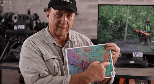
Dr. Richard Hansen explaining El Mirador Basin
This kind of technology makes a big difference because it’s going to allow us to tell the story. It’s going to allow us to reveal a page of humanity that we've never seen before.
- Dr. Richard Hansen
Embracing the Challenge
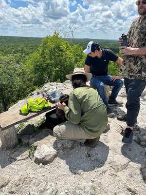
Capturing LiDAR in remote locations poses challenges, especially with no onsite internet connectivity and limited satellite imagery. The DJI Team, joined by authorized reseller Drone Plus Dallas met with DEL in Guatemala City for the expedition preparations. Here the team worked on the mission planning preparations, firmware updates, and logistics.
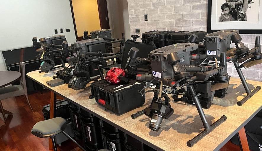
Pre-Flight Preparation in Guatemala City
The team aimed to map 25 km2 per day during the two-day expedition. The team used five Matrice 350 RTK's, each equipped with a Zenmuse L2 to achieve this goal. They divided the plot into sections for each drone and imported the KML flight missions into the controllers. Each drone was set to cover a minimum of 5 km2 per day, with the flight altitude set to 160m to maximize the scanned area per flight.
The main objective was to generate a Digital Terrain Model of the ground covered by the thick canopy layer of El Mirador. This model will help identify possible Maya structures currently hidden in the jungle, which would allow the Archeologist to then proceed with a more thorough scan and research of the area to confirm the presence of Maya ruins.
The Expedition - Mapping El Mirador
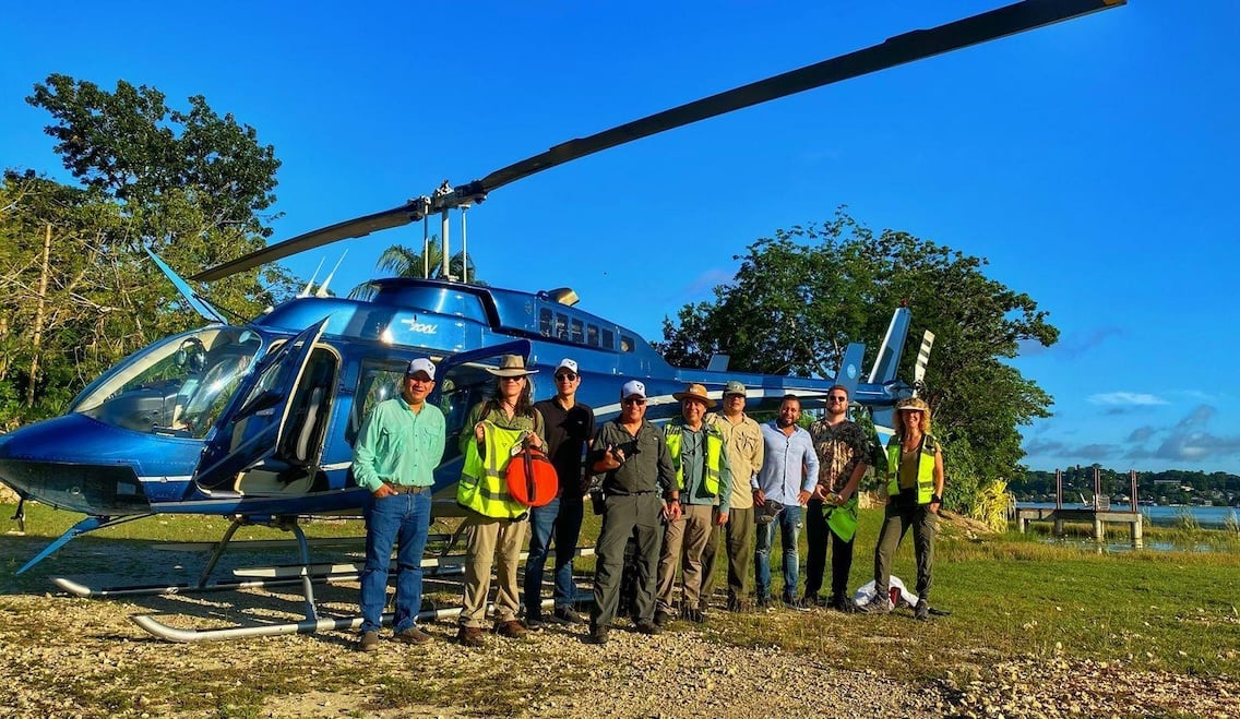
Team Departing to El Mirador
Upon arriving at camp, the team hiked to the top of the El Mirador pyramid and began setting up for the flights. The team utilized the DJI DRTK-2 base station, mounting it on top of the survey marker at the top of the pyramid.
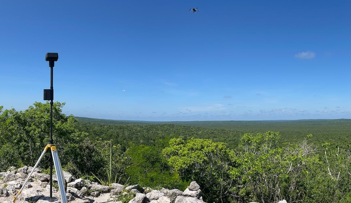
DJI DRTK-2 Station was located at a high point to ensure connectivity
One major challenge with capturing LiDAR data in dense vegetation is maintaining connectivity with the drone. Connectivity is important for two different reasons:
- Global Corrections: When capturing data with the L2, it’s important to either fly connected to an RTK base station (directly or through NTRIP) or to process the data with PPK. In the extreme remoteness of El Mirador, there’s no possibility of cellular NTRIP or downloading the PPK data from a station close by. This means that with either an RTK or PPK workflow, the pilot must stay connected to the drone or satellites while in flight.
- Mission Control: While there are settings within the DJI Pilot 2 app to allow the drone to fly a mission without controller connectivity, having a constant video downlink can give you peace of mind. When utilizing RTK, corrections are sent from the controller, so any downtime can cause correction errors.
For mapping missions like this, it is recommended that the pilot be located at a high point to ensure connectivity. For this mission, drones were launched at the pyramid's base, with the pilots at the top. Another method to fix this issue is to cut a hole in the tree canopy for a mast to maintain connectivity to the drone and satellites. However, this option would mean destroying the forest and would be time-consuming.
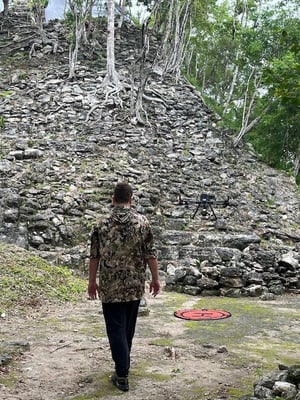
Take off spot with pilots tracking the mission progress from the top of the pyramid
The team completed 40 flights during the expedition and collected over 700 GB of LiDAR Data which then had to be processed and analyzed. Thanks to DJI Terra's easy integration and LiDAR processing capabilities, the team was able to process this data within a day, generating DTM in LAS file format and DEM both at 100% density.
LiDAR Meets Ancient History
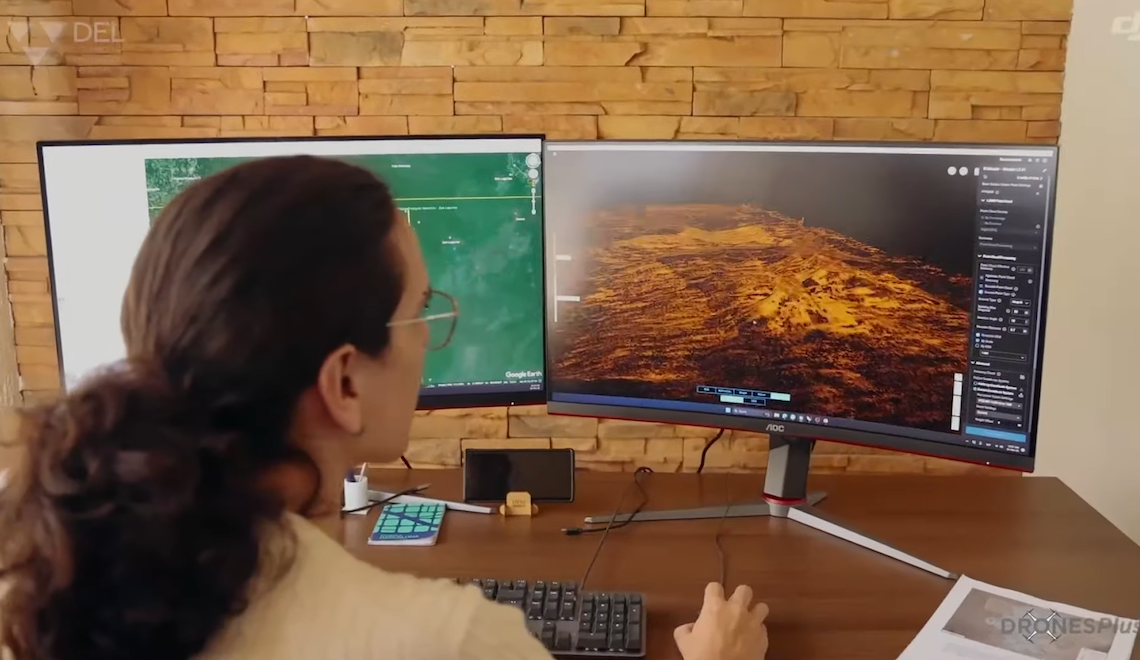
Going through data obtained from Zenmuse L2
The results obtained with the Zenmuse L2 exceeded both DEL and the archeologist's expectations. Thanks to its 5 returns and the 240,000 points, the vegetation penetration has been greatly improved resulting in a digital model ground point density of 19 points/m2 at a 160m altitude. These results show a significant improvement compared to previous missions in similar areas to both Manned Aircraft Flights with Mounted LiDAR and the Zenmuse L1.
|
Results |
Zenmuse L2 |
Manned Aircraft LiDAR |
Zenmuse L1 |
|
Altitude |
160m |
550m |
160m |
|
Point Density |
366 points/m2 |
48.39 |
234points/m2 |
|
Ground Point Density |
19 Grtn/m2 |
2.18 Grtn/m2 |
9 Grtn/m2 |
Source: Zenmuse L2 Whitepaper
After processing the data, thanks to DJI Terra’s Point Cloud Classification feature, the research team can remove the tree canopies and focus on the bare ground point cloud data. These models will then provide insightful information on potential settlements yet to be discovered and allow them to plan and prioritize upcoming research actions.
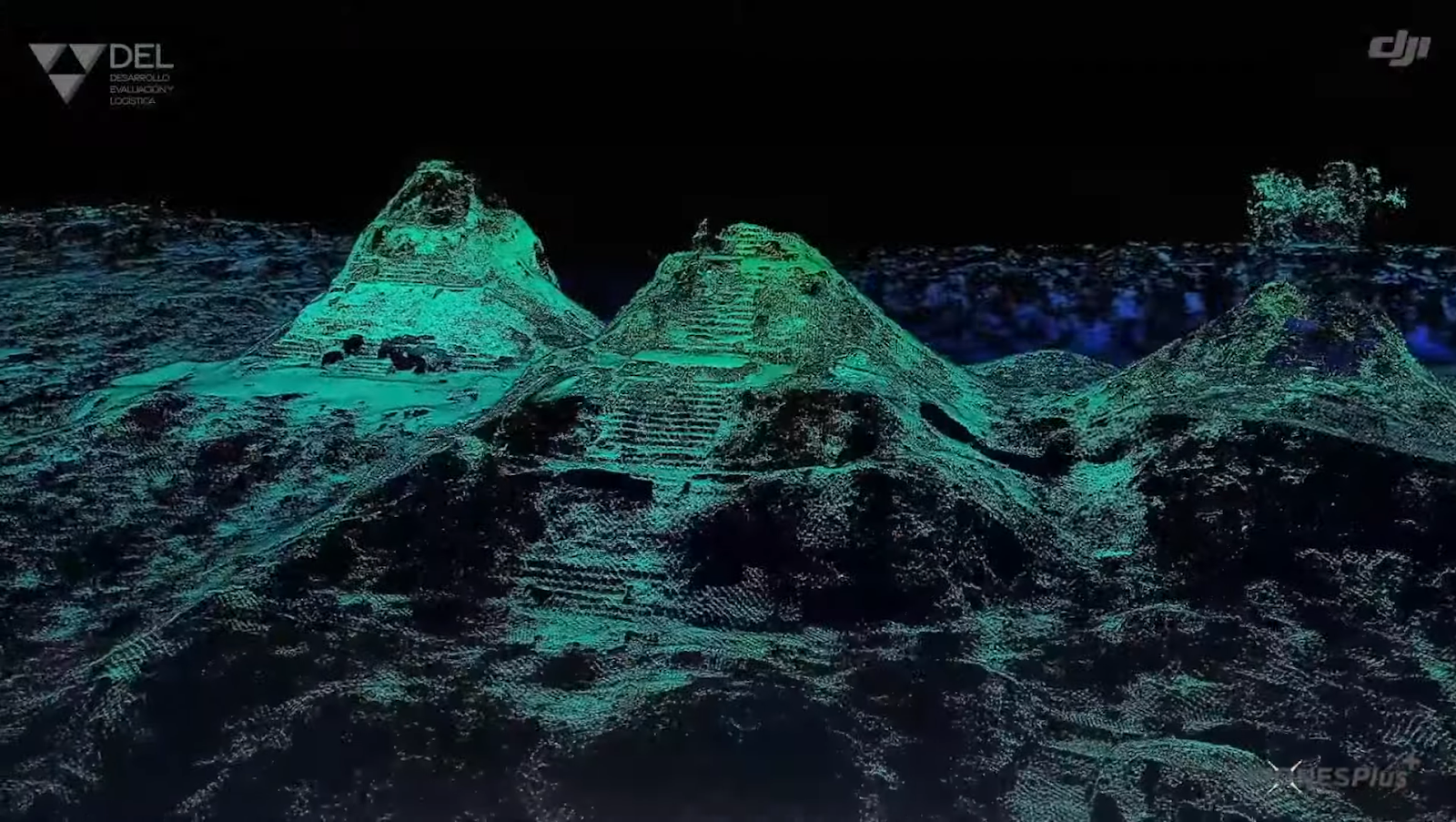
DEM Results from Zenmuse L2
While the research still needs to be completed on the ground, these drone-generated point cloud models allow them to scout the jungle floor and continue their research from miles away. This will bring us one step closer to unveiling the secrets hidden throughout El Mirador basin, and connect with the fascinating history of the Maya Ancient Civilization.
Everything we do is going to be a part of history now. Thanks to DJI for their vision in supporting this kind of project.
- Dr. Richard Hansen
Future of Drones & Archeology
Drone technology has proved to be an invaluable tool for archeological research and conservation efforts. Compared to traditional methods, both manned aerial aircraft and terrestrial scanners, drones provide a perfect balance between efficiency and accuracy.
Besides archeological discoveries there are multiple ways drones can help research and preserve historical sites and heritage:
- 3D Mapping and Reconstruction: Improved 3D mapping technologies will allow for more detailed and accurate reconstructions of archaeological sites. This can aid in the preservation of heritage sites and also in virtual tourism, where people can explore historical sites remotely.
- Educational Outreach: The use of drones can make archaeology more accessible to the public. Through high-quality imagery and interactive models, drones can bring ancient civilizations to life for educational purposes in classrooms or public exhibitions.
- Environmental Impact Studies: Before starting an archaeological dig, drones can be used to assess the environmental impact. This is crucial in ensuring that the archaeological work does not harm the existing ecosystem.
At DJI, We are committed to the use of drones to help communities and preserve history, if you are part of a research team looking to integrate drone technology. Reach out to your local DJI Authorize Reseller or contact us for consulting and support.


-2.png?width=300&name=HS%20-%20Featured%20Images%20(2)-2.png)

