
COVID-19 has become one of the worst health crises our generation has seen, affecting over 2 million people around the world, and possibly more in the coming months. To respond to the increasing number of confirmed cases, governments have had to quickly scale up their healthcare systems, going so far as to even build temporary hospitals to ensure they can properly treat COVID-19 patients.
In Argentina, the number of confirmed COVID-19 cases has doubled in the past two weeks. In response, the Argentine Government started the construction of twelve modular hospitals to expand the healthcare system capacity amid the COVID-19 crisis. These hospitals will add a total of 1,200 beds, including ICU, isolation rooms, and other necessary equipment to treat critical patients.
The urgency of the situation requires these hospitals to finish and start operating as soon as possible. The Ministry of Public Works, the organization in charge of these projects, turned to implement new drone technologies to speed the construction of these critical facilities.
Due to the quick turnaround needed for these facilities, drones made the most sense as surveyors could increase their turnaround time and also more efficiently share highly-accurate digitized maps of the area.
Facing the Challenge
The emergency, modular hospitals have been distributed across four different provinces in Argentina, with nine of them in Buenos Aires Province and three spread in the North, West, and Central regions.
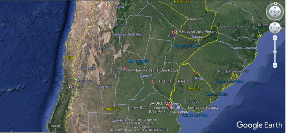
Argentina's Emergency Hospitals Locations
Each modular hospital consists of 1,100 m2 modules built on top of a concrete base. Like any other functional hospital, the modules also need external service facilities such as sanitary, sewage, electrical and telecom service connections— all of these complying with the ISO 9001/2015 Quality Standards and ISO 14001/2015 Environment Standard certifications.
The distance between locations and the number of parties required to build these hospitals represented delay risks for the project. As a result, the project team decided to leverage drones’ survey efficiency and reached out to RC Online, a DJI Partner, to assist with the survey and mapping of the construction sites.
Digital Assets Improve Efficiency
Drones have been widely integrated into multiple workflows on construction projects, from the land survey to project supervision. Through drone aerial imaging and processing software like DJI Terra, survey professionals can produce digital assets like 2D and 3D Orthomosaic Maps to help plan and track these projects.
To perform the survey, the teams traveled around 2,000km to visit the construction sites and collect field data. Equipped with DJI’s Phantom 4 Pro and Mavic 2 Pro drones, the teams were able to survey the 12 locations and over 10,000 m2 in just three days.
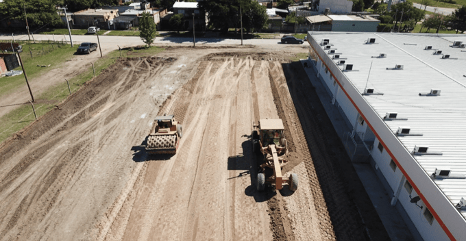
Aerial Image of the Construction Sites
After the on-site data collection, they processed the images for the final result. Using photogrammetry software, they were able to process over 6,000 images and create 2D and 3D maps with detailed information about the construction sites.
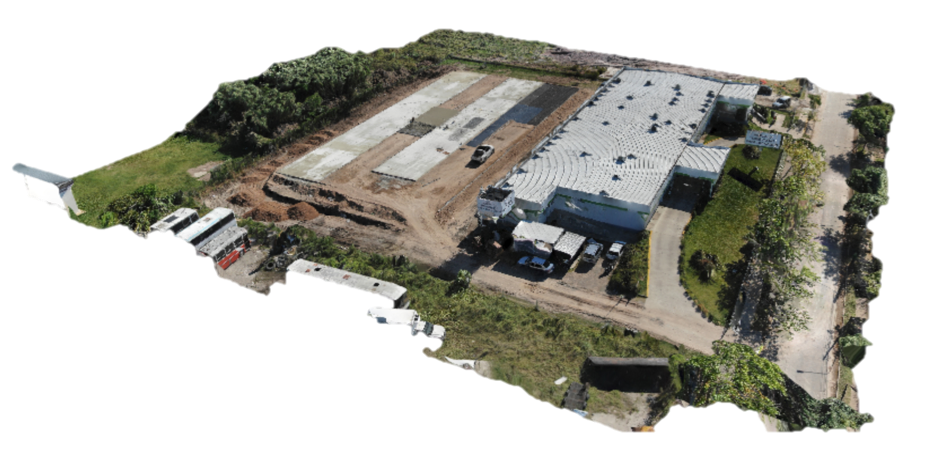
3D Reconstruction Map
The digitals maps became a valuable resource for efficient planning and quick execution. Just a few hours after the drones surveyed the sites, the data collected was available in a collaborative cloud environment, in which all organizations taking part in this project had access to. The digital assets allowed the parties involved, such as the Ministry of Public Works, Electricity Company, or Telcom Service Provider, to simultaneously get all the information necessary for the planning and execution of these projects.
Value of Drones for the Construction Industry
Monica Rivera, the Executive Coordinator of the program, spoke about the value of drones to this project and the construction industry at large, “Today, there is no longer any doubt that drones add value to the sector of planning and construction of public works.”
“The added value revolves around the collected data and how to take advantage of data stories within an integrated work execution cycle.”
Drones and digital mapping software are reshaping the construction industry. During emergencies, efficiency and accuracy translate lives saved. By providing shareable digital assets and reducing surveying time, the drones were able to contribute to this critical national project to help combat COVID-19.
If you would like to learn more about drones for surveying, you can read our article here. If you would like to read more about the different ways drones are helping to fight COVID-19, you can find a list of key applications here.
About our partner: RC Online, founded in 2012, is a pioneering drone service provider and DJI partner based in Buenos Aires, Argentina. In addition to Surveying operations, they also provide Infrastructure and Energy Facilities inspections.