Drones are continually proving to be powerful commercial tools, simultaneously providing users with leaps in efficiency and safety. The surveying and mapping industry is no exception.
With their ability to capture data from above, drones have been successfully integrated into surveying workflows to perform land surveys, photogrammetry, 3D mapping, topographic surveying, and more.
Whether you're an experienced surveyor looking to expand your toolkit, a drone enthusiast who wants to know more ways to use their drone, or are just generally interested in this awesome application of drones — we've got you covered. Read on as we go through everything you need to know to get started with drone surveying.

What Is a Drone Survey?
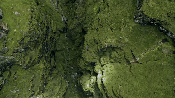
Surveying is the precise science of determining the positions of, and the distances between, points in 2D and 3D space. There is a big difference between aerial photography and surveying. Surveys provide critical information that enables informed decision-making, ranging from construction site planning to design and upkeep of infrastructure, delineating cadastral property boundaries, and more.
A drone survey is simply a survey conducted from overhead using a drone.
Recent technologies have significantly enhanced the capabilities of drones for surveying purposes, making them a cost-effective and efficient alternative to traditional surveying methods. Equipped with high-resolution cameras, GPS, and advanced mapping software, drones can produce precise measurements and detailed aerial imagery. This allows for generating accurate topographical maps, 3D models, and volumetric measurements.
Deliverables from drone surveying can vary based on project requirements but typically include orthomosaic maps, digital elevation models (DEMs), point clouds, and 3D reconstructions. These outputs are fundamental technologies within various sectors, facilitating tasks such as precise land measurement, construction monitoring, environmental conservation, and disaster management.
DJI Mavic 3 Enterprise
Why is Using Drones for Surveying Superior to Traditional Methods?
Unmanned Aerial Vehicles, or UAVs, excel at rapidly acquiring data from vantage points inaccessible to humans.
Drones make it much easier to survey challenging terrain that's otherwise hazardous or difficult to reach by humans. Additionally, while traditional surveying methods require meticulous measurement, preparation, and planning, drones can capture comparable data in dramatically shorter timeframes.
For instance, STRABAG, a leading Austrian construction company, estimates drones enable them to conduct surveys with a 75% reduced GCP setup time. Click here to learn more about STRABAG's gains in efficiency.
Drone Surveying Models
The Matrice 350 RTK is a state-of-the-art drone designed for precision and efficiency in aerial operations. It features advanced capabilities such as a 55-minute max flight time, IP55 rating for operation in challenging weather conditions, and DJI O3 Enterprise Transmission for stable' high-quality video feeds over long distances. These features, combined with the ability to support multiple payloads, enable the Matrice 350 RTK to quickly collect detailed, high-resolution data.
Compared to traditional surveying methods, the Matrice 350 RTK enhances the efficiency and accuracy of data collection over large areas. By integrating advanced features, it reduces the reliance on ground-based survey teams and minimizes the risk of human error — offering a practical alternative to traditional surveying methods that is both time-efficient and capable of delivering precise data in across various environmental conditions.
Moreover, its high-precision RTK (Real-Time Kinematic) navigation system further enhances the accuracy of surveying and mapping data, making it significantly superior to traditional surveying methods in terms of efficiency and data quality.
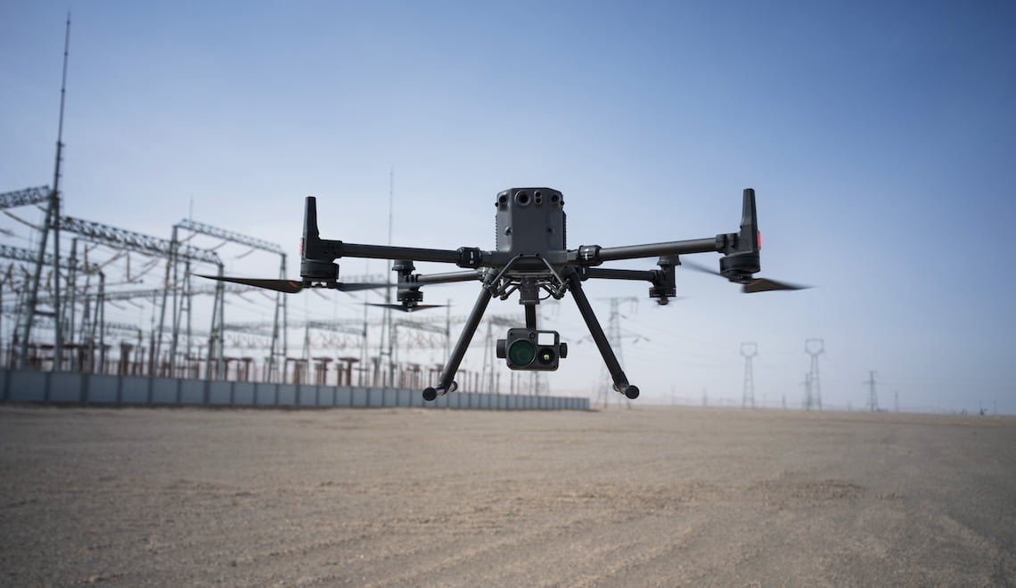
Matrice 350 RTK
Similarly, the DJI Mavic 3 Enterprise Series models — unlike traditional methods — offer advanced surveying capabilities with features tailored for various commercial applications. This series includes models like the Mavic 3E and Mavic 3T, both designed for high efficiency and precision in aerial surveying and inspection tasks. The Mavic 3E, equipped with a 4/3 CMOS Wide Camera and a mechanical shutter, is highly efficient in mapping missions by minimizing motion blur and supporting rapid interval shooting. While its RTK module ensures centimeter-level positioning accuracy, enhancing the quality of the data collected.
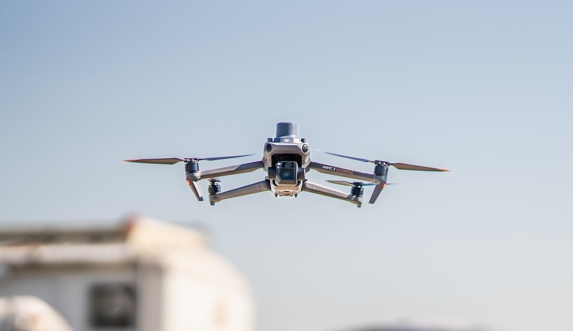
Mavic 3 Enterprise
The Mavic 3T, on the other hand, adds a 640 × 512 px thermal camera to its arsenal, making it ideal for specialized applications such as firefighting, SAR, and night operations, among others. This model's ability to measure point and area temperature, alongside its high-resolution zoom capabilities, allows for detailed inspections from a safe distance. Both drones feature a 56x hybrid zoom, omnidirectional obstacle sensing, and up to 45 minutes of flight time — ultimately ensuring extensive coverage and safe operation in complex environments.
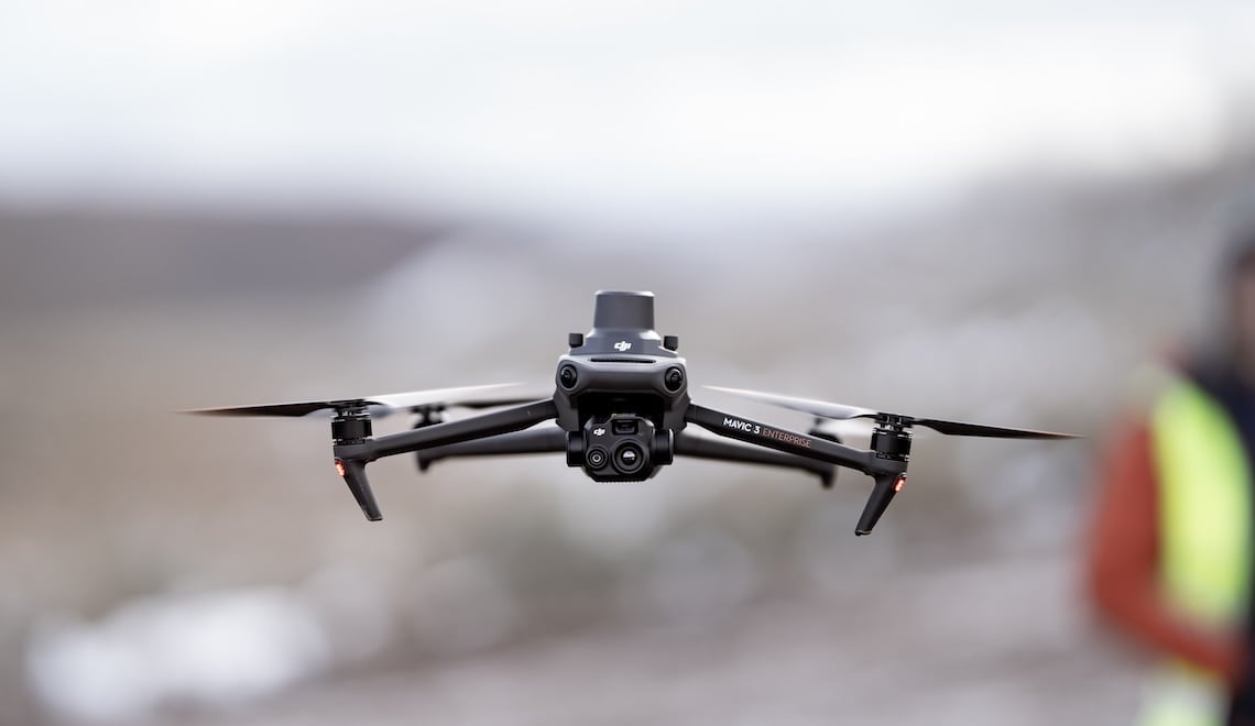
Mavic 3 Thermal
What Deliverables Can You Achieve With Drone Surveying?
Depending on your choice of data sensors and surveying software, drone surveying can produce a variety of deliverables with use cases in many industries.
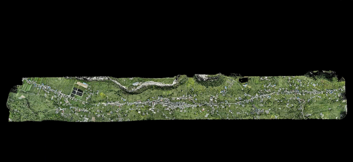
2D orthomosaic map: Surveying software can stitch together hundreds or thousands of digital photos captured by your drone and produce high-quality 2D orthomosaic maps. Importantly, these maps offer an accurate data representation of the surveyed area, with all objects correctly scaled and positioned as they are in reality — providing invaluable data for planning and analysis purposes.
3D orthomosaic map: Digital photos of the surveyed area can be compiled into a 3D orthomosaic map and provide actionable topographic data. These images are created using photogrammetry to process overlapping aerial photographs, resulting in detailed elevation models that can be used for various purposes, including volume measurements, terrain analysis, and 3D map visualization of landscapes.
3D models: Generate 3D models of targets in your surveying site for quick comparison with BIM. Unlike 2D models, these 3D models offer a comprehensive view, allowing for detailed analysis and virtual walkthroughs — fundamental for project planning, design adjustments, and stakeholder presentations.
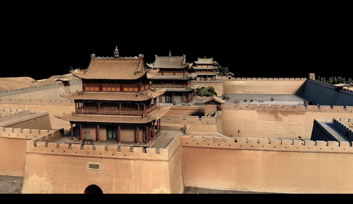
3D model of Jiayu Pass
Thermal mapping: Surveying with a thermal camera allows you to quickly identify targets with abnormal heat signatures. The Matrice 350 RTK offers night-vision capabilities and — when equipped with the correct thermal imaging payloads, such as the Zenmuse H20N — can conduct detailed thermal surveys. This is fundamental for applications where precise temperature readings are required, whether in agriculture for assessing crop health, construction for identifying insulation flaws, or energy sectors for monitoring power lines and substations for overheating components.
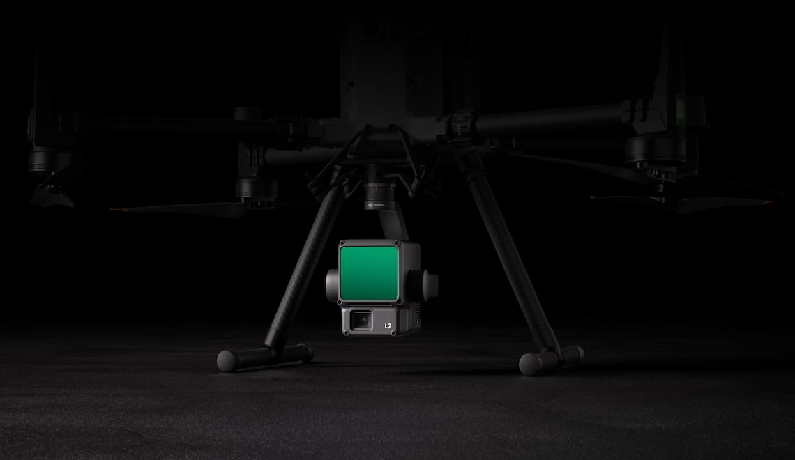
LiDAR Point Cloud: Equip your drone with the Zenmuse L2 LiDAR camera to produce a high-density point cloud. This means that every point within the area surveyed is captured, resulting in a highly detailed 3D model of the terrain and any structures. This works to create accurate data representations of physical spaces that can be used for various purposes, such as urban planning, environmental management, and the construction of virtual reality simulations. To learn more about drone LiDAR, click here.
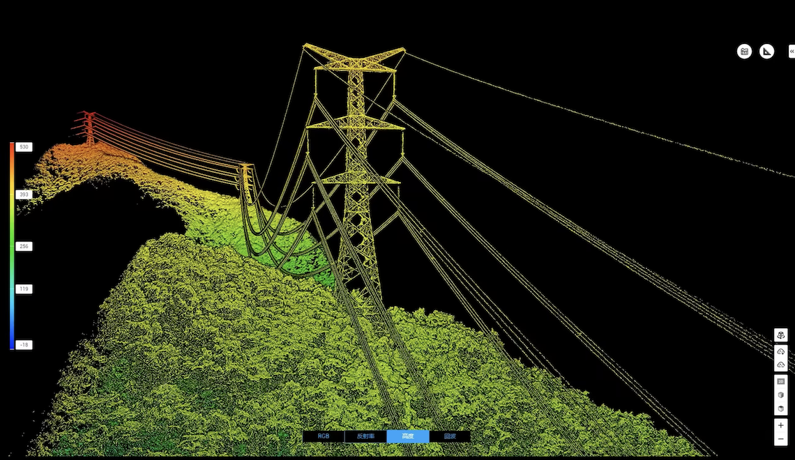
LiDAR point cloud model of transmission tower
Multispectral mapping: Capture multispectral data from beyond the visible light spectrum to give insight into agriculture and crop management. Specifically, multispectral mapping is commonly adopted for environmental monitoring, assessing vegetation health, and efficiently managing resources more generally. This is because multispectral mapping drone technology can detect issues not visible to the naked eye, whether plant stress, water distribution problems, or pest infestations. By analyzing wavelength variations, this modern drone technology provides actionable data that can inform targeted interventions, optimize crop yields, and contribute to sustainable surveying practices.
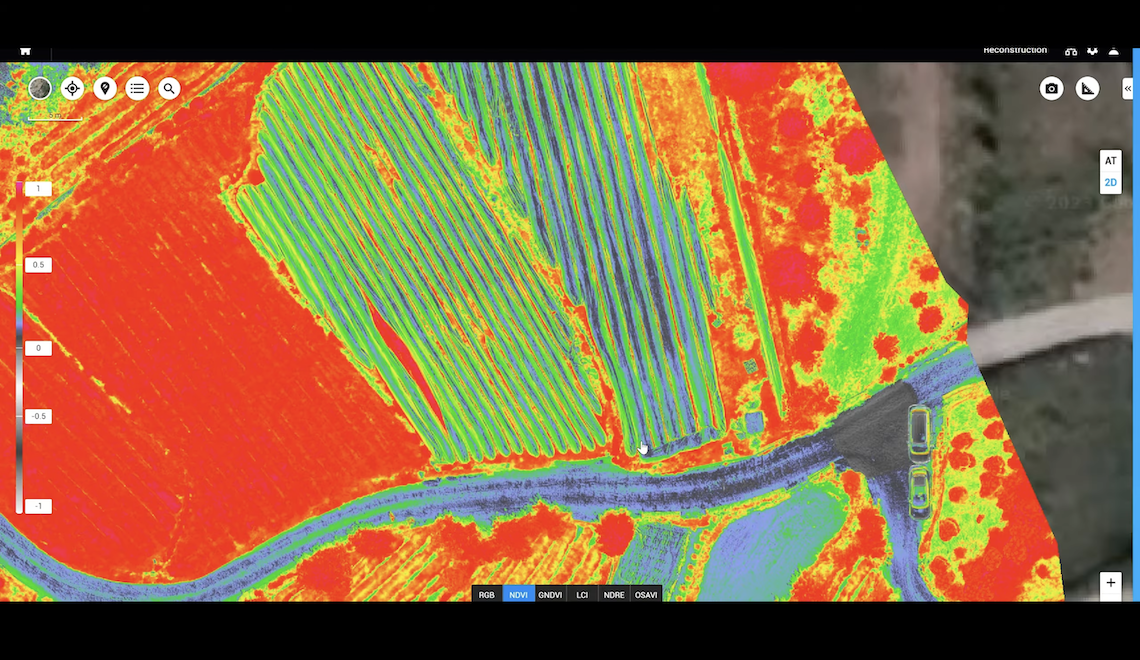
Multispectral view of Korean tea farm
Drones and BIM
In construction and project management, drone surveying can provide critical data that goes hand in hand with Building Information Modeling (BIM).
At each stage of the construction process, high-resolution 3D photogrammetric or laser models captured by drones can be overlaid on and compared with pre-planned BIM objects. This allows for discrepancies between plans and reality to be identified.
Early detection of these issues can reduce construction error, omission, and re-work. This project oversight has made drones an essential part of modern construction. Moreover, integrating drone-captured data with BIM facilitates more accurate monitoring and management of construction projects. It enables precise comparisons between planned models and actual site conditions, leading to improved decision-making processes. This combination significantly contributes to minimizing project delays and cost overruns by streamlining workflows and enhancing the accuracy of project tracking.
How Accurate are Drone Surveys?
Before adopting drones into their workflows, many surveyors ask about aerial surveying accuracy. What degree of accuracy can drone surveying techniques achieve?
Surveying drone solutions can produce surveys with different degrees of accuracy, depending on the project's requirements. In an independent study by DroneDeploy, the DJI Phantom 4 RTK achieved 2 cm relative vertical accuracy and 1.20 cm relative horizontal accuracy. For some applications, like checking crop growth or construction progress, high relative accuracy is sufficient. For other jobs that also require high absolute accuracy, there are drones equipped with real-time kinematics (RTK) and post-processing kinematics (PPK) capabilities. When paired with a few GCPs, survey-level accuracy can be achieved.
What Does a Typical Drone Surveying Workflow Look Like?
Here is an idea of how drones are typically integrated into your surveying workflows: Different drone solutions and drone-assisted workflows can offer varying degrees of accuracy. When selecting your surveying drone, it's important to recognize your demands, the demands of your clients, and the tradeoff between speed and accuracy.
Onsite Data Collection
The onsite data collection phase begins with identifying the mapping mission and establishing the aerial survey's purpose and scope. Subsequently, the site under consideration is carefully examined to gather essential information that might affect the data collection process. Setting up Ground Control Points (GCPs) is an optional step that can significantly enhance the precision of the aerial data; these are physical markers placed on the ground that can be identified in the aerial images. The planning of the flight missions involves strategizing the path and pattern that the drone or aircraft will follow to capture its imagery.
Once the flight plan is in place, the Position and Orientation System (POS) data is acquired, recording the aerial platform's precise location and angular orientation. This is followed by the execution of the flight mission to acquire aerial images of the site.
Data Processing
After onsite data collection, the data processing stage commences. This involves analyzing the aerial images along with the POS data and, if used, the measurements from the GCPs to perform aerial triangulation. Aerial triangulation is a method that mathematically establishes the geometry of the photographed area from different angles and is foundational for mapping. This process is scrutinized for its accuracy, and should it not meet the necessary standards, optional checkpoint measurements may be implemented to correct any discrepancies. Once the triangulation passes the accuracy check, the workflow generates a Digital Surface Model (DSM), a Digital Orthophoto Map (DOM), and 3D terrain models.
3D terrain model captured with Zenmuse L2
DJI's Drone Surveying Solutions
With all the benefits drones bring and so many surveying drone options, it raises the question: Which is the best drone for surveying?
The answer ultimately lies with your priorities. To read an in-depth analysis and evaluation whitepaper of the DJI Zenmuse L2 LiDAR system for the DJI M350/M300 and discover how it may fit your needs, click here.
Zenmuse L2 LiDAR System
The whitepaper covers accuracy and precision measurement techniques, a comprehensive comparison with its predecessor — the DJI Zenmuse L1 — and an in-depth feature analysis, which includes beam divergence, vegetation penetration capabilities, and LiDAR intensities. Additional tests and conclusions provide further insights into the L2's performance and capabilities, helping you determine if it's the right choice for your surveying projects.