
It used to be that agriculture involved quite a bit of guesswork: What would the weather patterns be? What kind of crop yield could be expected?
Over the years, farmers have found innovative ways to answer these questions as much as possible with new technologies. Agriculture drones are the next step in this process. Agriculture drones can be used to do anything from precision agriculture, to efficiently dispersing weed control or fertilizers, to optimizing field management. The results include reduced operation costs, improved crop quality, and increased yield rate.
The rapidly changing world of agriculture
The farming operations of today look quite different than even a few decades ago. New technology has allowed the growers of today to optimize each part of their operations — from field spraying to grow cycles and crop health.
A big part of that transformation can be attributed to drones and other types of unmanned aerial vehicles (UAV). With an agriculture drone, farmers get in-depth data analysis and mission planning as well as new tools capable of handling physical work.
Whether you’re an independent farmer or a leader of a larger organization, drone technology can help you beat your harvest goals and yield more crops with fewer resources. Two of the main ways that the right UAV and payload can help are efficient crop spraying and field mapping.
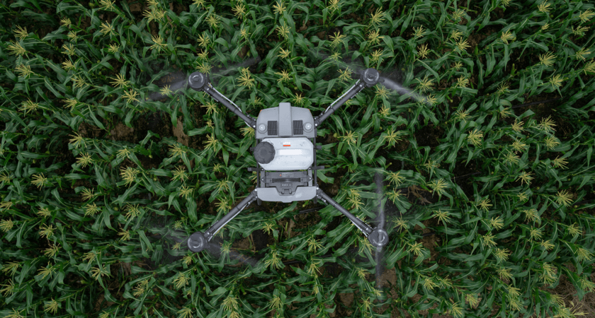
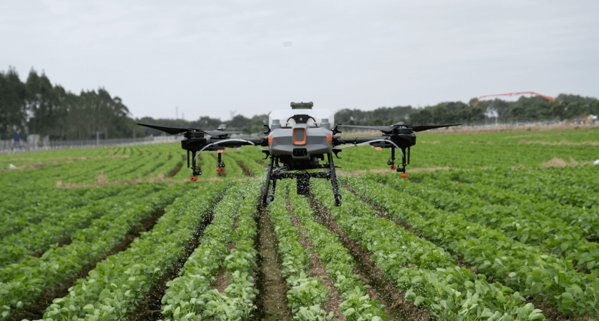 The Agras T10
Spraying a field with a UAV
The Agras line of spraying drones from DJI can help precisely deliver the following:
- Fertilizer
- Herbicide
- Fungicide
- Pesticide
- Seeds
- Desiccants
The efficient application of the above is a persistent challenge for any grower. If you spray too much concentrated in one place, you run up extra costs and potentially decrease the quality of your produce. Too low a concentration, however, and you leave your crops vulnerable to being overgrown with weeds, malnourished, or eaten by insects and other predators — potentially decreasing the yield rate.
However, the right farming drones and spraying payloads can distribute chemicals evenly and efficiently.
The results? Improved crop quality and a higher yield rate without intense manual labor. DJI drones can be used on nearly any kind of crop, including rice, wheat, corn, citrus trees, cotton, and much more.
In addition to covering more land at a lower price, drone spraying can offer major environmental benefits. Drones can more efficiently distribute pesticides so that you use less for the same overall effect. UAV seeding can also help maximize the efficient use of your land. With climate change and development expected to eat into the total amount of land globally available for farming, effective land use will be key to maintaining successful results in the years ahead.
Using drones to gather data for precision agriculture
Smart spraying and seeding aren’t the only ways to increase overall agricultural efficiency, cut costs, or increase yields. Drones can also be used to map out an area and create new insights — taking the guesswork out of much of the growing process.
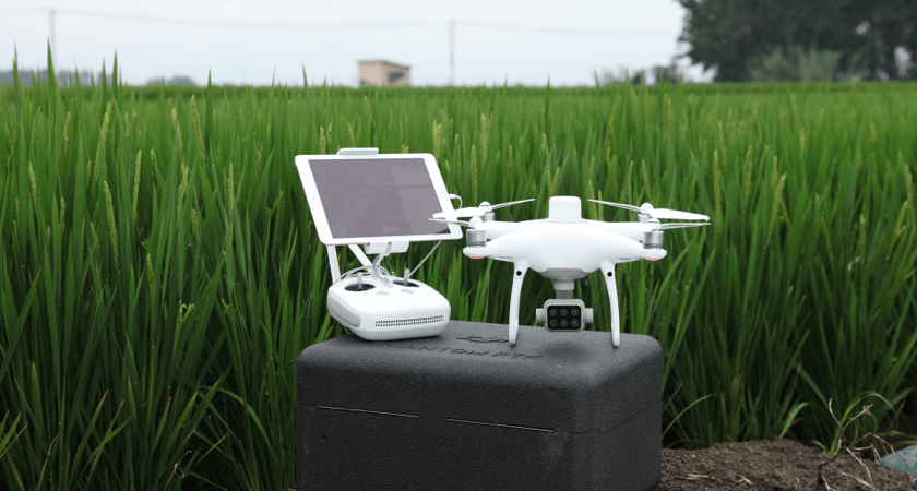 The P4 Multispectral
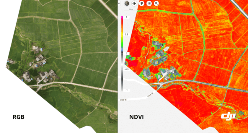
One of the keys to all of this is remote sensing technology, which picks up radiation on the ground and can track everything from physical characteristics to the amount of heat an area is generating. The best agriculture mapping drones take this concept further with what’s called multispectral imaging. This means that they can capture light sensors both visible and invisible within a set range. Two key types of maps that can be created with this kind of agricultural drone include:
- RGB maps: A birds-eye view but even better, even a basic Red Green Blue (RGB) map can offer fresh information. These maps allow you to see exactly how much land you have to grow on to the centimeter and assist with crop monitoring over an extended period of time, helping you adjust from season to season.
- NDVI maps: Normalized Difference Vegetation Index (NDVI) takes the insights of an RGB map one step further. The map shows the amount of infrared light reflected in an area, which is an indicator of malnourishment and drought. According to Go Intelligence, this kind of data collection can be used to spot problem crops as much as two weeks before physical signs emerge, making it an invaluable tool for farmers trying to accurately predict their yield rate.
For more information on how drone data can transform the way you grow, read our eBook “Multispectral Imaging Drones for Agriculture: Crop Health Data at Your Disposal.”

The right agriculture drones and payloads
When you’re looking for the best in agricultural technology, you want the drones and payloads of DJI. Our solutions are designed with the needs of growers in mind. DJI drones have sprayed over 350,000 square kilometers to date, and that’s just based on data that was manually uploaded by users.
Our top agricultural drones include:
The Agras T30 (or T20 or T10)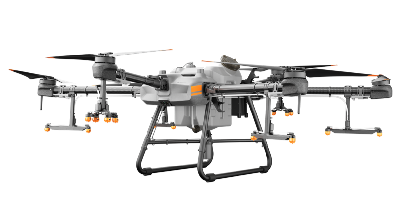
The newest in a line of successful Agras drones, the Agras T30 is your ideal solution for spraying larger fields thanks to its 40kg capacity, a flow rate of up to 50 kg per minute, a spreading width of up to 7 meters, and an hourly spreading capacity of 1 ton for urea. This translates to the ability to cover up to 40 acres per hour.
The mighty T30, however, isn’t the only drone Agras drone to choose from. The Agras T10 and Agras T20 are each designed to offer the same crop spraying capabilities but are more ideal for smaller and mid-size fields.
Phantom 4 RTK
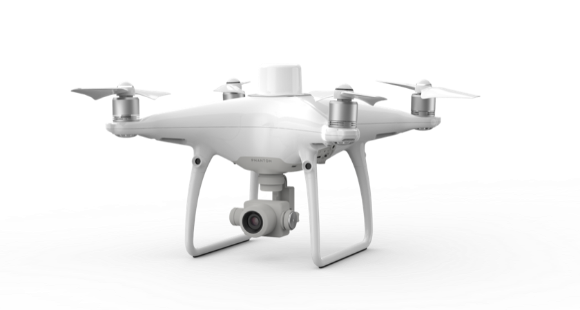 While the Agras line was designed with field spraying in mind, the Phantom 4 RTK is the perfect tool for field mapping. This drone can help to generate precise maps thanks to an RTK module that is integrated directly into the drone. The new TimeSync system continually aligns the flight controller, camera, and RTK module for fixed positioning data you can trust. This drone is the perfect complement to any surveying job, from the farm to the construction site.
P4 Multispectral
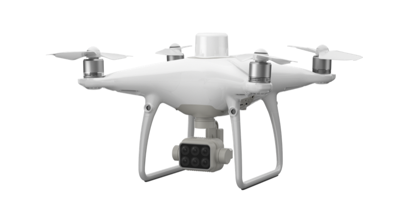
Designed with the agriculture sector in mind, the P4 Multispectral blends perfectly into your workflows. Use this tool takes advantage of multispectral imaging to gain immediate insights into your plants’ health. Features include an integrated spectral sunlight sensor and an RTK Module that allows for accuracy down to the centimeter.
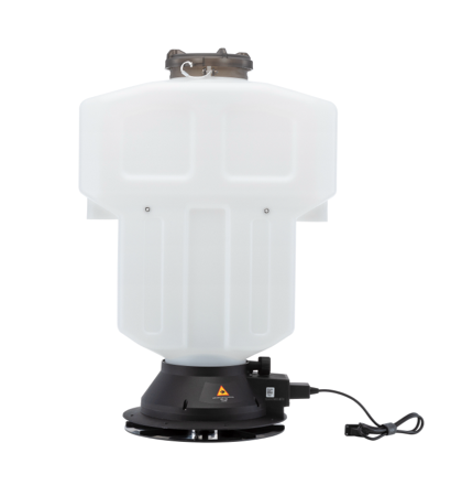
In addition to drones, DJI offers agriculture-specific payloads designed to take on some of the top challenges in the sector, including:
T Series Spreading System 3.0
Designed to pair perfectly with your DJI agricultural drone, this spreading system is an invaluable tool for everything from rice seeding to prairie reseeding to oil seeding and even fertilizer spreading.
For more information about how the right drones and payloads can help to save you money and improve farming practices, please read our buyer’s guide.


-3.png?width=300&name=Insight%20blog%20featured%20image%201140X660%20(2)-3.png)
-2.png?width=300&name=Insight%20blog%20featured%20image%201140X660%20(2)-2.png)