While rescue missions save victims from dangerous scenarios, they can also place responders at risk. To mitigate risk, many SAR operation teams have turned to enterprise drone technology to assist them in their missions. Drones are capable of rapidly covering extensive areas and navigating difficult terrain. They can locate missing individuals or collect significant information before responders arrive on the scene, providing them with the necessary context to act swiftly and make informed decisions.
Today's Search and Rescue Missions
While you hope you’ll never need the services of a search and rescue team, the unfortunate truth is that they’re in demand now more than ever. In recent years, natural disasters, like wildfires and tropical storms, have become an expected part of life for many across the world. As the pace of climate change accelerates, the prevalence of these natural disasters — and the importance of search and rescue to save lives — will continue to climb.
Climate change isn’t the only reason for the increased need for effective SAR. According to a 2020 article from Outside Magazine, the increase in outdoor recreation in the U.S. — especially in remote places in the West — has led to a spate of new missions compared to previous years. The Colorado-based Rocky Mountain Rescue Group, for example, now handles almost 250 missions a year — up sharply from an average closer to 170. In many places, SAR groups are being stretched thin, as most depend on volunteers with full-time jobs to fill their ranks. Civilians are also crowding beaches unlike ever before. As a direct results humans are coming in extremely close contact with sharks and other animals in the sea, often resulting in life threatening injuries due to people's lack of awareness when swimming in open water.
To meet these new challenges, search and rescue teams need to be able to handle each mission with the intentional dispersion of time and resources. This is where drone technology comes in.
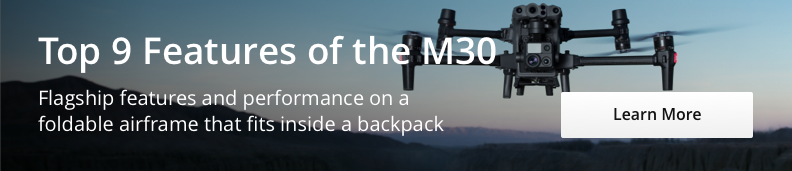
 DJI Matrice 30T
How Drones are Helping Save Lives
While they’re not a replacement for tried-and-true traditional methods, the right drone and payloads can complement existing efforts and expand capabilities.
Drones can offer teams an extensive amount of information at a quicker pace — ultimately, the potential difference between life and death. In fact, according to a study conducted by DJI, EENA, and Black Channel, drones can shave extensive amounts of time off of SAR activities. The study compared teams with drones to those operating exclusively on foot in multiple randomly simulated search efforts. Across the board, the teams with drones were able to locate victims an average of almost three minutes faster than their counterparts.
Across the board, search and rescue teams use drones to efficiently build situational awareness, plot rescue strategy, and even relay messages to individuals once they are found — all while keeping personnel at a safe distance.
 M350 RTK with Zenmuse L2 Payload Explanation with LifeGuards
Five key uses and advantages of search and rescue drones
1) Map out disaster zones: When the mission requires a full understanding of the surrounding terrain, drones can map the area faster and safer than traditional methods. Depending on the camera payload and software, you can create 2D maps, 3D topographic models, or thermal maps. During a disaster, drones are the ultimate tool for situational awareness. Their situational awareness capabilities were highly evident in a recent landslide in Norway where drones flew for 270 hours over 40 days to create and continuously update a map of the disaster area.
2) Find missing people in the dark: Drones can see what humans can’t. With a thermal camera, like the one equipped on the Zenmuse H30T, you can identify missing people who may not be visible based on their body heat. This capability is invaluable during night missions and avalanche zones.
3) Communicate with people in trouble: Drones can be equipped with a speaker to communicate with stranded people, send out a signal that they can hear, and then let them know they’ve been found and help is on the way. Such means have been successfully used by the Croatian Mountain Rescue Service (more on them later) to locate a missing woman.
4) Assess without intrusion: In avalanche zones, one small move or even too much noise can cause a new slide — placing stranded people out of reach. Luckily, the right drone can stay in the air for significant lengths of time and hover at altitudes that don’t emit excess noise or turbulence. Drones also limit the amount of time SAR workers need to be out in an avalanche zone by allowing them to access the site from a distance and only go where they need.
5) Monitor beaches for animal activity: Drones are equipped with powerful cameras capable of scanning beaches and open water for potential dangers such as sharks and other marine life. The DJI Matrice 30T is a perfect example for rescue missions along the coast, providing powerful cameras and long battery life to ensure that lifeguards can monitor beaches and respond to potential rescues quickly.
Search and Rescue Drones in Action: The Croatian Mountain Rescue Services
As a country filled with mountains, islands, and inlets, Croatia has plenty of places where explorers can easily get lost or badly injured — whether while hiking, climbing, skiing, or caving. Since 1950, the Croatian Mountain Rescue Services (HGSS) has been rescuing locals and tourists alike from dangerous situations.
Since 2013, the service has utilized drone technology to improve its response times and perform more comprehensive searches. Today, the HGSS boasts a formal drone program with 40 drones and 49 pilots. The team has also established a robust training proforma to ensure responders can take full advantage of the technology.
The drone program has proven to be a significant success for the HGSS team. To date, HGSS has successfully completed 10 rescues using drones. Additionally, HGSS responders have observed that, on average, missions are completed 30 minutes faster with the assistance of drones, representing a notable improvement in efficiency.
Saving Lives from Shark Attacks in Queensland, Australia, with Matrice 30T
 M30T Flying over a beach in Queensland, Australia
Lifeguards in Queensland, Australia, are utilizing the DJI Matrice 30T as part of the shark smart program to monitor beaches and enhance safety measures against shark attacks. These drones, equipped with advanced technology including thermal cameras and laser rangefinders, allow lifeguards to effectively detect and track shark activity in real-time. By flying these drones regularly—about once every 45 minutes—lifeguards can quickly spot sharks, assess potential threats, and take immediate action, such as closing beaches or dispatching jet skis to ensure the safety of swimmers.
The DJI Matrice 30T is particularly well-suited for the beach environment due to its durability and advanced features. Its weatherproof design is resistant to sand and salt, making it ideal for the harsh conditions of coastal inspection. The drone's high-resolution cameras with significant optical zoom capabilities enable lifeguards to monitor vast areas without constantly moving the drone, enhancing efficiency and coverage. The ability to detect and record GPS locations of sharks also allows lifeguards to analyze patterns and trends in shark behavior, further refining their safety protocols.
Moreover, the integration of DJI's FlightHub 2 interface and the potential use of artificial intelligence in the shark smart program indicate a future where drone operations could become even more autonomous and precise. The drones not only contribute to shark detection but also support broader search and rescue operations. This dual functionality has garnered positive public reactions, as people appreciate the added layer of protection while enjoying the beach, knowing that cutting-edge technology is actively working to prevent shark encounters and safeguard their lives.
DJI recently collaborated with Pure Gold Films to produce a case study video highlighting how Surf Life Saving Queensland leverages the DJI Matrice 30T to monitor and respond to potential dangers, ensuring the safety of every swimmer. Click below to see the complete video.
Video shot in partnership with Pure Gold Film