
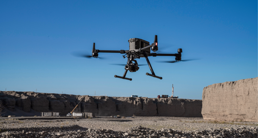
In a vast range of industries, drones are disrupting traditional methods of data collection and helping professionals work faster, smarter, and safer. A decade ago, the notion of a flying robot zipping across the sky and capturing images was more science fiction than fact. Now, agriculture, construction, surveying, and environmental monitoring professionals are all using DJI technology to produce in-depth maps and terrain models.
Drones have become go-to tools for mapping and aerial surveys, and by now you’re probably well aware of the process: your UAV flies along a preset path at high speed, snapping photos at regular intervals and at a consistent altitude. The photos are then stitched together by clever software to form accurate maps.
In this article, we’re going to dive deeper into the underlying technology and look at a key feature that sets enterprise-grade mapping drones apart from the rest: the presence of a mechanical shutter.
So what is a mechanical shutter? How does it differ from other types of shutter? And why does it play such a vital role in gathering high-quality aerial photographs? Let’s get started…
A closer look at how CMOS cameras work
To understand why mechanical shutters are so important for mapping and surveying applications, it’s useful to go back a few steps and explore how cameras (and camera drones) work.
When light enters a camera, it's captured by an image sensor, which is composed of millions of tiny pixels. These pixels are made from a material called a complementary metal oxide semiconductor (CMOS). When light hits the CMOS, it creates an electrical charge that’s used to generate the image.
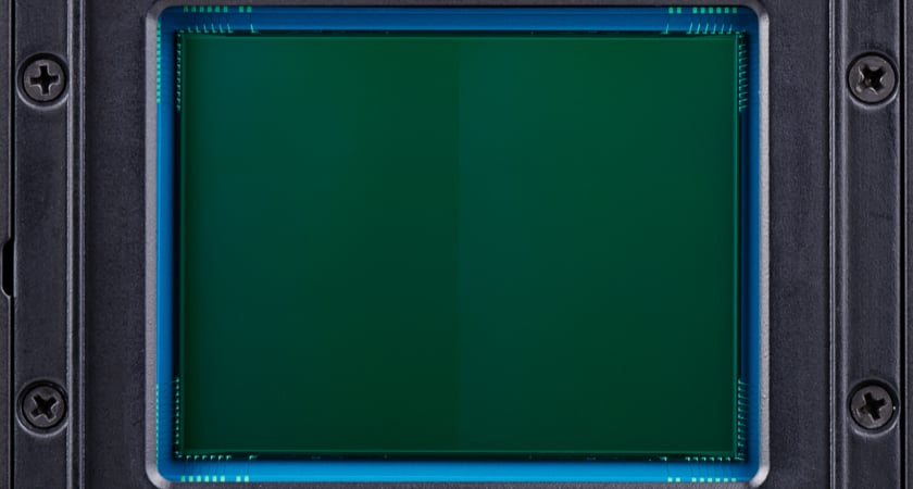
So how does the shutter fit in? The shutter controls how long the CMOS is exposed to light. If the shutter is open, light enters the camera and hits the CMOS. When the camera takes a picture, the shutter opens temporarily, allowing light to hit the CMOS and create an image.
What is a mechanical shutter and how does it differ from the rest?
There are several different shutter types, each of which exposes the CMOS’s pixels to light in a different manner.
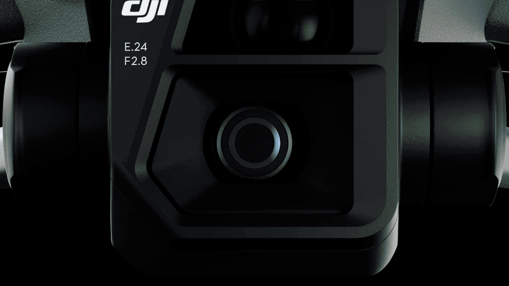
Let’s start with the mechanical shutter, the type that’s favored by mapping professionals and featured on the new Mavic 3 Enterprise, the Phantom 4 RTK, and the Zenmuse P1 sensor.
Mechanical shutters work by exposing the entire frame of the image sensor to light in one go. This means every pixel represents the exact same moment in time of exposure. As we’ll see shortly, this timing is everything. It makes more sense when you think about how mechanical shutters work in contrast to electronic shutters or rolling shutters.
Electronic shutters differ in that they expose the image sensor to light one line of pixels at a time. Electronic shutters use the camera’s sensor to control exposure to light and expose the pixels gradually from top to bottom. What this means is that electronic shutters actually have a short time delay between the top of your frame and the bottom. Most of the time that’s not an issue, but when movement is involved in the shot, these shutter types can cause what’s known as a rolling/jello effect - a type of image distortion that’s typical when shooting moving targets (or when the camera itself is moving at high speed, as it tends to during a drone mapping flight).
So to sum up, a mechanical shutter works by exposing each pixel of your camera’s sensor simultaneously. Electronic shutters expose the pixels to light one row at a time. But why is this important in the context of an aerial survey?
For professional surveyors accuracy is everything. Because rolling and electronic shutters can cause distortion when movement is introduced into the equation, they aren’t ideal for mapping missions. Even a small amount of the “jello effect” from a rolling shutter can undermine your mapping software’s sense of orientation, in turn reducing the accuracy of your measurements.
Is a mechanical shutter necessary for mapping missions?
The work of professional surveyors is generally judged on its accuracy. With many drones now combined with RTK technology to provide measurements with centimeter-level precision, there’s no excuse for shoddy imagery that could undermine your results. Using a drone with a mechanical shutter offers the best possible image quality and reduces the likelihood of the dreaded jello effect. Where electronic or rolling shutter systems introduce motion blur into the equation, mechanical shutters prevent it from happening. The risk of distortion would be minimal if the camera and its target were both static. But if you want to take advantage of the efficiency gains drones provide, you need a shutter that’s at its best when capturing images from a moving platform.
 Zenmuse P1 and its mechanical shutter
Which drones have a mechanical shutter?
Several of DJI’s Enterprise platforms have mechanical shutters that are ideal for mapping and surveying applications. These include:
Phantom 4 RTK
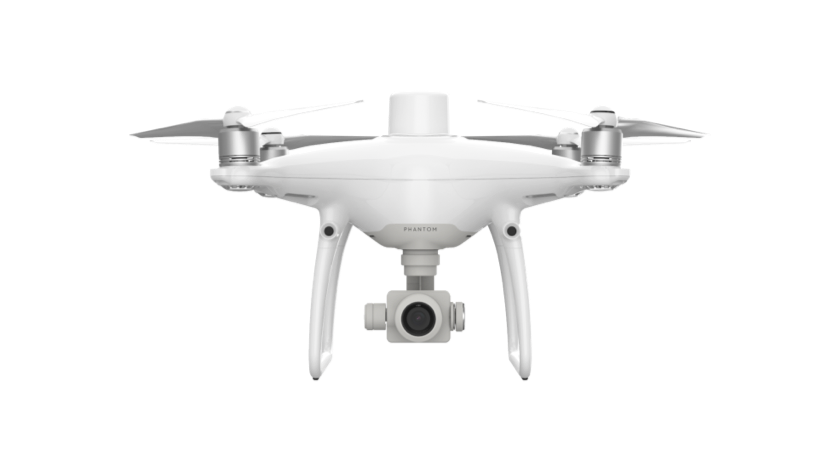
The Phantom 4 RTK has a built-in RTK module to provide centimeter-accurate data and reduce the reliance on ground control points during survey missions. Its 1-inch, 20-megapixel CMOS sensor has a mechanical shutter to eliminate the risk of rolling shutter blur.
Mavic 3 Enterprise
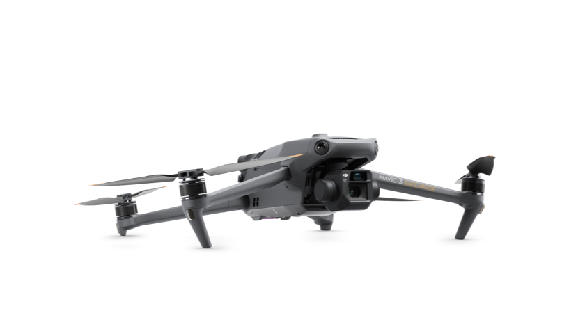
The Mavic 3 Enterprise (M3E) is a compact and portable platform with revolutionary capabilities for surveying professionals. As well as an RTK module for centimeter-level mapping precision, the M3E sports a 20MP wide camera with a 4/3 CMOS sensor and mechanical shutter.
Crucially, the M3E brings mapping and mission efficiency to new heights with its 0.7-second image capture rate. With shorter intervals between shots, you can drastically reduce survey duration.
The M3E is also capable in dim conditions. Its wide camera offers 3.3μm pixels alongside improved low-light software. Your operational window has never been this wide.
Matrice 300 RTK & Zenmuse P1
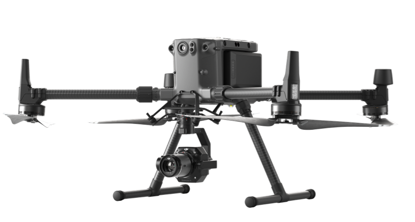
The Zenmuse P1 sensor is DJI’s flagship photogrammetry payload. It combines a full-frame 45 MP sensor with interchangeable fixed-focus lenses on a 3-axis stabilized gimbal.
A 4.4μm pixel size produces low noise and high sensitivity imaging, while its RTK module and 0.7-second intervals between shots allow for highly efficient survey missions.
The Zenmuse P1 also features a mechanical shutter and DJI’s TimeSync 2.0 system, which synchronizes time across modules at the microsecond level to ensure centimeter-accurate data and real-time orientation.
The Zenmuse P1 is exclusively compatible with the DJI M300.
Choosing the right drone for mapping and aerial surveys
If you're looking for the perfect drone for mapping and survey applications, we’d recommend flying with a camera that has a mechanical shutter. It’s by far the best way to eliminate the risk of a rolling shutter or jello effect. With the Phantom 4 RTK, the M3E, and the Zenmuse P1 sensor, you can take on dynamic survey missions, safe in the knowledge that your photos (and the maps and models they generate) are going to be as clear and accurate as possible.


-2.png?width=300&name=HS%20-%20Featured%20Images%20(2)-2.png)

