


Drone technology is on the rise. It’s being deployed to support the farmers who feed us, the public safety organizations that protect us, and the operations of the utility, construction, and transportation companies that support our modern lives.
The benefits of these flying, data-gathering devices are mostly measured in costs reduced, time saved, and efficiencies gained. But drones are also making an impact beyond bottom lines. Increasingly they are being used to aid life-saving operations. Not to mention the accidents drones prevent on a daily basis in potentially dangerous working environments.
The applications of drones are varied but connected by a common thread: data. Drones enable organizations to capture information in a way that’s quick, safe, inexpensive, objective, and of a higher quality than before.
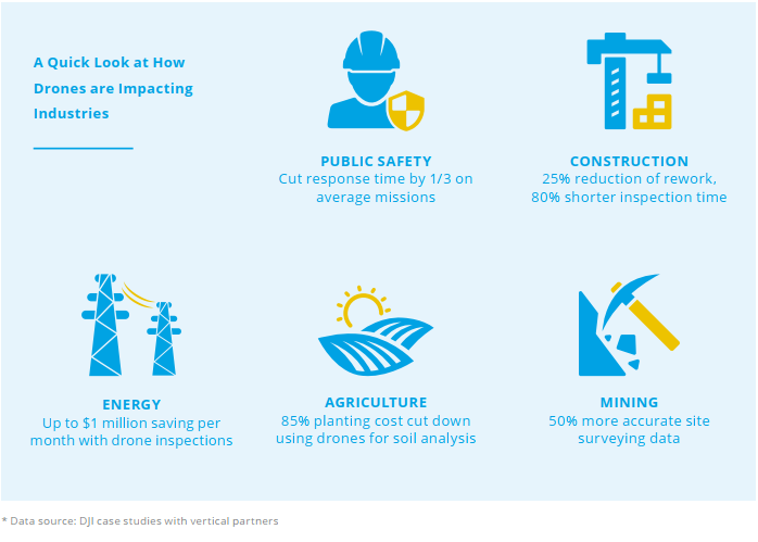
Because of this, they represent an early success story of the fourth industrial revolution. In a period being defined by the confluence of artificial intelligence, automation, and data, drones are enabling smarter decisions and more efficient operations.
But this is just the beginning. Drone technology and its usage are still in its infancy and there are plenty of exciting developments on the horizon. In short: there’s never been a better time to set up a drone program.
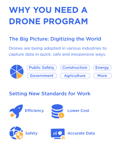
Download the full Building a Drone Program Infographic by DJI
Versatile data gathering
The drone platforms, payloads, software, and regulations that determine drone operations are constantly improving. Together they have enabled an ecosystem of versatile data gathering possibilities.
It’s important to view drones as a platform for different technologies. They combine various sensors to capture data points and leverage onboard computing and cloud processing to create actionable data sets for a variety of stakeholders.

Drones are typically deployed for two reasons. First up is the capture of high-resolution images and videos. These could be for almost any purpose, from creating marketing materials to industrial inspections.
Second is the gathering of unique data sets, which include LiDAR, thermal, and multispectral images. These can be used to build maps and models in the fields of construction, earthworks, and agriculture, or to provide first responders with valuable insights as an emergency unfolds.
The versatility of drone-based solutions isn’t limited to the type of payload and application. The always-evolving platforms powering the industry have inherent flexibility, too.
Advances in autonomous flight and computer vision have made gathering data at low-altitude easier than ever before. These flights can be reactive or proactive, according to a predetermined flight path or remotely controlled and off the cuff.
There are drones available from DJI Enterprise to suit the needs of any industry, including portable, quick-to-launch models with thermal capabilities (the Mavic 2 Enterprise Series), rugged, adaptable platforms (the Matrice 200 V2 Series and Matrice 600 Pro), and mapping and agriculture solutions offering data gathering precision to the nearest centimeter (the P4 RTK and P4 Multispectral).
Drones and data go hand in hand to optimize operations
In various industry verticals from construction, energy, mining, critical infrastructure to agriculture, operating at scale means working within tight margins and seeking out efficiency gains wherever possible.
More and more, these marginal gains are being harnessed through the insights that come with drone data. Orthomosaic maps are empowering farmers, engineers, and architects to understand reality better and respond efficiently. Maintenance teams in industries from energy to insurance are speeding up inspections and reducing the risk to themselves in the process.
It’s clear that drones have a significant role to play in the future of work. Organizations of all kinds are reaping the rewards that come as a result of gathering information with greater speed, as workflows are shortened and manual processes are automated and taken to the skies. New applications and benefits that stem from using aerial technology are emerging all the time.
The bottom line is that organizations not exploring the potential of drone technology face the prospect of being left behind by their competitors. Innovating is key to success in an increasingly digital world. If harnessing data is central to your business operations, it may be time to explore the possibilities and launch your own drone program.
Download a copy of our guide on building your drone program below. It includes examples of what industry leaders are doing with drones and the steps you can follow to take your ambitions from proof of concept to a full-scale initiative.

-1.png?width=300&name=DFR%203%20(3)-1.png)
.png?width=300&name=DFR%202%20(3).png)
