
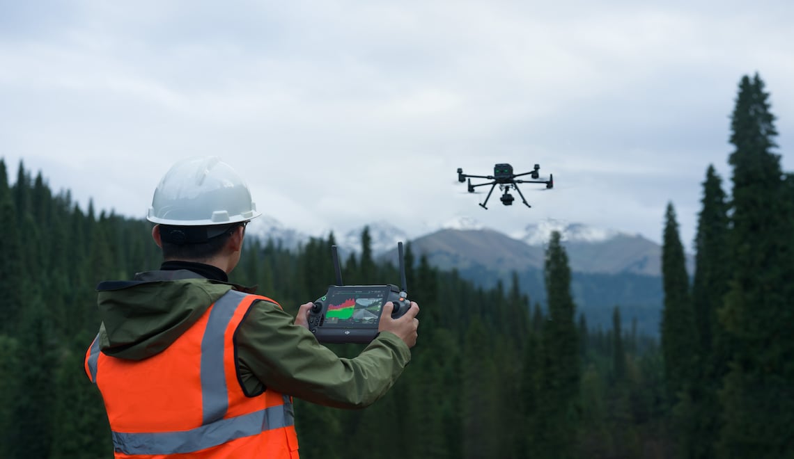
DJI is at the forefront of innovation regarding drone and aerial imaging. The Zenmuse L2 — our latest aerial LiDAR system — expands the boundaries of what's possible in aerial data acquisition.
This blog post explores the top 10 features of the Zenmuse L2, highlighting why it's making waves in the industry. From its advanced imaging capabilities to its robust design, each feature of the Zenmuse L2 underscores its role as an integral tool in the drone technology field. Let's look at what makes this model the standout choice for professionals and enthusiasts alike.
1. Advanced GNSS and IMU Integration
The Zenmuse L2 is notable for its precision, largely thanks to the integration of a high-precision Global Navigation Satellite System (GNSS) and DJI's custom-developed Inertial Measurement Unit (IMU). This combination is key to the L2's exceptional vertical and horizontal accuracy.
This integration goes beyond simply pinpointing locations; it enables the capture of the world with remarkable precision. The L2's GNSS and IMU integration is crucial for mapping complex landscapes or conducting thorough surveys, ensuring every data point is accurate and reliable. For professionals in fields like urban planning, environmental research or construction, where detailed geospatial data is vital, the L2 is an essential tool. Its ability to deliver precise measurements enhances the quality of projects and decision-making processes.
2. Exceptional Detection Range
This high-precision aerial LiDAR system stands out as a technological powerhouse, boasting a remarkable detection range of up to 250 meters. This capability indicates its advanced technological design, enabling users to gather detailed data from a safe and efficient distance.
The L2's detection range excels in various operational conditions, making it ideal for projects that demand a broad aerial perspective. It's particularly adept at covering large areas, such as expansive construction sites or extensive natural landscapes, providing comprehensive data without compromising detail. This extended range is invaluable in situations where accessing areas directly is either risky or not feasible, such as in hazardous environments or over difficult terrain.
The ability to capture high-quality data from afar enhances safety and increases the efficiency and scope of aerial surveying and monitoring tasks.
3. Unmatched Operational Efficiency
Moreover, Zenmuse L2 is recognized for its exceptional operational efficiency. This payload is adept at covering large areas swiftly, an attribute that proves invaluable in operations where time is a critical factor and the scale is vast.
The L2's capability extends beyond mere speed. It consistently maintains the highest quality of data, even across extensive areas. This balance of speed and precision is vital in applications where timely data collection and accuracy are paramount.
When pairing the Matrice 350 with the Zenmuse L2, operators have a tool to cover large areas swiftly, an invaluable attribute in operations like environmental monitoring or large-scale infrastructure projects. This combination of rapid data acquisition and meticulous accuracy positions this model as the optimal choice for professionals who demand efficiency without sacrificing quality in their aerial data collection.
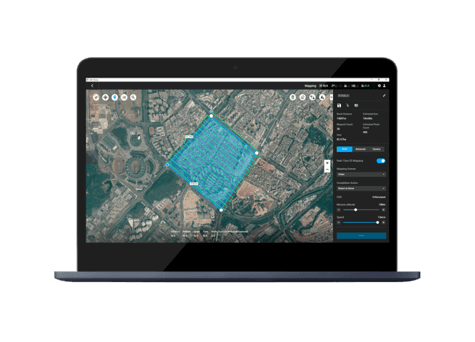
4. Seamless Integration with DJI Terra
The Zenmuse L2 takes data processing to advanced levels through its seamless integration with DJI Terra. The combination of sophisticated hardware and intuitive software significantly streamlines your workflow, efficiently transforming complex data into actionable insights with a single click.
DJI Terra’s integration significantly enhances both efficiency and accuracy in data handling. The L2 and DJI Terra collaboration is particularly effective for tasks requiring detailed mapping or intricate analysis. Together, they form a powerful team that saves time and effort and ensures that the data processed is of the highest quality. This synergy allows you to concentrate on broader project goals, secure in the knowledge that your data processing is swift and reliable, thereby optimizing your overall operational workflow.
5. Versatility Across Industries
The Zenmuse L2 is a chameleon in the world of aerial imaging, adapting its capabilities across various industries, such as:
- Surveying and Construction: The L2's precision is a game-changer in these fields. It transforms mapping and site planning, ensuring projects are executed with pinpoint accuracy.
- Agriculture: Here, the L2 revolutionizes how we understand and manage crops. Its detailed insights are pivotal in advancing precision agriculture.
- Infrastructure Inspection: The L2 excels in providing comprehensive data for maintaining and ensuring the safety of infrastructure.
- Environmental Monitoring: In this crucial area, the L2 plays a significant role in conservation efforts, offering detailed environmental data that can inform and guide sustainable practices.
6. Rugged Design for Diverse Environments
The Zenmuse L2 is built to endure. Its rugged design is not just about withstanding the elements; it's about delivering consistent, reliable performance in various environmental conditions.
Whether it's soaring above scorching deserts, navigating through humid rainforests, or enduring the chill of high-altitude winds, the L2 remains unfazed. This resilience makes it an ideal choice for professionals working in challenging climates and terrains, ensuring that no matter where the mission is, the L2 is ready to perform.
7. High-Resolution Imaging for Detailed Analysis
This model also excels in capturing images with its high-resolution imaging capabilities, each frame telling a story with depth and detail. This feature goes beyond providing mere clarity; it unveils the subtle details that typically escape the naked eye.
In environments where precision is paramount, the imaging quality of the L2 is essential. It's adept at conducting thorough inspections of structural integrity or creating detailed maps of archaeological sites. The L2's capacity to capture fine details ensures your analysis is grounded in the most complete and accurate data. Such meticulous detail is vital in sectors where accuracy is critical, such as heritage conservation, geological surveys, and precision engineering, ensuring that every nuance is captured and considered.

8. Real-Time Data Transmission
The Zenmuse L2 is renowned in the realm of professional drone operations for its capability for real-time data transmission. This feature equips decision-makers with instant access to essential information, crucial for navigating the complexities of modern projects.
The immediacy of this data transmission is a game-changer for efficient project management and rapid decision-making processes. It's particularly effective in situations where conditions are constantly evolving, requiring quick and informed responses. The L2 ensures that up-to-date data is readily available, facilitating a proactive and adaptable approach to various operational challenges.
This real-time transmission is invaluable in scenarios like emergency response, environmental monitoring and live construction site management, where staying informed with the latest developments is key to success.
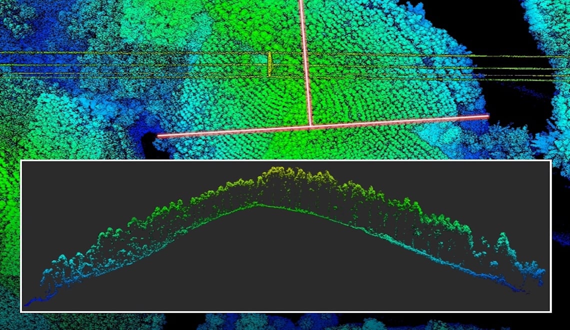
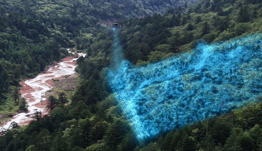
Raw point cloud data depicting 3D map of terrain
9. Enhanced Safety Features
Safety is fundamental to the design of the Zenmuse L2. Outfitted with advanced safety features, the L2 does more than just protect the equipment; it plays a crucial role in ensuring the safety and success of every mission.
These features represent a thoughtful combination of technology and proactive planning aimed at reducing risks. The L2 is adept at navigating around obstacles and maintaining stability even in challenging conditions. Its safety mechanisms ensure that both the mission objectives and the drone itself are secure from unexpected incidents. This includes features like automatic return-to-home on signal loss and real-time alerts, ensuring operators are always in control and informed, thereby enhancing the overall safety of the operation.
10. Long-Range and Endurance
The Zenmuse L2 sets new standards in aerial surveying with its compatibility with long-range drones and exceptional endurance. Its capabilities extend the potential of aerial data collection, enabling operations over greater distances and longer durations.
Perfectly suited for large-scale surveying projects, the L2's long-range abilities facilitate thorough data collection across expansive areas. This ensures that every aspect of the surveyed area is captured in detail. The drone's endurance is crucial for projects requiring comprehensive coverage and sustained operations, such as environmental studies, large agricultural lands, and extensive construction sites.
With the L2, professionals can confidently undertake extensive missions, knowing they will gather complete and precise data, even in remote or vast locations.

Key Takeaways
The DJI Zenmuse L2 is a leading solution for aerial data acquisition in the drone industry. It showcases DJI's dedication to advancing drone technology with its precise, efficient, versatile, and safety features. Professionals across various industries can benefit from the L2 as it exceeds their diverse needs in various industries such as surveying, environmental monitoring, agriculture, and infrastructure inspection.


-3.png?width=300&name=Insight%20blog%20featured%20image%201140X660%20(2)-3.png)