
With every platform and payload innovation, DJI Enterprise expands what is possible for first responders, inspection crews, surveyors, and other industrial users. With each iteration, the features that get the most attention tend to be things like flight time, megapixels, or thermal resolution. But here we’re going to focus on something that’s quietly become one of our most versatile and impactful tools: the laser rangefinder.
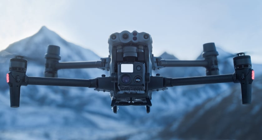
The laser rangefinder is integrated across the Zenmuse H series of hybrid payloads and the new Matrice 30 (M30).
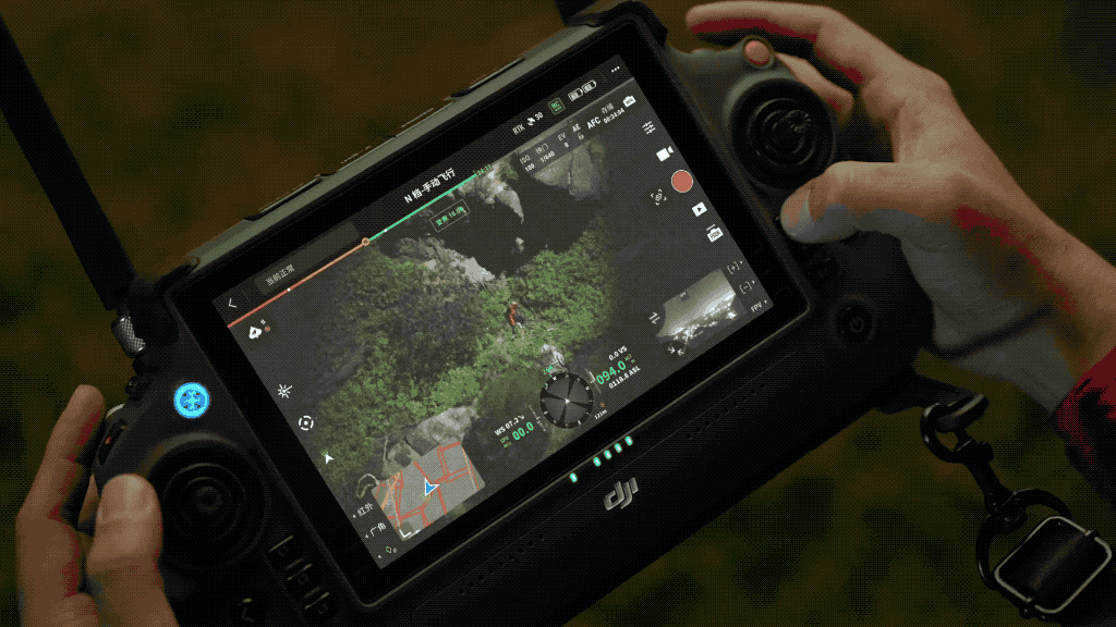
With a single tap in the Pilot 2 app, pilots can target a specific location or object and get its precise GPS coordinates and distance from the drone. This powerful capability can be put to work in all sorts of scenarios. Broadly these include enhancing collaboration between aerial and ground inspection teams and improving situational awareness during public safety operations.
What is a laser rangefinder and how does it work?
A laser rangefinder is a tool for measuring distance. It works by emitting an infrared laser, which reflects off the surface of your target and returns to the rangefinder. Because the speed of light is constant (c = 299,792,458 meters per second, in case you were wondering), the rangefinder analyses the travel time of that electromagnetic wave to precisely work out the distance to the object.
Typically, these tools are used in hunting, sports, surveying, and construction planning. Rangefinders with a longer range (the one on the H20 series payloads and M30 are accurate up to 1,200 meters) can be used to provide precise measurements in a variety of scenarios, particularly when you add that capability to a drone.
One reason drones and laser rangefinders are such a powerful combination is that the aircraft is already connected to GPS. As well as providing accurate distance measurements from above and accurate GPS coordinates of that object, location information is embedded into the metadata of any photos the drone captures.
During inspections and public safety missions, this capability unlocks precision in hindsight, not just in the moment.
Pilots flying a DJI Matrice 300 RTK or M30 can use the laser rangefinder to create markers around key locations that can be saved for later. We call them PinPoints.
What are PinPoints?
PinPoints are a feature unlocked by DJI drones carrying laser rangefinders. You’ll find them inside the Pilot 2 and FlightHub 2 apps as part of a suite of collaborative management tools called Live Annotations. These tools enable teams to coordinate operations in real-time. You can drop pins, draw lines, mark shapes, and generally designate points or areas of interest.
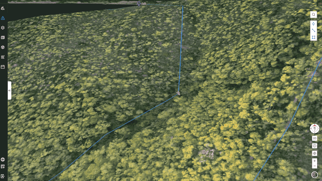
The PinPoint function has been designed to help teams keep track of anything that’s worth keeping track of. It overlays a marker onto a shared operational map and tags it with its GPS coordinates. In dynamic operations, certain key elements may remain static. PinPoints allow teams to share aerial intelligence and ensure nothing is left behind or overlooked.
How to use PinPoints
We've made a guide on how to use PinPoints, how to navigate between them, as well as advanced settings like labeling, color coding, and management, all as part of a greater series on DJI Pilot 2. You can view the guide below:
Laser rangefinders in action
Here are a few ways that laser rangefinders are being used by enterprise pilots around the world.
1. Marking at-risk property during wildfires
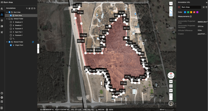
After a wildfire grew out of control in Cleburn, Texas, several local fire departments were faced with a smoking expanse of 20 acres. From the ground they couldn’t tell where the hotspots were or in which direction the fire was heading. Fortunately, among those at the scene was the North Central Texas Public Safety Unmanned Response Team (NTXPSURT). The NTXPSURT crew had early access to the new DJI M30T and were able to use its thermal capabilities and laser rangefinder to track the spread of the blaze and coordinate the operation from above.
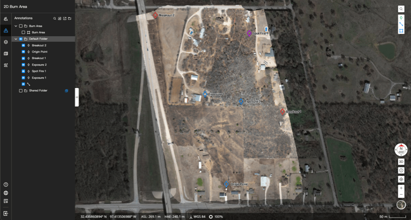
The 2D Cloud Mapping feature quickly created an orthomosaic map of the fire. The laser rangefinder was then put to work to drop PinPoints on precise coordinates. These were labeled, color-coded, and used to mark the fire’s boundaries, communicate points of interest to team members, and highlight structures that were at risk. The PinPoint capability allowed the incident commander to share this intelligence between different crews, keep track of the fire’s progress, and direct resources to where they were needed.
2. Managing the aftermath of a fire
When taking on a wildfire, the role of firefighters is twofold. The primary goal is to tackle and extinguish the blaze before lives are lost or property is destroyed. But the second aspect is just as important: firefighters need to prevent smouldering areas from reigniting and causing a secondary fire.
It’s here that thermal imaging from above combined with a laser rangefinder can help emergency crews work safely and efficiently. The use of PinPoints allows incident commanders to mark any hotspots detected with the thermal sensor and share that information with the ground team.
3. Making sure nothing gets left behind during a police operation
Police chases are dynamic operations, often spanning multiple locations. It’s common for suspects to discard weapons or evidence while on the run, sometimes leaving officers with a choice to make: continue the chase or search for the hidden item. With the laser rangefinder and PinPoints, locations of interest or discarded objects can be marked for later.
Officers can return to that location as soon as the suspect has been apprehended, or share that information in real-time with colleagues on the ground.
4. Post-storm damage assessments
In the aftermath of a storm or natural disaster, efforts begin to restore communications and other vital services. An effective damage assessment provides emergency crews, telecoms, and insurance companies with the information they need to reconnect communities and get the rebuild underway.
The accuracy of these surveys is vital. A laser rangefinder enables inspection crews to augment maps and orthomosaics with PinPoints that mark key locations and infrastructure, from downed utility poles to damaged structures. This capability combines visuals with precise metadata, allowing greater collaboration and more effective damage assessments.
5. Search & Rescue information sharing
Successful search and rescue missions are built on information sharing. When ground teams are empowered with aerial intelligence, they can work faster and smarter. PinPoints can be invaluable in this context, allowing incident commanders to annotate maps with precise markers, communicate priorities, and designate objects of interest.
The ability to accurately mark and communicate locations from above can reduce overall mission time and prevent unnecessary searches that could put crews at risk.
Which DJI drones have a laser rangefinder?
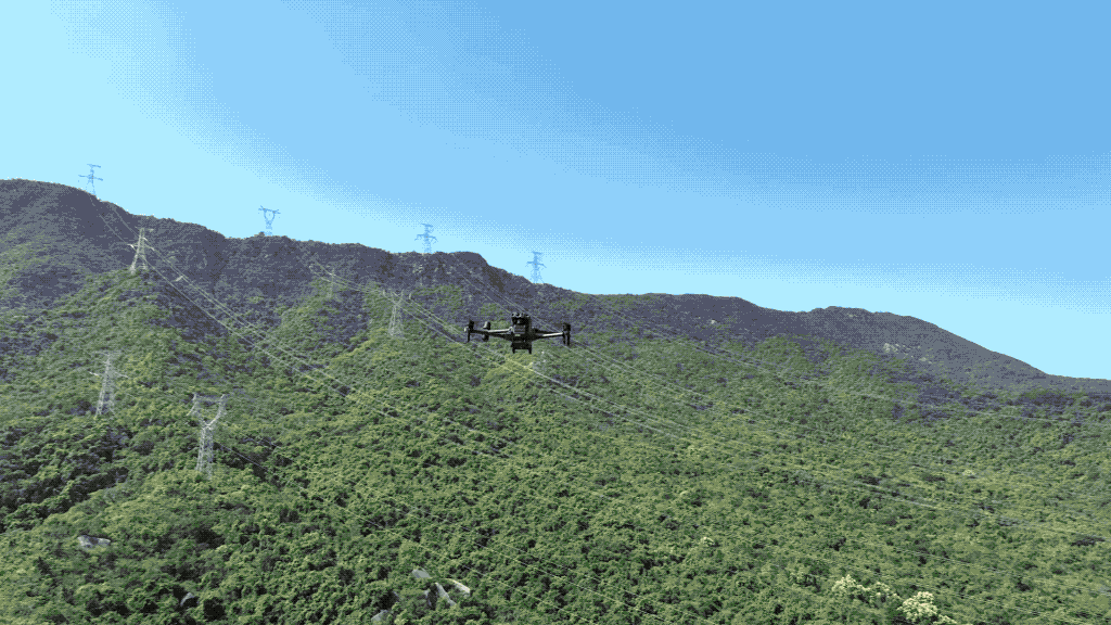
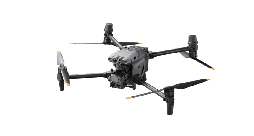
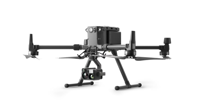
If you want to integrate a laser rangefinder into your aerial operations, you’ll need to fly one of two platforms in the DJI Enterprise range: the M300 RTK and the M30.
The laser rangefinder found on both has a measuring range of 3-1200m and an accuracy of ±0.2 m + D×0.15% (where D is the distance to a vertical surface).
The $14,700 M30 and M30T platforms combine ease of use with portability and power. Both models have the laser rangefinder built in.
The $13,700 M300 RTK is a rugged and adaptable platform with leading flight time, payload options, and safety features. It’s compatible with the H20, H20N and H20T sensor payloads - all of which include our laser rangefinder.
You can compare DJI’s thermal and night vision drones here.
Smarter equipment, smarter software, smoother operations
When a drone is deployed during an emergency, it can provide aerial data that enhances the safety and coordination of teams on the ground. When a laser rangefinder and clever software tools are added into the equation, incident commanders can mark areas of interest with precise coordinates and share collaborative maps with colleagues.
Read our FlightHub2 blog to learn more about how our latest application enables ground to cloud collaboration for commercial and public safety drone operations.


-3.png?width=300&name=Insight%20blog%20featured%20image%201140X660%20(2)-3.png)