
Drones and helicopters don’t mix: that’s a message we have heard time and again. And not without reason. If a reckless drone pops up near an active fire to capture a ‘cool’ photo or video, it could very well endanger the lives of aerial firefighters and hinder wildfire suppression efforts.
In June 2020, during Nevada’s Poeville Fire, public safety officials were forced to halt aerial operations after receiving reports of two unidentified drones flying in the area. And this was not an isolated incident. Civilian drones have meddled with aerial firefighting so many times in recent years that the United States’ wildland fire agencies, as well as the Federal Aviation Administration (FAA), have been running dedicated public-outreach campaigns to dissuade hobbyist pilots from flying near a natural disaster.
Principally, the problem isn’t so much with drones flying into a wildfire – but with unauthorized civilian drones jeopardizing firefighting helicopters and the crew on board. Because with proper regulations and airspace organization, the integration of drones into the firefighters’ toolkit can prove to be a gamechanger.
Drones turbocharge aerial firefighting to save millions
This is exactly what happened in 2017, during the burnout phase of the North Umpqua Fire in Oregon. The US Department of the Interior (DOI) decided to leverage a drone to provide situational awareness to the ground crews. The drone’s infrared camera soon detected a spot fire across containment lines, threatening the very area the firefighters were trying to protect.
In its official statement after the fire, the DOI said that failure to promptly discover the spot fire would have led to the potential destruction of $50 million of property and infrastructure.
So, it’s no surprise that the frontline firefighters and battalion chiefs who have already witnessed the enhancements that agile and quick-to-deploy drones bring to ground-based, conventional firefighting techniques call them the greatest innovation in firefighting in recent years.

An example of helicopters and firefighting drones working in harmony
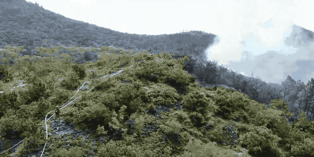
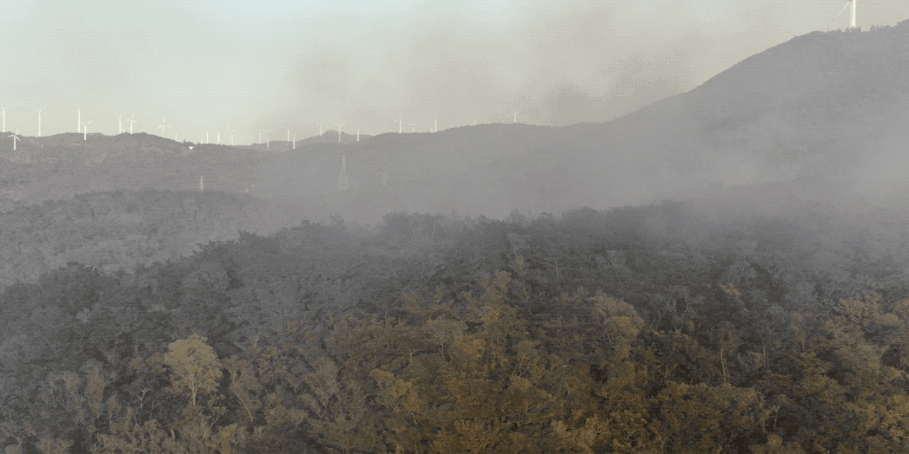
On October 23, 2020, a fierce forest fire broke out in Nan'ao county, a mountainous rural area of Shantou city in south China. Unstable, high-speed winds meant that the blaze would spread quickly, forming three fire sites – the Hulu Mountain in the west, Guantong Station in the middle, and a small hill on the station’s east. Public safety officials would be required to mobilize all forces to contain the fire.
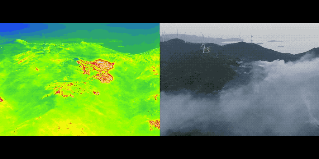
An essential part of the frontline crew’s arsenal was a DJI Matrice 300 RTK drone equipped with the H20T hybrid sensor solution, i.e., both visible light and radiometric infrared sensors. While the powerful wide-angle zoom camera came in handy to cover ground quickly, the thermal imaging camera ensured that even those fire hotspots, obscured by thick smoke and not visible to the naked eye, were detected quickly.
More importantly, because of its size and easy maneuverability, the drone was able to access areas where even helicopter pilots would face constraints – and that too without putting the crew at risk.
It is also important to note that Nan'ao county has an average annual wind speed of 8.5 m/s and an ordinary drone could not have succeeded in providing the command center with stable, jitter-free, continuous live transmission from the affected area. The DJI M300 RTK, however, is designed to operate in the harshest of environments and equipped to withstand wind speeds up to 15 m/s.
Read more about the six hardcore weather tests that put the M300 RTK drone into a class of its own.
With its longest-in-class flight time (55 min), 15 km transmission range, and unrivaled safety and reliability features, the DJI M300 RTK drone with Zenmuse H20T payload:
- Provided the firefighters with a bird’s-eye view of large swathes of forest land,
- Shared precise location coordinates of volatile hotspots, and
- Served as an early warning system to support the hazard mitigation and rescue work.
Situational awareness with dual sensors and the laser rangefinder
At around 8 am on October 25, the M300 RTK flew to the Hulu Mountain fire spot on the west side. By using both infrared and visible light cameras in a dual-screen mode, the fire source – which was obscured up by smoke – was discovered quickly. The zoomed-in footage clearly showed the spread of the fire at close range, helping the command center to understand the risks and mobilize helicopter water tankers accordingly.
The same afternoon, a new blaze was reported on the hills on the east side. The DJI drone was up in the air within minutes to investigate the situation and work out the ignition point. But it did more than that.
The drone footage showed that a water source was available about 300 meters to the west of the ignition point. The exact coordinates of the water source was transmitted to the ground team using the laser rangefinder feature of the Zenmuse H20T. This enabled the forest fire brigade to set up a water pipe between the water source and the fire site, effectively suppressing the fire in no time.
Avoiding secondary fires and reignition with drone fire fighting
By October 26 morning, the Nan'ao county fire had reached its final stages. The chief concern of the firefighting crew at this point was to avoid secondary fires and reignition. Relying on traditional manpower to investigate and report would both slow down the progress and make any probable flame containment difficult.
So, the M300 RTK rose again to an altitude of 90 meters and combed through the smoldering terrain, carefully investigating the risk of re-ignition. As soon as the drone’s wide-angle lens revealed a steady stream of smoke rising from dead leaves and branches, the operator leveraged the 20x zoom mode to get a clearer picture. But since it was daytime and the smoke was obstructing the view, the operator switched to the infrared thermal sensor to ascertain the temperature of the surrounding vegetation.
Together, these details confirmed a potential reignition smoke point and the laser rangefinder was used to relay the exact coordinates of the budding hotspot to the command center. Once the precise geolocation was received, a helicopter took off immediately to eliminate the smoke point.
The entire process, from the discovery of a suspicious ignition spot to the suppression of the fire at a budding stage, took no more than one hour – a clear testimony that if drones and helicopters work together, wildfire fighting efforts can be improved dramatically.
Also read: 4 Ways Drones Fight Forest Fires
Firefighting drones boost safety and decision-making
Drones improve safety for both those on the frontlines as well as the public and the property they protect. And at a time when wildfires are becoming bigger and more ferocious with every season, staying one step ahead of the flames has become more essential than ever.
It has been proven time and again that DJI drones can take aerial firefighting to the next level by flying in the poorest of weather conditions and providing fire crews with reliable geotagged data that improves decision-making.
Our drones have helped public safety agencies to understand changes in fire behavior and make swift calls on whether to escalate or dial-down resources. If you are also interested in a look into ways drones can be deployed, and the steps disaster response agencies should take to build a successful drone program, download our free eBook on ‘Launching a Fire Department Drone Deployment Program’.


-3.png?width=300&name=Insight%20blog%20featured%20image%201140X660%20(2)-3.png)