
Our planet is at a tipping point. Global temperatures continue to rise with stark consequences for many of the things we take for granted.
Fortunately, a technology has emerged that can gather data for conservation projects, support the work of environmental researchers, play a key role in implementing sustainable solutions, and service renewable energy infrastructure.
And it can do all of those things in a way that’s better, easier, faster, cheaper, and safer than before. In case you haven’t guessed yet, we’re talking about drones. These flying robots are tackling climate change from multiple angles: improving the efficiency of solar farms and wind farms, protecting endangered species from above, and bolstering the work of scientists all over the world.
Accessible, low-altitude aerial data collection is having a significant impact on humanity's environmental efforts. To celebrate Earth Day, here are some inspiring ways that drones are helping the planet.
Protecting wildlife from above
Drones enabling conservation projects
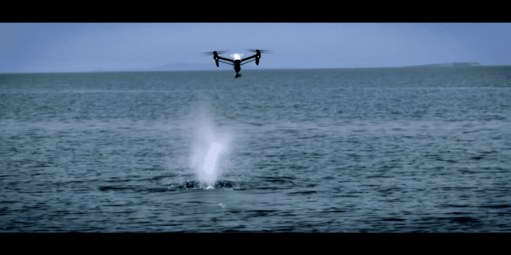
Drones have given scientists and research teams around the world an affordable but game-changing way to gather data. Nowhere is that clearer than the field of marine conservation, where research missions have traditionally been limited to well-funded projects and a privileged few.
For Dr. Iain Kerr and the team at Ocean Alliance, drones have democratized access to ocean research and revolutionized the way whale data is gathered. The SnotBot concept turns DJI drones into flying Petri dishes. It’s crude, inspiring, and utterly brilliant. As a result, Kerr’s team has captured the imaginations of countless conservationists.
Sea Shepherd used DJI drones to track and log illegal fishing activity in the South Indian Ocean. With an eye in the sky, the team captured evidence of illegal driftnets and documented the crew attempting to hide evidence of their activities.
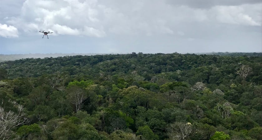
On dry land, drones are supporting conservation efforts from Antarctica to Borneo. Often researchers simply need to count animal populations to understand the challenges they face over time. However, nature rarely forms an orderly queue. Combined with image recognition software, drones offer a quick and cost-effective way to scan large areas, operating high above terrain that would otherwise be difficult for teams on the ground to access.
Whether it’s mapping the location of 300,000 nesting pairs of Adélie penguins or using thermal imaging to detect the heat signatures of polar bear dens, drones are empowering environmental projects.
Drones saving the lives of animals
On top of providing researchers with data to support conservation efforts, drones are being used for emergency environmental missions.
There are several NGO and law enforcement organizations around the world using drones to prevent illegal wildlife poaching. Air Shepherd is one example, with successful operations in South Africa, Zimbabwe, Malawi, and Botswana. In Kenya, drones with thermal cameras are used to detect poachers operating under the cover of darkness. Their presence provides both an enforcement tool and an effective deterrent.
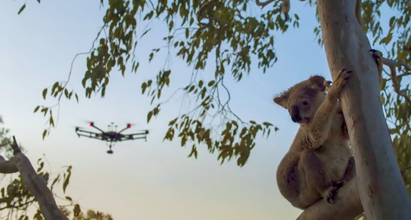
DJI equipment has also been used for wildlife search and rescue missions. Following devastating forest fires in Victoria, Australia, in 2020, the Mavic Enterprise Dual was used to search for injured koalas in need of treatment.
In Graubünden, Switzerland, thermal drones have saved the lives of hundreds of newborn deer to date. Ahead of the annual Spring harvest, farmers and conservation groups have been using UAVs to spot the animals’ heat signatures from above, giving them time to catch and move them before the mowers move in.
Drones mapping sensitive environments
Like with wildlife populations, researchers need a precise understanding of habitats to plan conservation efforts.
Broadly, the mapping technology used to innovate the construction and mining industries can also be applied to forests, ice sheets, and coastal areas. Drone images can be captured at scale, stitched together, and analyzed to compare geographical changes over time.
In the Amazon, DJI hardware has been used to monitor the daily intake and release of atmospheric chemicals above the rainforest. A team from Harvard modified a DJI M600 drone, swapping out the usual camera for a chemical-detecting sensor to gather data on how global warming is impacting plants in the region.
In Iceland and Greenland, drones added greater depth to historic data gathered at higher altitudes, helping scientists track the rate at which glaciers are melting. Photogrammetry software was used to create 3D models, which in turn brought to life how the warming climate is altering Iceland’s iconic landscapes.
Drones are also being used to map plastic waste on coastlines in Portugal, Cambodia, Denmark, and the UK. By documenting the level of pollution and giving scientists insight into our litter habits, all of these projects have helped to streamline cleanup efforts and publicize the scale of the problem.
Drone mapping can also be harnessed for environmental enforcement. In Sumatra, Indonesia, aerial photography is being analyzed to expose rainforest destruction from illegal palm oil plantations and logging camps.
Smart farming with drones to reduce the environmental impact of the Agriculture industry
Agriculture is an industry we all depend on. Increasing its sustainability is vital for future generations. There are several ways that drones are being deployed to create smarter workflows and help farmers embrace a productivity revolution.
Precision agriculture
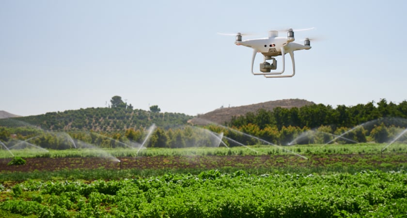
With a growing global population, farmers are turning to technology to maximize their yields and better adapt to the recurring challenges of weather, climate change, pests, and disease.
To make data-driven decisions, you need data. Whether planning crop cycles, assessing crop health, detecting infestations, or determining hydration levels, drones and the latest generation of sensors make capturing insights quick and cost-effective.
Drones for Contour Mapping & Irrigation
Drones are being used all over the world to map agricultural terrain and ensure plots are planned with topography in mind. Using photogrammetry or LiDAR to generate 3D maps, farmers can stay one step ahead of soil erosion and irrigation issues.
Multispectral imaging from above can pinpoint areas that are too saturated or dehydrated.
Drones for Crop Assessment & Spraying
Real-time health checks are now accessible with a multispectral camera and a drone. Farmers can build Vegetation Index (VI) maps to reveal critical crop health information, detect anomalies, and allocate resources with maximum efficiency.
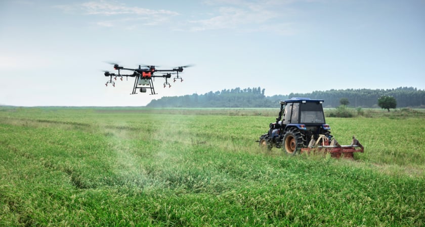
Drones can also be used for more targeted pest control. Specialized models, such as the DJI AGRAS T16, spray the right amount of fertilizer, herbicide, or pesticide, in a way that’s more cost-effective and less damaging to the environment compared to blanket drops from manned aircraft.
For more information on adopting drones for smart farming, read our Agriculture Buying Guide.

How drones are helping us prepare for rising sea levels
Some of the most serious consequences of climate change are already being felt in the form of rising sea levels. At this point, mitigation is required alongside efforts to reduce the long-term impact.
Coastal areas are most at risk, so understanding water flows is vital. Drones are the perfect tools for littoral and bathymetric surveys because they can cover a huge amount of ground in a small space of time, without sacrificing data granularity.
In 2020, DJI Phantom 4 RTKs were used to map 60km of coastline between Togo and Benin in West Africa. By digitizing the fragile coastal ecosystem, researchers have gained insights into its current state and now have a fresh set of ortho-images and topographic data to work with.
Scientists from the University of Ghana have used DJI drones to monitor coastal erosion along the country’s Volta Delta, with a view to building an early warning for potentially devastating floods to the nearby Fuvemeh community.
And with drone-enabled LiDAR surveys, scientists can simulate shoreline changes to account for rising sea levels, run storm impact models, and predict which areas will be most at risk of flooding.
Tree planting drones
With most environmental applications, drone technology is used to gather data that researchers, businesses, and governments can use to make smarter, greener decisions. But in some cases, UAVs play a more active role.
In the UAE, petrol delivery group CAFU has used drones at every stage of an ambitious tree-planting project. In March 2021, 10,000 Ghaf trees were successfully planted by drone in the Dubai desert.
The process began with drones being used to scan potential planting locations, measuring the suitability of the soil, wind, and humidity. AI was used to determine the best spots for seeds to be planted, and a map was generated with GPS markers for drone-enabled seed drops. Monthly drone inspections are taking place to track the progress of each tree.
In Europe, Spanish startup CO2 Revolution has been using DJI drones to automate reforestation, lowering the time and cost of recovery after wildfires and logging activity. The technology is expected to assist in the planting of millions of trees across Spain in the coming years.
In the UK, Dendra Systems is taking a similar approach. After successful trials using drones to replant Mangrove trees in Myanmar, its solution has been deployed on tree-planting projects in Australia, South Africa, and Morocco.
Drones and clean energy
From the gas in our cars to the coal and oil that supply global power stations, it’s clear that a move away from fossil fuels is central to the fight against climate change. But to make renewable energy sources cheaper and more widespread, green energy suppliers need to lower their costs and increase the efficiency of their operations. Drones are proving to be the perfect solution.
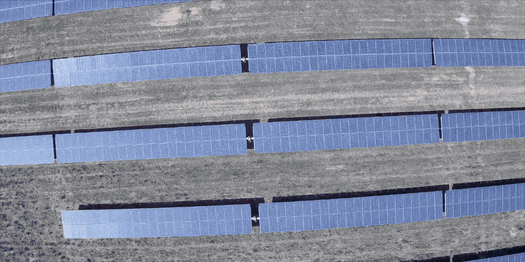
How drones are used in the solar industry
For solar farm operators, drones provide a quick and easy way to carry out inspections. Regular flights that combine thermal with RGB images can highlight anomalies and, in many cases, diagnose the nature of the issue.
Dirt, debris, and defects can all impact the efficiency and profitability of solar modules. Drone technology is bringing down the cost of inspecting solar infrastructure at scale.
Details that would otherwise be invisible to the naked eye, including module faults and defective diodes, can be picked up by thermography. Animal nests and any debris can easily be detected when combining aerial imagery with automated analysis.
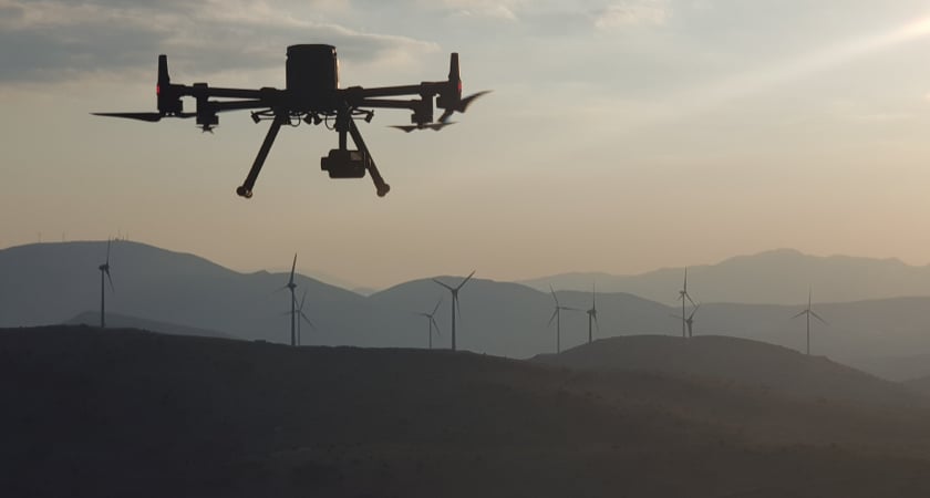
How drones are supporting wind farms
Drones are also proving to be a game-changer for wind farm maintenance. UAVs can be used to gather data or stream it to crews on the ground in real-time. Detailed reports can pinpoint turbine blade corrosion and faults, allowing wind farm managers to cut both efficiency losses and maintenance costs.
DJI’s wind-resistant drones can be deployed in a matter of minutes, drastically reducing the time required to gather data and removing the need to have teams work at height.
Drones and nuclear power
Nuclear power has an enormous role to play in the move away from fossil fuels. But nuclear plants present special challenges for protecting health and safety during operations.
The threat of radiation exposure means that infrastructure inspections can put workers in harm’s way. With drones as their eyes, engineers can now perform visual inspections from a safe distance. Some nuclear power plants have turned to custom drone payload solutions to enable inspection missions that would otherwise be dangerous and costly to take. For active plants, single flights can provide power companies with savings of hundreds of thousands of dollars, as costly shutdowns can be avoided while inspections are taking place.
The same concept works for nuclear cleanups. In late 2020, Flyability’s Elios 2 was sent in to get a closer look at Chernobyl’s Reactor Five. It was the first time since the 1986 catastrophe that experts were able to get a visual and determine the level of radioactivity there.
Drones are powering Earth’s sustainable future
Drones are at the forefront of a technological revolution. These flying robots are providing scientists with an easy and inexpensive way to gather vital climate data, giving renewable energy companies a powerful productivity tool, and helping researchers prepare for the complex implications of climate change.
#DronesHelp
#DronesHelpPlanetEarth


-2.png?width=300&name=HS%20-%20Featured%20Images%20(2)-2.png)
